Edisto Island

Last updated

Edisto Island
Edisto Island National Scenic Byway - Sunrise from the Crest of McKinley Washington, Jr., Bridge - NARA - 7718267.jpg
USA South Carolina location map.svg
Red pog.svg
Edisto Island
Location of Edisto Island in South Carolina
Coordinates: 32°33′34″N80°17′42″W / 32.55944°N 80.29500°W / 32.55944; -80.29500
Country United States
State South Carolina
County Charleston
Area
  Total67.8 sq mi (175.5 km2)
  Land67.6 sq mi (175.1 km2)
  Water0.2 sq mi (0.4 km2)
Elevation
8 ft (3 m)
Population
 (2000)
  Total2,301
Time zone UTC-5 (Eastern (EST))
  Summer (DST) UTC-4 (EDT)
ZIP Code
29438 [1]
Area code(s) 843 and 854
GNIS feature ID1247638 [2]

Edisto Island is one of South Carolina's Sea Islands, the larger part of which lies in Charleston County, with its southern tip in Colleton County. Edisto Beach is in Colleton County, and the Charleston County part of the island is unincorporated.

Contents

The island, the town, and the Edisto River are named after the historic Edistow people, a Native American sub-tribe of the Cusabo Indians, who inhabited the island as well as nearby mainland areas.

History

Indigenous peoples often had fishing camps on the islands, using them seasonally. The historic Edisto people are known to have occupied the island as well as mainland areas and traded with the upcountry Catawba. [3] The sub-tribe became extinct during the colonial period. The Wassamasaw Tribe of Varnertown Indians is a group of descendants of various tribes, including Edisto, who intermarried and who have occupied a settlement between Summerville and Moncks Corner in Berkeley County, South Carolina. In 2009, they gained state recognition as an Indian Tribe, one of nine tribes to do so. [3] [4]

The first tracts of land, called plantations, were granted on Edisto Island before 1700. There were several attempts by the French and the Spanish to settle in this area in the 1500s, however, those attempts all failed. The first group of Europeans who succeeded in settling Edisto Island were English people who settled the island in the late 1600s and early 1700s. Though it is unclear when the modern name was adopted, the island was called "Locke Island", after the English philosopher and Secretary to the Lords Proprietors of Carolina John Locke, during the late 1600s. [5] For most of the 1700s, the area exported rice. [6] Landowners first harvested timber and deerskins, planted indigo and some rice, and kept herds of free-ranging cattle to produce hides for the European market and salt beef for Caribbean plantations. Cotton gradually became the principal crop, and after the American Revolution, Edisto Island planters became wealthy and famous from their production of long-staple Sea Island cotton. The labor done by hundreds of enslaved Africans who developed the creole Gullah language and culture on the islands and in the Lowcountry, distinctive for its African traditions.

During the American Revolution, there were huge amounts of British soldiers present on Edisto Island. After retaking Savannah in 1788, the British pushed into South Carolina, during this time Beaufort was made into their headquarters and large amounts of British troops were stationed on Edisto Island under the capture of Charleston in 1780. [7]

The 1790 census reported the island had a population of 223 Whites and 1,692 Black slaves. The 1860 census indicated 329 Whites and 5,082 slaves. [8]

Civil war

Edisto Island was largely abandoned by planters in November and December 1861, and escaped slaves began setting up their own refugee camps there. In January 1862, armed settlers from the island and Confederate forces clashed, and a Confederate raid in reprisal killed unarmed settlers. In February, Union forces were stationed on the island to develop it as a staging area for future campaigns against Charleston, twenty-five miles away, as well as to protect the colony, which would eventually number thousands of settlers. As Union forces took control of the island, a number of skirmishes occurred, and Confederates withdrew. Pineberry Battery was further up the Edisto River from the island, which was one likely path for a land campaign against Charleston. In June, most of the Union troops left the island in a campaign, which culminated in the Battle of Secessionville. In July, the remaining troops withdrew, and the colony was removed to St. Helena Island. For the rest of the war, a small number of escaped slaves and plantation owners remained and farmed the island, but it was largely abandoned. Near the end of the war, the island was again used as a location of colonies of freed slaves. [9]

Reconstruction

From 1865 until 1877 the Island was primarily run by agents of the Freedmen's Bureau as well by recently freed African-Americans. As a result, the island became a base of support for the Republican Party. While Klan terror effected much of the state, Edisto Island was largely spared this by coincidence. There were large amounts of troops from the United States Army present on Edisto Island, and the population was overwhelmingly African-American. Most whites on the island were either troops from the United States Army or agents of the Freedmen's Bureau. As a result, the Klan deemed the area not worth it, and focused their activities elsewhere in the state. [10]

Historic preservation

Since the twentieth century, the island has been redeveloped for use as a tourist destination and resorts, although some private plantations remain.
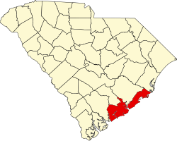
The Alexander Bache U.S. Coast Survey Line, Bailey's Store, Bleak Hall Plantation Outbuildings, Brick House Ruins, Brookland Plantation, Cassina Point, Crawford's Plantation House, Edisto Island Baptist Church, Edisto Island Presbyterian Church, Fig Island, Frogmore, Paul Grimball House Ruins, Hutchinson House, Middleton's Plantation, Oak Island, Old House Plantation, Peter's Point Plantation, Presbyterian Manse, Prospect Hill, William Seabrook House, Seaside School, Seaside Plantation House, Spanish Mount Point, Sunnyside, Hephzibah Jenkins Townsend's Tabby Oven Ruins, Trinity Church, Wescott Road, and Windsor Plantation are listed in the National Register of Historic Places. [11]

Geography

Map of the island National Scenic Byway - Edisto Island (South Carolina) - NARA - 68886659.jpg
Map of the island

Edisto Island is located 26 miles (42 km) southwest of Charleston. Edisto Island is home to Edisto Beach and Wyndham Oceanridge resort.

Edisto Beach State Park is also located on the island. The park is open to day visitors as well as tent and RV camping. The park has a ranger station, bathrooms with running water and showers, a playground, and an education center. The campsites are unique in that there are many that are on the beachfront, overlooking the ocean. Hanging moss trees shade the park. Each site is equipped with electricity and water hook ups, a fire pit, and a picnic table.

There are some small restaurants in walking distance from the campground and a supermarket is located across the street.

The only grocery store near the beach is a Food Lion out on Jungle Road. There are three gas stations and about a dozen independently owned restaurants, most of which specialize in local seafood.

Demographics

View from space (Edisto Island is in the center-right of the picture) ISS036-E-8381 - View of South Carolina.jpg
View from space (Edisto Island is in the center-right of the picture)

As of the census of 2000, there were 2,301 people, 1,030 households, and 685 families residing in the CDP. The population density was about 34 people per square mile. There were 1,193 housing units at an average density of 34ppl/sq mi (84.4/km2). The racial makeup of the CDP was 59.6% White, 39.1% African American, 0.20% Native American, 0.0% Asian, 0.6% from other races, and 0.5% from two or more races. Hispanic or Latino of any race were 1.4% of the population.

There were 1,030 households, out of which 31.5% had children under the age of 18 living with them, 41.4% were married couples living together, 21.0% had a female householder with no husband present, and 33.4% were non-families. 28.7% of all households were made up of individuals, and 10.8% had someone living alone who was 65 years of age or older. The average household size was 2.55 and the average family size was 3.16.

In the CDP the population was spread out, with 27.0% under the age of 18, 9.4% from 18 to 24, 27.8% from 25 to 44, 22.3% from 45 to 64, and 13.4% who were 65 years of age or older. The median age was 36 years. For every 100 females, there were 91.8 males. For every 100 females age 18 and over, there were 82.8 males.

The median income for a household in the CDP was $25,962, and the median income for a family was $31,000. Males had a median income of $24,609 versus $19,131 for females. The per capita income for the CDP was $17,500. About 18.2% of families and 20.8% of the population were below the poverty line, including 22.3% of those under age 18 and 34.5% of those age 65 or over.

Notable people

See also

Related Research Articles

<span class="mw-page-title-main">Orangeburg County, South Carolina</span> County in South Carolina, United States

Orangeburg County is a county located in the U.S. state of South Carolina. As of the 2020 census, the population was 84,223. Its county seat is Orangeburg. The county was created in 1769.

<span class="mw-page-title-main">Dorchester County, South Carolina</span> County in South Carolina, United States

Dorchester County is a county located in the U.S. state of South Carolina. As of the 2020 census, the population was 161,540. Its county seat is St. George.

<span class="mw-page-title-main">Colleton County, South Carolina</span> County in South Carolina, United States

Colleton County is in the Lowcountry region of the U.S. state of South Carolina. As of the 2020 census, the population was 38,604. Its county seat is Walterboro. The county is named after Sir John Colleton, 1st Baronet, one of the eight Lords Proprietor of the Province of Carolina. After two previous incarnations, the current Colleton County was created in 1800.

<span class="mw-page-title-main">Charleston County, South Carolina</span> County in South Carolina, United States

Charleston County is located in the U.S. state of South Carolina along the Atlantic coast. As of the 2020 census, the population was 408,235, making it the third most populous county in South Carolina. Its county seat is Charleston. It is also the largest county in the state by total area, although Horry County has a larger land area. The county was created in 1800 by an act of the South Carolina State Legislature.

<span class="mw-page-title-main">Beaufort County, South Carolina</span> County in South Carolina, United States

Beaufort County is a county in the U.S. state of South Carolina. As of the 2020 census, its population was 187,117. Its county seat is Beaufort and its largest community is Hilton Head Island.

<span class="mw-page-title-main">St. Simons, Georgia</span> Place in Georgia, United States

St. Simons Island is a barrier island and census-designated place (CDP) located on St. Simons Island in Glynn County, Georgia, United States. The names of the community and the island are interchangeable, known simply as "St. Simons Island" or "SSI", or locally as "The Island". St. Simons is part of the Brunswick metropolitan statistical area, and according to the 2020 U.S. census, the CDP had a population of 14,982. Located on the southeast Georgia coast, midway between Savannah and Jacksonville, St. Simons Island is both a seaside resort and residential community. It is the largest of Georgia's renowned Golden Isles. Visitors are drawn to the Island for its warm climate, beaches, variety of outdoor activities, shops and restaurants, historical sites, and natural environment.

Navassa is a town in Brunswick County, North Carolina, United States. The population was 1,505 at the 2010 census, up from 479 in 2000.

<span class="mw-page-title-main">Moncks Corner, South Carolina</span> Town in South Carolina, United States

Moncks Corner is a town in and the county seat of Berkeley County, South Carolina, United States. The population was 7,885 at the 2010 census. As defined by the U.S. Census Bureau, Moncks Corner is included within the Charleston-North Charleston, SC Metropolitan Statistical Area.

<span class="mw-page-title-main">Isle of Palms, South Carolina</span> Barrier island on the coast of South Carolina, United States

Isle of Palms is a city in Charleston County, South Carolina, United States. At the 2010 census, the population was 4,133. Isle of Palms is a barrier island on the South Carolina coast. The city is included within the Charleston-North Charleston-Summerville metropolitan area and the Charleston-North Charleston Urbanized Area. The town lies along a narrow strip of land, hugging the beach, separated from the mainland by the Intracoastal Waterway. It is a community of both vacation home owners and year-round residents, with large beachfront homes, resorts, and local restaurants. Beach volleyball is popular in the summer, and the "Windjammer" club hosts several tournaments throughout the year.

<span class="mw-page-title-main">Mount Pleasant, South Carolina</span> Town in South Carolina, United States

Mount Pleasant is a large suburban town in Charleston County, South Carolina, United States. In the Lowcountry, it is the fourth-most populous municipality in South Carolina, and for several years was one of the state's fastest-growing areas, doubling in population between 1990 and 2000. The population was 90,801 at the 2020 census. It is part of the Charleston metropolitan area.

<span class="mw-page-title-main">Seabrook Island, South Carolina</span> Town in South Carolina, United States

Seabrook Island, formerly known as Simmons Island, is a barrier island in Charleston County, South Carolina, United States. The population was 1,714 at the 2010 census, up from 1,250 in 2000.

<span class="mw-page-title-main">Edisto Beach, South Carolina</span> Town in South Carolina, United States

Edisto Beach is a town in Colleton County, South Carolina, United States. Edisto Beach's population was 414 as of the 2010 census, down from 641 in 2000. The town limits include only the developed coastal area of Edisto Island within Colleton County, while the majority of the island consists of unincorporated land in Charleston County. Due to its status as a bedroom community, Edisto Beach is among the most affluent communities in the state.

<span class="mw-page-title-main">Walterboro, South Carolina</span> City in South Carolina, United States

Walterboro is a city in Colleton County, South Carolina, United States. The city's population was 5,398 at the 2010 census. It is the county seat of Colleton County. Walterboro is located 48 miles (77 km) west of Charleston and is located near the ACE Basin region in the South Carolina Lowcountry.

<span class="mw-page-title-main">Georgetown, South Carolina</span> City in South Carolina, United States

Georgetown is the third oldest city in the U.S. state of South Carolina and the county seat of Georgetown County, in the Lowcountry. As of the 2010 census it had a population of 9,163. Located on Winyah Bay at the confluence of the Black, Great Pee Dee, Waccamaw, and Sampit rivers, Georgetown is the second largest seaport in South Carolina, handling over 960,000 tons of materials a year, while Charleston is the largest.

Stateburg is a census-designated place (CDP) in the High Hills of Santee in Sumter County, South Carolina, United States. The population was 1,380 at the 2010 census. It is included in the Sumter, South Carolina Metropolitan Statistical Area. Stateburg is located within the larger Stateburg Historic District.

<span class="mw-page-title-main">Gullah</span> African American ethnic group in south United States

The Gullah are an African American ethnic group who predominantly live in the Lowcountry region of the U.S. states of South Carolina, North Carolina, Georgia, and Florida within the coastal plain and the Sea Islands. Their language and culture have preserved a significant influence of Africanisms as a result of their historical geographic isolation and the community's relation to their shared history and identity.

<span class="mw-page-title-main">McLeod Plantation</span> Historic house in South Carolina, United States

McLeod Plantation is a former slave plantation located on James Island, South Carolina, near the intersection of Folly and Maybank roads at Wappoo Creek, which flows into the Ashley River. The plantation is considered an important Gullah heritage site, preserved in recognition of its cultural and historical significance to African-American and European-American cultures.

<span class="mw-page-title-main">African Americans in South Carolina</span> Largest racial and ethnic minority in South Carolina, United States

Black South Carolinians are residents of the state of South Carolina who are of African American ancestry. This article examines South Carolina's history with an emphasis on the lives, status, and contributions of African Americans. Enslaved Africans first arrived in the region in 1526, and the institution of slavery remained until the end of the Civil War in 1865. Until slavery's abolition, the free black population of South Carolina never exceeded 2%. Beginning during the Reconstruction Era, African Americans were elected to political offices in large numbers, leading to South Carolina's first majority-black government. Toward the end of the 1870s however, the Democratic Party regained power and passed laws aimed at disenfranchising African Americans, including the denial of the right to vote. Between the 1870s and 1960s, African Americans and whites lived segregated lives; people of color and whites were not allowed to attend the same schools or share public facilities. African Americans were treated as second-class citizens leading to the civil rights movement in the 1960s. In modern America, African Americans constitute 22% of the state's legislature, and in 2014, the state's first African American U.S. Senator since Reconstruction, Tim Scott, was elected. In 2015, the Confederate flag was removed from the South Carolina Statehouse after the Charleston church shooting.

The Battle of The Pineberry Battery was a series of minor engagements, fought April 29, 1862, in Charleston County, South Carolina, during the American Civil War. The engagements proceeded from an attack by the Union Navy on a battery on John Berkeley Grimball's plantation on Edisto Island. After successfully destroying the battery, the ship was attacked twice by Confederate artillery forces before returning to its station. The attack was a part of Union efforts to secure Edisto Island, which housed a large colony of escaped African Americans and served as a launching point of a campaign against Charleston.

<span class="mw-page-title-main">Edisto Island during the American Civil War</span>

Edisto Island during the American Civil War was the location of a number of minor engagements and for a time of a large colony of escaped African-American slaves during the American Civil War (1861–1865). Edisto Island was largely abandoned by planters in November 1861 and in December 1861, escaped slaves began setting up their own refugee camps there. In January 1862, armed African Americans from the island and Confederate forces clashed and a Confederate raid in reprisal killed a small number of unarmed African Americans. In February, Union forces were stationed on the island to develop it as a staging area for future campaigns against Charleston, twenty-five miles away, as well as to protect the colony, which would eventually number thousands of African Americans. As Union forces took control of the island, a number of skirmishes occurred, but Confederates withdrew. In June, most of the Union troops left the island in a campaign, which culminated in the Battle of Secessionville. In July, the remaining troops withdrew, and the colony was removed to St. Helena Island. For the rest of the war, a small number of escaped slaves and plantation owners remained and farmed the island, but it was largely abandoned. Near the end of the war, the island was again used as a location of colonies of freed slaves.

References

  1. "Edisto Island ZIP Code". zipdatamaps.com. 2022. Retrieved November 11, 2022.
  2. "US Board on Geographic Names". United States Geological Survey. June 30, 2015. Retrieved January 31, 2008.
  3. 1 2 Bo Petersen, "Researchers explore local tribe's ties to legendary temple" [ permanent dead link ], The Post and Courier, April 17, 2005, accessed December 14, 2011
  4. Bo Petersen, "Local tribe reclaims its roots, heritage" [ permanent dead link ], April 17, 2005, accessed December 14, 2011
  5. Connor, Amy S. (June 1998). Edisto Island: A Family Affair. Arcadia Publishing. p. 7. ISBN   9780738517674.{{cite book}}: CS1 maint: date and year (link)
  6. "Edisto's Storied Past". May 3, 2021.
  7. Wicked Edisto: The Dark Side of Eden by Alexia Jones Helsley
  8. Starobin, Paul (April 11, 2017). Madness Rules the Hour: Charleston, 1860 and the Mania for War (First ed.). Public Affairs.
  9. Tomblin 2009, p65-73, 85-86, 95
  10. Edisto Island, 1861 to 2006: Ruin, Recovery and Rebirth By Charles Spencer
  11. "National Register Information System". National Register of Historic Places . National Park Service. July 9, 2010.
  12. "15 Minutes with Kardea Brown | Charleston Magazine". August 25, 2020.

Sources