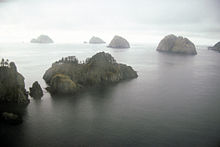
This is a list of islands of the U.S. state of Alaska. Approximately 2,670 named islands help to make Alaska the largest state in the United States. [A] [1]
^ A: Notes:
USGS GNIS named islands by Borough or Census Area: [2]
The Farne Islands are a group of islands off the coast of Northumberland, England. The group has between 15 and 20 islands depending on the level of the tide. They form an archipelago, divided into the Inner Group and the Outer Group. The main islands in the Inner Group are Inner Farne, Knoxes Reef, the East and West Wideopens, and the Megstone; the main islands in the Outer Group are Staple Island, Brownsman, North and South Wamses, Big Harcar, and Longstone. The two groups are separated by Staple Sound. The highest point, on Inner Farne, is 62 feet (19 m) above mean sea level.
The Commander Islands, Komandorski Islands, or Komandorskie Islands are a series of islands in the Russian Far East, a part of the Aleutian Islands, located about 175 km (109 mi) east of the Kamchatka Peninsula in the Bering Sea. Treeless and sparsely populated, the islands consist of Bering Island, Medny Island and fifteen islets and rocks. The largest of the latter are Tufted Puffin Rock (Kamen Toporkov or Ostrov Toporkov), 15 ha, and Kamen Ariy, which are between 3 km (1.9 mi) and 13 km (8.1 mi) west of the only settlement, Nikolskoye. Administratively, the Commanders compose the Aleutsky District of the Kamchatka Krai in Russia.
The Rat Islands are a group of American volcanic islands in the Aleutian Islands in southwestern Alaska, between Buldir Island and the Near Islands group to its west, and Amchitka Pass and the Andreanof Islands group to its east. The islands in the group are, from west to east, Kiska, Little Kiska, Segula, Hawadax or Kryssei, Khvostof, Davidof, Little Sitkin, Amchitka, and Semisopochnoi. The total land area of the Rat Islands is 360.849 sq mi (934.594 km2). None of the islands are inhabited at present, but at least Amchitka Island was an Aleut territory until the end of the eighteenth century.
The Alaska Maritime National Wildlife Refuge is a United States National Wildlife Refuge comprising 2,400 islands, headlands, rocks, islets, spires and reefs in Alaska, with a total area of 4.9 million acres (20,000 km2), of which 2.64 million acres (10,700 km2) is wilderness. The refuge stretches from Cape Lisburne on the Chukchi Sea to the tip of the Aleutian Islands in the west and Forrester Island in the southern Alaska Panhandle region in the east. The refuge has diverse landforms and terrains, including tundra, rainforest, cliffs, volcanoes, beaches, lakes, and streams.
Tatihou is an islet of Normandy in France with an area of 29 hectares. It is located to the east of the Cotentin peninsula just off the coast near Saint-Vaast-la-Hougue. It is almost uninhabited, and is usually reached by amphibious craft although, being a tidal island, it is also possible to walk there over the local oyster beds at low tide. Access to the island is limited to 500 visitors per day.
The Seal Islands are a group of small islands and rocky islets lying about 7 km north and north-west of Elephant Island, in the South Shetland Islands of Antarctica. They extend east–west for about 5 km, and are separated from Elephant Island by Sealers Passage. The group takes its name from the largest island, which Captain William Smith named Seal Island in 1820 because of the number of seals killed there.
Koniuji Island is one of the Andreanof Islands subgroup of the Aleutian Islands of southwestern Alaska, United States. It lies northwest of Atka Island and east of Kasatochi Island. Koniuji Island has a land area of 0.37 sq mi and is uninhabited. The name "Koniuji" is derived from Russian: конюга, romanized: konyuga "auklet", bestowed by Russian sailors in reference to the endemic seabirds. The Aleut name is Tanax̂silĝux̂ "the big made island", in reference to putative recent volcanic activity.
Seal Island, Seal Islands and similar may refer to:
The Needle Rocks, also known as the Needles, are a group of five main rock islets located close to the south-western coast of Tasmania, Australia. With a combined area of approximately 10.5 hectares (0.041 sq mi), the islets are part of the Maatsuyker Islands Group, and comprise part of the Southwest National Park and the Tasmanian Wilderness World Heritage Site.
The Five Islands Nature Reserve is a protected nature reserve located in the Tasman Sea, off the Illawarra east coast of the state of New South Wales, Australia. The 26-hectare (64-acre) reserve comprises five continental islands that are situated between 0.5 and 3.5 kilometres east of Port Kembla. The Five Islands are Flinders Islet, Bass Islet, Martin Islet, Big Island and Rocky Islet.
The George Rocks, also historically known as King George's Rocks, is part of the Waterhouse Island Group, a group of three adjacent uninhabited granite islets and associated reefs with a combined area of 7 hectares, situated in Banks Strait, part of Bass Strait, lying close to the north-eastern coast of Tasmania, Australia.
Brother Island, Brothers Island, etc. may refer to any of several islands and island groups around the world, including
The Fox Islands Passes are waterways in the Fox Islands area of the U.S. state of Alaska, connecting the Bering Sea with the North Pacific Ocean.
Big Koniuji Island is an island located in the Aleutians East Borough, Gulf of Alaska, southwest of mainland Alaska, United States. It is part of the Shumagin Islands, which consist of 20 islands, and lies southeast of Popof Island.