Related Research Articles
Aleneva is a census-designated place in the Kodiak Island Borough in the U.S. state of Alaska. As of the 2010 census, the population was 37, down from 68 in 2000.
Chiniak is a census-designated place (CDP) in Kodiak Island Borough, Alaska, United States. The population was 47 at the 2010 census, down from 50 in 2000.
Kodiak Station is a census-designated place (CDP) in Kodiak Island Borough, Alaska, United States. At the 2020 census the population was 1,673, up from 1,301 in 2010.
Ouzinkie, is a hamlet on Spruce Island in Kodiak Island Borough, Alaska, United States. At the 2010 census the population was 161, down from 225 in 2000.

Port Lions is a city located on Kodiak Island in the Kodiak Island Borough of the U.S. state of Alaska. As of the 2010 census, the population of the city was 194, down from 256 in 2000.
Womens Bay is a census-designated place (CDP) in Kodiak Island Borough, Alaska, United States. At the 2020 census the population was 743, up from 719 in 2010. The name is correctly spelled "Womens", without an apostrophe.

Afognak is an island in the Kodiak Archipelago 5 km (3.1 mi) north of Kodiak Island in the U.S. state of Alaska. It is 43 miles (69 km) long from east to west and 23 miles (37 km) wide from north to south and has a land area of 1,812.58 km2 (699.84 sq mi), making it the 18th largest island in the United States. The coast is split by many long, narrow bays. The highest point is 2,546 feet (776 m).

The Pacific Spaceport Complex – Alaska (PSCA), formerly known as the Kodiak Launch Complex (KLC), is a dual-use commercial and military spaceport for sub-orbital and orbital launch vehicles. The facility is owned and operated by the Alaska Aerospace Corporation, a public corporation of the State of Alaska, and is located on Kodiak Island in Alaska.

Coast Guard Air Station Kodiak is an Air Station of the United States Coast Guard located in Kodiak, Alaska. It is the largest in the service's Pacific Area, with a crew of 85 officers and 517 enlisted personnel, and the largest Coast Guard Base in terms of physical size at 23,000 acres. It is a tenant command of Base Support Unit Kodiak, and shares its airfield with Kodiak Airport. The station operates MH-60 Jayhawk and MH-65 Dolphin helicopters, and the HC-130 Hercules fixed-wing aircraft.
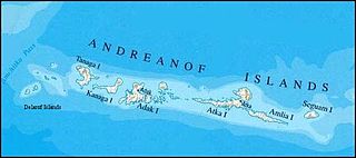
The Delarof Islands are a group of small islands at the extreme western end of the Andreanof Islands group in the central Aleutian Islands, Alaska. The Delarofs consist of 11 named islands: Amatignak, Gareloi, Ilak, Kavalga (Qavalĝa), Ogliuga (Aglaga), Skagul (Sxaĝulax̂), the Tag (Tagachaluĝis), Tanadak (Tanaadax̂), Ugidak (Qagan-tanax̂), Ulak, and Unalga (Unalĝa).

Unga Island is the largest of the Shumagin Islands off the Alaska Peninsula in southwestern Alaska, United States. The island has a land area of 170.73 sq mi (442.188 km2), making it the 36th largest island in the United States. As of the 2000 census, it had a permanent population of one.
Near Island is an island that comprises part of the city of Kodiak, Alaska, United States. It lies across the Near Island Channel just south of downtown Kodiak. The island is the site of St. Herman Harbor, the newer of Kodiak's two marinas. Near island has a land area of 1.117 km2 and a resident population of six people as of the 2000 census. It is connected to downtown Kodiak by the Near Island Bridge on Dog Bay Road.
Whale Island is an island of the Kodiak Archipelago in the Gulf of Alaska in Kodiak Island Borough, Alaska, United States. It lies off the northern end of Kodiak Island, between it and Afognak Island to the north. It is separated from Kodiak Island by Whale Pass, and from Afognak Island by Afognak Strait. Raspberry Island lies to the west, while Spruce Island lies to the east. Whale Island has a land area of 39.235 km2 and is unpopulated.
Ouzinkie Airport is a state-owned public-use airport serving Ouzinkie, a city on Spruce Island in the Kodiak Island Borough of the U.S. state of Alaska.
Trident Basin Seaplane Base is a city-owned, public-use seaplane base located in the City of Kodiak, in the Kodiak Island Borough of the U.S. state of United States. This seaplane base is located 4 nautical miles (7 km) northeast of the Kodiak Airport.

Windham Bay is located 45 miles (72 km) southeast of Juneau, in the U.S. state of Alaska. Windham Bay is listed as site 6 within Southeast Alaska's Zone 3 of the Alaska Dept. of Environmental Conservation's Geographic Response Strategy oil spill response plan. Part of the bay is a protected wilderness area; the Chuck River Wilderness, established in 1990 by the United States Congress, covers an area of 74,506 acres (30,152 ha). The Chuck River flows into Windham Bay, which has a protected anchorage north of Port Houghton, where the historic Chuck Mining Camp once operated.
Lakes named Summit Lake in Alaska include:

The Barren Islands (Sugpiaq: Usu'unaat) are an archipelago in Alaska in the United States. They are the northernmost islands of the Kodiak Archipelago. The largest island of the group is Ushagat Island. The islands have a combined land area of 16.23 square miles (42.03 km²) and are uninhabited. The largest breeding grounds of seabirds in Alaska are located in the Barren Islands on East Amatuli Island and Nord Island. The archipelago is part of the Alaska Maritime National Wildlife Refuge.

The USS YP-73 (ex-Corsair) was a converted fishing vessel which served as an auxiliary patrol boat in the U.S. Navy during World War II.
References
- ↑ U.S. Geological Survey Geographic Names Information System: Queer Island
- ↑ Orth, Donald J. (1967). Dictionary of Alaska Place Names. U.S. Government Printing Office. p. 787.
Coordinates: 57°40′36″N152°22′48″W / 57.6766667°N 152.38°W
| | This article about a location in the Kodiak Island Borough, Alaska is a stub. You can help Wikipedia by expanding it. |