Interior Alaska

Last updated
Interior Alaska. Interior Alaska Stub.png
Interior Alaska.
Fall in Interior Alaska. Interior fall.jpg
Fall in Interior Alaska.

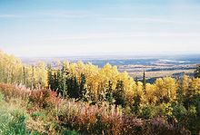
Interior Alaska is the central region of Alaska's territory, roughly bounded by the Alaska Range to the south and the Brooks Range to the north. It is largely wilderness. Mountains include Denali in the Alaska Range, the Wrangell Mountains, and the Ray Mountains. The native people of the interior are Alaskan Athabaskans. The largest city in the interior is Fairbanks, Alaska's second-largest city, in the Tanana Valley. Other towns include North Pole, just southeast of Fairbanks, Eagle, Tok, Glennallen, Delta Junction, Nenana, Anderson, Healy and Cantwell. The interior region has an estimated population of 113,154.

Contents

Climate

Northern Lights and Big Dipper at Fairbanks, AK during September. Big Dipper and Aurora.jpg
Northern Lights and Big Dipper at Fairbanks, AK during September.

Interior Alaska experiences extreme seasonal temperature variability. Winter temperatures in Fairbanks average −12 °F (−24 °C) and summer temperatures average +62 °F (+17 °C). Temperatures there have been recorded as low as −65 °F (−54 °C) in mid-winter, and as high as +99 °F (+37 °C) in summer. Both the highest and lowest temperature records for the state were set in the Interior, with 100 °F (38 °C) in Fort Yukon and −80 °F (−62 °C) in Prospect Creek. [1] Temperatures within a given winter are highly variable as well; extended cold snaps of forty below zero can be followed by unseasonable warmth with temperatures above freezing due to chinook wind effects.

Summers can be warm and dry for extended periods creating ideal fire weather conditions. Weak thunderstorms produce mostly dry lightning, sparking wildfires that are mostly left to burn themselves out as they are often far from populated areas. The 2004 season set a new record with over 6,600,000 acres (27,000 km2) burned.

Lakes and peaks of the Alaska Range seen from the Denali Highway Lakesalaskarange.JPG
Lakes and peaks of the Alaska Range seen from the Denali Highway

The average annual precipitation in Fairbanks is 11.3 inches (287 mm). Most of this comes in the form of snow during the winter. Most storms in the interior of Alaska originate in the Gulf of Alaska, south of the state, though these storms often have limited precipitation due to a rain shadow effect caused by the Alaska Range.

On clear winter nights, the aurora borealis can often be seen in the sky. Like all subarctic regions, the months from May to July in the summer have no night, only a twilight during the night hours. The months of November to January have little daylight. Fairbanks receives an average 21 hours of daylight between May 10 and August 2 each summer, and an average of less than four hours of daylight between November 18 and January 24 each winter.

The interior of Alaska is largely underlined by discontinuous permafrost, which grades to continuous permafrost as the Arctic Circle is approached.

Climate data for Fairbanks International Airport, Alaska (1991–2020 normals, [lower-alpha 1] extremes 1904present [lower-alpha 2] )
MonthJanFebMarAprMayJunJulAugSepOctNovDecYear
Record high °F (°C)52
(11)
50
(10)
56
(13)
76
(24)
90
(32)
96
(36)
99
(37)
93
(34)
84
(29)
72
(22)
54
(12)
58
(14)
99
(37)
Mean maximum °F (°C)29.7
(−1.3)
35.4
(1.9)
45.1
(7.3)
61.9
(16.6)
76.6
(24.8)
85.1
(29.5)
85.0
(29.4)
80.0
(26.7)
69.3
(20.7)
54.8
(12.7)
32.7
(0.4)
32.2
(0.1)
87.5
(30.8)
Average high °F (°C)0.6
(−17.4)
11.6
(−11.3)
24.9
(−3.9)
45.6
(7.6)
62.1
(16.7)
71.8
(22.1)
72.7
(22.6)
66.4
(19.1)
55.3
(12.9)
34.1
(1.2)
12.3
(−10.9)
4.3
(−15.4)
38.5
(3.6)
Daily mean °F (°C)−8.3
(−22.4)
0.2
(−17.7)
10.7
(−11.8)
33.7
(0.9)
50.3
(10.2)
61.0
(16.1)
62.9
(17.2)
57.0
(13.9)
45.8
(7.7)
26.2
(−3.2)
4.1
(−15.5)
−4.3
(−20.2)
28.3
(−2.1)
Average low °F (°C)−17.2
(−27.3)
−11.2
(−24.0)
−3.4
(−19.7)
21.7
(−5.7)
38.6
(3.7)
50.2
(10.1)
53.1
(11.7)
47.6
(8.7)
36.2
(2.3)
18.4
(−7.6)
−4.1
(−20.1)
−13.0
(−25.0)
18.1
(−7.7)
Mean minimum °F (°C)−43.2
(−41.8)
−36.0
(−37.8)
−27.3
(−32.9)
−2.4
(−19.1)
26.2
(−3.2)
40.2
(4.6)
44.2
(6.8)
36.1
(2.3)
23.4
(−4.8)
−2.9
(−19.4)
−25.9
(−32.2)
−36.5
(−38.1)
−45.8
(−43.2)
Record low °F (°C)−66
(−54)
−58
(−50)
−56
(−49)
−32
(−36)
−1
(−18)
28
(−2)
30
(−1)
21
(−6)
3
(−16)
−28
(−33)
−54
(−48)
−62
(−52)
−66
(−54)
Average precipitation inches (mm)0.61
(15)
0.52
(13)
0.40
(10)
0.34
(8.6)
0.54
(14)
1.48
(38)
2.26
(57)
2.10
(53)
1.35
(34)
0.76
(19)
0.74
(19)
0.57
(14)
11.67
(296)
Average snowfall inches (cm)10.2
(26)
10.0
(25)
6.5
(17)
3.1
(7.9)
0.9
(2.3)
0.0
(0.0)
0.0
(0.0)
0.0
(0.0)
2.3
(5.8)
8.2
(21)
12.5
(32)
10.9
(28)
64.6
(164)
Average precipitation days (≥ 0.01 in)8.76.95.73.76.210.812.813.510.79.89.58.8107.1
Average snowy days (≥ 0.1 in)10.28.36.72.60.60.00.00.01.38.311.210.459.6
Average relative humidity (%)69.365.560.456.250.256.664.270.868.974.172.871.365.0
Average dew point °F (°C)−17.0
(−27.2)
−11.9
(−24.4)
−0.2
(−17.9)
16.2
(−8.8)
29.7
(−1.3)
42.6
(5.9)
48.7
(9.3)
46.0
(7.8)
34.5
(1.4)
17.4
(−8.1)
−3.8
(−19.9)
−13.2
(−25.1)
15.8
(−9.0)
Mean monthly sunshine hours 541202243023193342741641228571362,105
Source 1: [2] [3] NOAA (relative humidity 1961–1990) [4] [5] [6] [7]
Source 2: Danish Meteorological Institute (sun, 1931–1960) [8]

Alaska Natives

While the vast majority of indigenous Native people of Interior Alaska are Athabaskan Indians, large Yup'ik and Iñupiaq populations reside in Fairbanks. [9]

The federally recognized tribes of Interior Alaska: [9]

Notes

  1. Mean monthly maxima and minima (i.e. the highest and lowest temperature readings during an entire month or year) calculated based on data at said location from 1991 to 2020.
  2. Records for Fairbanks have been kept at the Fairbanks International Airport since December 1929 and at an undisclosed location from September 1904 to November 1929. For more information, see ThreadEx

Related Research Articles

<span class="mw-page-title-main">Yukon–Koyukuk Census Area, Alaska</span> Census area in Alaska, United States

Yukon–Koyukuk Census Area is a census area in the U.S. state of Alaska. As of the 2020 census, the population was 5,343, down from 5,588 in 2010. With an area of 147,842.51 sq mi (382,910.3 km2), it is the largest of any county or county-equivalent in the United States, or about the same size as the entire state of Montana. It is part of the unorganized borough of Alaska and therefore has no borough seat. Its largest communities are the cities of Galena, in the west, and Fort Yukon, in the northeast.

<span class="mw-page-title-main">Healy, Alaska</span> Census-designated place in Alaska, United States

Healy is a census-designated place (CDP) and the borough seat of Denali Borough in the U.S. state of Alaska. The population was 966 at the time of the 2020 census, down from 1,021 in 2010.

<span class="mw-page-title-main">College, Alaska</span> Census-designated place in Alaska, United States

College is a census-designated place (CDP) in Fairbanks North Star Borough, Alaska, United States. It is part of the Fairbanks, Alaska Metropolitan Statistical Area. As of the 2020 census, the population was 11,332, down from 12,964 in 2010. College is the third-most populated CDP in Alaska.

<span class="mw-page-title-main">Fairbanks, Alaska</span> City in Alaska, United States

Fairbanks is a home rule city and the borough seat of the Fairbanks North Star Borough in the U.S. state of Alaska. Fairbanks is the largest city in the Interior region of Alaska and the second largest in the state. The 2020 Census put the population of the city proper at 32,515 and the population of the Fairbanks North Star Borough at 95,655, making it the second most populous metropolitan area in Alaska after Anchorage. The Metropolitan Statistical Area encompasses all of the Fairbanks North Star Borough and is the northernmost Metropolitan Statistical Area in the United States, located 196 miles by road south of the Arctic Circle.

<span class="mw-page-title-main">Big Delta, Alaska</span> CDP in Alaska, United States

Big Delta is a census-designated place (CDP) in Southeast Fairbanks Census Area, Alaska, United States. The population was 591 at the 2010 census, down from 749 in 2000. Big Delta is at the confluence of the Delta River and the Tanana River and gets its name from the huge river delta formed by the confluence.

<span class="mw-page-title-main">Delta Junction, Alaska</span> City in Alaska, United States

Delta Junction is a city in the Southeast Fairbanks Census Area, Alaska, United States. As of the 2010 census, the population was 958, up from 840 in 2000. The 2018 estimate was down to 931. The city is located a short distance south of the confluence of the Delta River with the Tanana River, which is at Big Delta. It is about 160 km (99 mi) south of Fairbanks. Native inhabitants are Tanana Athabaskans.

<span class="mw-page-title-main">Allakaket, Alaska</span> City in Alaska, United States

Allakaket is a second class city in the Yukon-Koyukuk Census Area of the Unorganized Borough of the U.S. state of Alaska. The population was 105 at the 2010 census.

<span class="mw-page-title-main">Evansville, Alaska</span> CDP in Alaska, United States

Evansville is a census-designated place (CDP) in Yukon-Koyukuk Census Area, Alaska, United States. The population was 15 at the 2010 census, down from 28 in 2000. The community is adjacent to Bettles. The community is named after Wilford Evans, Sr, who took part in the founding of Bettles Lodge.

<span class="mw-page-title-main">Galena, Alaska</span> City in Alaska, United States

Galena is a city in the Yukon-Koyukuk Census Area in the U.S. state of Alaska. At the 2020 census the population was 472, slightly up from 470 in 2010. Galena was established in 1918, and a military airfield was built adjacent to the city during World War II. The city was incorporated in 1971.

Minto is a census-designated place (CDP) in Yukon-Koyukuk Census Area, Alaska, United States. As of the 2020 census, the population of the CDP is 150, down from 210 in 2010. The name is an anglicized version of the Lower Tanana Athabaskan name Menhti, meaning 'among the lakes'. After repeated flooding the village was relocated to its present location in 1969. The former village site is now known as Old Minto.

<span class="mw-page-title-main">Nenana, Alaska</span> City in Alaska, United States

Nenana (Lower Tanana: Toghotili; is a home rule city in the Yukon-Koyukuk Census Area of the Unorganized Borough in the Interior of the U.S. state of Alaska. Nenana developed as a Lower Tanana community at the confluence where the tributary Nenana River enters the Tanana. The population was 378 at the 2010 census, down from 402 in 2000.

<span class="mw-page-title-main">Tanana, Alaska</span> City in the Yukon-Koyukuk Census Area in Alaska, United States

Tanana is a city in the Yukon-Koyukuk Census Area in the U.S. state of Alaska. At the 2010 census the population was 246, down from 308 in 2000. It was formerly known as Clachotin, adopted by Canadian French.

<span class="mw-page-title-main">Tanana River</span> River in Alaska, United States

The Tanana River is a 584-mile (940 km) tributary of the Yukon River in the U.S. state of Alaska. According to linguist and anthropologist William Bright, the name is from the Koyukon (Athabaskan) tene no, tenene, literally "trail river".

The Tanana Valley is a lowland region in central Alaska in the United States, on the north side of the Alaska Range, where the Tanana River emerges from the mountains. Traditional inhabitants of the valley are Tanana Athabaskans of Alaskan Athabaskans.

Lower Tanana is an endangered language spoken in Interior Alaska in the lower Tanana River villages of Minto and Nenana. Of about 380 Tanana people in the two villages, about 30 still speak the language. As of 2010, “Speakers who grew up with Lower Tanana as their first language can be found only in the 250-person village of Minto.” It is one of the large family of Athabaskan languages, also known as Dené.

Koyukon is the geographically most widespread Athabascan language spoken in Alaska. The Athabaskan language is spoken along the Koyukuk and the middle Yukon River in western interior Alaska. In 2007, the language had approximately 300 speakers, who were generally older adults bilingual in English. The total Koyukon ethnic population was 2,300.

<span class="mw-page-title-main">Tanana Chiefs Conference</span> Gathering of Indigenous leaders in Alaska

Tanana Chiefs Conference (TCC), the traditional tribal consortium of the 42 villages of Interior Alaska, is based on a belief in tribal self-determination and the need for regional Native unity. TCC is a non-profit organization that works toward meeting the needs and challenges for more than 10,000 Alaska Natives in Interior Alaska.

<span class="mw-page-title-main">Geography of Alaska</span> Geographical features of Alaska

Alaska occupies the northwestern portion of the North American continent and is bordered only by Canada on the east. It is one of two U.S. states not bordered by another state; Hawaii is the other. Alaska has more ocean coastline than all of the other U.S. states combined. About 500 miles (800 km) of Canadian territory separate Alaska from Washington state. Alaska is thus an exclave of the United States that is part of the continental U.S. and the U.S. West Coast, but is not part of the contiguous U.S.

<span class="mw-page-title-main">Climate of Anchorage</span>

Anchorage, Alaska has a subarctic climate with the code Dfc according to the Köppen climate classification due to its short, cool summers. The weather on any given day is very unpredictable. Some winters feature several feet of snow and cold temperatures, while the summers are typically mild but are cool compared to the contiguous US and interior Alaska. Because of Anchorage's high latitude, summer days are very long and winter daylight hours are very short. The longest day of sunlight being 18hrs and 21 minutes, and shortest being 5 hours and 28 minutes. Anchorage is often cloudy during the winter, which decreases the amount of sunlight experienced by residents.

<span class="mw-page-title-main">Tanana Athabaskans</span> Alaskan Athabaskan peoples

The Tanana Athabaskans, Tanana Athabascans or Tanana Athapaskans are an Alaskan Athabaskan peoples of the Athabaskan-speaking ethnolinguistic group. They are the original inhabitants of the Tanana River drainage basin in east-central Alaska Interior, United States and a little part lived in Yukon, Canada. Tanana River Athabaskan peoples are called in Lower Tanana and Koyukon language Ten Hʉt'ænæ, in Gwich'in language Tanan Gwich'in. In Alaska, where they are the oldest, there are three or four groups identified by the languages they speak. These are the Tanana proper or Lower Tanana and/or Middle Tanana, Tanacross or Tanana Crossing, and Upper Tanana. The Tanana Athabaskan culture is a hunter-gatherer culture and have a matrilineal system. Tanana Athabaskans were semi-nomadic and as living in semi-permanent settlements in the Tanana Valley lowlands. Traditional Athabaskan land use includes fall hunting of moose, caribou, Dall sheep, and small terrestrial animals, and also trapping. The Athabaskans did not have any formal tribal organization. Tanana Athabaskans were strictly territorial and used hunting and gathering practices in their semi-nomadic way of life and dispersed habitation patterns. Each small band of 20–40 people normally had a central winter camp with several seasonal hunting and fishing camps, and they moved cyclically, depending on the season and availability of resources.

References

  1. "State Extremes". Western Regional Climate Center, Desert Research Institute. Archived from the original on 5 January 2007. Retrieved 2007-01-03.
  2. Shulski, p. 155
  3. Alaska Climate Research Center. "Fairbanks International Airport, AK" Archived January 11, 2013, at the Wayback Machine , climate.gi.alaska.edu. Accessed October 4, 2009.
  4. "NOWData - NOAA Online Weather Data". National Oceanic and Atmospheric Administration . Retrieved May 8, 2021.
  5. "Station: FAIRBANKS INTL AP, AK". U.S. Climate Normals 2020: U.S. Monthly Climate Normals (1991-2020). National Oceanic and Atmospheric Administration. Archived from the original on 2023-05-09. Retrieved May 8, 2021.
  6. "WMO Climate Normals for FAIRBANKS/INTL, AK 19611990". National Oceanic and Atmospheric Administration. Archived from the original on 2023-05-09. Retrieved August 31, 2020.
  7. "Northern Alaska Climate (Contains high temperature records for July 28, 1919)". National Weather Service. Archived from the original on 2023-07-30. Retrieved 2023-07-30.
  8. Cappelen, John; Jensen, Jens. "USA - Fairbanks, Alaska" (PDF). Climate Data for Selected Stations (1931-1960) (in Danish). Danish Meteorological Institute. p. 303. Archived from the original (PDF) on April 27, 2013. Retrieved March 14, 2016.
  9. 1 2 ihs.gov: Interior Alaska Service Area

65°N152°W / 65°N 152°W / 65; -152