Dillingham Census Area, Alaska

Last updated

Dillingham Census Area, Alaska
Amalik Bay Archeological District (20357938118).jpg
Map of Alaska highlighting Dillingham Census Area.svg
Location within the U.S. state of Alaska
Coordinates: 59°57′N158°26′W / 59.95°N 158.43°W / 59.95; -158.43
CountryFlag of the United States.svg United States
StateFlag of Alaska.svg Alaska
Established1980 [1]
Largest city Dillingham
Area
  Total
20,915 sq mi (54,170 km2)
  Land18,569 sq mi (48,090 km2)
  Water2,346 sq mi (6,080 km2)  11.2%
Population
 (2020)
  Total
4,857
  Density0.26/sq mi (0.10/km2)
Time zone UTC−9 (Alaska)
  Summer (DST) UTC−8 (ADT)
Congressional district At-large

Dillingham Census Area is a census area located in the state of Alaska, United States. At the 2020 census, the population was 4,857, [2] slightly up from 4,847 in 2010. [3] It is part of the unorganized borough and therefore has no borough seat. Its largest community by far is the city of Dillingham, on a small arm of Bristol Bay on the Bering Sea.

Contents

Geography

According to the U.S. Census Bureau, the census area has a total area of 20,915 square miles (54,170 km2), of which 18,569 square miles (48,090 km2) is land and 2,346 square miles (6,080 km2) (11.2%) is water. [4]

Adjacent boroughs and census areas

National protected areas

Demographics

Historical population
CensusPop.Note
1960 4,024
1970 3,485−13.4%
1980 4,61632.5%
1990 4,012−13.1%
2000 4,92222.7%
2010 4,847−1.5%
2020 4,8570.2%
2023 (est.)4,607 [5] −5.1%
U.S. Decennial Census [6]
1790-1960 [7] 1900-1990 [8]
1990-2000 [9] 2010-2020 [3]

2020 census

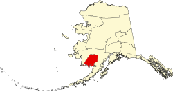
Dillingham Census Area, Alaska – Racial and ethnic composition
Note: the US Census treats Hispanic/Latino as an ethnic category. This table excludes Latinos from the racial categories and assigns them to a separate category. Hispanics/Latinos may be of any race.
Race / Ethnicity (NH = Non-Hispanic)Pop 1980 [10] Pop 1990 [11] Pop 2000 [12] Pop 2010 [13] Pop 2020 [14] % 1980% 1990% 2000% 2010% 2020
White alone (NH)1,0511,0071,03185577022.77%25.10%20.95%17.64%15.85%
Black or African American alone (NH)181811190.02%0.20%0.37%0.23%0.39%
Native American or Alaska Native alone (NH)3,5202,9173,4153,4313,41276.26%72.71%69.38%70.79%70.25%
Asian alone (NH)7253032450.15%0.62%0.61%0.66%0.93%
Native Hawaiian or Pacific Islander alone (NH)x [15] x [16] 169xx0.02%0.12%0.19%
Other race alone (NH)1466170.30%0.15%0.12%0.02%0.14%
Mixed race or Multiracial (NH)x [17] x [18] 310410449xx6.30%8.46%9.24%
Hispanic or Latino (any race)23491111011460.50%1.22%2.26%2.08%3.01%
Total4,6164,0124,9224,8474,857 100.00%100.00%100.00%100.00%100.00%


As of the 2020 census, the county had a population of 4,857. The median age was 31.3 years, 31.7% of residents were under the age of 18, and 10.5% were 65 years of age or older. For every 100 females there were 105.9 males, and for every 100 females age 18 and over there were 109.5 males age 18 and over. [19]

The racial makeup of the county was 16.5% White, 0.5% Black or African American, 71.1% American Indian and Alaska Native, 1.0% Asian, 0.2% Native Hawaiian and Pacific Islander, 0.6% from some other race, and 10.2% from two or more races. Hispanic or Latino residents of any race comprised 3.0% of the population. [20]

0.0% of residents lived in urban areas, while 100.0% lived in rural areas. [21]

There were 1,558 households in the county, of which 42.6% had children under the age of 18 living with them and 25.6% had a female householder with no spouse or partner present. About 27.0% of all households were made up of individuals and 7.1% had someone living alone who was 65 years of age or older. [19]

There were 2,405 housing units, of which 35.2% were vacant. Among occupied housing units, 63.7% were owner-occupied and 36.3% were renter-occupied. The homeowner vacancy rate was 0.6% and the rental vacancy rate was 9.3%. [19]

2000 census

At the 2000 census there were 4,922 people, 1,529 households, and 1,105 families living in the census area. The population density was 0 people per square mile (0 people/km2). There were 2,332 housing units at an average density of 0 per square mile (0/km2). The racial makeup of the census area was 21.64% White, 0.37% Black or African American, 70.13% Native American, 0.61% Asian, 0.02% Pacific Islander, 0.55% from other races, and 6.68% from two or more races. 2.26% of the population were Hispanic or Latino of any race. 34.6% reported speaking Yupik or Eskimo at home . [22] Of the 1,529 households 45.30% had children under the age of 18 living with them, 51.10% were married couples living together, 15.00% had a female householder with no husband present, and 27.70% were non-families. 23.30% of households were one person and 3.60% were one person aged 65 or older. The average household size was 3.20 and the average family size was 3.84.

The age distribution was 38.10% under the age of 18, 7.70% from 18 to 24, 28.90% from 25 to 44, 19.50% from 45 to 64, and 5.70% 65 or older. The median age was 29 years. For every 100 females, there were 109.00 males. For every 100 females age 18 and over, there were 108.80 males. The per capita income is estimated at 23,500 U.S. dollars per year.

Politics

United States presidential election results for Dillingham Census Area, Alaska [23]
Year Republican Democratic Third party(ies)
No.%No.%No.%
1960 19241.03%27658.97%00.00%
1964 15623.18%51776.82%00.00%
1968 34049.93%32046.99%213.08%
1972 36551.63%31244.13%304.24%
1976 51253.39%41142.86%363.75%
1980 37836.84%47746.49%17116.67%
1984 1,05566.98%46129.27%593.75%
1988 80058.18%52037.82%554.00%
1992 70745.67%53534.56%30619.77%
1996 54439.00%64346.09%20814.91%
2000 89153.90%59235.81%17010.28%
2004 79758.47%52138.22%453.30%
2008 1,08454.66%85142.91%482.42%
2012 59236.12%96759.00%804.88%
2016 66034.59%99251.99%25613.42%
2020 82243.10%98451.60%1015.30%
2024 76350.70%67044.52%724.78%

Dillingham Census Area is quite competitive in presidential elections.

Communities

Koliganek and the Nushagak River August 11, 2011 Village of Koliganek, Alaska (6990791332).jpg
Koliganek and the Nushagak River

Cities

Census-designated places

See also

References

  1. In 1980, the United States Census Bureau divided the Unorganized Borough into 12 census areas.
  2. "2020 Census Data - Cities and Census Designated Places" (Web). State of Alaska, Department of Labor and Workforce Development. Retrieved October 31, 2021.
  3. 1 2 "State & County QuickFacts". United States Census Bureau. Archived from the original on August 9, 2014. Retrieved May 18, 2014.
  4. "US Gazetteer files: 2010, 2000, and 1990". United States Census Bureau. February 12, 2011. Retrieved April 23, 2011.
  5. "Annual Estimates of the Resident Population for Counties: April 1, 2020 to July 1, 2023". United States Census Bureau. Retrieved March 28, 2024.
  6. "U.S. Decennial Census". United States Census Bureau. Retrieved May 18, 2014.
  7. "Historical Census Browser". University of Virginia Library. Retrieved May 18, 2014.
  8. "Population of Counties by Decennial Census: 1900 to 1990". United States Census Bureau. Retrieved May 18, 2014.
  9. "Census 2000 PHC-T-4. Ranking Tables for Counties: 1990 and 2000" (PDF). United States Census Bureau. Archived (PDF) from the original on October 9, 2022. Retrieved May 18, 2014.
  10. "Alaska: 1980, General Social and Economic Characteristics, Table 59: Persons by Race, Hispanic Origin, and Sex" (PDF). United States Census Bureau . Archived from the original (PDF) on December 18, 2025.
  11. "Alaska: 1990, General Population Characteristics, Table 5: Race and Hispanic Origin" (PDF). United States Census Bureau . Archived from the original (PDF) on September 30, 2025.
  12. "P004: Hispanic or Latino, and Not Hispanic or Latino by Race – 2000: DEC Summary File 1 – Dillingham Census Area, Alaska". United States Census Bureau .
  13. "P2: Hispanic or Latino, and Not Hispanic or Latino by Race – 2010: DEC Redistricting Data (PL 94-171) – Dillingham Census Area, Alaska". United States Census Bureau .
  14. "P2: Hispanic or Latino, and Not Hispanic or Latino by Race – 2020: DEC Redistricting Data (PL 94-171) – Dillingham Census Area, Alaska". United States Census Bureau .
  15. included in the Asian category in the 1980 Census
  16. included in the Asian category in the 1990 Census
  17. not an option in the 1980 Census
  18. not an option in the 1990 Census
  19. 1 2 3 "2020 Decennial Census Demographic Profile (DP1)". United States Census Bureau. 2021. Retrieved December 20, 2025.
  20. "2020 Decennial Census Redistricting Data (Public Law 94-171)". United States Census Bureau. 2021. Retrieved December 20, 2025.
  21. "2020 Decennial Census Demographic and Housing Characteristics (DHC)". United States Census Bureau. 2023. Retrieved December 20, 2025.
  22. "U.S. Census website". United States Census Bureau . Retrieved May 14, 2011.
  23. Elections, RRH (February 2, 2018). "RRH Elections". rrhelections.com. Retrieved January 12, 2020.

59°57′N158°26′W / 59.95°N 158.43°W / 59.95; -158.43