This article needs additional citations for verification .(February 2010) |
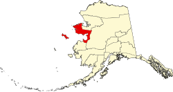
Nome Census Area, Alaska | |
|---|---|
 | |
 Location within the U.S. state of Alaska | |
| Coordinates: 64°44′N164°11′W / 64.74°N 164.19°W | |
| Country | |
| State | |
| Established | 1980 [1] |
| Named after | Nome |
| Largest city | Nome |
| Area | |
• Total | 28,278 sq mi (73,240 km2) |
| • Land | 22,962 sq mi (59,470 km2) |
| • Water | 5,316 sq mi (13,770 km2) 18.8% |
| Population (2020) | |
• Total | 10,046 |
• Estimate (2022) | 9,835 |
| • Density | 0.43751/sq mi (0.16892/km2) |
| Time zone | UTC−9 (Alaska) |
| • Summer (DST) | UTC−8 (ADT) |
| Congressional district | At-large |
Nome Census Area is a census area located in the U.S. state of Alaska, mostly overlapping with the Seward Peninsula. As of the 2020 census, the population was 10,046, up from 9,492 in 2010. [2] It is part of the unorganized borough and therefore has no borough seat. Its largest community by far is the city of Nome.