References
- ↑ Patty, Stanton (April 13, 2008). "'The Last Train to Nowhere' sits outside Nome, a ghost on the tundra". Seattle Times . Retrieved February 27, 2023.
- ↑ Pacific Monthly (Public domain ed.). Pacific monthly published Company. 1902. pp. 269–. Retrieved April 6, 2013.
- ↑ Smith, Philip Sidney (1910). Geology and mineral resources of the Solomon and Casadepaga quadrangles, Seward Peninsula, Alaska (Public domain ed.). Government Printing Office. pp. 9–. Retrieved April 6, 2013.
Municipalities and communities of Nome Census Area, Alaska, United States | ||
|---|---|---|
| Cities | 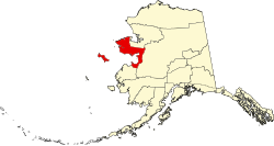 | |
| CDP | ||
| Unincorporated communities | ||
| Ghost towns | ||
64°33′20″N164°24′53″W / 64.55556°N 164.41472°W
| | This article about a location in the Nome Census Area, Alaska is a stub. You can help Wikipedia by expanding it. |
| | This United States ghost town-related article is a stub. You can help Wikipedia by expanding it. |