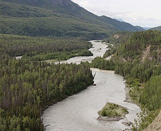
The Susitna River is a 313-mile (504 km) long river in the Southcentral Alaska. It is the 15th largest river in the United States, ranked by average discharge volume at its mouth. The river stretches from the Susitna Glacier to Cook Inlet's Knik Arm.
The Matanuska River is a 75-mile (121 km) long stream in Southcentral Alaska, United States. The river drains a broad valley south of the Alaska Range eponymously known as the Matanuska Valley.
The Glenn Highway is a highway in the U.S. state of Alaska, extending 179 miles (288 km) from Anchorage near Merrill Field to Glennallen on the Richardson Highway. The Tok Cut-Off is often considered part of the Glenn Highway, for a total length of 328 miles (528 km).

The Kiwalik River is a stream on the Seward Peninsula in the U.S. state of Alaska. The headwaters of the river originate in the eastern portion of the peninsula, around Granite Mountain. The river flows north to its mouth at Kiwalik Lagoon, Chukchi Sea. The start of the 20th century mining town of Candle is found on its western bank at the confluence of Candle Creek. The ore minerals and materials found in the river basin are galena, gold, pyrite, scheelite, silver and sphalerite, and the primary commodities are tungsten, lead and zinc.
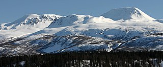
The Talkeetna Mountains are a mountain range in Alaska. The Matanuska and Susitna River valleys, with towns such as Trapper Creek, Talkeetna, Wasilla, Palmer, Sutton, and Chickaloon, roughly bound the Talkeetnas in the westerly parts of the range. Sovereign Mountain rises to 8,849 feet (2,697 m) in the remote and heavily glaciated central part of the range. The east side of the range fronts a broad, about 100 miles (160 km) wide, lake-studded lowland of forests and swamps, across which rises the gigantic Mount Wrangell volcanic edifice. Alaska Highway 4 runs northward through this lowland. Hundreds of miles to the west Alaska Highway 3 runs along the western side of the Talkeetna range, with the Alaska Range directly west. Alaska Highway 1, running along the southern front of the Talkeetna Mountains, lies mainly in a valley marking a tectonic divide between the Jurassic and Cretaceous rocks of the accretionary wedge, island-arc, and basement rocks in the Peninsular terrane, and the Chugach Mountains in the Chugach terrane to the south. The range stretches as much as a hundred miles north to south. Alaska Highway 8, seasonal and unpaved, passes over highlands rising to above 4,000 feet (1,200 m), north of the Talkeetnas.

The Fish River is a waterway in the U.S. state of Alaska. The 47-mile-long (76 km) river rises in the Bendeleben Mountains and flows south to Golovnin Lagoon, before emptying into Golovnin Bay, Norton Sound, and the Bering Sea. The basin formed by the Fish River is known for its placer gold deposits, and in particular, the Niukluk River and its tributaries; production from this tributary valley is reported to be more than from any other place in the region. A galena mine existed 40 miles (64 km) from the sea, worked on occasion by a San Francisco corporation with a few hundred tons of ore taken to the city for smelting and refining for silver. Walter Curran Mendenhall found obscure fossils on Fish River at White Mountain.
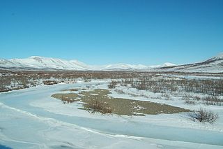
The Bendeleben (/ˈbɛn.dəˌleɪ.bɨn/) Mountains are a mountain range on the heart of the Seward Peninsula in Nome Census Area, Alaska, United States. This range forms a major divide between drainage basins draining into the Pacific Ocean and the Arctic Ocean. The tallest peak, Mount Bendeleben is 3,730 feet (1,140 m) at the summit, and is located on the west end. Bits of the range go into the Bering Land Bridge National Preserve, but most of the peaks remain unclaimed. The Tubutulik River flows in the area.

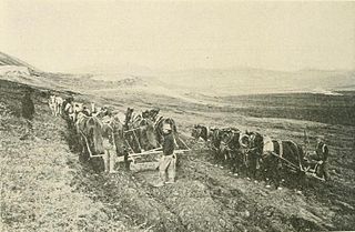
Gold mining in Alaska, a state of the United States, has been a major industry and impetus for exploration and settlement since a few years after the United States acquired the territory from Russia. Russian explorers discovered placer gold in the Kenai River in 1848, but no gold was produced. Gold mining started in 1870 from placers southeast of Juneau, Alaska.

The Nome mining district, also known as the Cape Nome mining district, is a gold mining district in the U.S. state of Alaska. It was discovered in 1898 when Erik Lindblom, Jafet Lindeberg and John Brynteson, the "Three Lucky Swedes", found placer gold deposits on Anvil Creek and on the Snake River few miles from the future site of Nome. Word of the strike caused a major gold rush to Nome in the spring of 1899.
Niukluk River is a waterway in the U.S. state of Alaska. It rises in the Bendeleben Mountains and, after flowing across a broad valley lowland for about 15 miles (24 km), enters a narrower valley, in which it flows for about 20 miles (32 km). Below the mouth of Melsing Creek, the valley broadens out and merges with that of Fish River, to which the Niukluk is tributary. It receives many tributaries, of which the Koksuktapaga, joining it from the south, is the largest. In Niukluk River itself, gold was found at its head, though most abundant below the mouth of American Creek. Just below the mouth of Ophir Creek, a little gold has been rocked out on the bars. The broad gravel flood plain in this part of the basin is said to be auriferous. Below the mouth of Ophir Creek the river has cut a small rock canyon 50 feet (15 m) below an old valley floor, leaving broad benches on either side. These benches are sheeted over by a few feet of gravel.
Eldorado River is a waterway on the Seward Peninsula]] in the U.S. state of Alaska. It is situated 14 miles (23 km) west of Solomon. This river has its source within a few miles of Salmon Lake, from which it is separated by a low divide. It flows southeast through a broad gravel-filled valley for 30 miles (48 km) to Flambeau River before emptying into Safety Sound. Its headwaters reach the limestones of the Nome series and much of its course lies in a chlorite-albite-schist belt. The Eldorado River provides a southerly drainage into the Bering Sea.
Fox River is a waterway on the Seward Peninsula in the U.S. state of Alaska. It is 32 miles (51 km) from Solomon. The Fox flows eastward for 18 miles (29 km) before reaching the Fish River from the west.
Nome River is a waterway on the Seward Peninsula in the U.S. state of Alaska. It has its source in a narrow valley in the southern margin of the Kigluaik Mountains, 4.5 miles (7.2 km) west of Salmon Lake.

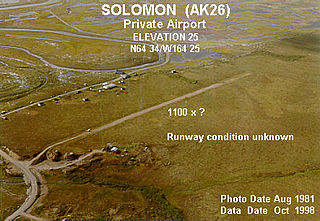
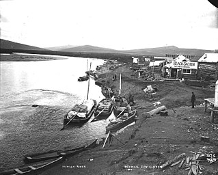
Council City and Solomon River Railroad is an abandoned railroad in the U.S. state of Alaska. Its name refers to Solomon River and the city of Council in the Nome Census Area. The railway operated from 1903 to 1907. The remains of the railroad at Mile 31 of the Nome-Council Highway, comprising three locomotives, two flat cars and a boiler, were listed as an historic district on the National Register of Historic Places in 2001.
Dickson was a settlement in the U.S. state of Alaska. Situated in the Nome Census Area on the Seward Peninsula, it was located directly opposite Solomon, on the east bank of the Solomon River. It was the coastal terminus of the Council City and Solomon River Railroad. All of its industries and inhabitants were connected with the railroad. Established in 1903, it was named for T. Warren Dickson, general manager of the Western Alaska Construction Company, which built the railroad. By 1910, its population was approximately 50 residents.

Bluestone River is a waterway located on the Seward Peninsula in the U.S. state of Alaska. A tributary of the Tuksuk Channel from the south, Bluestone is a north-flowing stream situated 11 miles (18 km) southeast of Teller. It was named in 1900 by Edward Chester Barnard, topographer of the United States Geological Survey.
The Miocene Ditch is one of three historic ditches located along the west side of the Nome River, on the Seward Peninsula, Alaska. It and the other two, the Seward and Pioneer ditches, were built to provide water to early placer mining operations near Nome. The Miocene is the oldest and longest of the three ditches, and the highest in elevation. From suitable locations along the Nome-Taylor Road the ditches form distinct parallel lines crossing tundra promontories west of the river.

Kuskulana River is a waterway in the U.S. state of Alaska. It is located in the Wrangell–St. Elias National Park and Preserve.