Haycock, Alaska | |
|---|---|
 Haycock, Alaska | |
| Coordinates: 65°12′35″N161°09′56″W / 65.20972°N 161.16556°W | |
| Country | United States |
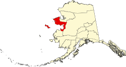
| State | Alaska |
| Census area | Nome |
| Elevation | 184 ft (56 m) |
| Time zone | UTC-9 (Alaska (AKST)) |
| • Summer (DST) | UTC-8 (AKDT) |
| Area code | 907 |
| GNIS feature ID | 1403253 [1] |
Haycock is an unincorporated community and mining camp in the Nome Census Area, Alaska, United States.