This article needs additional citations for verification .(December 2019) |
Unorganized Borough | |
---|---|
Coordinates: 57°30′N156°42′W / 57.5°N 156.7°W | |
Country | United States |
State | Alaska |
Seat | None |
Largest community | Bethel |
Area | |
• Total | 323,440 sq mi (837,700 km2) |
Population (2020) | |
• Total | 77,157 |
• Density | 0.24/sq mi (0.092/km2) |
Time zones | UTC−9 (Alaska) |
• Summer (DST) | UTC−8 (ADT) |
UTC−10 (Hawaii–Aleutian) | |
• Summer (DST) | UTC−9 (HADT) |
The Unorganized Borough is composed of the portions of the U.S. state of Alaska which are not contained in any of its 19 organized boroughs. While referred to as the "Unorganized Borough", it is not a borough itself, as it forgoes that level of government structure. It encompasses nearly half of Alaska's land area, 323,440 square miles (837,700 km2), and, as of the 2020 U.S. Census, it had a population of 77,157, which was 10.52% of the population of the state. [1] The largest communities in the Unorganized Borough are the cities of Bethel, Unalaska, and Valdez.
This vast area has no local government other than that of school districts, municipalities, and tribal village governments. Except within some incorporated cities, all government services in the Unorganized Borough, including law enforcement, are provided by the state or by a tribal government. School districts in the Unorganized Borough are operated either by cities, in those limited instances when the city has chosen to undertake those powers, or through the general guidance of the Alaska Department of Education under the auspices of Rural Education Attendance Areas.
Unique among the United States, Alaska is not entirely subdivided into county equivalents. To facilitate census-taking in the vast unorganized area, the United States Census Bureau, in cooperation with the state, divided the unorganized borough into 11 census areas, beginning with the 1970 Census and undergoing border or name adjustments most recently in 2007, 2008, 2013, 2015, and 2019. [2]
Census area | FIPS code [3] | Largest town (as of 2000) | Etymology | Density | Population [4] | Area [5] | Map |
---|---|---|---|---|---|---|---|
Aleutians WestCensus Area | 016 | Unalaska | Location in the western Aleutian Islands. | 1.27 | 5,232 | 4,394 sq mi (11,380 km2) | |
BethelCensus Area | 050 | Bethel | City of Bethel, the largest settlement in the census area, which is itself named for the Biblical term Bethel ("house of God"). | 0.45 | 18,666 | 40,631 sq mi (105,234 km2) | |
ChugachCensus Area | 063 | Valdez | The Chugach people (Part of Valdez–Cordova Census Area prior to January 2, 2019) [6] [7] | 0.71 | 7,102 | 9,530 sq mi (24,683 km2) | |
Copper RiverCensus Area | 066 | Glennallen | The Copper River (Part of Valdez–Cordova Census Area prior to January 2, 2019) [6] [7] | 0.11 | 2,617 | 24,692 sq mi (63,952 km2) | |
DillinghamCensus Area | 070 | Dillingham | 
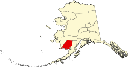
The city of Dillingham, the largest settlement in the area, which was named after United States Senator Paul Dillingham (1843-1923), who toured Alaska with his Senate subcommittee in 1903. | 0.27 | 4,857 | 18,334 sq mi (47,485 km2) | |
Hoonah–AngoonCensus Area | 105 | Hoonah | The cities of Hoonah and Angoon | 0.33 | 2,365 | 6,555 sq mi (16,977 km2) | |
KusilvakCensus Area | 158 | Hooper Bay | Kusilvak Mountains (Known as Wade Hampton prior to 2015) | 0.48 | 8,368 | 17,077 sq mi (44,229 km2) | |
NomeCensus Area | 180 | Nome | City of Nome, the largest settlement in the census area. | 0.43 | 10,046 | 22,970 sq mi (59,492 km2) | |
Prince of Wales-HyderCensus Area | 198 | Craig | Prince of Wales Island and the town of Hyder (Known as Prince of Wales-Outer Ketchikan prior to the expansion of Ketchikan Gateway Borough in 2008) | 1.18 | 5,753 | 5,264 sq mi (13,634 km2) | |
Southeast FairbanksCensus Area | 240 | Deltana | Its location, southeast of Fairbanks | 0.28 | 6,808 | 24,823 sq mi (64,291 km2) | |
Yukon-KoyukukCensus Area | 290 | Fort Yukon | Yukon River ("great river" in Gwich’in), which flows through the census area; and the city of Koyukuk | 0.04 | 5,343 | 145,576 sq mi (377,040 km2) |
This section needs additional citations for verification .(April 2023) |
During the 1950s, when the push for the territory of Alaska to become a state was at its height, any municipal government was extremely limited and scattered. Territory-wide, there were no more than a few dozen incorporated cities, and a small handful of service districts, broken into public utility districts and independent school districts. The service districts were authorized by the territorial legislature in 1935 to allow unincorporated areas limited powers to provide services and to raise taxes for them.
The United States Congress had forbidden the territory from establishing counties. [8] [ why? ] The delegates of the convention which wrote the Alaska Constitution had, in fact, debated the merits of establishing counties, and had rejected the idea in favor of creating a system of boroughs, both organized and unorganized.
The intent of the framers of the constitution was to provide for maximum local self-government with a minimum of local government units and tax-levying jurisdictions. The minutes of the constitutional convention indicate that counties were not used as a form of local government for various reasons. The failure of some local economies to generate enough revenue to support separate counties was an important issue, as was the desire to use a model that would reflect the unique character of Alaska, provide for maximum local input, and avoid a body of county case law already in existence.
Instead, Alaska adopted boroughs as a form of regional government. This regionalization tried to avoid having a number of independent, limited-purpose governments with confusing boundaries and inefficient governmental operations, as the territorial service districts had been. The boroughs were widely seen as an important foundation for the government to provide services without becoming all-powerful and unnecessarily intrusive, an argument which surfaced time and time again during various attempts by the legislature to create organized boroughs out of portions of the unorganized borough.
Alaska adopted the borough structure by statute in 1961, and envisioned boroughs to serve as an "all-purpose" form of local government, to avoid the perceived problems of county government in the lower 48 states as well as Hawaii. According to Article X of the Alaska Constitution, areas of the state unable to support borough government were to be served by several unorganized boroughs, which were to be mechanisms for the state to regionalize services; however, separate unorganized boroughs were never created. The entire state was defined as one vast unorganized borough by the Borough Act of 1961, and over the ensuing years, Alaska's organized boroughs were carved out of it.
Alaska's first organized borough, and the only one incorporated immediately after passage of the 1961 legislation, was the Bristol Bay Borough. The pressure from residents of other areas of the state to form boroughs led to the Mandatory Borough Act of 1963, which called for all election districts in the state over a certain minimum population to incorporate as boroughs by January 1, 1964.
A resolution of the State of Alaska's Local Boundary Commission introduced in January 2009 spells this out in greater detail:
Furthermore, 21 Rural Education Attendance Areas were established by the Legislature in 1975. This created regional divisions of the unorganized borough for the purpose of establishing rural school districts. Many REAAs were later absorbed into organized boroughs.
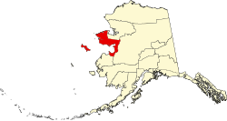
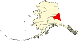
There are 19 Regional Educational Attendance Areas in the unorganized borough. [10]
Regional name | Headquarters | REAA or Borough School Locations | Notes |
---|---|---|---|
Alaska Gateway | Tok | Northeast central Alaska area | |
Aleutian Region | Nikolski (closed) | ||
Annette Island | Metlakatla | ||
Bering Straits | Unalakleet | Norton Sound Seward Peninsula | |
Chatham | Angoon | Elfin Cove (closed), Cube Cove (closed) | |
Chugach | |||
Copper River | Glennallen | Chistochina (closed), Copper Center (closed), Gakona (closed), Nelchina (closed) | |
Delta/Greely | Delta Junction | Healy Lake (closed), Fort Greely (closed) | |
Iditarod | McGrath | Lake Minchumina (closed), Lime Village (closed) | |
Kuspuk | Aniak | Red Devil (closed) | |
Lower Kuskokwim | Nunivak Island | ||
Lower Yukon | Mountain Village | Pitkas Point (closed) | |
Pribilof Islands | Saint Paul | Saint George (closed) | |
Southeast Island | Edna Bay (closed), Port Protection (closed) | ||
Southwest Region | Aleknagik | Portage Creek (closed) | |
Yukon Flats | Fort Yukon | Birch Creek (closed), Central (closed) | |
Yukon-Koyukuk | Bettles (closed) | ||
Yupiit (Akiachak, Akiak, Tuluksak) | Akiachak | ||
Kashunamiut (Chevak) | Chevak | ||
A number of boroughs have been incorporated since the Mandatory Borough Act, but most (the primary examples being North Slope, Northwest Arctic, and Denali) were incorporated to exploit a significant potential source of taxation, such as natural resource extraction and tourism.[ citation needed ]
Many residents of the Unorganized Borough, particularly those in the larger communities which may be most susceptible to organized borough incorporation, have been opposed to such incorporation, and say the status quo suits them just fine.[ citation needed ]
On the other hand, many Alaskans residing in organized boroughs feel that they unfairly subsidize residents of the Unorganized Borough, especially for education. In 2003, the Alaska Division of Community Advocacy identified eight areas within the Unorganized Borough meeting standards for incorporation. [11] Bills have been introduced in the Alaska Legislature to compel these areas to incorporate, though as of 2009 [update] , none have been signed into law.
Aleutians West Census Area is a census area located in the U.S. state of Alaska. As of the 2020 census, the population was 5,232, down from 5,561 in 2010.
The Denali Borough is a borough located in the U.S. state of Alaska. As of the 2020 census the population of the borough was 1,619, down from 1,826 in 2010. The borough seat and most populated community is Healy, and its only incorporated place is Anderson. The borough was incorporated in December 1990.
Yukon–Koyukuk Census Area is a census area in the U.S. state of Alaska. As of the 2020 census, the population was 5,343, down from 5,588 in 2010. With an area of 147,842.51 sq mi (382,910.3 km2), it is the largest of any county or county-equivalent in the United States, or slightly larger than the entire state of Montana. It is part of the unorganized borough of Alaska and therefore has no borough seat. Its largest communities are the cities of Galena, in the west, and Fort Yukon, in the northeast.
In the United States, a county or county equivalent is an administrative or political subdivision of a U.S. state or other territories of the United States which consists of a geographic area with specific boundaries and usually some level of governmental authority. The term "county" is used in 48 states, while Louisiana and Alaska have functionally equivalent subdivisions called parishes and boroughs, respectively. The specific governmental powers of counties vary widely between the states, with many providing some level of services to civil townships, municipalities, and unincorporated areas. Certain municipalities are in multiple counties; New York City is uniquely partitioned into five counties, referred to at the city government level as boroughs. Some municipalities have been consolidated with their county government to form consolidated city-counties, or have been legally separated from counties altogether to form independent cities. Conversely, those counties in Connecticut, Rhode Island, eight of Massachusetts's 14 counties, and Alaska's Unorganized Borough have no government power, existing only as geographic distinctions.
The City of Unalaska is the main population center in the Aleutian Islands. The city is in the Aleutians West Census Area, a regional component of the Unorganized Borough in the U.S. state of Alaska. Unalaska is located on Unalaska Island and neighboring Amaknak Island in the Aleutian Islands off mainland Alaska. The population was 4,254 at the 2020 census, which is 81% of the entire Aleutians West Census Area. Unalaska is the second largest city in the Unorganized Borough, behind Bethel.
Craig is a city in the Prince of Wales-Hyder Census Area in the Unorganized Borough in the U.S. state of Alaska. The population was 1,036 at the 2020 census, down from 1,201 in 2010.
Alakanuk(ah-LUG-uh-nuck) is a second class city in the Kusilvak Census Area of the Unorganized Borough in the western part of the U.S. state of Alaska. As of the 2010 census, the population of the city was 677, up from 652 in 2000.
An unincorporated area is a region that is not governed by a local municipal corporation. There are many unincorporated communities and areas in the United States and Canada. Most other countries have very few or no unincorporated areas.
In 45 of the 50 states of the United States, the county is used for the level of local government immediately below the state itself. Louisiana uses parishes, and Alaska uses boroughs. In Connecticut, Massachusetts, and Rhode Island, some or all counties within states have no governments of their own; the counties continue to exist as legal entities, however, and are used by states for some administrative functions and by the United States Census bureau for statistical analysis. There are 3,242 counties and county equivalent administrative units in total, including the District of Columbia and 100 county-equivalents in the U.S. territories.
Most U.S. states and territories have at least two tiers of local government: counties and municipalities. Louisiana uses the term parish and Alaska uses the term borough for what the U.S. Census Bureau terms county equivalents in those states. Civil townships or towns are used as subdivisions of a county in 20 states, mostly in the Northeast and Midwest.
A federal territory is an administrative division under the direct and usually exclusive jurisdiction of a federation's national government. A federal territory is a part of a federation, but not a part of any federated state. The states constitute the federation itself and share sovereignty with the federal government, while a territory does not have sovereign status and is constitutionally dependent on the federal government.
The town is the basic unit of local government and local division of state authority in the six New England states. Most other U.S. states lack a direct counterpart to the New England town. New England towns overlay the entire area of a state, similar to civil townships in other states where they exist, but they are fully functioning municipal corporations, possessing powers similar to cities and counties in other states. New Jersey's system of equally powerful townships, boroughs, towns, and cities is the system which is most similar to that of New England. New England towns are often governed by a town meeting, an assembly of eligible town residents. The great majority of municipal corporations in New England are based on the town model; there, statutory forms based on the concept of a compact populated place are uncommon, though elsewhere in the U.S. they are prevalent. County government in New England states is typically weak at best, and in some states nonexistent. Connecticut, for example, has no county governments, nor does Rhode Island. Both of those states retain counties only as geographic subdivisions with no governmental authority, while Massachusetts has abolished eight of fourteen county governments so far. Counties serve mostly as dividing lines for the states' judicial systems and some other state services in the southern New England states, while providing varying services in the more sparsely populated three northern New England states.
The government of Alaska in common with state and federal governments of the United States, has three branches of government: the executive, consisting of the Governor of Alaska and the state agencies; the state legislature consisting of two chambers, the House of Representatives and the Senate; and the judiciary consisting of the Supreme court and lower courts.
The following outline is provided as an overview of and topical guide to the U.S. state of Alaska:
In the United States, an independent city is a city that is not in the territory of any county or counties and is considered a primary administrative division of its state. Independent cities are classified by the United States Census Bureau as "county equivalents" and may also have similar governmental powers to a consolidated city-county or a unitary authority. However, in the case of a consolidated city-county, a city and a county were merged into a unified jurisdiction in which the county at least nominally exists to this day, whereas an independent city was legally separated from any county or merged with a county that simultaneously ceased to exist even in name.
The administrative divisions of Alaska are the various units of government that provide local government services in the state of Alaska.
Aleutian Region School District is a school district headquartered in Anchorage, Alaska. It serves the Aleutian Islands west of Unalaska, including Adak, Atka, and Nikolski. ARSD is the school district in the United States that is both the farthest east and the farthest west. Several uninhabited islands, including Attu and Shemya, are within the district's physical boundaries.