Hooper Bay, Alaska

Last updated

Hooper Bay
Naparyarmiut
Hooper Bay.JPG
Hooper Bay with wind turbines in background.
USA Alaska location map.svg
Red pog.svg
Hooper Bay
Location in Alaska
Coordinates: 61°31′44″N166°05′46″W / 61.52889°N 166.09611°W / 61.52889; -166.09611
CountryUnited States
State Alaska
Census Area Kusilvak
Incorporated February 7, 1966 [1]
Government
   Mayor Benjamin Nukusuk [2]
   State senator Donald Olson (D)
   State rep. Neal Foster (D)
Area
[3]
  Total7.53 sq mi (19.50 km2)
  Land7.50 sq mi (19.42 km2)
  Water0.03 sq mi (0.08 km2)
Elevation
26 ft (8 m)
Population
 (2020)
  Total1,375
  Density183.41/sq mi (70.81/km2)
Time zone UTC-9 (Alaska (AKST))
  Summer (DST) UTC-8 (AKDT)
ZIP code
99604
Area code 907
FIPS code 02-33470
GNIS feature ID 1403493

Hooper Bay (Central Yupik : Naparyarmiut) is a city in Kusilvak Census Area, Alaska, United States. At the 2020 census the population was 1,375, up from 1,093 in 2010. [4]

Contents

On August 3, 2006, a major fire destroyed approximately fifteen acres of the city including thirty-five structures, twelve homes, the elementary school, middle school, high school, teacher housing complex, stores, offices and storage shelters, leaving 70 people homeless. [5] [6] [7]

Geography and climate

Hooper Bay is located at 61°31′44″N166°5′46″W / 61.52889°N 166.09611°W / 61.52889; -166.09611 (61.528980, -166.096196), [8] 20 miles (32 km) south of Cape Romanzof and 25 miles (40 km) south of Scammon Bay in the Yukon-Kuskokwim Delta. The city is separated into two sections: a heavily built-up townsite located on gently rolling hills, and a newer section in the lowlands.

According to the United States Census Bureau, the city has a total area of 8.8 square miles (23 km2), of which 8.7 square miles (23 km2) is land and 0.1 square miles (0.26 km2) (0.91%) is water.

Hooper Bay is located within the polar climate zone (Köppen ET), because the hottest month is only 49.2 °F (9.6 °C). It is atypical of polar climates in having winters sufficiently moderated by the sea that permafrost is merely sporadic, and in seeing heavy late summer rainfall more typical of subpolar oceanic climates. The substantial maritime moderation, however, means snowfall is heavy, exceeding or approaching 4 inches or 0.10 metres for eight months of the year

Climate data for Cape Romanzof LRRS Airport (1961–1990 normals, extremes 1953–1985)
MonthJanFebMarAprMayJunJulAugSepOctNovDecYear
Record high °F (°C)49
(9)
48
(9)
46
(8)
60
(16)
71
(22)
72
(22)
79
(26)
73
(23)
63
(17)
60
(16)
45
(7)
48
(9)
79
(26)
Mean maximum °F (°C)36.8
(2.7)
33.8
(1.0)
37.0
(2.8)
41.0
(5.0)
53.8
(12.1)
62.6
(17.0)
68.0
(20.0)
64.6
(18.1)
56.4
(13.6)
44.3
(6.8)
38.0
(3.3)
36.6
(2.6)
69.9
(21.1)
Mean daily maximum °F (°C)18.6
(−7.4)
15.6
(−9.1)
19.6
(−6.9)
26.3
(−3.2)
38.3
(3.5)
48.1
(8.9)
52.8
(11.6)
52.1
(11.2)
46.5
(8.1)
34.7
(1.5)
25.5
(−3.6)
19.7
(−6.8)
33.3
(0.7)
Daily mean °F (°C)13.7
(−10.2)
10.0
(−12.2)
14.3
(−9.8)
20.9
(−6.2)
34.4
(1.3)
43.5
(6.4)
49.2
(9.6)
49.0
(9.4)
43.8
(6.6)
31.2
(−0.4)
23.2
(−4.9)
14.3
(−9.8)
29.0
(−1.7)
Mean daily minimum °F (°C)8.7
(−12.9)
5.6
(−14.7)
9.0
(−12.8)
16.4
(−8.7)
29.7
(−1.3)
39.3
(4.1)
45.0
(7.2)
45.4
(7.4)
40.2
(4.6)
28.7
(−1.8)
18.0
(−7.8)
10.1
(−12.2)
24.8
(−4.0)
Mean minimum °F (°C)−14.0
(−25.6)
−14.1
(−25.6)
−11.7
(−24.3)
−1.6
(−18.7)
16.6
(−8.6)
31.5
(−0.3)
38.8
(3.8)
39.2
(4.0)
32.1
(0.1)
15.7
(−9.1)
3.5
(−15.8)
−9.5
(−23.1)
−19.6
(−28.7)
Record low °F (°C)−23
(−31)
−26
(−32)
−26
(−32)
−15
(−26)
3
(−16)
25
(−4)
31
(−1)
33
(1)
23
(−5)
4
(−16)
−15
(−26)
−23
(−31)
−26
(−32)
Average precipitation inches (mm)1.17
(30)
0.84
(21)
0.90
(23)
0.93
(24)
1.41
(36)
2.23
(57)
3.14
(80)
4.54
(115)
4.36
(111)
2.78
(71)
1.46
(37)
1.31
(33)
25.06
(637)
Average snowfall inches (cm)9.2
(23)
5.3
(13)
7.9
(20)
8.1
(21)
3.9
(9.9)
1.0
(2.5)
0.0
(0.0)
0.0
(0.0)
1.1
(2.8)
9.4
(24)
9.7
(25)
10.1
(26)
65.7
(167)
Average precipitation days (≥ 0.01 inch)10.97.39.911.310.812.116.319.918.818.214.610.8165.9
Average snowy days (≥ 0.01 inch)10.46.610.211.06.10.60.00.00.912.013.311.182.8
Source 1: WRCC [9]
Source 2: XMACIS (snowfall) [10]

Demographics

Hooper Bay youth, 1930 Edward S. Curtis Collection People 011.jpg
Hooper Bay youth, 1930
Historical population
CensusPop.Note
1880 175
1890 138−21.1%
1930 209
1940 29943.1%
1950 3072.7%
1960 46049.8%
1970 4906.5%
1980 62728.0%
1990 84534.8%
2000 1,01420.0%
2010 1,0937.8%
2020 1,37525.8%
U.S. Decennial Census [11]

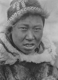
Hooper Bay first appeared on the 1880 U.S. Census as an Yup'ik settlement of Askinuk. [12] On the 1890 census, it returned as Askinaghamiut. It did not appear again until 1930, when it was first returned as Hooper Bay. It formally incorporated in 1966.

As of the census [13] of 2000, there were 1,014 people, 227 households, and 187 families residing in the city. The population density was 116.8 inhabitants per square mile (45.1/km2). There were 239 housing units at an average density of 27.5 per square mile (10.6/km2). The racial makeup of the city was 4.24% White, 93.69% Native American, and 2.07% from two or more races. 0.10% of the population were Hispanic or Latino of any race.

There were 227 households, out of which 61.7% had children under the age of 18 living with them, 34.4% were married couples living together, 30.0% had a female householder with no husband present, and 17.6% were non-families. 15.4% of all households were made up of individuals, and 0.9% had someone living alone who was 65 years of age or older. The average household size was 4.47 and the average family size was 4.97.

In the city, the age distribution of the population shows 49.2% under the age of 18, 9.0% from 18 to 24, 24.5% from 25 to 44, 11.5% from 45 to 64, and 5.8% who were 65 years of age or older. The median age was 18 years. For every 100 females, there were 98.8 males. For every 100 females age 18 and over, there were 116.4 males.

The median income for a household in the city was $26,667, and the median income for a family was $27,500. Males had a median income of $31,250 versus $32,083 for females. The per capita income for the city was $7,841. About 28.4% of families and 27.9% of the population were below the poverty line, including 30.1% of those under age 18 and 31.6% of those age 65 or over.

Education

Students in pre-kindergarten through twelfth grade attend Hooper Bay School, also known as Naparyarmiut Elicarviat, administered by the Lower Yukon School District. [14] It is a bilingual school with a Yup'ik language immersion program in kindergarten through third grade, the first program of its kind in the district. [15] High school students have the option of the state's public boarding schools, Nenana Student Living Center and Mt. Edgecumbe High School. [16]

Related Research Articles

<span class="mw-page-title-main">Aniak, Alaska</span> City in Alaska, United States

Aniak is a city in the Bethel Census Area in the U.S. state of Alaska. At the 2010 census the population was 501, down from 572 in 2000.

<span class="mw-page-title-main">Bethel, Alaska</span> City in Alaska, United States

Bethel is a city in the U.S. state of Alaska, located on the Kuskokwim River approximately 50 miles (80 km) from where the river discharges into Kuskokwim Bay. It is the largest community in western Alaska and in the Unorganized Borough and the eighth-largest in the state. Bethel has a population of 6,325 as of the 2020 census, up from 6,080 in 2010.

<span class="mw-page-title-main">Chefornak, Alaska</span> City in Alaska, United States

Chefornak is a city in Bethel Census Area, Alaska, United States. At the 2010 census its population was 418, up from 394 in 2000.

<span class="mw-page-title-main">Chuathbaluk, Alaska</span> City in Alaska, United States

Chuathbaluk is a city in Bethel Census Area, Alaska, United States.

<span class="mw-page-title-main">Goodnews Bay, Alaska</span> City in Alaska, United States

Goodnews Bay is a city in Bethel Census Area, Alaska, United States. As of the 2010 census, the population of the city was 243, up from 230 in 2000.

<span class="mw-page-title-main">Kwethluk, Alaska</span> City in Alaska, United States

Kwethluk is a city in Bethel Census Area in the U.S. state of Alaska. At the 2010 census the population was 721, up from 713 in 2000. It is the birthplace of Saint Olga of Alaska

<span class="mw-page-title-main">Mekoryuk, Alaska</span> City in Alaska, United States

Mekoryuk is a city located on Nunivak Island in the Bethel Census Area, Alaska, United States. At the 2010 census the population was 191, down from 210 in 2000.

Nightmute is a city and village in Bethel Census Area, Alaska, United States. The population was 208 at the 2000 census and 280 as of the 2010 census.

<span class="mw-page-title-main">Quinhagak, Alaska</span> City in Alaska, United States

Quinhagak is a city in Bethel Census Area, Alaska, United States. As of the 2020 census, the population of the city is 776, up from 669 in 2010.

<span class="mw-page-title-main">Toksook Bay, Alaska</span> City in Alaska, United States

Toksook Bay(TOOK-sook or TUCK-sook) is a city and village on Nelson Island in Bethel Census Area, Alaska. The population was 590 at the 2010 census, up from 532 in 2000. As of 2018, the estimated population was 667, making it the largest village on the island.

Upper Kalskag is a city in Bethel Census Area, Alaska, United States. It is thirty miles west of Aniak. At the 2010 census the population was 210, down from 230 in 2000.

Ekwok is a city in Dillingham Census Area, Alaska, United States. At the 2020 census, the population was 111.

Larsen Bay is a city in Kodiak Island Borough, Alaska, United States. At the 2010 census the population was 87, down from 115 in 2000.

<span class="mw-page-title-main">Chignik, Alaska</span> City in Alaska, United States

Chignik is a city in Lake and Peninsula Borough, Alaska, United States. It is two hundred and fifty miles southwest of Kodiak. At the 2020 census the population was 97, up from 91 in 2010.

St. Michael, historically referred to as Saint Michael, is a city in Nome Census Area, Alaska. The population was 401 at the 2010 census, up from 368 in 2000.

<span class="mw-page-title-main">Kobuk, Alaska</span> City in Alaska, United States

Kobuk is a city in Northwest Arctic Borough, Alaska, United States. At the 2010 census the population was 151, up from 109 in 2000.

<span class="mw-page-title-main">Alakanuk, Alaska</span> City in Alaska, United States

Alakanuk(ah-LUG-uh-nuck) is a second class city in the Kusilvak Census Area of the Unorganized Borough in the western part of the U.S. state of Alaska. As of the 2010 census, the population of the city was 677, up from 652 in 2000.

<span class="mw-page-title-main">Chevak, Alaska</span> City in Alaska, United States

Chevak is a city in Kusilvak Census Area, Alaska, United States. At the 2020 census the population was 951, up from 938 in 2010.

Marshall is a city in Kusilvak Census Area, Alaska, United States. At the 2010 census the population was 414, up from 349 in 2000.

Pilot Station is a city in Kusilvak Census Area, Alaska, United States. The population was 568 at the 2010 census, up from 550 in 2000.

References

  1. 1996 Alaska Municipal Officials Directory. Juneau: Alaska Municipal League/Alaska Department of Community and Regional Affairs. January 1996. p. 67.
  2. 2015 Alaska Municipal Officials Directory. Juneau: Alaska Municipal League. 2015. p. 73.
  3. "2020 U.S. Gazetteer Files". United States Census Bureau. Retrieved October 29, 2021.
  4. "2020 Census Data - Cities and Census Designated Places" (Web). State of Alaska, Department of Labor and Workforce Development. Retrieved October 31, 2021.
  5. "Hundreds Evacuate, Structures Destroyed in Hooper Bay Fire". ABC Alaska News. August 4, 2006. Archived from the original on January 16, 2013. Retrieved October 22, 2008.
  6. deMarban, Alex (August 15, 2006). "Children faulted in Hooper Bay fire". Anchorage Daily News. Archived from the original on October 15, 2008. Retrieved October 22, 2008.
  7. "Cleanup begins in Hooper Bay | Juneau Empire - Alaska's Capital City Online Newspaper". juneauempire.com. Archived from the original on October 25, 2015.
  8. "US Gazetteer files: 2010, 2000, and 1990". United States Census Bureau. February 12, 2011. Retrieved April 23, 2011.
  9. "CAPE ROMANZOF, ALASKA (501318)". Western Regional Climate Center. Archived from the original on January 27, 2024. Retrieved January 27, 2024.
  10. XMACIS
  11. "Census of Population and Housing". Census.gov. Retrieved June 4, 2015.
  12. "Geological Survey Professional Paper". 1949.
  13. "U.S. Census website". United States Census Bureau . Retrieved January 31, 2008.
  14. "Low test scores don't deter Hooper Bay School leaders". Anchorage Daily News. March 15, 2015. Retrieved July 29, 2019.
  15. Dillon, R.A. (May 18, 2002). "School Reaches Out to Embrace Native Roots". www.turtletrack.org. Canku Ota. Retrieved July 29, 2019.
  16. Brown, Cathy (June 27, 2004). "Alaska Boarding Schools Make a Comeback". Washington Post. Retrieved July 29, 2019.

Further reading

Photographs

Hooper Bay, Alaska. Looking south through the town in 1969. Hooper Bay in Winter.jpg
Hooper Bay, Alaska. Looking south through the town in 1969.
Winter Day in Hooper Bay.jpg
Winter Scene in Hooper Bay.jpg
Berms near airport and ocean. Berms Bordering the Ocean Beach.jpg
Berms near airport and ocean.
Alaskan tundra outside of Hooper Bay. Near Hooper Bay Airport.jpg
Alaskan tundra outside of Hooper Bay.
Abandoned boat frame.jpg
Near Slough; In Need of Repair.jpg
Looking south over Hooper Bay, 1968. Looking South Over Hooper Bay.jpg
Looking south over Hooper Bay, 1968.
Aerial - Hooper Bay, Alaska 1968.jpg
Hooper Bay, Alaska Cemetery.jpg
Eskimo kids label artifacts that they find as "Old Timers". "Old Timers" dug from from Hooper Bay, Alaska.jpg
Eskimo kids label artifacts that they find as "Old Timers".
Hooper Bay has been known for high quality baskets for many decades. Baskets from Hooper Bay, Alaska.jpg
Hooper Bay has been known for high quality baskets for many decades.