Lime Village, Alaska

Last updated

Lime Village
Hek'dichen Hdakaq'
Lime village.jpg
AKMap-doton-LimeVillage.PNG
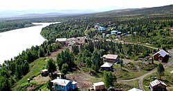
Location of Lime Village, Alaska
Coordinates: 61°20′29″N155°29′27″W / 61.34139°N 155.49083°W / 61.34139; -155.49083
CountryUnited States
State Alaska
Census Area Bethel
Government
   State senator Lyman Hoffman (D)
   State rep. Bryce Edgmon (I)
Area
[1]
  Total78.71 sq mi (203.87 km2)
  Land76.52 sq mi (198.19 km2)
  Water2.19 sq mi (5.67 km2)
Population
 (2020)
  Total13
  Density0.17/sq mi (0.07/km2)
Time zone UTC-9 (Alaska (AKST))
  Summer (DST) UTC-8 (AKDT)
ZIP code
99557 [2]
Area code 907
FIPS code 02-44030
GNIS ID 2418687 [3]
Sts. Constantine and Helen Chapel SaintsConstantineAndHelenChapel.jpg
Sts. Constantine and Helen Chapel

Lime Village (Tanaina : Hek'dichen Hdakaq') [4] is a census-designated place (CDP) in Bethel Census Area, Alaska, United States. The 2020 census found a population of 13, down from 29 in 2010. It has also been known as Hungry Village.

Contents

In July 2008, Lime Village gained notoriety [5] when it was reported that their gasoline prices were more than double of the already-high national average of over $4/gallon with Lime Village selling regular unleaded gasoline at $8.55/gallon. The high prices were considered ironic considering that Alaska is one of the main suppliers of oil in the United States, but have the highest state average due to scattered villages throughout Alaska such as Lime Village making it difficult to transport oil and other goods.

Geography

Lime Village is located at 61°20′29″N155°29′27″W / 61.34139°N 155.49083°W / 61.34139; -155.49083 (61.341383, -155.490944). [6]

According to the United States Census Bureau, the CDP has a total area of 82.5 square miles (214 km2), of which, 80.3 square miles (208 km2) of it is land and 2.2 square miles (5.7 km2) of it (2.67%) is water.

Demographics

Historical population
CensusPop.Note
1940 38
1950 29−23.7%
1970 25
1980 4892.0%
1990 42−12.5%
2000 6−85.7%
2010 29383.3%
2020 13−55.2%
U.S. Decennial Census [7] [8]

Lime Village first appeared on the 1940 U.S. Census as the unincorporated village of Hungry. It did not appear on the 1960 census. It returned in 1970 as Lime Village. It was made a census-designated place (CDP) in 1980.

2000

As of the census of 2000, there were 6 people, 5 households, and 0 families residing in the CDP. The population density was 0.1 inhabitants per square mile (0.039/km2). There were 24 housing units at an average density of 0.3 per square mile (0.12/km2). The racial makeup of the CDP was 83.33% White, and 16.67% from two or more races.

There were 5 households, out of which none were married couples living together, and 100.0% were non-families. 80.0% of all households were made up of individuals, and none had someone living alone who was 65 years of age or older. The average household size was 1.20 and the average family size was 0.00.

In the CDP the population was spread out, with 66.7% from 25 to 44, 33.3% from 45 to 64. The median age was 44 years. For every 100 females, there were 200.0 males. For every 100 females age 18 and over, there were 200.0 males.

2010

As of the census of 2010, there were 29 [9] people and 11 households. The population density was 0.1 inhabitants per square mile (0.039/km2). There were 24 housing units at an average density of 0.3 per square mile (0.12/km2). The racial makeup of the CDP was 3.4% White, 93.1% Native American (79.3% specified Alaska Native), and 3.4% from two or more races.

School

The Lime Village School, formerly operated by the Iditarod Area School District, [10] closed in 2007, [11] when the enrollment of six students failed to meet the state-mandated minimum of ten students. As of Fall 2008 the school remained closed. The lack of access to local schooling has increased urban migration, though many migrants continue to spend summers in the village.

Related Research Articles

<span class="mw-page-title-main">Crooked Creek, Alaska</span> Census-designated place in Alaska, United States

Crooked Creek is a census-designated place (CDP) in Bethel Census Area, Alaska, United States. As of the 2010 census, the population of the CDP was 105, down from 137 in 2000.

<span class="mw-page-title-main">Kasigluk, Alaska</span> Census-designated place in Alaska, United States

Kasigluk is a census-designated place (CDP) in the Bethel Census Area in the U.S. state of Alaska. At the 2010 census the population was 569, up from 543 in 2000. Kasigluk consists of two smaller villages, called Akiuk and Akula.

<span class="mw-page-title-main">Stony River, Alaska</span> Census-designated place in Alaska, United States

Stony River is a census-designated place (CDP) in Bethel Census Area, Alaska, United States. The population was 54 at the 2010 census, down from 61 in 2000.

<span class="mw-page-title-main">Tuluksak, Alaska</span> CDP in Alaska, United States

Tuluksak is a census-designated place (CDP) in Bethel Census Area, Alaska, United States. At the 2010 census the population was 373, down from 428 in 2000.

<span class="mw-page-title-main">Igiugig, Alaska</span> Census-designated place in Alaska, United States

Igiugig is a census-designated place (CDP) in Lake and Peninsula Borough, Alaska, United States. The population was 68 at the 2020 census, up from 54 in 2010. The village is at the source of the Kvichak River, at the outlet of Lake Iliamna.

<span class="mw-page-title-main">Ugashik, Alaska</span> Census-designated place in Alaska, United States

Ugashik is a census-designated place (CDP) in Lake and Peninsula Borough, Alaska, United States. The population was 4 at the 2020 census, down from 12 in 2010.

<span class="mw-page-title-main">Chickaloon, Alaska</span> Census-designated place in Matanuska-Susitna Borough, Alaska, United States

Chickaloon is a census-designated place (CDP) in Matanuska-Susitna Borough, Alaska, United States. It is part of the Anchorage, Alaska Metropolitan Statistical Area. The population was 254 at the 2020 census, down from 272 in 2010.

<span class="mw-page-title-main">Knik River, Alaska</span> CDP in Alaska, United States

Knik River is a census-designated place (CDP) in Matanuska-Susitna Borough in the U.S. state of Alaska. Located 15 miles southeast from Palmer along the Knik River, it is part of the Anchorage, Alaska Metropolitan Statistical Area. The population was 792 at the 2020 census, up from 744 in 2010.

<span class="mw-page-title-main">Skwentna, Alaska</span> CDP in Alaska, United States

Skwentna is a census-designated place (CDP) on Iditarod Trail in Matanuska-Susitna Borough, Alaska, United States. Located 61 miles northwest of Wasilla along the Skwentna River, it is part of the Anchorage, Alaska Metropolitan Statistical Area. At the 2020 census the population was 62, up from 37 in 2010. The town is served by Skwentna Airport.

<span class="mw-page-title-main">Willow, Alaska</span> CDP in Alaska, United States

Willow is a census-designated place (CDP) in the Matanuska-Susitna Borough in the U.S. state of Alaska. Located 26 miles northwest from Wasilla along the George Parks Highway, it is part of the Anchorage, Alaska Metropolitan Statistical Area. At the 2020 census the population was 2,196, up from 2,102 in 2010.

<span class="mw-page-title-main">Point Lay, Alaska</span> CDP in Alaska, United States

Point Lay is a census-designated place (CDP) in North Slope Borough, Alaska, United States. At the 2020 census the population was 330, up from 189 in 2010.

<span class="mw-page-title-main">Alcan Border, Alaska</span> Census-designated place in Alaska, United States

Alcan Border, also known as Port Alcan, is a census-designated place in the Southeast Fairbanks Census Area in the U.S. state of Alaska. Part of the Unorganized Borough, Alcan Border is the site of the Alcan - Beaver Creek Border Crossing, the main U.S. port of entry for persons arriving in Alaska by road. The population was 33 at the 2010 census, up from 21 in 2000.

<span class="mw-page-title-main">Dot Lake, Alaska</span> CDP in Alaska, United States

Dot Lake is a census-designated place (CDP) in Southeast Fairbanks Census Area, Alaska, United States. It is located on the Alaska Highway between Delta Junction and Tok. The population was 13 at the 2010 census, down from 19 in 2000.

<span class="mw-page-title-main">Mendeltna, Alaska</span> CDP in Alaska, United States

Mendeltna is a census-designated place (CDP) in Copper River Census Area, Alaska, United States. The population was 36 at the 2020 census, down from 39 in 2010.

<span class="mw-page-title-main">Anvik, Alaska</span> City in Alaska, United States

Anvik is a city, home to the Deg Hit'an people, in the Yukon-Koyukuk Census Area, Alaska, United States. The name Anvik, meaning "exit" in the Central Alaskan Yup'ik language, became the common usage despite multiple names at the time, and may have come from early Russian explorers. The native name in the Deg Xinag language is Deloy Ges. The population was 85 at the 2010 census, down from 104 in 2000.

<span class="mw-page-title-main">Beaver, Alaska</span> CDP in Alaska, United States

Beaver is a census-designated place (CDP) in Yukon-Koyukuk Census Area, Alaska, United States. At the time of the 2010 census the population was 84, unchanged from 2000, however the 2020 census reported a total population of 48.

Birch Creek is a census-designated place (CDP) in Yukon-Koyukuk Census Area, Alaska, United States. The population was 33 at the 2010 census, up from 28 in 2000.

<span class="mw-page-title-main">Lake Minchumina, Alaska</span> CDP in Alaska, United States

Lake Minchumina is a census-designated place (CDP) in Yukon-Koyukuk Census Area, Alaska, United States. As of the 2020 census, the population of the CDP is 30.

Shageluk is a city in Yukon-Koyukuk Census Area, Alaska, United States. At the 2010 census the population was 83, down from 129 in 2000.

<span class="mw-page-title-main">Takotna, Alaska</span> Census-designated place in Alaska, United States

Takotna(Tochotno’) IPA:[tʰot͡ʃʰoʔno] in Upper Kuskokwim) is a census-designated place (CDP) in the Yukon-Koyukuk Census Area, Alaska, United States. The population was 52 as of the 2010 Census, an increase of 4% from 50 at the 2000 Census.

References

  1. "2020 U.S. Gazetteer Files". United States Census Bureau. Retrieved October 29, 2021.
  2. "Lime Village AK ZIP Code". zipdatamaps.com. 2023. Retrieved June 16, 2023.
  3. U.S. Geological Survey Geographic Names Information System: Lime Village, Alaska
  4. "Alaska Native Place Names". Alaska Native Language Archive.
  5. "Alaska Suffers From Highest U.S. Gas Prices". Autoblog.com.
  6. "US Gazetteer files: 2010, 2000, and 1990". United States Census Bureau. February 12, 2011. Retrieved April 23, 2011.
  7. "U.S. Decennial Census". Census.gov. Retrieved June 6, 2013.
  8. "In Rural Alaska, villages fight extinction once schools close". Anchorage Daily News. April 11, 2012. Retrieved June 21, 2021.
  9. "U.S. Census website".
  10. "Schools." Iditarod Area School District. October 16, 2001. Retrieved on March 28, 2017.
  11. Solberg, Dustin (December 14, 2007). "Dwindling numbers close school in Lime Village". Bristol Bay Times at Juneau Empire. Archived from the original on March 28, 2017. Retrieved March 28, 2017.