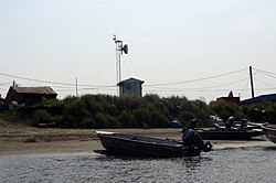
Oscarville Kuiggayagaq | |
---|---|
Coordinates: 60°43′17″N161°46′6″W / 60.72139°N 161.76833°W | |
Country | United States |
State | Alaska |
Census Area | Bethel |
Government | |
• State senator | Lyman Hoffman (D) |
• State rep. | Conrad McCormick (D) |
Area | |
• Total | 2.78 sq mi (7.20 km2) |
• Land | 2.60 sq mi (6.74 km2) |
• Water | 0.18 sq mi (0.46 km2) |
Population (2020) | |
• Total | 70 |
• Density | 26.88/sq mi (10.38/km2) |
Time zone | UTC-9 (Alaska (AKST)) |
• Summer (DST) | UTC-8 (AKDT) |
ZIP code | 99559 [2] |
Area code | 907 |
FIPS code | 02-58330 |
Oscarville (Central Yupik : Kuiggayagaq) is a census-designated place (CDP) in Bethel Census Area, Alaska, United States. The population was 70 at the 2010 census, up from 61 in 2000.
Oscarville is located at 60°43′17″N161°46′6″W / 60.72139°N 161.76833°W (60.721274, -161.768440). [3]
According to the United States Census Bureau, the CDP has a total area of 1.6 square miles (4.1 km2), of which, 1.5 square miles (3.9 km2) of it is land and 0.1 square miles (0.26 km2) of it (8.54%) is water.
Census | Pop. | Note | %± |
---|---|---|---|
1940 | 11 | — | |
1950 | 27 | 145.5% | |
1960 | 51 | 88.9% | |
1970 | 41 | −19.6% | |
1980 | 56 | 36.6% | |
1990 | 57 | 1.8% | |
2000 | 61 | 7.0% | |
2010 | 70 | 14.8% | |
2020 | 70 | 0.0% | |
U.S. Decennial Census [4] |
Oscarville first reported on the 1940 U.S. Census as an unincorporated native village. In 1980, it was made a census-designated place (CDP).
As of the census [5] of 2000, there were 61 people, 15 households, and 12 families residing in the CDP. The population density was 40.6 inhabitants per square mile (15.7/km2). There were 20 housing units at an average density of 13.3 per square mile (5.1/km2). The racial makeup of the CDP was 0.00% White, 98.36% Native American, and 1.64% from two or more races.
There were 15 households, out of which 53.3% had children under the age of 18 living with them, 66.7% were married couples living together, 6.7% had a female householder with no husband present, and 20.0% were non-families. 20.0% of all households were made up of individuals, and none had someone living alone who was 65 years of age or older. The average household size was 4.07 and the average family size was 4.58.
In the CDP, the population was spread out, with 42.6% under the age of 18, 6.6% from 18 to 24, 27.9% from 25 to 44, 14.8% from 45 to 64, and 8.2% who were 65 years of age or older. The median age was 25 years. For every 100 females, there were 110.3 males. For every 100 females age 18 and over, there were 133.3 males.
The median income for a household in the CDP was $8,125, and the median income for a family was $16,250. Males had a median income of $24,375 versus $0 for females. The per capita income for the CDP was $5,824. There were 50.0% of families and 40.0% of the population living below the poverty line, including 18.8% of under eighteens and 100.0% of those over 64.
Lower Kuskokwim School District operates the Qugcuun Memorial School, K-12. As of 2018 [update] the school had 13 students. It is a bilingual English-Yup'ik school. [6]
Atmautluak is a census-designated place (CDP) in Bethel Census Area, Alaska, United States. The population was 277 at the 2010 census, down from 294 in 2000.
Kasigluk is a census-designated place (CDP) in the Bethel Census Area in the U.S. state of Alaska. At the 2010 census the population was 569, up from 543 in 2000. Kasigluk consists of two smaller villages, called Akiuk and Akula.
Kipnuk is a census-designated place (CDP) in Bethel Census Area, Alaska, United States. At the 2010 census the population was 639, down from 644 in 2000.
Napakiak is a city in Bethel Census Area, Alaska, United States. At the 2010 census the population was 354, up one resident from 353 since 2000.
Napaskiak is a city in Bethel Census Area, Alaska, United States. At the 2010 census the population was 405, up from 390 in 2000.
Tuntutuliak is a census-designated place (CDP) in Bethel Census Area, Alaska, United States. At the 2010 census the population was 408, up from 370 in 2000.
Sawmill is a census-designated place (CDP) in Apache County, Arizona, United States. Sawmill is a part of Fort Defiance Agency, which is on the Navajo Nation. The population was 748 at the 2010 census. It is named after and developed around a sawmill. A trading post has been present since 1907.
Winslow West is a census-designated place (CDP) in Navajo and Coconino counties in Arizona, United States. The population was 438 at the 2010 census. The entire community is off-reservation trust land belonging to the Hopi Tribe of Arizona. It lies just west of the city of Winslow, and is more than 50 km (31 mi) south of the main Hopi Reservation.
Jeddito is a census-designated place (CDP) in Navajo County, Arizona, United States. The population was 293 at the 2010 census.
West Crossett is a census-designated place (CDP) in Ashley County, Arkansas, United States. Per the 2020 census, the population was 1,144.
Westgate is a city in Fayette County, Iowa, United States. The population was 192 at the time of the 2020 census, down from 234 in 2000.
Chance is a census-designated place (CDP) in Somerset County, Maryland, United States. The population was 377 at the 2000 census. It is included in the Salisbury, Maryland-Delaware Metropolitan Statistical Area.
Helena Valley Northwest is a census-designated place (CDP) in Lewis and Clark County, Montana, United States. The population was 3,482 at the 2010 census. It is part of the Helena Micropolitan Statistical Area.
Claverack-Red Mills, commonly known as Claverack, is a census-designated place (CDP) in Columbia County, New York, United States. The population was 953 at the 2020 census.
Asylum Township is a township in Bradford County, Pennsylvania, United States. It is part of Northeastern Pennsylvania. The population was 999 at the 2020 census. The town contains the historic site of French Azilum.
East Berwick is a census-designated place (CDP) in Salem Township, Luzerne County, Pennsylvania, United States. The population was 2,007 at the 2010 census.
Socastee is a census-designated place (CDP) in Horry County, South Carolina, United States. The population was 19,952 at the 2010 census.
Gloucester Point is a census-designated place (CDP) in Gloucester County, Virginia, United States. The population was 9,402 at the 2010 census. It is home to the College of William & Mary's Virginia Institute of Marine Science, a graduate school for the study of oceanography.
South Hill is a census-designated place (CDP) in Pierce County, Washington, immediately south of Puyallup. The population was 64,708 at time of the 2020 census, up from 52,431 in 2010. The area primarily consists of suburban housing and shopping with several retail shopping centers, residential neighborhoods, and apartment/condo complexes throughout. Because South Hill is unincorporated, its addresses are part of the Puyallup "postal city" or ZCTA.
Okauchee Lake is a census-designated place (CDP) in Waukesha County, Wisconsin, United States. The population was 5,094 at the 2020 census. Okauchee Lake is located in the town of Oconomowoc.