Kwigillingok, Alaska

Last updated

Kwigillingok
Kuigilnguq
CDP
Scenic Kwigillingok (9685208351).jpg
Aerial view of Kwigillingok
AKMap-doton-Kwigillingok.PNG
Location of Kwigillingok, Alaska
Coordinates: 59°52′20″N163°9′58″W / 59.87222°N 163.16611°W / 59.87222; -163.16611
CountryUnited States
State Alaska
Census Area Bethel
Government
   State senator Lyman Hoffman (D)
   State rep. Conrad McCormick (D)
Area
[1]
  Total23.83 sq mi (61.71 km2)
  Land23.79 sq mi (61.62 km2)
  Water0.04 sq mi (0.09 km2)
Population
 (2020)
  Total380
  Density15.97/sq mi (6.17/km2)
Time zone UTC-9 (Alaska (AKST))
  Summer (DST) UTC-8 (AKDT)
ZIP codes
99622
Area code 907
FIPS code 02-42490

Kwigillingok (Central Yupik : Kuigilnguq) is a census-designated place (CDP) in Bethel Census Area, Alaska, United States. The population was 321 at the 2010 census, down from 338 in 2000.

Contents

Geography

Kwigillingok is located at 59°52′20″N163°09′58″W / 59.872266°N 163.166165°W / 59.872266; -163.166165 . [2]

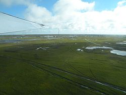
According to the United States Census Bureau, the CDP has a total area of 20.2 square miles (52 km2), of which, 20.1 square miles (52 km2) of it is land and 0.1 square miles (0.26 km2) of it (0.35%) is water.

Demographics

Historical population
CensusPop.Note
1920 104
1940 146
1950 24567.8%
1960 34440.4%
1970 148−57.0%
1980 354139.2%
1990 278−21.5%
2000 33821.6%
2010 321−5.0%
2020 38018.4%
U.S. Decennial Census [3]

Kwigillingok first appeared on the 1920 U.S. Census as Quigillingok, [4] an unincorporated native village. It did not appear on the 1930 census, but was returned as "Quigilinook" in 1940. [5] In 1950, the name was changed to the present spelling of Kwigillingok. It was made a census-designated place in 1980.

As of the census [6] of 2000, there were 388 people, 96 households, and 89 families residing in the CDP. The population density was 16.8 inhabitants per square mile (6.5/km2). There were 78 housing units at an average density of 3.9 per square mile (1.5/km2). The racial makeup of the CDP was 2.07% White, 97.63% Native American, and 0.30% from two or more races.

There were 96 households, out of which 60.3% had children under the age of 18 living with them, 74.0% were married couples living together, 8.2% had a female householder with no husband present, and 9.6% were non-families. 6.8% of all households were made up of individuals, and none had someone living alone who was 65 years of age or older. The average household size was 4.63 and the average family size was 4.89.

In the CDP, the population was spread out, with 39.9% under the age of 18, 8.9% from 18 to 24, 29.9% from 25 to 44, 14.2% from 45 to 64, and 7.1% who were 65 years of age or older. The median age was 26 years. For every 100 females, there were 131.5 males. For every 100 females age 18 and over, there were 128.1 males.

The median income for a household in the CDP was $36,250, and the median income for a family was $33,250. Males had a median income of $23,125 versus $50,625 for females. The per capita income for the CDP was $7,577. About 28.8% of families and 34.7% of the population were below the poverty line, including 46.8% of those under age 18 and none of those age 65 or over.

Transportation

The Kwigillingok Airport is the only connection to the outside world, as there are no roads leading to the town.

Education

It is served by the K-12 Kwigillingok School, operated by the Lower Kuskokwim School District. As of 2021 it has about 144 students. [7]

Related Research Articles

<span class="mw-page-title-main">Moores Mill, Alabama</span> Census-designated place in Alabama, United States

Moores Mill is an unincorporated community and census-designated place (CDP) in Madison County, Alabama, United States, and is included in the Huntsville-Decatur Combined Statistical Area. The population was 6,729 at the 2020 census, up from 5,682 at the 2010 census.

<span class="mw-page-title-main">Kongiganak, Alaska</span> CDP in Alaska, United States

Kongiganak is a census-designated place (CDP) in Bethel Census Area, Alaska, United States, and primarily sits on the eastern shore of the Kongiganak River. As of the 2010 census, the population was 439, up from 359 in 2000.

<span class="mw-page-title-main">Fox River, Alaska</span> Census-designated place in Alaska, United States

Fox River is a census-designated place (CDP) in Kenai Peninsula Borough, Alaska, United States. At the 2010 census the population was 685, up from 616 in 2000. It was first reported by the U.S. Geological Survey in 1895. The Fox River, which flows by the CDP, might have been named for Theodore Fox, a local mining magnate.

Seldovia Village is a census-designated place (CDP) in Kenai Peninsula Borough, Alaska, United States. At the 2010 census the population was 165, up from 144 in 2000. Seldovia Village is not to be confused with the adjacent city of Seldovia.

<span class="mw-page-title-main">Santan, Arizona</span> CDP in Pinal County, Arizona, United States

Santan is an unincorporated community, and former census-designated place (CDP), in Pinal County, Arizona, United States. The settlement was named "Santa Ana" by its Akimel O'odham inhabitants in 1857, and pronounced "Santana".

<span class="mw-page-title-main">Fussels Corner, Florida</span> Census-designated place in Florida, United States

Fussels Corner is a census-designated place (CDP) in Polk County, Florida, United States. The population was 5,313 at time of the 2000 census. It is part of the Lakeland–Winter Haven Metropolitan Statistical Area.

<span class="mw-page-title-main">Holualoa, Hawaii</span> Census-designated place in Hawaii, United States

Holualoa is a census-designated place (CDP) in the North Kona District of Hawaii County, Hawaii, United States. The population was 8,538 at the 2010 census, up from 6,107 at the 2000 census.

<span class="mw-page-title-main">Falmouth Foreside</span> Census-designated place in Maine, United States

Falmouth Foreside is a census-designated place (CDP) within the town of Falmouth in Cumberland County, Maine, United States. As of the 2010 census, the CDP population was 1,511. It is part of the Portland–South Portland–Biddeford, Maine Metropolitan Statistical Area.

<span class="mw-page-title-main">Wilson-Conococheague, Maryland</span> CDP in Maryland, United States

Wilson-Conococheague is a census-designated place (CDP) in Washington County, Maryland, United States. The population was 2,262 at the 2020 census.

<span class="mw-page-title-main">Sherwood, Hamilton County, Ohio</span> Census-designated place in Ohio, United States

Sherwood is a census-designated place (CDP) in Hamilton County, Ohio, United States. The population was 3,633 at the 2020 census.

<span class="mw-page-title-main">South Canal, Ohio</span> Census-designated place in Ohio, United States

South Canal is an unincorporated community and census-designated place in western Newton Township, Trumbull County, Ohio, United States. The population was 1,101 at the 2020 census. It is part of the Youngstown–Warren metropolitan area.

Stony Point is a census-designated place (CDP) in Sequoyah County, Oklahoma, United States. It is part of the Fort Smith, Arkansas-Oklahoma Metropolitan Statistical Area. The population was 177 at the 2000 census.

<span class="mw-page-title-main">Glide, Oregon</span> Census-designated place in Oregon, United States

Glide is a census-designated place (CDP) in Douglas County, Oregon, United States. The population was 1,795 at the 2010 census.

<span class="mw-page-title-main">Port Trevorton, Pennsylvania</span> CDP in Pennsylvania, United States

Port Trevorton is a census-designated place (CDP) in Snyder County, Pennsylvania, United States. The population was 451 at the 2000 census.

<span class="mw-page-title-main">Valley View, York County, Pennsylvania</span> CDP in Pennsylvania, United States

Valley View is a census-designated place (CDP) in York County, Pennsylvania, United States. The population was 2,817 at the 2010 census.

<span class="mw-page-title-main">Tradewinds, Texas</span> CDP in Texas, United States

Tradewinds is a census-designated place (CDP) in San Patricio County, Texas, United States. The population was 180 at the 2010 census.

<span class="mw-page-title-main">Inez, Texas</span> CDP in Texas, United States

Inez is a census-designated place (CDP), on Interstate 69/U.S. Highway 59, fifteen miles northeast of Victoria, near the Jackson County, Texas line in Victoria County, Texas, United States. The population was 2,098 at the 2010 census. It is included in the Victoria, Texas, Metropolitan Statistical Area. The name is that of a daughter of a railroad developer.

<span class="mw-page-title-main">Verlot, Washington</span> CDP in Washington, United States

Verlot is a census-designated place (CDP) in Snohomish County, Washington, United States. The population was 285 at the 2010 census.

Hampden is a census-designated place (CDP) consisting of the eastern portion of the town of Hampden in Penobscot County, Maine, United States. The population of the CDP was 4,343 at the 2010 census.

Madison is a census-designated place (CDP) in the town of Madison in Somerset County, Maine, United States. The population was 2,533 at the 2020 census.

References

  1. "2020 U.S. Gazetteer Files". United States Census Bureau. Retrieved October 29, 2021.
  2. "US Gazetteer files: 2010, 2000, and 1990". United States Census Bureau. February 12, 2011. Retrieved April 23, 2011.
  3. "U.S. Decennial Census". Census.gov. Retrieved June 6, 2013.
  4. "Population of Outlying Possessions by Civil Divisions: 1920 and earlier years" (PDF). United States Census Bureau. 1920. pp. 680 & 681.
  5. "Alaska - Number of Inhabitants" (PDF). United States Census Bureau. 1940.
  6. "U.S. Census website". United States Census Bureau . Retrieved January 31, 2008.
  7. "Kwigillingok School." Kwigillingok School. Retrieved on June 9, 2021.