Red Devil, Alaska | |
---|---|
Coordinates: 61°46′41″N157°20′54″W / 61.77806°N 157.34833°W | |
Country | United States |
State | Alaska |
Census Area | Bethel |
Government | |
• State senator | Lyman Hoffman (D) |
• State rep. | Bryce Edgmon (I) |
Area | |
• Total | 27.83 sq mi (72.07 km2) |
• Land | 25.13 sq mi (65.08 km2) |
• Water | 2.70 sq mi (6.99 km2) |
Population (2020) | |
• Total | 22 |
• Density | 0.88/sq mi (0.34/km2) |
Time zone | UTC-9 (Alaska (AKST)) |
• Summer (DST) | UTC-8 (AKDT) |
ZIP code | 99656 |
Area code | 907 |
FIPS code | 02-64930 |
GNIS ID | 2419198 [2] |
Red Devil is a census-designated place (CDP) in Bethel Census Area, Alaska, United States. The population was 23 at the 2010 census, down from 48 in 2000. Their post office was founded in 1957. [3]
The village was named after the Red Devil Mine, established in 1921 by Hans Halverson when numerous mercury (quicksilver) deposits were discovered in the surrounding Kilbuck-Kuskokwim Mountains. By 1933, the mine was producing substantial quantities of mercury. Although the mine changed ownership twice over the years, it continued to operate until 1971. [4]
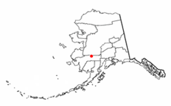
According to the United States Census Bureau, the CDP has a total area of 26.4 square miles (68 km2), of which, 24.2 square miles (63 km2) of it is land and 2.2 square miles (5.7 km2) of it (8.34%) is water. [5]
Census | Pop. | Note | %± |
---|---|---|---|
1960 | 152 | — | |
1970 | 81 | −46.7% | |
1980 | 39 | −51.9% | |
1990 | 53 | 35.9% | |
2000 | 48 | −9.4% | |
2010 | 23 | −52.1% | |
2020 | 22 | −4.3% | |
U.S. Decennial Census [6] |
Red Devil first appeared on the 1960 U.S. Census as an unincorporated village. In 1980, it was made a census-designated place (CDP).
As of the census [7] of 2010, there were 23 people, 12 occupied households, residing in the CDP. The population density was 1.9 inhabitants per square mile (0.73/km2). There were 22 housing units at an average density of 0.9/sq mi (0.4/km2). The racial makeup of the CDP was 17.4% White, 43.5% Native American, and 39.1% from two or more races. The population was spread out, with 2 people under the age of 14, 2 people 15 to 19 and the remaining 19 people were 25 or older. The median income for a household for 2009 in the CDP was $59,886. 40.4% of the population lives beneath the poverty line.
Lime Village is a census-designated place (CDP) in Bethel Census Area, Alaska, United States. The 2020 census found a population of 13, down from 29 in 2010. It has also been known as Hungry Village.
Tuluksak is a census-designated place (CDP) in Bethel Census Area, Alaska, United States. At the 2010 census the population was 373, down from 428 in 2000.
Fox is a census-designated place (CDP) in Fairbanks North Star Borough, Alaska, United States. It is part of the Fairbanks, Alaska Metropolitan Statistical Area. At the 2010 census the population was 417, up from 300 in 2000.
Beluga is a census-designated place (CDP) in Kenai Peninsula Borough, Alaska, United States. The population was 20 at the 2010 census, down from 32 in 2000.
Kasilof is a census-designated place (CDP) in Kenai Peninsula Borough, Alaska, United States. At the 2020 census the population was 525, down from 549 in 2010.
Womens Bay is a census-designated place (CDP) in Kodiak Island Borough, Alaska, United States. At the 2020 census the population was 743, up from 719 in 2010. The name is correctly spelled "Womens", without an apostrophe.
Buffalo Soapstone is a census-designated place (CDP) in Matanuska-Susitna Borough, Alaska, United States. It is part of the Anchorage, Alaska Metropolitan Statistical Area. The population was 1,021 at the 2020 census, up from 855 in 2010.
Chase is a census-designated place (CDP) in Matanuska-Susitna Borough, Alaska, United States. Located 9.2 miles north from Talkeetna, it is part of the Anchorage, Alaska Metropolitan Statistical Area. The population was 19 at the 2020 census, down from 34 in 2010.
Chickaloon is a census-designated place (CDP) in Matanuska-Susitna Borough, Alaska, United States. It is part of the Anchorage, Alaska Metropolitan Statistical Area. The population was 254 at the 2020 census, down from 272 in 2010.
Meadow Lakes is a census-designated place (CDP) in Matanuska-Susitna Borough, Alaska, United States. Located west of Wasilla, it is part of the Anchorage, Alaska Metropolitan Statistical Area. As of the 2020 census, the population was 9,197, up from 7,570 in 2010. It is the fifth-most populated CDP in Alaska and the third largest community in the borough.
Trapper Creek is a census-designated place (CDP) in Matanuska-Susitna Borough, Alaska, United States. It is part of the Anchorage Metropolitan Area and is known as the southern gateway to Denali State Park. According to the 2020 census the population of Trapper Creek was 499.
Red Dog Mine is a census-designated place (CDP) in the Northwest Arctic Borough of the U.S. state of Alaska. The population was 5 at the 2020 census, down from 309 in 2010.
Cube Cove was an unincorporated community and census-designated place on the northwestern side of Admiralty Island in the Hoonah-Angoon Census Area of the U.S. state of Alaska. The population was 72 at the 2000 United States Census, but it was not included in the 2010 census.
Alcan Border, also known as Port Alcan, is a census-designated place in the Southeast Fairbanks Census Area in the U.S. state of Alaska. Part of the Unorganized Borough, Alcan Border is the site of the Alcan - Beaver Creek Border Crossing, the main U.S. port of entry for persons arriving in Alaska by road. The population was 33 at the 2010 census, up from 21 in 2000.
Tolsona is a census-designated place (CDP) in Copper River Census Area, Alaska, United States. The population was 12 at the 2020 census, down from 30 in 2010.
Arctic Village is an unincorporated Native American village and a census-designated place (CDP) in Yukon-Koyukuk Census Area, Alaska, United States. As of the 2010 census, the population of the CDP was 152. This was unchanged from 2000. The village is located in the large Gwitch'in speaking region of Alaska, and the local dialect is known as Di'haii Gwitch'in or shahanh. As of 1999, over 95% of the community speaks and understands the language. As of 2019, the second village chief was against oil drilling because of the impact on caribou
Birch Creek is a census-designated place (CDP) in Yukon-Koyukuk Census Area, Alaska, United States. The population was 33 at the 2010 census, up from 28 in 2000.
Central is a census-designated place (CDP) in Yukon-Koyukuk Census Area, Alaska, United States. At the 2010 census the population was 96, down from 134 in 2000. Every February, Central hosts a checkpoint for the long-distance Yukon Quest sled dog race.
Rampart is a census-designated place (CDP) in Yukon-Koyukuk Census Area, Alaska, United States. The population was 24 at the 2010 census, down from 45 in 2000.
Eureka Roadhouse is a census-designated place (CDP) in the Matanuska-Susitna Borough in the U.S. state of Alaska. It is part of the Anchorage Metropolitan Area. The population was 24 at the 2020 census.
{{cite web}}
: CS1 maint: archived copy as title (link)