Chuathbaluk, Alaska

Last updated

Chuathbaluk
Curarpalek
St. Sergius Chapel, Chuathbaluk, Alaska.jpg
USA Alaska location map.svg
Red pog.svg
Chuathbaluk
Location in Alaska
Coordinates: 61°34′32″N159°14′50″W / 61.57556°N 159.24722°W / 61.57556; -159.24722
CountryUnited States
State Alaska
Census area Bethel
Incorporated 1975 [1]
Government
   Mayor Robert Golley, Jr. [2]
   State senator Lyman Hoffman (D)
   State rep. Bryce Edgmon (I)
Area
[3]
  Total6.22 sq mi (16.12 km2)
  Land4.47 sq mi (11.58 km2)
  Water1.75 sq mi (4.54 km2)
Elevation
154 ft (47 m)
Population
 (2020)
  Total104
  Density23.27/sq mi (8.98/km2)
Time zone UTC-9 (Alaska (AKST))
  Summer (DST) UTC-8 (AKDT)
ZIP code
99557 [4]
Area code 907
FIPS code 02-14330
GNIS feature ID 1400376

Chuathbaluk[ pronunciation? ] (Central Yupik : Curarpalek[ pronunciation? ]) is a city in Bethel Census Area, Alaska, United States.

Contents

At the 2010 census the population was 118, [5] down from 119 in 2000.

Geography

Chuathbaluk is located at 61°34′32″N159°14′50″W / 61.57556°N 159.24722°W / 61.57556; -159.24722 (61.575693, -159.247311), [6] on the Kuskokwim River, approximately 100 miles (160 km) upstream from Bethel. The Russian Mountains, a small circular mountain range, stand just to the north of the town.

According to the United States Census Bureau, the city has a total area of 5.2 square miles (13.4 km2), of which 3.5 square miles (9.0 km2) is land and 1.7 square miles (4.5 km2), or 33.19%, is water. [5]

Demographics

Historical population
CensusPop.Note
1970 94
1980 10511.7%
1990 97−7.6%
2000 11922.7%
2010 118−0.8%
2020 104−11.9%
U.S. Decennial Census [7]

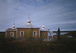
Chuathbaluk first appeared on the 1970 census as an unincorporated village. It formally incorporated in 1975. Prior to that, the community had been known as "Little Russian Mission." This was not to be confused with the present city of Russian Mission (Ikogmute) on the Yukon, so it was often called the Little Russian Mission to avoid confusion. Under the prior name, it never reported a population separately. [8]

As of the census [9] of 2000, there were 119 people, 33 households, and 23 families residing in the city. The population density was 33.8 inhabitants per square mile (13.1/km2). There were 43 housing units at an average density of 12.2 per square mile (4.7/km2). The racial makeup of the city was 5.04% White, 91.60% Native American, 0.84% from other races, and 2.52% from two or more races.

There were 33 households, out of which 45.5% had children under the age of 18 living with them, 30.3% were married couples living together, 27.3% had a female householder with no husband present, and 27.3% were non-families. 21.2% of all households were made up of individuals, and 3.0% had someone living alone who was 65 years of age or older. The average household size was 3.61 and the average family size was 4.21.

In the city, the age distribution of the population shows 42.9% under the age of 18, 8.4% from 18 to 24, 28.6% from 25 to 44, 16.0% from 45 to 64, and 4.2% who were 65 years of age or older. The median age was 23 years. For every 100 females, there were 91.9 males. For every 100 females age 18 and over, there were 106.1 males.

The median income for a household in the city was $34,286, and the median income for a family was $34,167. Males had a median income of $46,250 versus $28,750 for females. The per capita income for the city was $10,100. There were 16.7% of families and 24.1% of the population living below the poverty line, including 27.5% of under eighteens and none of those over 64.

History

During the 19th century, Deg Hit'an Athabascan people had summer fish camps in the area. [10] The Russian Orthodox Church built the St. Sergius Mission by 1894, and residents of Kukuktuk from 20 miles (32 km) downriver moved to the mission.

Once established, village has been called Chukbak, St. Sergius Mission, Kuskokwim Russian Mission, and Little Russian Mission. The village was often confused with Russian Mission on the Yukon, so in the 1960s the name was changed to Chuathbaluk, which is derived from the Yup'ik word Curapalek, meaning "the hills where the big blueberries grow."

Much of the village was lost in an influenza epidemic in 1900. By 1929, the site was deserted, although Russian Orthodox members continued to hold services at the mission. In 1954, the Crow Village Sam Phillips family from Crow Village resettled the mission, and later residents of Aniak and Crooked Creek joined their settlement. The church was rebuilt in the late 1950s, and a state school opened in the 1960s. The city was incorporated in 1975.

Related Research Articles

<span class="mw-page-title-main">Myrtlewood, Alabama</span> Town in Alabama, United States

Myrtlewood is a town in Marengo County, Alabama, United States. At the 2020 census the population was 70, down from 130 in 2010.

<span class="mw-page-title-main">Aniak, Alaska</span> City in Alaska, United States

Aniak is a city in the Bethel Census Area in the U.S. state of Alaska. At the 2010 census the population was 501, down from 572 in 2000.

<span class="mw-page-title-main">Chefornak, Alaska</span> City in Alaska, United States

Chefornak is a city in Bethel Census Area, Alaska, United States. At the 2010 census its population was 418, up from 394 in 2000.

<span class="mw-page-title-main">Crooked Creek, Alaska</span> Census-designated place in Alaska, United States

Crooked Creek is a census-designated place (CDP) in Bethel Census Area, Alaska, United States. As of the 2010 census, the population of the CDP was 105, down from 137 in 2000.

<span class="mw-page-title-main">Goodnews Bay, Alaska</span> City in Alaska, United States

Goodnews Bay is a city in Bethel Census Area, Alaska, United States. As of the 2010 census, the population of the city was 243, up from 230 in 2000.

<span class="mw-page-title-main">Kwethluk, Alaska</span> City in Alaska, United States

Kwethluk is a city in Bethel Census Area in the U.S. state of Alaska. At the 2010 census the population was 721, up from 713 in 2000. It is the birthplace of Saint Olga of Alaska

<span class="mw-page-title-main">Lower Kalskag, Alaska</span> City in Alaska, United States

Lower Kalskag is a city in Bethel Census Area, Alaska, United States. It is twenty-six miles west of Aniak. At the 2010 census the population was 282, up from 267 in 2000.

<span class="mw-page-title-main">Mekoryuk, Alaska</span> City in Alaska, United States

Mekoryuk is a city located on Nunivak Island in the Bethel Census Area, Alaska, United States. At the 2010 census the population was 191, down from 210 in 2000.

<span class="mw-page-title-main">Napakiak, Alaska</span> City in Alaska, United States

Napakiak is a city in Bethel Census Area, Alaska, United States. At the 2010 census the population was 354, up one resident from 353 since 2000.

Nightmute is a city and village in Bethel Census Area, Alaska, United States. The population was 208 at the 2000 census and 280 as of the 2010 census.

Nunapitchuk is a city in Bethel Census Area, Alaska, United States. At the 2010 census the population was 496, up from 466 in 2000.

<span class="mw-page-title-main">Stony River, Alaska</span> Census-designated place in Alaska, United States

Stony River is a census-designated place (CDP) in Bethel Census Area, Alaska, United States. The population was 54 at the 2010 census, down from 61 in 2000.

Upper Kalskag is a city in Bethel Census Area, Alaska, United States. It is thirty miles west of Aniak. At the 2010 census the population was 210, down from 230 in 2000.

<span class="mw-page-title-main">Hooper Bay, Alaska</span> Town in Alaska

Hooper Bay is a city in Kusilvak Census Area, Alaska, United States. At the 2020 census the population was 1,375, up from 1,093 in 2010.

Kotlik is a city in Kusilvak Census Area, Alaska, United States. At the 2010 census the population was 577, down from 591 in 2000.

Mountain Village is a city in Kusilvak Census Area, Alaska, United States, located on the Yukon River near the Yukon-Kuskokwim Delta. At the 2010 census the population was 813, up from 755 in 2000.

<span class="mw-page-title-main">Russian Mission, Alaska</span> City in Alaska, United States

Russian Mission is a city in Kusilvak Census Area, Alaska. It was the location of a fur trading post of the Russian-American Company in 1842. After the sale of Russian-American possessions to the United States in 1867, it was officially named Russian Mission in the early 1900s. The sale of alcohol is prohibited. At the 2020 census the population was 421, up from 312 in 2010.

<span class="mw-page-title-main">McGrath, Alaska</span> City in Alaska, United States

McGrath is a city and village on the Kuskokwim River in Alaska, United States. The population was 301 at the 2020 census. Despite its small population, the village is an important transportation and economic hub for the area.

<span class="mw-page-title-main">Nikolai, Alaska</span> City in Alaska, United States

Nikolai is a city in Yukon-Koyukuk Census Area, Alaska, United States. The population was 94 as of the 2010 census, down from 100 in 2000.

<span class="mw-page-title-main">Lake Wisconsin, Wisconsin</span> CDP in Wisconsin, United States

Lake Wisconsin is a census-designated place (CDP) in Columbia and Sauk counties, in the towns of Lodi and Merrimac, in Wisconsin, United States. The population was 4,189 at the 2010 census.

References

  1. 1996 Alaska Municipal Officials Directory. Juneau: Alaska Municipal League/Alaska Department of Community and Regional Affairs. January 1996. p. 39.
  2. 2023 Alaska Municipal Officials Directory (PDF). Juneau: Alaska Municipal League. January 2023. p. 56. Retrieved November 12, 2023.
  3. "2020 U.S. Gazetteer Files". United States Census Bureau. Retrieved October 29, 2021.
  4. "Chuathbaluk AK ZIP Code". zipdatamaps.com. 2023. Retrieved June 16, 2023.
  5. 1 2 "Geographic Identifiers: 2010 Demographic Profile Data (G001): Chuathbaluk city, Alaska". U.S. Census Bureau, American Factfinder. Archived from the original on February 12, 2020. Retrieved September 18, 2013.
  6. "US Gazetteer files: 2010, 2000, and 1990". United States Census Bureau. February 12, 2011. Retrieved April 23, 2011.
  7. "Census of Population and Housing". Census.gov. Retrieved June 4, 2015.
  8. "Geological Survey Professional Paper". 1949.
  9. "U.S. Census website". United States Census Bureau . Retrieved January 31, 2008.
  10. "Ingalik". www.mnsu.edu. Archived from the original on November 13, 2005. Retrieved January 13, 2022.

61°34′32″N159°14′50″W / 61.575693°N 159.247311°W / 61.575693; -159.247311