
Cripple Creek is a statutory city that is the county seat of Teller County, Colorado, United States. The city population was 1,155 at the 2020 United States Census. Cripple Creek is a former gold mining camp located 20 miles (32 km) southwest of Colorado Springs near the base of Pikes Peak. The Cripple Creek Historic District, which received National Historic Landmark status in 1961, includes part or all of the city and the surrounding area. The city is now a part of the Colorado Springs, CO Metropolitan Statistical Area and the Front Range Urban Corridor.

Jefferson County is a county located in the U.S. state of Colorado. As of the 2020 census, the population was 582,910, making it the fourth-most populous county in Colorado. The county seat is Golden, and the most populous city's Lakewood.
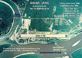
Aniak is a city in the Bethel Census Area in the U.S. state of Alaska. At the 2010 census the population was 501, down from 572 in 2000.
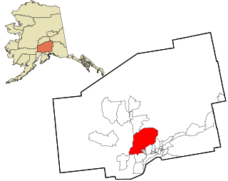
Willow is a census-designated place (CDP) in the Matanuska-Susitna Borough in the U.S. state of Alaska. Located 26 miles northwest from Wasilla along the George Parks Highway, it is part of the Anchorage, Alaska Metropolitan Statistical Area. At the 2020 census the population was 2,196, up from 2,102 in 2010.
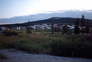
Elim is a city in Nome Census Area, Alaska, United States. At the 2010 census the population was 330, up from 313 in 2000.

Golovin is a city in Nome Census Area, Alaska, United States. At the 2010 census the population was 156, up from 144 in 2000.
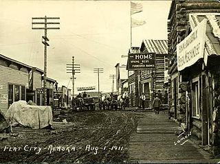
Flat is a census-designated place (CDP) in Yukon-Koyukuk Census Area, Alaska, United States. As of the 2010 Census, the population of the CDP was 0, down from 4 residents in 2000. Its post office closed in January 2004. Summer residents visited less and none remained by 2014. As of 2023, few buildings are inhabitable with hundreds of collapsed ruins.

McGrath is a city and village on the Kuskokwim River in Alaska, United States. The population was 301 at the 2020 census. Despite its small population, the village is an important transportation and economic hub for the area.

Ruby is an incorporated town in central western Alaska, situated on the south bank of the Yukon River at the northwesternmost tip of the Nowitna National Wildlife Refuge. It is accessible only by boat or air. A formerly sizeable gold-mining and lumbering town servicing the region, at the 2010 census the population was just 166, with only a general store and post office remaining as businesses, down from 188 in 2000.
Shageluk is a city in Yukon-Koyukuk Census Area, Alaska, United States. At the 2010 census the population was 83, down from 129 in 2000.
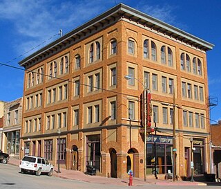
The City of Victor is a Statutory City in Teller County, Colorado, United States. Gold was discovered in Victor in the late 19th century, an omen of the future of the town. With Cripple Creek, the mining district became the second largest gold mining district in the country and realized approximately $10 billion of mined gold in 2010 dollars. It reached its peak around the turn of the century when there were about 18,000 residents in the town. Depleted ore in mines, labor strife and the exodus of miners during World War I caused a steep decline in the city's economy, from which it has never recovered. The population was 379 at the 2020 census. There is a resumed mining effort on Battle Mountain.

Iditarod is an abandoned town in the Yukon-Koyukuk Census Area in the U.S. state of Alaska. It is presently located within the boundaries of the Flat Census Designated Place, which has no residents as of 2010.
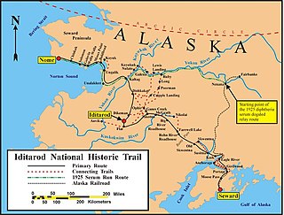
The Iditarod Trail, also known historically as the Seward-to-Nome Trail, is a thousand-plus mile (1,600 km) historic and contemporary trail system in the US state of Alaska. The trail began as a composite of trails established by Alaskan native peoples. Its route crossed several mountain ranges and valleys and passed through numerous historical settlements en route from Seward to Nome. The discovery of gold around Nome brought thousands of people over this route beginning in 1908. Roadhouses for people and dog barns sprang up every 20 or so miles. By 1918 World War I and the lack of 'gold fever' resulted in far less travel. The trail might have been forgotten except for the 1925 diphtheria outbreak in Nome. In one of the final great feats of dog sleds, twenty drivers and teams carried the life-saving serum 674 miles (1,085 km) in 127 hours. Today, the Iditarod Trail Sled Dog Race serves to commemorate the part the trail and its dog sleds played in the development of Alaska, and the route and a series of connecting trails have been designated Iditarod National Historic Trail.
Council is an abandoned townsite in the Nome Census Area in the U.S. state of Alaska. It has a population of zero as of the 2000 and 2010 U.S. Censuses.
Gold mining in Alaska, a state of the United States, has been a major industry and impetus for exploration and settlement since a few years after the United States acquired the territory in 1867 from the Russian Empire. Russian explorers discovered placer gold in the Kenai River in 1848, but no gold was produced. Gold mining started in 1870 from placers southeast of Juneau, Alaska.

Chatanika is a small unincorporated community located in the Fairbanks North Star Borough, Alaska, United States, north-northeast of the city of Fairbanks. The community runs along an approximately 20-mile (32 km) stretch of the Steese Highway, the majority of which sees the highway paralleled by the Chatanika River. The community consists of sparsely scattered residential subdivisions, several roadside businesses, a boat launch where the Steese Highway crosses the Chatanika River, relics of past gold mining operations in the area and the Poker Flat Research Range operated by the Geophysical Institute of the University of Alaska Fairbanks.
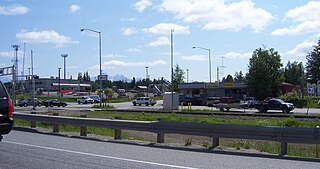
The City of Wasilla (Dena'ina: Benteh) is a city in Matanuska-Susitna Borough, United States and the fourth-largest city in Alaska. It is located on the northern point of Cook Inlet in the Matanuska-Susitna Valley of the southcentral part of the state. The city's population was 9,054 at the 2020 census, up from 7,831 in 2010. Wasilla is the largest city in the borough and a part of the Anchorage metropolitan area, which had an estimated population of 398,328 in 2020.

The Cripple Creek & Victor Gold Mine, formerly and historically the Cresson Mine, is an active gold mine located near the town of Victor, in the Cripple Creek mining district in the US state of Colorado. The richest gold mine in Colorado history, it is the only remaining significant producer of gold in the state, and produced 322,000 troy ounces of gold in 2019, and reported 3.45 million troy ounces of Proven and Probable Reserves as at December 31, 2019. It was owned and operated by AngloGold Ashanti through its subsidiary, the Cripple Creek & Victor Gold Mining Company (CC&V), until 2015, when it sold the mine to Newmont Mining Corporation.

Gold Rush is a reality television series that airs on Discovery and its affiliates worldwide. The series follows the placer gold mining efforts of various family-run mining companies, mostly in the Klondike region of Dawson City, Yukon, Canada, as well as in the U.S. state of Alaska. In its 12th season as of early 2021, prior seasons also included mining efforts in South America and western North America.

John Beaton was a gold miner and businessman whose discovery of gold in Flat, Alaska, began the Iditarod Gold Rush.


