Chandalar, Alaska

Last updated

Chandalar, Alaska
USA Alaska location map.svg
Red pog.svg
Chandalar, Alaska
Location within the state of Alaska
Coordinates: 67°30′19″N148°29′37″W / 67.50528°N 148.49361°W / 67.50528; -148.49361
Country United States
State Alaska
Census Area Yukon-Koyukuk
Government
   State senator Donny Olson (D)
   State rep. Dean Westlake (D)
Elevation
1,873 ft (571 m)
Time zone UTC-9 (Alaska (AKST))
  Summer (DST) UTC-8 (AKDT)
Area code 907

Chandalar is an unincorporated community in Yukon-Koyukuk Census Area in the U.S. state of Alaska.

Contents

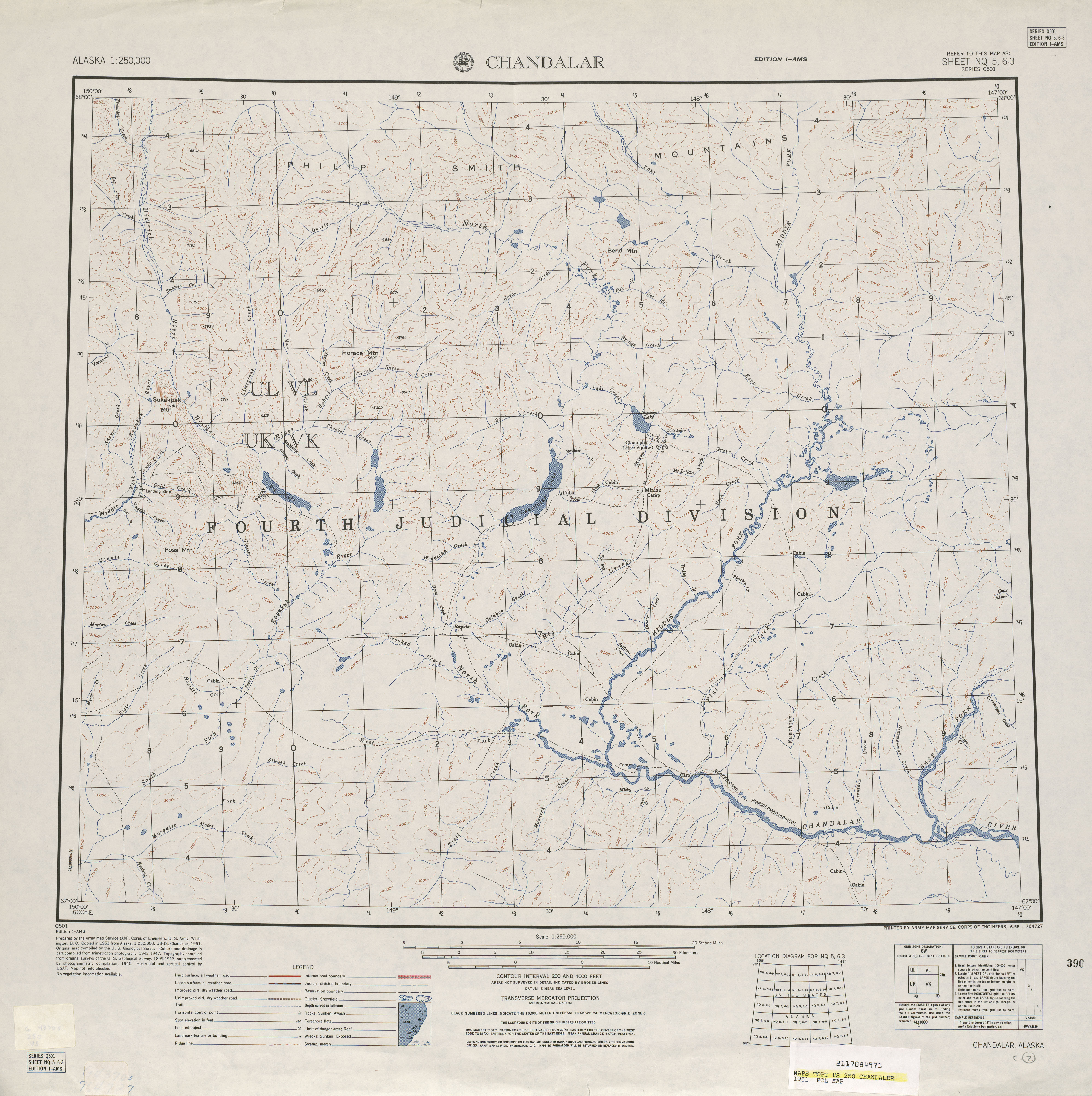
Chandalar is located on the eastern shore of Chandalar Lake by Chandalar Lake Airport, about 200 miles north of Fairbanks, and is at an elevation of 1,873 feet. It succeeded an earlier community (or communities) by that name (see History). The present Chandalar has never formally reported a population on the U.S. Census.

The community is served by the Chandalar Lake Airport and is not accessible by road. It was featured in the National Geographic show Life Below Zero . [1]

Toponymy

Chandalar derives from a 19th century French Slavey Jargon expression "Gens De Large", meaning nomadic people. The name was given by employees of the Hudson's Bay Company. Over time the word eventually evolved into its present day namesake Chandalar. [2]

History, other Chandalars and Little Squaw

At least two communities bore the name of Chandalar before the present one. The Chandalar Mining Camp [3] was located several miles to the northeast of the current Chandalar. [4] 67°35′28″N148°09′37″W / 67.59111°N 148.16028°W / 67.59111; -148.16028 (Chandalar, Alaska) [5] This settlement was developed as a mining camp in about 1906-07, and a post office was established in 1908, but it was shut down in 1944. [6]

Also at or adjacent to this location was the mining camp of Little Squaw, which was along the same named creek (now known as Crystal Creek.) Little Squaw had been named for the daughter of Frank & Nevelo Yasuda, who helped found this mining area. [7] Little Squaw appeared twice on the U.S. Census, reporting a population of 8 in 1930 [8] and 10 in 1940. [9] In at least one instance, Little Squaw and Chandalar were reported as being the same place on the 1951 USGS Chandalar Topographical Map. [10]

The present-day census-designated place of Venetie, Alaska was also called Chandalar Village. [11] It is unclear if this was the "Chandalar" reported on the 1920 and 1930 U.S. Censuses. Maps of the time were not clear on the location, though the 1929 USGS Topographical Map of Chandalar-Sheenjek Region, Alaska [12] reported Chandalar at the present location of Venetie. A review of the names on the census rolls for 1930 Chandalar and 1940 Venetie would confirm whether this was the same location.

The name was removed to the present settlement on Chandalar Lake by the airport around the 1940s.

Climate

Chandalar has a continental subarctic climate (Köppen Dfc). The nearest weather station is at Chandalar Lake.

Climate data for Chandalar Lake, Alaska, 19912020 normals, extremes 19632011
MonthJanFebMarAprMayJunJulAugSepOctNovDecYear
Record high °F (°C)38
(3)
38
(3)
50
(10)
54
(12)
83
(28)
87
(31)
92
(33)
90
(32)
78
(26)
59
(15)
42
(6)
31
(−1)
92
(33)
Mean maximum °F (°C)24.9
(−3.9)
25.0
(−3.9)
30.3
(−0.9)
44.4
(6.9)
67.1
(19.5)
77.0
(25.0)
79.8
(26.6)
73.7
(23.2)
60.9
(16.1)
38.9
(3.8)
25.8
(−3.4)
22.8
(−5.1)
80.3
(26.8)
Mean daily maximum °F (°C)−5.7
(−20.9)
1.4
(−17.0)
13.3
(−10.4)
31.6
(−0.2)
52.1
(11.2)
66.5
(19.2)
69.2
(20.7)
60.6
(15.9)
46.5
(8.1)
26.3
(−3.2)
6.7
(−14.1)
1.6
(−16.9)
30.8
(−0.6)
Daily mean °F (°C)−15.8
(−26.6)
−9.9
(−23.3)
−0.9
(−18.3)
16.9
(−8.4)
39.5
(4.2)
53.8
(12.1)
56.7
(13.7)
48.6
(9.2)
35.8
(2.1)
16.6
(−8.6)
−4.0
(−20.0)
−8.2
(−22.3)
19.1
(−7.2)
Mean daily minimum °F (°C)−25.9
(−32.2)
−21.2
(−29.6)
−15.1
(−26.2)
2.2
(−16.6)
26.8
(−2.9)
41.1
(5.1)
44.2
(6.8)
36.6
(2.6)
25.0
(−3.9)
6.8
(−14.0)
−14.8
(−26.0)
−17.9
(−27.7)
7.3
(−13.7)
Mean minimum °F (°C)−52.5
(−46.9)
−51.5
(−46.4)
−43.4
(−41.9)
−27.5
(−33.1)
5.8
(−14.6)
27.0
(−2.8)
31.1
(−0.5)
21.1
(−6.1)
7.4
(−13.7)
−19.0
(−28.3)
−38.2
(−39.0)
−47.0
(−43.9)
−56.9
(−49.4)
Record low °F (°C)−74
(−59)
−68
(−56)
−62
(−52)
−45
(−43)
−25
(−32)
20
(−7)
25
(−4)
11
(−12)
−8
(−22)
−44
(−42)
−57
(−49)
−63
(−53)
−74
(−59)
Average precipitation inches (mm)0.43
(11)
0.25
(6.4)
0.34
(8.6)
0.20
(5.1)
0.58
(15)
1.20
(30)
1.32
(34)
1.53
(39)
0.99
(25)
0.57
(14)
0.35
(8.9)
0.57
(14)
8.33
(211)
Average snowfall inches (cm)8.8
(22)
5.5
(14)
4.9
(12)
4.7
(12)
1.0
(2.5)
trace0.0
(0.0)
trace1.4
(3.6)
9.1
(23)
5.9
(15)
6.6
(17)
47.9
(121.1)
Average precipitation days (≥ 0.01 in)6.34.84.94.35.19.210.910.69.28.96.36.286.7
Average snowy days (≥ 0.1 in)6.85.35.24.01.30.00.00.01.38.86.37.146.1
Source 1: NOAA (precip/snow, precip days/snow days 1981-2010) [13] [14]
Source 2: WRCC (mean maxima and minima 1963-2011) [15]

Demographics

(Old) Chandalar

Historical population
CensusPop.Note
1920 32
1930 6293.8%
1940 0−100.0%
U.S. Decennial Census [16]

Chandalar first appeared on the 1920 [17] U.S. Census and again in 1930 [8] as an unincorporated village. It reported "no population" in 1940 [18] and did not appear on the census again under that name. As stated under "history", it is unclear if this Chandalar is the former mining camp at Little Squaw Creek or if it was the present day Venetie.

New Chandalar

The new settlement that sprang up around the Chandalar Lake Airstrip has never formally reported a population to date, as of the 2010 Census. [19] However it has a population of about 5.

Related Research Articles

<span class="mw-page-title-main">Yukon River</span> Major watercourse in northwestern North America

The Yukon River is a major watercourse of northwestern North America. From its source in British Columbia, Canada, it flows through Canada's territory of Yukon. The lower half of the river continues westward through the U.S. state of Alaska. The river is 3,190 kilometres (1,980 mi) long and empties into the Bering Sea at the Yukon–Kuskokwim Delta. The average flow is 6,400–7,000 m3/s (230,000–250,000 cu ft/s). The total drainage area is 833,000 km2 (321,500 sq mi), of which 323,800 km2 (125,000 sq mi) lies in Canada. The total area is more than 25% larger than Texas or Alberta.

<span class="mw-page-title-main">Yukon–Koyukuk Census Area, Alaska</span> Census area in Alaska, United States

Yukon–Koyukuk Census Area is a census area in the U.S. state of Alaska. As of the 2020 census, the population was 5,343, down from 5,588 in 2010. With an area of 147,842.51 sq mi (382,910.3 km2), it is the largest of any county or county-equivalent in the United States, or slightly larger than the entire state of Montana. It is part of the unorganized borough of Alaska and therefore has no borough seat. Its largest communities are the cities of Galena, in the west, and Fort Yukon, in the northeast.

<span class="mw-page-title-main">Healy, Alaska</span> Census-designated place in Alaska

Healy is a census-designated place (CDP) and the borough seat of Denali Borough in the U.S. state of Alaska. The population was 966 at the time of the 2020 census, down from 1,021 in 2010.

<span class="mw-page-title-main">Denali Park (CDP), Alaska</span> Census-designated place in Alaska, United States

Denali Park, formerly McKinley Park, is a census-designated place (CDP) in Denali Borough, in the U.S. state of Alaska. As of the 2020 census, the population of the CDP was 163, down from 185 at the 2010 census.

<span class="mw-page-title-main">Big Lake, Alaska</span> CDP in Alaska, United States

Big Lake is a census-designated place (CDP) in Matanuska-Susitna Borough, Alaska, United States. It is part of the Anchorage, Alaska Metropolitan Statistical Area. The population was 3,833 at the 2020 census, up from 3,350 in 2010.

<span class="mw-page-title-main">Sutton-Alpine, Alaska</span> Census-designated place in Alaska, United States

Sutton is a census-designated place (CDP) in the Matanuska-Susitna Borough in the U.S. state of Alaska. At the 2020 census the population was 1,038, down from 1,447 in 2010. The CDP includes the former coal mining community and road construction camp of Sutton, as well as the former mining camps of Eska and Jonesville.

<span class="mw-page-title-main">Nome, Alaska</span> City in Alaska, United States

Nome is a city in the Nome Census Area in the Unorganized Borough of the US state of Alaska. The city is located on the southern Seward Peninsula coast on Norton Sound of the Bering Sea. It had a population of 3,699 recorded in the 2020 census, up from 3,598 in 2010. Nome was incorporated on April 9, 1901. It was once the most-populous city in Alaska. Nome lies within the region of the Bering Straits Native Corporation, which is headquartered in Nome.

<span class="mw-page-title-main">Healy Lake, Alaska</span> CDP in Alaska, United States

Healy Lake is a census-designated place (CDP) in Southeast Fairbanks Census Area, Alaska, United States. The population was 13 at the 2010 census, down from 37 in 2000.

<span class="mw-page-title-main">Chenega, Alaska</span> CDP in Alaska, United States

Chenega is a census-designated place (CDP) on Evans Island in the Chugach Census Area in the U.S. state of Alaska. Located in Prince William Sound, the CDP consists of the Chugach Alutiiq village of Chenega Bay, which was established only after the Good Friday earthquake destroyed the original community on Chenega Island to the north. As of the 2020 census, the population of the CDP was 59, largely Alaska Natives; as of 2021, the population of Chenega is estimated at 49. Chenega Bay is in the Chugach School District and has one school, Chenega Bay Community School, serving approximately 16 students from preschool through high school.

<span class="mw-page-title-main">Chisana, Alaska</span> CDP in Alaska, United States

Chisana is a census-designated place (CDP) in the Copper River Census Area in the U.S. state of Alaska. As of the 2010 Census, the population of the CDP was 0. The English name Chisana derives from the Ahtna Athabascan name Tsetsaan' Na, meaning literally 'copper river'. The Chisana River joins the Nabesna River just north of Northway Junction, Alaska, to form the Tanana River, a major tributary of the Yukon River. The Chisana Airport consists of a turf and gravel runway which is largely serviced by flights from Tok, Alaska.

Nelchina is a census-designated place (CDP) in Copper River Census Area, Alaska, United States. The population was 45 at the 2020 census, down from 59 in 2010.

<span class="mw-page-title-main">Arctic Village, Alaska</span> CDP in Alaska, United States

Arctic Village is an unincorporated Native American village and a census-designated place (CDP) in Yukon-Koyukuk Census Area, Alaska, United States. As of the 2010 census, the population of the CDP was 152. This was unchanged from 2000. The village is located in the large Gwitch'in speaking region of Alaska, and the local dialect is known as Di'haii Gwitch'in or shahanh. As of 1999, over 95% of the community speaks and understands the language. As of 2019, the second village chief was against oil drilling because of the impact on caribou.

<span class="mw-page-title-main">Circle, Alaska</span> CDP in Alaska, United States

Circle is a census-designated place (CDP) in Yukon-Koyukuk Census Area, Alaska, United States. At the 2010 census the population was 104, up from 100 in 2000.

<span class="mw-page-title-main">Livengood, Alaska</span> CDP in Alaska, United States

Livengood is a census-designated place (CDP) in Yukon-Koyukuk Census Area, Alaska, United States. The population was 16 at the 2020 census, compared to 13 in 2010 and 29 in 2000.

<span class="mw-page-title-main">Venetie, Alaska</span> CDP in Alaska, United States

Venetie, is a census-designated place (CDP) in Yukon–Koyukuk Census Area, Alaska. At the 2010 census, the population was 166, down from 202 in 2000. It includes the Village of Venetie, a Gwich'in tribal entity designated in the 1971 Alaska Native Claims Settlement Act.

<span class="mw-page-title-main">Wiseman, Alaska</span> CDP in Alaska, United States

Wiseman is a census-designated place (CDP) in Yukon-Koyukuk Census Area, Alaska, United States. The full time resident population is 12 as of 2022.

<span class="mw-page-title-main">Chandalar River</span> River in the United States of America

The Chandalar River is a 100-mile (160 km) tributary of the Yukon River in the U.S. state of Alaska. Its peak flow, recorded by the United States Geological Survey (USGS) between 1964 and 1974 at a stream gauge at Venetie, was 62,800 cubic feet per second (1,780 m3/s) on June 9, 1968.

Gold mining in Alaska, a state of the United States, has been a major industry and impetus for exploration and settlement since a few years after the United States acquired the territory in 1867 from the Russian Empire. Russian explorers discovered placer gold in the Kenai River in 1848, but no gold was produced. Gold mining started in 1870 from placers southeast of Juneau, Alaska.

<span class="mw-page-title-main">Yukon Flats</span> Area of wetlands, forest, bog, and low-lying ground in central Alaska, USA

The Yukon Flats are a vast area of wetlands, forest, bog, and low-lying ground centered on the confluence of the Yukon River, Porcupine River, and Chandalar River in the central portion of the U.S. state of Alaska. The Yukon Flats are bordered in the north by the Brooks Range, in the south by the White Mountains, and cover an area of approximately 11,000 square miles (28,490 km2). The Yukon Flats are a critical waterfowl breeding ground due to the large area of wetland provided by the estimated 40,000 small lakes and streams in the area. In recognition of this fact, the area is protected under the Yukon Flats National Wildlife Refuge.

Venetie Airport is a public use airport located in Venetie, in the Yukon-Koyukuk Census Area of the U.S. state of Alaska. It is privately owned by the Venetie Tribal Government.

References

  1. "About Chandalar". National Geographic . Archived from the original on July 8, 2016. Retrieved July 17, 2016.
  2. Shalev, Asaf (May 31, 2016). "Feds recognize Native names of major Alaska river system". Anchorage Daily News. Retrieved August 10, 2023.
  3. "Map of area, reference to location of Chandalar" (PDF). Goldrichmining.com. pp. 24/25.
  4. "Domestic Names | U.S. Geological Survey". Usgs.gov. Retrieved January 29, 2022.
  5. "67°35'27.5"N 148°09'36.9"W · Yukon Flats School District, AK". Google.com. Retrieved January 29, 2022.
  6. "Domestic Names | U.S. Geological Survey". Usgs.gov. Retrieved January 29, 2022.
  7. "Frank Yasuda". Alaskamininghalloffame.org. Retrieved January 29, 2022.
  8. 1 2 "Alaska" (PDF). 2.census.gov. Retrieved January 29, 2022.
  9. "Alaska" (PDF). 2.census.gov. Retrieved January 29, 2022.
  10. "Photographic image of 1951 map" (JPG). Legacy.lib.utexas.edu. Retrieved January 29, 2022.
  11. "Venetie – Tanana Chiefs Conference". Tananachiefs.org. Retrieved January 29, 2022.
  12. "1929 Map" (XSL). Cartweb.georgraphy.ua.edu. Retrieved January 30, 2022.
  13. "U.S. Climate Normals Quick Access - Station: Chandalar Lake, AK (1991-2020)". National Oceanic and Atmospheric Administration. Retrieved on October 22, 2022.
  14. "U.S. Climate Normals Quick Access - Station: Chandalar Lake, AK (1981-2010)". National Oceanic and Atmospheric Administration. Retrieved on October 22, 2022.
  15. "CHANDALAR LAKE, AK". Western Regional Climate Center. Retrieved on October 22, 2022
  16. "U.S. Decennial Census". Census.gov. Retrieved June 6, 2013.
  17. "Population : 1920 Census Data" (PDF). 2.census.gov. Retrieved January 30, 2022.
  18. "1940 Census Enumeration District Descriptions - Alaska - Fourth Judicial Division County - ED 4-42, ED 4-43, ED 4-44". Catalog.archives.gov. Retrieved January 30, 2022.
  19. "Alaska: 2010 Summary Population and Housing Characteristics : 2010 Census of Population and Housing" (PDF). Census.gov. Retrieved January 30, 2022.