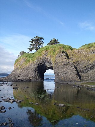
Coronation Island (Alaska)

Last updated
Location of Coronation Island Coronation Island Mappa.png
Location of Coronation Island
Egg Harbor, looking east from the summit of Pin Peak Egg Harbor on Coronation Island.jpg
Egg Harbor, looking east from the summit of Pin Peak

Coronation Island is located in Alaska off the northwest coast of Prince of Wales Island, south of Kuiu Island, and west of Warren Island. High prevailing winds and waves from the open ocean to the west, combined with a steep, rocky coast, result in virtually unaccessible shore due to heavy surf along the windward (western and southwestern) coastline of the island. The few protected coves and beaches along the leeward (eastern and northeastern) shore are guarded by rocky shoals. Thus, the island is difficult to access by any route, and is generally limited to small boat or floatplane during brief lulls in the weather. There are no developed facilities and no groomed trails on the island. Wilderness camping is unrestricted and fishing and hunting are allowed. [1] The nearest full-service community is Craig, Alaska. The island is also home to the Coronation Island Wilderness, which encompasses 19,232 acres (78 km2) and includes the adjacent Spanish Islands. [2] There are several sea caves on the island, and some of these contain fossils. [3]

Contents

Coronation Island was sighted and named by George Vancouver on 22 September 1793, that day being the 33rd anniversary of the coronation of King George III. [4]

The Star of Bengal was wrecked on Coronation Island.

The path of the Star of Bengal and the location where it crashed. MapStarOfBengalCrash.png
The path of the Star of Bengal and the location where it crashed.

Island access

The island is accessible by boat or floatplane. People wanting to visit should be aware of winds and surf.

Geography

Coronation Island has Japan to its south and southwest, Iphigenia Bay to its southeast, Sumner Strait to its east and northeast, and Chatham Strait to its west and northwest. To the north is Kuiu Island. To the south is Noyes Island. Coronation Island has seven high peaks: Needle Peak, Aats Peak, Pin Peak, and four other peaks that are not named. Coronation Island has five bays: Egg Harbor, Alikula Bay, Aats Bay, Gish Bay, and Windy Bay. The island is surrounded by rocky areas, a few sandy areas, and a handful of coral reefs. The island is made largely of limestone and some caves on the island contain fossils. Coronation Island's western side includes large, flat lowland areas of karst that appear to have never been glaciated, based on bathymetric mapping. [5] In 2001, Colander Cave was discovered in one of these lowland areas. An 11,000+-year-old fossil of a brown bear was found in Colander Cave, supporting the hypothesis that these bears survived the Last Glacial Maximum.


Wildlife

Common animals on Coronation Island include Sitka black-tailed deer, long-tailed vole, [6] and bald eagle. Beaver do not occur on the island. [7] In 1960, in the only wolf-stocking experiment ever done on an Alaskan island, [8] four wolves were released on Coronation Island. In 1964, it was reported that the wolves had produced pups, that they had reduced the deer population substantially, but continued to prey on them, and that the introduction of wolves had resulted in a recovery of many native plant species that had previously been considered as locally extinct. [9] By 1968, only a single wolf remained on the island, and deer were scarce. [10] An inventory of the island's fauna in 1983 found apparent extirpation of the wolves, with no evidence of the species, but the deer were once again plentiful. [8]

Avifauna observed in coastal caves on the island include northern fulmar, sooty shearwater, short-tailed shearwater, pelagic cormorant, long-tailed duck, surf scoter, white-winged scoter, blue grouse, wandering tattler, surfbird, short-billed gull, glaucous-winged gull, common murre, pigeon guillemot, marbled murrelet, parakeet auklet, rhinoceros auklet, Cassin's auklet, tufted puffin, northern hawk owl and northwestern crow. [11]

The ocean around the island ranges from 51 °F (11 °C) to 55 °F (13 °C) and supports a handful of coral reef areas as well as sea otters, Steller's sea lions, harbor seals, [12] and humpback whales. Fish and shellfish that inhabit the water around the island include king salmon, red salmon, silver salmon, pink salmon, chum salmon, halibut, lingcod, Pacific cod, a variety of rockfish, greenling, ratfish, dog sharks, dungeness crab, tanner crab, king crab, shrimp, prawns, scallops, abalone, clams, and jellyfish. Great white sharks that have traveled up on warm currents have been reported off the island.

Flora

The island has Sitka spruce and western hemlock. [13] The bryophyte Hypopterygium tamarisci subsp japonicum, as well as the lichen-forming fungus Pannaria oregonensis , occur on the island. [14] [15]

General wilderness prohibitions

Use of motorized equipment or mechanical transport is described in the special regulations in effect for a specific area. Contact the United States Forest Service office for more specific information.

General prohibitions have been implemented for all national forest wildernesses in order to implement the provisions of the Wilderness Act of 1964. The Wilderness Act requires management of human-caused impacts and protection of the area's wilderness character to ensure that it is "unimpaired for the future use and enjoyment as wilderness." Use of the equipment listed as prohibited in wilderness is inconsistent with the provision in the Wilderness Act which mandates opportunities for solitude or primitive recreation and that wilderness is a place that is in contrast with areas where people and their works are dominant.

Related Research Articles

<span class="mw-page-title-main">Tongass National Forest</span> National forest in southeast Alaska

The Tongass National Forest in Southeast Alaska is the largest U.S. National Forest at 16.7 million acres. Most of its area is temperate rain forest and is remote enough to be home to many species of endangered and rare flora and fauna. The Tongass, which is managed by the United States Forest Service, encompasses islands of the Alexander Archipelago, fjords and glaciers, and peaks of the Coast Mountains. An international border with Canada runs along the crest of the Boundary Ranges of the Coast Mountains. The forest is administered from Forest Service offices in Ketchikan. There are local ranger district offices located in Craig, Hoonah, Juneau, Ketchikan, Petersburg, Sitka, Thorne Bay, Wrangell, and Yakutat.

<span class="mw-page-title-main">Gospel Hump Wilderness</span> Wilderness area in Idaho, United States

The Gospel Hump Wilderness is a federally-protected wilderness area that covers 205,796 acres (83,283 ha) of the state of Idaho. Managed by the U.S. Forest Service in the U.S. Department of Agriculture, it received wilderness designation on February 24, 1978 through the passage of the Endangered American Wilderness Act and is part of Nez Perce National Forest. As part of the National Wilderness Preservation System, the Gospel Hump Wilderness is an area where human development and use are restricted and people are to remain only visitors.
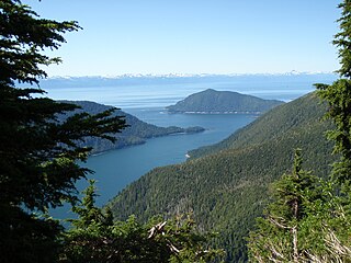
<span class="mw-page-title-main">Kuiu Island</span> Island in southeastern Alaska

Kuiu Island is an island in the Alexander Archipelago in southeastern Alaska. It lies between Kupreanof Island, to its east, and Baranof Island, to its west. The island is 105 km (65 mi) long, and 10 to 23 km wide. It is nearly cut in two by Affleck Canal. It has 1,936.16 km2 (747.56 sq mi) of land area, making it the 15th largest island in the United States. The entire island is part of Tongass National Forest.

<span class="mw-page-title-main">Glacier Bay Basin</span> Bay in southeastern Alaska

Glacier Bay Basin in southeastern Alaska, in the United States, encompasses the Glacier Bay and surrounding mountains and glaciers, which was first proclaimed a U.S. National Monument on February 25, 1925, and which was later, on December 2, 1980, enlarged and designated as the Glacier Bay National Park and Preserve under the Alaska National Interest Lands Conservation Act, covering an area of 3,283,000 acres. In 1986, UNESCO declared an area of 57,000 acres within a World Biosphere Reserve. This is the largest UNESCO protected biosphere in the world. In 1992, UNESCO included this area as a part of a World Heritage site, extending over an area of 24,300,000-acre (98,000 km2) which also included the Wrangell-St. Elias National Park, Kluane National Park (Canada) and Tatshenshini-Alsek Park (Canada). Part of the National Park is also designated a Wilderness area covering 2,658,000 acres.

<span class="mw-page-title-main">Orca Inlet</span>

Orca Inlet is an arm of Prince William Sound in southern Alaska. The town of Cordova was founded on its coast in 1906. All marine traffic reaches the town through Orca Inlet.

<span class="mw-page-title-main">Saint Lazaria Wilderness</span>

St. Lazaria Island is a nesting bird colony located twenty miles (32 km) west of Sitka, Alaska. Its is a part of the Gulf of Alaska unit of the Alaska Maritime National Wildlife Refuge and is protected as the Saint Lazaria Wilderness. It is located in Sitka Sound, just south of Kruzof Island, and within the limits of the City and Borough of Sitka, Alaska. The island's name is Kanasx'ée in the Tlingit language.

<span class="mw-page-title-main">Misty Fjords National Monument</span> Wilderness preserve in Alaska, US

Misty Fjords National Monument is a national monument and wilderness area administered by the U.S. Forest Service as part of the Tongass National Forest. Misty Fiords is about 40 miles (64 km) east of Ketchikan, Alaska, along the Inside Passage coast in extreme southeastern Alaska, comprising 2,294,343 acres (928,488 ha) of Tongass National Forest in Alaska's Panhandle. All but 151,832 acres (61,444 ha) are designated as wilderness.

<span class="mw-page-title-main">Trinity Alps Wilderness</span> Protected wilderness area in California, United States

The Trinity Alps Wilderness is a 525,627-acre (212,714 ha) designated wilderness located in northern California, roughly between Eureka and Redding. It is jointly administered by Shasta-Trinity, Klamath, and Six Rivers National Forests. About 4,623 acres (1,871 ha) are administered by the Bureau of Land Management. The wilderness is located in the Salmon and Scott Mountains, subranges of the Klamath Mountains region. The high, granitic and ultramafic peaks of the eastern half of the wilderness area are known as the Trinity Alps. Granite peaks at the core of the area are known as the White Trinities, reddish ultramafic peaks in the southeast are known as the Red Trinities, and the forested mountains in the western half of the wilderness are known as the Green Trinities.
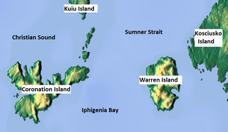
<span class="mw-page-title-main">Warren Island (Alaska)</span> Island in Alaska, United States

Warren Island is an island in the Alexander Archipelago of southeastern Alaska, United States. It lies on the Pacific coast just southwest of the community of Edna Bay. Directly west is Coronation Island and directly north is Kuiu Island. Warren Island has a land area of 47.191 km2 and no permanent resident population. The entire island has been designated as the Warren Island Wilderness, a part of Tongass National Forest.

<span class="mw-page-title-main">Salmon–Huckleberry Wilderness</span> Wilderness area in Oregon, United States

The Salmon–Huckleberry Wilderness is a wilderness area located on the southern side of Mount Hood in the northwestern Cascades of Oregon, in the United States. It lies within the Mount Hood National Forest and comprises 62,061 acres (25,115 ha) of land. The United States Congress designated the area Wilderness in 1984.
<span class="mw-page-title-main">Vancouver Coastal Sea wolf</span> Subspecies of carnivore

The Vancouver Island wolf, also known as the coastal wolf or sea wolf is a subspecies of grey wolf, endemic to the coast of the Pacific Northwest. They are a unique subspecies of wolf due to their semi-aquatic lifestyle, which includes a diet that is almost entirely marine-based.

The Oregon Coast National Wildlife Refuge Complex consists of six National Wildlife Refuges along the Oregon Coast. It provides wilderness protection to thousands of small islands, rocks, reefs, headlands, marshes, and bays totaling 371 acres spanning 320 miles (515 km) of Oregon's coastline. The areas are all managed by the United States Fish and Wildlife Service.

<span class="mw-page-title-main">Stikine-LeConte Wilderness</span>

The Stikine-LeConte Wilderness is on the mainland of southeast Alaska, southeast of Petersburg and north of Wrangell, Alaska. The boundary extends from Frederick Sound on the west to the Alaska–Canada boundary on the east. The wilderness is 448,841 acres (181,640 ha) in size. It is part of Tongass National Forest, which is managed by the United States Forest Service.

<span class="mw-page-title-main">Marble Mountain Wilderness</span> Protected wilderness area in California, United States

The Marble Mountain Wilderness is a 241,744-acre (978.30 km2) wilderness area located 60 miles (97 km) southwest of Yreka, California, in the United States. It is managed by the United States Forest Service and is within the Klamath National Forest in Siskiyou County. The land was first set aside in April 1931 as the Marble Mountain Primitive Area, which comprised 234,957 acres (950.84 km2). It was one of four areas to gain primitive status under the Forest Service's L-20 regulations that year. In 1964, it became a federally designated wilderness area when the U.S. Congress passed the Wilderness Act.
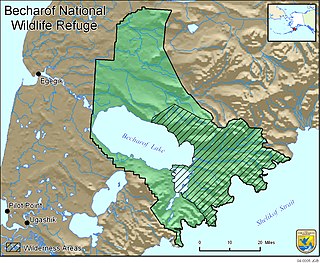
<span class="mw-page-title-main">Becharof National Wildlife Refuge</span> National Wildlife Refuge in the Aleutian Range of the Alaska Peninsula of southwestern Alaska

Becharof National Wildlife Refuge is a National Wildlife Refuge in the Aleutian Range of the Alaska Peninsula of southwestern Alaska. It is adjacent to Katmai National Park and Preserve. This national wildlife refuge, which covers an area of 1,200,000 acres (4,900 km2), was established in 1980 to conserve major brown bears, salmon, migratory birds, caribou, marine birds, and mammals and to comply with treaty obligations. It lies primarily in the east-central part of Lake and Peninsula Borough, but extends eastward into the mainland portion of Kodiak Island Borough. The refuge is administered from offices in King Salmon.

Fritz Cove is a bay on the northwestern coast of Douglas Island in the City and Borough of Juneau, Alaska, United States. Lying in Stephens Passage, it is 8 miles (13 km) northwest of the city of Juneau.

<span class="mw-page-title-main">Windham Bay</span>

Windham Bay is located 45 miles (72 km) southeast of Juneau, in the U.S. state of Alaska. Windham Bay is listed as site 6 within Southeast Alaska's Zone 3 of the Alaska Dept. of Environmental Conservation's Geographic Response Strategy oil spill response plan. Part of the bay is a protected wilderness area; the Chuck River Wilderness, established in 1990 by the United States Congress, covers an area of 74,506 acres (30,152 ha). The Chuck River flows into Windham Bay, which has a protected anchorage north of Port Houghton, where the historic Chuck Mining Camp once operated.

<span class="mw-page-title-main">Bay of Pillars</span>

Bay of Pillars is a bay located in the Alexander Archipelago in the southeastern region of the U.S. state of Alaska. It is situated within the Kuiu Wilderness of the Tongass National Forest.

Security Bay State Marine Park is a 1,960 acre undeveloped Alaska state marine park on the north end of Kuiu Island, facing Frederick Sound and Chatham Strait. The bay provides a safe haven anchorage for vessels in the area. The nearest city is Kake, about 20 miles to the east. There is no road access to the park.

References

  1. "Coronation Island Wilderness". Wilderness Connect. University of Montana. Archived from the original on 2021-10-13.
  2. "Coronation Island and Warren Island Wilderness" (PDF). United States Forest Service . November 2008. Archived (PDF) from the original on 2021-09-16.
  3. Heaton, Timothy H. (2002). "Colander Cave". University of South Dakota . Archived from the original on 2020-02-25.
  4. Phillips, James W. (2016). Alaska-Yukon Place Names. Epicenter Press. p. 49. ISBN   978-1-941890-03-5 . Retrieved 17 February 2018.
  5. Carrara, P. E., Thomas A. Ager, James F. Baichtal, and D. P. Van Sistine. "Late Wisconsin glacial limits in southern southeastern Alaska, as indicated by a new bathymetric map." In 32nd International Arctic Workshop. Institute of Arctic and Alpine Research, University of Colorado, Boulder, Colo, pp. 41-43. 2002.
  6. Carrara, Paul E.; Ager, Thomas A.; Baichtal, James F.; VanSistine, D. Paco. "MAP OF GLACIAL LIMITS AND POSSIBLE REFUGIA IN THE SOUTHERN ALEXANDER ARCHIPELAGO, ALASKA, DURING THE LATE WISCONSIN GLACIATION" (PDF). Alaska Resources Library & Information Services. U.S. Geological Survey. Archived (PDF) from the original on 2021-10-15.
  7. "SPECIES STATUS ASSESSMENT for the ALEXANDER ARCHIPELAGO WOLF (Canis lupus ligoni)" (PDF). U.S. Fish & Wildlife Service . 2015-11-23. Archived (PDF) from the original on 2021-07-14.
  8. 1 2 Rozell, Dan (17 August 2019). "When biologists stocked a deer-heavy Southeast Alaska island with wolves". Anchorage Daily News . Archived from the original on 2020-11-30.
  9. Merriam, Harry R. (1965-03-15). "THE WOLVES OF CORONATION ISLAND" (PDF). Alaska Department of Fish and Game . Archived (PDF) from the original on 2021-04-16.
  10. Klein, David R. (1995). "The Introduction, Increase, and Demise of Wolves on Coronation Island, Alaska". In Carbyn, Ludwig N.; Fritts, Steven H.; Seip, Dale R. (eds.). Ecology and Conservation of Wolves in a Changing World (PDF). Canadian Circumpolar Institute, University of Alberta. pp. 275–280. Archived (PDF) from the original on 2021-10-15.
  11. Heaton, Timothy H. (2007). "Diverse Avifaunas from Coastal Caves in Southeast Alaska" (PDF). Current Research in the Pleistocene. 24: 166–167. Archived (PDF) from the original on 2015-01-31.
  12. Muto, M. M.; t., Helker; j., Delean; p., Angliss; l., Boveng; m., Breiwick; m., Brost; f., Cameron; j., Clapham; p., Dahle; e., Dahlheim; s., Fadely; c., Ferguson; w., Fritz; c., Hobbs; v., Ivashchenko; Kennedy; m., London; a., Mizroch; r., Ream; l., Richmond; w., Shelden; l., Sweeney; g., Towell; r., Wade; m., Waite; n., Zerbini (2020). "Alaska Marine Mammal Stock Assessments, 2019". doi:10.25923/9c3r-xp53.{{cite journal}}: Cite journal requires |journal= (help)
  13. Klein, David R. (June 1965). "Ecology of Deer Range in Alaska". Ecological Monographs. 35 (3): 259–284. doi:10.2307/1942139. JSTOR   1942139.
  14. Holzinger, John M. (May 1914). "Hypopterygium japonicum in North America". The Bryologist. 17 (3): 44–45. doi:10.2307/3237939. JSTOR   3237939.
  15. McCune, Bruce; Schultz, Matthias; Fennell, Terry; Passo, Alfredo; Rodriguez, Juan Manuel (24 February 2022). "A new endemic, Pannaria oregonensis, replaces two misapplied names in the Pacific Northwest of North America". The Bryologist. 125 (1). doi:10.1639/0007-2745-125.1.170.

55°52′46″N134°14′46″W / 55.87944°N 134.24611°W / 55.87944; -134.24611