
The Aleutian Islands World War II National Monument is a U.S. national monument in the Aleutian Islands of Alaska. The monument was initially created as part of World War II Valor in the Pacific National Monument in 2008 by an executive order of President George W. Bush. In 2019, it was separated to become a national monument in its own right.
Contents
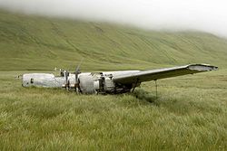
Located on four islands within the Alaska Maritime National Wildlife Refuge, the monument includes battlefields, Japanese-occupied sites and an aircraft crash landing site.
It is managed by the United States Fish and Wildlife Service.