Clark County is a county located in the U.S. state of Nevada, which also comprises the Las Vegas-Henderson-North Las Vegas, NV Metropolitan Statistical Area. The land area of Clark County is 8,061 square miles (20,880 km2), or roughly the size of New Jersey. As of the 2020 census, the population was 2,265,461. Most of the county population resides in the Las Vegas Census County Divisions, which has 2,196,623 people as of the 2020 Census. It is by far the most populous county in Nevada, and the 11th-most populous county in the United States. It covers 7% of the state's land area but holds 73% of the state's population, making Nevada the most centralized state in the United States.

The Red Rock Canyon National Conservation Area in Clark County, Nevada, United States, is an area managed by the Bureau of Land Management as part of its National Landscape Conservation System, and protected as a National Conservation Area. It is about 15 miles (24 km) west of Las Vegas. More than three million people visit the area each year.

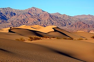
The Mojave Desert is a desert in the rain shadow of the southern Sierra Nevada mountains and Transverse Ranges in the Southwestern United States. Named for the indigenous Mohave people, it is located primarily in southeastern California and southwestern Nevada, with small portions extending into Arizona and Utah.

The Desert National Wildlife Refuge is a protected wildlife refuge, administered by the U.S. Fish and Wildlife Service, located north of Las Vegas, Nevada, in northwestern Clark and southwestern Lincoln counties, with much of its land area lying within the southeastern section of the Nevada Test and Training Range. The Desert NWR, created on May 20, 1936, is the largest wildlife refuge in the lower 48 states of the United States, encompassing 1.615 million acres (6,540 km2) of the Mojave Desert in the southern part of Nevada. The refuge was originally established at 2.25 million acres. In 1940 840,000 acres were transferred to the Department of Defense.

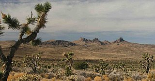
The Bigelow Cholla Garden Wilderness is in the eastern Mojave Desert and within Mojave Trails National Monument, located in San Bernardino County, California.

The Castle Mountains are located in the Eastern Mojave Desert, in northeastern San Bernardino County, California, and Clark County, Nevada. The range lies south and east of the New York Mountains, southwest of Searchlight and west of Cal-Nev-Ari, Nevada.

The Beaver Dam Mountains Wilderness is a wilderness area located in northwestern Arizona and southwestern Utah, USA, within the arid Colorado Plateau region. The jagged mountains and gently sloping alluvial plain of the Beaver Dam Mountains straddle the border between the two states. The Wilderness contains some of the lowest elevation land in Utah, and includes a 13 miles (21 km) section of the Virgin River Gorge. The area comprises some 18,667 acres (7,554 ha), 15,000 acres (6,100 ha) of which in Arizona and approximately 3,667 acres (1,484 ha) in Utah. The area was designated Wilderness by the U.S. Congress in 1984 and is administered by the Bureau of Land Management.

Spirit Mountain, also known as Avi Kwa Ame is a mountain within the Lake Mead National Recreation Area near Laughlin, Nevada. It is listed on the United States National Register of Historic Places as a sacred place to Native American tribes in Southern Nevada. Spirit Mountain is the highest point in the Spirit Mountain Wilderness and is the highest point in the Newberry Mountains with the summit peak at 5,639 feet (1,719 m).

The mountains in the McCullough Range lie mostly above the city of Henderson in the U.S. state of Nevada. The range has two distinct areas with the northern portion being primarily volcanic in origin, while the southern part of the range is primarily composed of metamorphic rock.

The Eldorado Mountains, also called the El Dorado Mountains, are a north-south trending mountain range in southeast Nevada bordering west of the south-flowing Colorado River; the endorheic Eldorado Valley borders the range to the west, and the range is also on the western border of the Colorado River's Black Canyon of the Colorado, and El Dorado Canyon on the river. The range is 50 miles (80 km) southeast of Las Vegas, Nevada; and the Eldorado Mountains connect with the Highland and Newberry mountains.
Arrow Canyon Wilderness is a 27,530-acre (11,140 ha) wilderness area located in Clark County in the U.S. state of Nevada. It received wilderness designation with the passage of the Clark County Conservation of Public Land and Natural Resources Act of 2002 and protects the northern portion of the Arrow Canyon Range. The Arrow Canyon Wilderness is managed by the Bureau of Land Management.
The California Desert Protection Act of 2010 was legislation proposed by U.S. Senator Dianne Feinstein. The stated aim of the legislation was "to provide for conservation, enhanced recreation opportunities, and development of renewable energy in the California Desert Conservation Area."

Little Finland is a scenic red rock area, located in a remote section of Clark County, Nevada, south of Mesquite, known for its red rock scenery and strangely-shaped, delicate rock formations. The landscape is similar to Valley of Fire State Park, which is about 20 miles (32 km) to the west, across Lake Mead. The rock formations are composed of red Aztec Sandstone, fossil sand dunes. Many of the features are small erosional fins, hence the name.

Basin and Range National Monument is a national monument of the United States spanning approximately 704,000 acres of remote, undeveloped mountains and valleys in Lincoln and Nye counties in southeastern Nevada. It is described as "one of the emptiest spaces in a state famous for its emptiness."

Castle Mountains National Monument is a U.S. National Monument located in the eastern Mojave Desert and northeastern San Bernardino County, in the state of California.

Sand to Snow National Monument is a U.S. National Monument located in San Bernardino County and northern Riverside County, Southern California.
Grand Wash Cliffs Wilderness is a protected wilderness area in the Grand Canyon-Parashant National Monument in the U.S. state of Arizona. Established in 1984 under the Arizona Wilderness Act the area is managed by the Bureau of Land Management. This desert wilderness is a 12-mile stretch of the Grand Wash Cliffs encompassing escarpments, canyons, and sandstone buttes that make up the transition zone between the Colorado Plateau and the Basin and Range Province.

Muddy Mountains Wilderness Area is a 48,154-acre wilderness area, which is a part of the Muddy Mountains in Clark County, Nevada. The area is a part of the Lake Mead National Recreation Area.

Ireteba Peaks Wilderness is a 32,745 acre wilderness area spanning the area of the southern part of Eldorado Mountains to the northern parts of Lake Mohave. It is located 45 miles (72 km) south of Las Vegas and was designated as a wilderness area in 2002. Iretaba Peaks Wilderness is managed by the National Park Service and the Bureau of Land Management. The western (BLM) portion of the wilderness is part of Avi Kwa Ame National Monument, designated in 2023.

Avi Kwa Ame National Monument is a national monument that protects approximately 506,000 acres (2,050 km2) of the Mojave Desert in southern Nevada. President Joe Biden established it as a monument under the authority of the Antiquities Act on March 21, 2023. It is named for Avi Kwa Ame, also known as Spirit Mountain, which is visible from most of the monument and is considered sacred as the site of creation by the Yuman tribes. Most of the monument is managed by the Bureau of Land Management as part of the National Conservation Lands, and the National Park Service manages the portion within Lake Mead National Recreation Area.


