
The Humboldt–Toiyabe National Forest (HTNF) is the principal U.S. National Forest in the U.S. state of Nevada, and has a smaller portion in Eastern California. With an area of 6,289,821 acres (25,454.00 km2), it is the largest U.S. National Forest outside of Alaska.

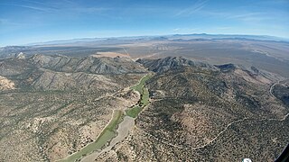
The Toiyabe Range is a mountain range in Lander and Nye counties, Nevada, United States. Most of the range is included within the Humboldt-Toiyabe National Forest. The highest point in the range, near its southern end, is Arc Dome, an area protected as the Arc Dome Wilderness. The highest point in Lander County, Bunker Hill, is also located within the Toiyabe Range. The range starts in northwestern Nye County north of Tonopah, Nevada and runs approximately 120 miles (190 km) north-northeast into southern Lander County, making it the second longest range in the state.

The Jarbidge Wilderness is a wilderness area located in the Jarbidge Mountains of northern Elko County in northeastern Nevada, United States. It is contained within the Jarbidge Ranger District of the Humboldt-Toiyabe National Forest.
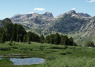
The Ruby Mountains Wilderness is a protected wilderness area in the Ruby Mountains of Elko County, Nevada, United States. It covers an area of approximately 90,000 acres (36,000 ha), and is administered by the Humboldt–Toiyabe National Forest.
The White Pine Range is a group of mountains in southern White Pine County, in eastern Nevada. The range runs for approximately 51 miles (82 km) from Beck Pass in the north to Currant Pass in the south. To the west of the range are the Duckwater (Shoshone) tribal lands and the northern arm of large Railroad Valley. To the east are Jakes Valley and the northern part of the long White River Valley. To the south are the Horse and Grant Ranges.
The Currant Mountain Wilderness is a 47,357-acre (19,165 ha) wilderness area centered on Currant Mountain in the White Pine Range of Nye County and White Pine County, in the eastern section of the state of Nevada in the western United States.
The Quinn Canyon Wilderness is a protected wilderness area in the Quinn Canyon Range of Nye County, in the central section of the state of Nevada in the western United States.
The Grant Range Wilderness is a protected wilderness area in the Grant Range of Nye County, in the central section of the state of Nevada in the western United States.

The Mt. Moriah Wilderness is a 89,790-acre (36,340 ha) wilderness area in the northern part of the Snake Range of White Pine County, in the eastern section of the state of Nevada in the western United States.
The Santa Rosa–Paradise Peak Wilderness is a protected wilderness area in the southern part of the Santa Rosa Range in Humboldt County, in northern Nevada in the western United States. It covers an area of approximately 31,000 acres (13,000 ha), and is administered by the Humboldt–Toiyabe National Forest.

The Alta Toquima Wilderness is a protected wilderness area in the Toquima Range of Nye County, in the central section of the state of Nevada in the western United States. It covers an area of 35,860 acres (14,510 ha), and is administered by the Humboldt-Toiyabe National Forest. The Mount Jefferson Research Natural Area protects 4,953 acres (2,004 ha) around Mount Jefferson, the highest peak in the Toquima Range and Nye County. The Mount Jefferson Research Natural Area is one of the most unusual environments in the United States, due to its extreme alpine conditions. Wildlife is plentiful in the Wilderness, including bighorn sheep, deer, grouse, chukar and native trout.

The Arc Dome Wilderness is a protected wilderness area in the Toiyabe Range of Nye County, in the central section of the state of Nevada in the western United States. It covers an area of approximately 115,000 acres (47,000 ha), Nevada's largest Wilderness area. Attractions include the 70-mile (110 km)-long Toiyabe Crest Trail offers travelers atop the ridge of the Toiyabe Range, including 30 miles (48 km) within the Arc Dome Wilderness.
The Mt. Rose Wilderness is a protected wilderness area in the Carson Range of Washoe County, in the northwesternU.S. state of Nevada. It is located between Lake Tahoe and Reno, Nevada.

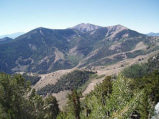
Mount Jefferson is the highest mountain in both the Toquima Range and Nye County in Nevada, United States. It is the sixth highest mountain in the state. As the high point of a range which is well separated from other ranges by low basins, Mount Jefferson has a high topographic prominence of 5,861 feet (1,786 m). This makes it the most prominent peak in Nye County and the third most prominent peak in Nevada. For similar reasons, it is also the highest mountain for over 90 miles in all directions. It is located about 50 miles (80 km) northeast of the county seat of Tonopah within the Alta Toquima Wilderness of the Humboldt-Toiyabe National Forest, near the smaller towns of Carvers and Round Mountain. Three distinct summits are located on a broad area of subalpine tundra: North Summit rises to 11,820 feet (3,603 m), Middle Summit to 11,692 feet (3,564 m), and South Summit to 11,949 feet (3,642 m). During the Pleistocene, alpine glaciers eroded several cirques east of the summit plateau.

La Madre Mountain Wilderness Area consists of 47,180 acres (19,090 ha) covering a part of Clark County, Nevada, that lies just west of the city of Las Vegas, between that city and Mount Charleston. The area includes La Madre Mountain and several archaeological areas including the Brownstone Canyon Archaeological District. The area is administered by the Humboldt-Toiyabe National Forest and the Bureau of Land Management.
The High Schells Wilderness is a 121,497-acre (49,168 ha) wilderness area in the Schell Creek Range of White Pine County, in the U.S. state of Nevada. The Wilderness lies within the Humboldt-Toiyabe National Forest and is therefore administered by the U.S. Forest Service.
The White Pine Range Wilderness is a 40,013-acre (16,193 ha) wilderness area in southwestern White Pine County, in the U.S. state of Nevada.

The Red Mountain Wilderness is a 20,490-acre (8,290 ha) wilderness area in southwestern White Pine County and northeastern Nye County, within the White Pine Range in the U.S. state of Nevada. The Wilderness lies within the Humboldt-Toiyabe National Forest, administered by the U.S. Forest Service.

Shellback Wilderness is a 36,143-acre (14,627 ha) wilderness area in western White Pine County, in the U.S. state of Nevada. The Wilderness lies within the Humboldt-Toiyabe National Forest and is therefore administered by the U.S. Forest Service.
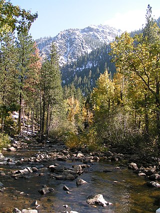
The West Fork Carson River is a major tributary of the Carson River, about 35 miles (56 km) long, in Alpine County, California, and Douglas County, Nevada, in the United States.


