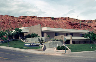
Clark County is a county located in the U.S. state of Nevada. As of the 2020 census, the population was 2,265,461. Most of the county population resides in the Las Vegas Census County Divisions, which hold 2,196,623 people as of the 2020 Census, across 435 square miles (1,130 km2). It is by far the most populous county in Nevada, and the 11th most populous county in the United States. It covers 7% of the state's land area but holds 73% of the state's population, making Nevada the most centralized state in the United States.

Washington County is a county in the southwestern corner of Utah, United States. As of the 2020 United States Census, the population was 180,279, making it the fifth-most populous county in Utah. Its county seat and largest city is St. George. The county was created in 1852 and organized in 1856. It was named after the first President of the United States, George Washington. A portion of the Paiute Indian Reservation is in western Washington County. Washington County comprises the St. George, UT Metropolitan Statistical Area.

The Red Rock Canyon National Conservation Area in Clark County, Nevada, United States, is an area managed by the Bureau of Land Management as part of its National Landscape Conservation System, and protected as a National Conservation Area. It is about 15 miles (24 km) west of Las Vegas, and is easily seen from the Las Vegas Strip. More than three million people visit the area each year.

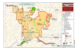
The Black Rock Desert is a semi-arid region of lava beds and playa, or alkali flats, situated in the Black Rock Desert–High Rock Canyon Emigrant Trails National Conservation Area, a silt playa 100 miles (160 km) north of Reno, Nevada that encompasses more than 300,000 acres (120,000 ha) of land and contains more than 120 miles (200 km) of historic trails. It is in the northern Nevada section of the Great Basin with a lakebed that is a dry remnant of Pleistocene Lake Lahontan.

Petroglyph National Monument stretches 17 miles (27 km) along Albuquerque, New Mexico's West Mesa, a volcanic basalt escarpment that dominates the city's western horizon. Authorized June 27, 1990, the 7,236 acre (29.28 km2) monument is cooperatively managed by the National Park Service and the City of Albuquerque. The western boundary of the monument features a chain of dormant fissure volcanoes. Beginning in the northwest corner, Butte volcano is followed to its south by Bond, Vulcan, Black and JA volcanoes.

The Morley Nelson Snake River Birds of Prey National Conservation Area has one of the densest populations of nesting raptors. The National Conservation Area (NCA) is located 35 miles (56 km) south of Boise, Idaho along 81 miles (130 km) of the Snake River, and is managed by the Bureau of Land Management. The NCA covers 484,873 acres (1,962.21 km2). In descending order of land area it is located in Ada, Elmore, Owyhee, and Canyon counties.
Sloan is an unincorporated community located in Clark County, Nevada, 18 miles (29 km) southwest of Las Vegas. The community has a population of 105 residents, as per the 2010 U.S. Census. Sloan is renowned for its canyon, petroglyphs, and the George W. Dunaway Army Reserve Center.

The McInnis Canyons National Conservation Area (MCNCA) is a 123,400-acre (499 km2) National Conservation Area located in Mesa County, west of Grand Junction, Colorado. The MCNCA has rugged sandstone canyons, natural arches, spires, and alcoves carved into the Colorado Plateau, through which runs a 24-mile (39 km) stretch of the Colorado River. Included in the MCNCA is the 75,500-acre (306 km2) Black Ridge Canyons Wilderness (BRCW) with 5,200 acres (21 km2) extending into eastern Grand County, Utah at the MCNCA's western boundary.

The mountains in the McCullough Range lie mostly above the city of Henderson in the U.S. state of Nevada. The range has two distinct areas with the northern portion being primarily volcanic in origin, while the southern part of the range is primarily composed of metamorphic rock.

Black Mountain is a landmark mountain south of the Las Vegas Valley. It is one of the more prominent of the mountains in the McCullough Range.

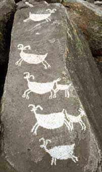
Coso Rock Art District is a rock art site containing over 100,000 Petroglyphs by Paleo-Indians and/or Native Americans. The district is located near the towns of China Lake and Ridgecrest, California. Big and Little Petroglyph Canyons were declared a National Historic Landmark in 1964. In 2001, they were incorporated into this larger National Historic Landmark District. There are several other distinct canyons in the Coso Rock Art District besides the Big and Little Petroglyph Canyons. Also known as Little Petroglyph Canyon and Sand Tanks, Renegade Canyon is but one of several major canyons in the Coso Range, each hosting thousands of petroglyphs. The majority of the Coso Range images fall into one of six categories: bighorn sheep, entopic images, anthropomorphic or human-like figures, other animals, weapons & tools, and "medicine bag" images. Scholars have proposed a few potential interpretations of this rock art. The most prevalent of these interpretations is that they could have been used for rituals associated with hunting.

The Black Rock Desert–High Rock Canyon Emigrant Trails National Conservation Area is the federal land in northwestern Nevada, under the Bureau of Land Management-BLM management and protection, and the ten Wilderness Areas within it.

Weepah Spring Wilderness is a 51,480-acre (20,830 ha) wilderness area in Lincoln and Nye Counties, in the U.S. state of Nevada. The Wilderness lies approximately 35 miles (56 km) north of the town of Alamo and is administered by the U.S. Bureau of Land Management.

The Painted Rock Petroglyph Site is a collection of hundreds of ancient petroglyphs near the town of Theba, Arizona, United States, listed on the National Register of Historic Places in 1977. The site is operated and maintained by the Bureau of Land Management (BLM), and includes an improved campground as well as an informative walking trail showcasing the petroglyphs.

The Gunnison Gorge National Conservation Area is a 62,844-acre (254.32 km2) National Conservation Area located in west-central Colorado near Montrose. It is managed by the Bureau of Land Management (BLM) as part of the National Landscape Conservation System. 57,725 acres (233.60 km2) were designated in the Black Canyon of the Gunnison National Park and Gunnison Gorge National Conservation Area Act of 1999. The Black Canyon of the Gunnison Boundary Revision Act of 2003 expanded the NCA to its current size.

Spirit Mountain Wilderness Area is a 33,518-acre (13,564 ha) wilderness area located in the Newberry Mountains in Clark County, Nevada, 10 miles (16 km) northwest of Laughlin. Spirit Mountain lies within the area. It is managed by the Bureau of Land Management and the National Park Service.

The Dominguez–Escalante National Conservation Area is a 209,610-acre (848.3 km2) National Conservation Area located in western Colorado southeast of Grand Junction and northwest of Montrose. It is managed by the Bureau of Land Management (BLM), and was created as part of the Omnibus Public Land Management Act of 2009. In 2009 66,280 acres (26,820 ha) were also designated as the Dominguez Canyon Wilderness.

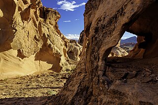
Little Finland is a scenic red rock area, located in a remote section of Clark County, Nevada, south of Mesquite, known for its red rock scenery and strangely-shaped, delicate rock formations. The landscape is similar to Valley of Fire State Park, which is about 20 miles (32 km) to the west, across Lake Mead. The rock formations are composed of red Aztec Sandstone, fossil sand dunes. Many of the features are small erosional fins, hence the name.

Gold Butte National Monument is a United States national monument located in Clark County, Nevada, northeast of Las Vegas and south of Mesquite and Bunkerville. The monument protects nearly 300,000 acres of desert landscapes featuring a wide array of natural and cultural resources, including rock art, sandstone towers, and important wildlife habitat for species including the Mojave Desert tortoise, bighorn sheep, and mountain lion. The area also protects historic ranching and mining sites such as the ghost town of Gold Butte, although little but mine openings, cement foundations, and a few pieces of rusting equipment remains. The monument is managed by the Bureau of Land Management.

Avi Kwa Ame National Monument is a national monument that protects approximately 506,000 acres (2,050 km2) of the Mojave Desert in southern Nevada. President Joe Biden established it as a monument under the authority of the Antiquities Act on March 21, 2023. It is named for Avi Kwa Ame, also known as Spirit Mountain, which is visible from most of the monument and is considered sacred as the site of creation by the Yuman tribes. Most of the monument is managed by the Bureau of Land Management as part of the National Conservation Lands, and the National Park Service manages the portion within Lake Mead National Recreation Area.


