Las Vegas High School Neighborhood Historic District

Last updated

Las Vegas High School Neighborhood Historic District
Las Vegas High School Neighborhood Historic District, 3.JPG
USA Nevada location map.svg
Red pog.svg
Usa edcp location map.svg
Red pog.svg
LocationE. Bridger, S. 9th, E. Gass and S. 6th Streets
Las Vegas, Nevada
Coordinates 36°9′44″N115°8′23″W / 36.16222°N 115.13972°W / 36.16222; -115.13972
Architectural style Pueblo
NRHP reference No. 90002204 [1]
Added to NRHPJanuary 30, 1991

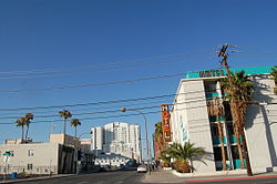
Las Vegas High School Neighborhood Historic District, is a historic district which was listed on the National Register of Historic Places in 1991. [2] The Las Vegas High School Academic Building and Gymnasium, already listed on the National Register in 1986, is included as a contributing property within the district. That property was later expanded to include Fraser Hall in 2021 and to include the entire 15 acres (6.1 ha) campus of the Las Vegas High School in 2022.

Contents

When nominated, the area included 236 properties of which 4 were listed on the National Register of Historic Places and a total of 150 properties were contributing properties. [3]

Boundary

Gass Avenue to 6th Street to Garces Avenue to 8th Street to Garces Avenue, north to Clark Avenue to 8th Street to Bridger Avenue to Chef Andre Rochet Place West to 6th Street to Bonneville Avenue south to Garces Avenue, south and then east to 7th Street and back to Garces Avenue. [4]

Related Research Articles

The Avenues is an affluent neighborhood in Salt Lake City, Utah. It is named after the perfectly gridlike, closely laid out roads called Avenues and Streets. First surveyed in the 1850s, the Avenues became Salt Lake City's first neighborhood. Today, the Avenues neighborhood is generally considered younger, more progressive, and somewhat "artsy" when compared to other neighborhoods. Many young professionals choose to live there due to the culture and easy commute to downtown.. It is also one of the most important strongholds of the Utah Democratic Party.

<span class="mw-page-title-main">Northern Liberties, Philadelphia</span> Former District in Pennsylvania, United States

Northern Liberties is a neighborhood in Philadelphia, Pennsylvania, United States. Prior to its incorporation into Philadelphia in 1854, it was among the top 10 largest cities in the U.S. in every census from 1790 to 1850.

<span class="mw-page-title-main">Downtown Las Vegas</span> Human settlement in United States

Downtown Las Vegas is the central business district and historic center of Las Vegas, Nevada. It is the original townsite, and the Downtown gaming area was the primary gambling district of Las Vegas prior to the Strip. As the urban core of the Las Vegas Valley, it features a variety of hotel and business highrises, cultural centers, historical buildings and government institutions, as well as residential and retail developments. Downtown is located in the center of the Las Vegas Valley and just north of the Las Vegas Strip, centered on Fremont Street, the Fremont Street Experience and Fremont East. The city defines the area as bounded by I-15 on the west, Washington Avenue on the north, Maryland Parkway on the east and Sahara Avenue on the south.

<span class="mw-page-title-main">Kensington, Philadelphia</span> Neighborhood in Philadelphia, Pennsylvania

Kensington, colloquially known locally as Kenzo, is a neighborhood in Philadelphia that belongs to or divides Lower Northeast and North Philadelphia. As with all neighborhoods in the city, the lack of any official designation means the boundaries of the area vary between sources over time and are disputed among locals. Kensington, as most long-term residents view it, refers generally to the area consisting of Kensington, East, or Lower Kensington, West Kensington, and Harrowgate. The adjacent Fairhill and Norris Square neighborhoods are more separate but may be included in Kensington; Fishtown and South (Olde) Kensington were historically included. The most conservative boundaries of the neighborhood, shown in the map below, are Front Street and 5th Street to the west, the Amtrak train tracks to the North, Trenton Avenue, the Trenton Avenue train tracks, and Frankford Avenue to the east, and Cecil B. Moore Avenue to the south.

<span class="mw-page-title-main">Fletcher Place</span> United States historic place

Fletcher Place is a historic district and neighborhood in the city of Indianapolis, Indiana named after Calvin Fletcher, a prominent local banker, farmer and state senator.

<span class="mw-page-title-main">Herron–Morton Place Historic District</span> Historic district in Indiana, United States

Herron–Morton Place is a historic district in Indianapolis, Indiana, United States. The boundaries of the neighborhood are East 16th Street on the south, East 22nd Street on the north, North Pennsylvania Street on the west, and Central Avenue on the east.

<span class="mw-page-title-main">Strivers' Section Historic District</span> Historic district in Washington, D.C., United States

The Strivers' Section Historic District is a historic district located in the Dupont Circle neighborhood of Washington, D.C. Strivers' Section was historically an enclave of upper-middle-class African Americans, often community leaders, in the late 19th and early 20th centuries. It takes its name from a turn-of-the-20th-century writer who described the district as "the Striver's section, a community of Negro aristocracy." The name echoes that of Strivers' Row in Harlem, a New York City historic neighborhood of black professionals. The district is roughly bounded by Swann Street and the Dupont Circle Historic District on the south, Florida Avenue and the Washington Heights Historic District on the north and west, and the Sixteenth Street Historic District on the east.

<span class="mw-page-title-main">Prospect Hill Historic District (New Haven, Connecticut)</span> Historic district in Connecticut, United States

The Prospect Hill Historic District is an irregularly-shaped 185-acre (75 ha) historic district in New Haven, Connecticut. The district encompasses most of the residential portion of the Prospect Hill neighborhood.

<span class="mw-page-title-main">Whitney Avenue Historic District</span> Historic district in Connecticut, United States

The Whitney Avenue Historic District is a historic district in the East Rock neighborhood of New Haven, Connecticut. It is a 203-acre (82 ha) district which included 1,084 contributing buildings when it was listed on the National Register of Historic Places in 1989.

<span class="mw-page-title-main">Las Vegas High School Historic District</span> Historic district in Nevada, United States

The Las Vegas High School Historic District in Las Vegas, Nevada is a historic district which includes 11 buildings on the 15 acres (6.1 ha) campus of the school district. It was listed on the National Register of Historic Places in 2022.

<span class="mw-page-title-main">John S. Park Historic District</span> Historic district in Nevada, United States

John S. Park Historic District, composed of the Park Place Addition and Vega Verde subdivisions, is in Las Vegas, Clark County, Nevada. The historic district is named for John S. Park who arrived in Las Vegas in 1907. It was listed on the United States National Register of Historic Places in 2003.

<span class="mw-page-title-main">National Register of Historic Places listings in Albany, New York</span>

There are 75 properties listed on the National Register of Historic Places in Albany, New York, United States. Six are additionally designated as National Historic Landmarks (NHLs), the most of any city in the state after New York City. Another 14 are historic districts, for which 20 of the listings are also contributing properties. Two properties, both buildings, that had been listed in the past but have since been demolished have been delisted; one building that is also no longer extant remains listed.

<span class="mw-page-title-main">Berkley Square</span> Historic house in Nevada, United States

Berkley Square was designed in 1949 by Paul Revere Williams and is named after Thomas L. Berkley, an attorney from Oakland, California. The historic district contained 148 homes. It was built in the African American West Las Vegas area of Las Vegas, Nevada. The district was listed on the National Register of Historic Places in 2009. Terry and Jerry Holmes were born at 512 Byrnes Avenue in Berkley Square on March 3, 1951, to Canary and Clarence Holmes.

<span class="mw-page-title-main">Hillside Historic District (Waterbury, Connecticut)</span> Historic district in Connecticut, United States

The Hillside Historic District in Waterbury, Connecticut is a 106-acre (43 ha) historic district that was listed on the National Register of Historic Places (NRHP) in 1987. It encompasses a residential area north of the city's central business district, and is bounded on the south by West Main Street, the west by Willow Avenue and Cliff and Frederick Streets, on the north by Buckingham Street and Woodland Terrace, and on the east by Cooke Street. Developed principally over an 80-year period between 1840 and 1920, it includes a cross-section of architectural styles of the 19th and early 20th centuries. The area was a desirable neighborhood of the city for much of this time, and was home to a number of the city's elite. In 1987, it included 395 buildings deemed to contribute to the historic character of the area, and one other contributing structure. It includes the Wilby High School and the Benedict-Miller House, which are both separately listed. 32 Hillside Road, a several acre property that includes the Benedict Miller House, was the original site of The University of Connecticut's Waterbury Branch until 2003.

<span class="mw-page-title-main">27th Street Historic District</span> Historic district in California, United States

The 27th Street Historic District is a historic district in the South Los Angeles area of Los Angeles, California. The district was listed on the National Register of Historic Places in 2009 as part of the multiple property submission for African Americans in Los Angeles.

<span class="mw-page-title-main">Woodward Heights, Lexington</span> United States historic place

Woodward Heights is a neighborhood and historic district located immediately west of downtown Lexington, Kentucky. It is bounded by Maxwell Street and the Pleasant Green Hill neighborhood to the southwest, by the parking lot for Rupp Arena to the southeast, by the Lexington Convention Center property to the northeast, and by Herlihy, Cox, and High Streets to the north.

<span class="mw-page-title-main">Appleton P. Clark Jr.</span> American architect

Appleton Prentiss Clark Jr. was an American architect from Washington, D.C. During his 60-year career, Clark was responsible for designing hundreds of buildings in the Washington area, including homes, hotels, churches, apartments and commercial properties. He is considered one of the city's most prominent and influential architects from the late 19th and early 20th centuries. Many of his designs are now listed on the National Register of Historic Places (NRHP).

<span class="mw-page-title-main">Lincoln Park Historic District (Pomona, California)</span> Historic district in California, United States

The Lincoln Park Historic District in Pomona, California is a 45-block, 230-acre residential neighborhood. The district consists of 821 structures—primarily single family homes built between the 1890s through the 1940s—featuring a wide variety of architectural styles from late Victorian and National Folk homes, Craftsman and Craftsman-influenced homes, as well as late 19th and 20th Century Revival architectural styles including Colonial, Mission/Spanish, Tudor and Classical Revival.

<span class="mw-page-title-main">Cliff/Cannon, Spokane</span> Neighborhood in Spokane, Washington, United States

Cliff/Cannon is a neighborhood in Spokane, Washington. It is located immediately south of Downtown, Spokane, and on the lower reaches of the broader South Hill. The neighborhood is home to a medical district with Sacred Heart and Deaconess both having their main hospital campuses along Cliff/Cannon's denser northern edge. To the south the neighborhood becomes more residential. City parks break up the residential zoning of the southern half of Cliff/Cannon. It is adjacent to the Cannon Hill area of the neighboring but separate Manito/Cannon Hill neighborhood. The Marycliff-Cliff Park Historic District, a National Historic District listed on the National Register of Historic Places, is located within the neighborhood.

West Adams Terrace is a neighborhood in Los Angeles. Dating back to 1905, it contains seven Los Angeles Historic-Cultural Monuments, one property on the National Register of Historic Places and one Green Book property. In 2003, the neighborhood was designated a Historic Preservation Overlay Zone.

References

  1. "National Register Information System". National Register of Historic Places . National Park Service. July 9, 2010.
  2. "Clark County". State of Nevada. July 31, 2008. Archived from the original on July 25, 2011. Retrieved October 12, 2008.
  3. "Las Vegas High School Neighborhood Historic District Registration Form" (PDF). Retrieved October 30, 2009.
  4. "Las Vegas High School Neighborhood Historic District" (PDF). The City of Las Vegas. May 17, 2007. Retrieved October 30, 2009.

Commons-logo.svg Media related to Las Vegas High School Neighborhood Historic District at Wikimedia Commons