
The Red Rock Canyon National Conservation Area in Clark County, Nevada, is an area managed by the Bureau of Land Management as part of its National Landscape Conservation System, and protected as a National Conservation Area. It is about 15 miles (24 km) west of Las Vegas, and is easily seen from the Las Vegas Strip. More than three million people visit the area each year.

The Black Rock Desert is a semi-arid region of lava beds and playa, or alkali flats, situated in the Black Rock Desert–High Rock Canyon Emigrant Trails National Conservation Area, a silt playa 100 miles (160 km) north of Reno, Nevada that encompasses more than 300,000 acres (120,000 ha) of land and contains more than 120 miles (200 km) of historic trails. It is in the northern Nevada section of the Great Basin with a lakebed that is a dry remnant of Pleistocene Lake Lahontan.

Lassen National Forest is a United States national forest of 1,700 square miles (4,300 km2) in northeastern California. It is named after pioneer Peter Lassen, who mined, ranched and promoted the area to emigrant parties in the 1850s.
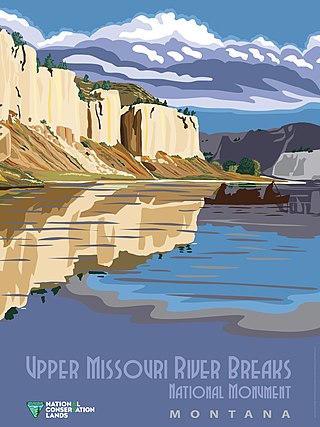
National Conservation Lands, formally known as the National Landscape Conservation System, is a 35-million-acre (140,000 km2) collection of lands in 873 federally recognized areas considered to be the crown jewels of the American West. These lands represent 10% of the 258 million acres (1,040,000 km2) managed by the Bureau of Land Management (BLM). The BLM is the largest federal public land manager and is responsible for over 40% of all the federal public land in the nation. The other major federal public land managers include the US Forest Service (USFS), National Park Service (NPS), and the US Fish and Wildlife Service (USFWS).

The Black Ridge Canyons Wilderness (BRCW) is located in western Colorado with a small portion extending into eastern Utah, USA, within the arid Colorado Plateau region approximately 15 miles (24 km) west of Grand Junction, Colorado. The wilderness lies on the northwest flank of the Uncompahgre Plateau. It is characterized by the high, east-west trending Black Ridge dissected by seven major canyon systems, draining into the Colorado River in Ruby Canyon. Elevations range from 4,700 feet (1,400 m) above sea level along the river to 6,800 feet (2,070 m). Canyons vary in length from several miles to twelve miles in length and may contain interesting side canyons. Geological features in these canyons include spires, windows, giant alcoves and desert varnish. Canyons may reach a depth of almost 1,000 feet (300 m), forming spectacular red rock cliffs. Spring runoff and summer thunderstorms create glistening waterfalls and plunge pools. Rattlesnake Canyon contains the second largest concentration of natural arches in the country. Mee Canyon is even more remote, and contains Arch Tower.
The High Rock Lake Wilderness is a wilderness area in Nevada containing the northern portion of the Calico Hills. High Rock Lake, for which the wilderness was named, was created about 11,800 years ago after a large rockslide closed the outlet to High Rock and Little High Rock Canyons. This new outlet cut a narrow canyon that empties at Soldier Meadows. One special geological feature in Fly Canyon is the potholes. The potholes were carved by whirlpool action of sand and gravel in the stream. Another unique feature is the Fly Slide where emigrants lowered their wagons with ropes into Fly Canyon portion of the Applegate-Lassen Trail. Elevations in the wilderness range from 4,000 to 7,660 ft with scattered vegetation of saltbrush and sagebrush.

The Black Rock Range is a mountain range in northwestern Nevada. It is named for Black Rock Point, which is located at the southern end of the range. The Black Rock Range divides the Black Rock Desert into eastern and western arms. Pahute Peak, also known as Big Mountain, is the highest point in the range at 8,566 feet (2,611 m) above sea level.
Calico Mountains Wilderness is a U S Wilderness Area in Nevada under the Bureau of Land Management. It is located in the Calico Hills.
The Black Rock Desert–High Rock Canyon Emigrant Trails National Conservation Area is the federal land in northwestern Nevada, under the Bureau of Land Management-BLM management and protection, and the ten Wilderness Areas within it.
The Black Rock Desert Wilderness is a U S Wilderness Area in Nevada under the Bureau of Land Management. It is located in the east arm of the Black Rock Desert playa east of the Black Rock Range and west of the Jackson Mountains. The wilderness has a land area of 314,829 acres, or 1,274.1 km². It is the largest U.S. designated wilderness area that is managed solely by the Bureau of Land Management, and the largest that is not located within a National Forest, National Park, or National Wildlife Refuge. It is located within the Black Rock Desert – High Rock Canyon Emigrant Trails National Conservation Area, also managed by the BLM.
The East Fork High Rock Canyon Wilderness is a U S Wilderness Area in Nevada under the Bureau of Land Management. It is located on the northeast side of High Rock Canyon but does not include the 4x4 trail inside High Rock Canyon nor a 4x4 trail to the Yellow Hills.
The Little High Rock Canyon Wilderness is a US Wilderness Area in Nevada under the Bureau of Land Management. It is located south of the High Rock Canyon Wilderness and west of the High Rock Lake Wilderness.
The North Black Rock Range Wilderness is a U S Wilderness Area in Nevada under the Bureau of Land Management. It is located northeast of Soldier Meadows and south of the Summit Lake Indian Reservation.
The North Jackson Mountains Wilderness is a U S Wilderness Area in Nevada under the Bureau of Land Management. It is located in the Jackson Mountains north of the South Jackson Mountains Wilderness and east of the Black Rock Desert Wilderness.
The Pahute Peak Wilderness is a U S Wilderness Area in Nevada under the Bureau of Land Management. It is located in the central Black Rock Range west of the Black Rock Desert Wilderness.
The South Jackson Mountains Wilderness is a U.S. Wilderness Area in Nevada under the Bureau of Land Management. It is located in the Jackson Mountains, south of the North Jackson Mountains Wilderness and east of the Black Rock Desert Wilderness.

The Owyhee River Wilderness is located on the high basalt plateaus of Owyhee County in southwestern Idaho in the western United States. The wilderness area is named after and protects the upper Owyhee River, its tributaries, and the surrounding desert canyon landscape. Whitewater rafting is a popular recreational activity in this wilderness area. Managed by the Bureau of Land Management, it is the second-largest U.S. Wilderness Area that is not located within a National Forest, National Park, or National Wildlife Refuge. The BLM's Black Rock Desert Wilderness, located within Black Rock Desert – High Rock Canyon Emigrant Trails National Conservation Area, is larger. About 67.3 miles (108.3 km) of the Owyhee River is classified as a wild river.

The Santa Rosa Wilderness is a 72,259-acre (292.42 km2) wilderness area in Southern California, in the Santa Rosa Mountains of Riverside and San Diego counties, California. It is in the Colorado Desert section of the Sonoran Desert, above the Coachella Valley and Lower Colorado River Valley regions in a Peninsular Range, between La Quinta to the north and Anza Borrego Desert State Park to the south. The United States Congress established the wilderness in 1984 with the passage of the California Wilderness Act, managed by both the US Forest Service and the Bureau of Land Management. In 2009, the Omnibus Public Land Management Act was signed into law which added more than 2,000 acres (8.1 km2). Most of the Santa Rosa Wilderness is within the Santa Rosa and San Jacinto Mountains National Monument.
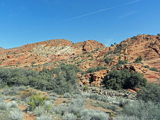
Cottonwood Canyon Wilderness is a 11,712-acre (47.4 km2) wilderness area in the US state of Utah. It was designated March 30, 2009, as part of the Omnibus Public Land Management Act of 2009. Located adjacent to the southern edge of the Dixie National Forest, it encompasses and protects a transition zone between the Colorado Plateau to the east and the Mojave Desert to the west. It is bordered by the Cottonwood Forest Wilderness to the northeast and is itself a part of the Red Cliffs National Conservation Area.


