Related Research Articles

Chenega is a census-designated place (CDP) on Evans Island in the Chugach Census Area in the U.S. state of Alaska. Located in Prince William Sound, the CDP consists of the Chugach Alutiiq village of Chenega Bay, which was established only after the Good Friday earthquake destroyed the original community on Chenega Island to the north. As of the 2010 census, the population of the CDP was 76, largely Alaska Natives. As of 2021, the population of Chenega is 41. Chenega Bay is in the Chugach School District and has one school, Chenega Bay Community School, serving approximately 16 students from preschool through high school.

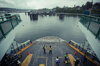
Whittier is a city at the head of the Passage Canal in the U.S. state of Alaska, about 58 miles (93 km) southeast of Anchorage. The city is within the Chugach Census Area, one of the two entities established in 2019 when the former Valdez–Cordova Census Area was dissolved. At the 2010 census the population was 220, up from 182 in 2000. The 2018 estimate was 205 people, almost all of whom live in a single building, the Begich Towers. Whittier is also a port for the Alaska Marine Highway.
Bainbridge Island is a city and island in Kitsap County, Washington, United States, located in Puget Sound. The population was 23,025 at the 2010 census and an estimated 25,298 in 2019, making Bainbridge Island the second largest city in Kitsap County.
Winslow is the name of the downtown area of the city of Bainbridge Island, Washington, and is the original name of the city. It encompasses the area around the main street, Winslow Way, and is made up of approximately 1.5 square miles (3.9 km2) overlooking Eagle Harbor.
Evans Island is an island in the Prince William Sound of southern Alaska. It lies just east of Bainbridge Island across the Prince of Wales Passage. Elrington Island lies to its south, Latouche Island to its southeast, and Knight Island to its northeast. Although Evans Island had been inhabited up to the time of the Russian exploration of Alaska, the island had no modern-day inhabitants until 1984, when a group of residents and former residents of the original Alutiq village of Chenega, on Chenega Island, decided to build the village of Chenega Bay on Crab Bay on Evans Island. Old Chenega had been destroyed and one-third of its residents had been killed by the tsunami from the 1964 Alaska earthquake. The new community of Chenega is coextensive with Evans Island, which has a land area of 74.605 km² and a population of 86 persons as of the 2000 census.
Bainbridge may refer to:

Portage Glacier is a glacier on the Kenai Peninsula of the U.S. state of Alaska and is included within the Chugach National Forest. It is located south of Portage Lake and 6 km (4 mi) west of Whittier.
Chenega Island is an island of Aleuts in Prince William Sound in the U.S. state of Alaska. It is the traditional home to the community of Chenega, though much of its population eventually migrated to Chenega Bay on nearby Evans Island after the 1964 Good Friday earthquake and accompanying tsunami. Chenega Island and its surrounding habitat were also heavily impacted by the 1989 Exxon Valdez oil spill. The island has a land area of 57.084 km² and, after the mass emigration, was unpopulated as of the 2000 census.
The Sanak Islands are a subgroup of the Fox Islands group of islands, located in the Aleutians East Borough of Alaska.

Montague Island lies in the Gulf of Alaska at the entrance to Prince William Sound, Alaska. The island has a land area of 790.88 km², making it the 26th largest island in the United States. As of the 2000 census, Montague did not have a permanent resident population, making it at that time the largest uninhabited island in the United States. Since then, the 2010 abandonment of the United States Coast Guard station on Attu Island in the Aleutian Islands, which at 892.8 km² is larger than Montague Island, causes Attu to claim that title. Montague Island was named by Captain James Cook in honor of John Montagu, 4th Earl of Sandwich, one of his greatest supporters.
Hawkins Island is an island in the northern part of the Gulf of Alaska in the state of Alaska, United States. It lies just west of the city of Cordova, between that city and the further offshore Hinchinbrook Island. Prince William Sound lies to the north side of the island, while Orca Inlet and the main body of the Gulf of Alaska lie to its south. Hawkins Island has a land area of 176.388 km2 and a population of four persons was reported as of the 2000 census.
Esther Island is an island in the northwestern part of Prince William Sound on the south-central coast of the state of Alaska in the United States. It has a land area of 127.336 km² and a resident population of 31 persons as of the 2000 census. The island is the site of the South Esther Island State Marine Park, a part of the Alaska State Parks system. The island is only accessible by floatplane or boat and has no permanent settlements other than the Wally Noerenberg Hatchery, one of the world's largest salmon hatcheries, owned and operated by the Prince William Sound Aquaculture Corporation (PWSAC). The hatchery raises three different species of salmon and is located within the state marine park.
Culross Island is an island near the western end of Prince William Sound of the Gulf of Alaska in Alaska, United States. It lies just off the northeast corner of the Kenai Peninsula, separated from it by the Culross Passage. The island has a land area of 74.709 km² and had no population at the 2000 census.

Hall Island is a small island located 3.5 miles (5.6 km) to the northwest of St. Matthew Island in the Bering Sea in Alaska, United States. It serves as a haulout site for Pacific walrus. It is 5 miles (8.0 km) in length and has a land area of 6.1758 square miles (15.995 km2). The highest point is 1,610 feet (490 m). Hall Island is uninhabited. It is part of the Bering Sea unit of the Alaska Maritime National Wildlife Refuge. It is one of three hall islands.

ALSIB was the Soviet Union portion of the Alaska-Siberian air road receiving Lend-Lease aircraft from the Northwest Staging Route. Aircraft manufactured in the United States were flown over this route for World War II combat service on the Eastern Front.

Northstar Island is a 5-acre (20,000 m2) artificial island in the Beaufort Sea, 12 miles (19 km) northwest of Prudhoe Bay, Alaska and 6 miles (9.7 km) north of the Alaska coast. The island was created to develop the Northstar Oil Pool, which is located approximately 12,500 feet (3,800 m) below the seabed. The oil pool was discovered on January 30, 1984 by Royal Dutch Shell.

Portage is a ghost town and former settlement on Turnagain Arm in Alaska, about 47 miles (76 km) southeast of Downtown Anchorage. The town was destroyed in the 1964 Alaska earthquake when the ground in the area sank about six feet (1.8 m), putting most of the town below high tide level. All that remains today are the ruins of a few buildings and a "ghost forest" of trees that died after salt water inundated their root systems. Where there was once a town there is now only a railroad and road junction linking the Seward Highway and the Alaska Railroad to Portage Glacier park and the Anton Anderson Memorial Tunnel, which leads to Whittier.

Glory of Russia Cape is the northernmost point of St. Matthew Island in the Bering Sea in the US state of Alaska. The cape is hilly, with the peak 1.3 miles (2.1 km) south of the cape being 1,475 feet (450 m) high, while at its coastline the cape is 5 m above mean sea level.

The Bainbridge Island Japanese American Exclusion Memorial is an outdoor exhibit commemorating the internment of Japanese Americans from Bainbridge Island in the state of Washington. It is located on the south shore of Eagle Harbor, opposite the town of Winslow. Administratively, it is a unit of the Minidoka National Historic Site in Idaho. The mission of the memorial is Nidoto Nai Yoni, “Let It Not Happen Again”.
Gull Island is a small island located at 70.365745°N 148.366098°W, 8 km off shore from Prudhoe Bay, Alaska, in the Beaufort Sea. In plan view it is shaped somewhat like the capital letter "L", with a length of approximately 300 m, and is about 30 m wide along much of its length. In some satellite images it appears like a small crescent, due to its low topographic prominence above sea level. Little more than a gravel pad, it is a roosting place for seagulls in the summertime. It was also the site of petroleum exploration as part of the larger Prudhoe Bay Oil Field exploration in the 1960s and 1970s.
References
- ↑ Phillips, James W. (2016). Alaska-Yukon Place Names. Epicenter Press. p. 30. ISBN 978-1-941890-03-5 . Retrieved 17 February 2018.
Coordinates: 60°06′28″N148°09′02″W / 60.107774°N 148.150652°W
| | This article about a location in the Chugach Census Area, Alaska is a stub. You can help Wikipedia by expanding it. |