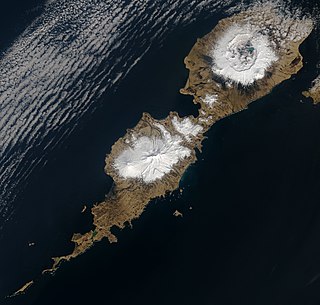
Nikolski is a census-designated place (CDP) on Umnak Island in Aleutians West Census Area, Alaska, United States. The population was 39 at the 2020 census, up from 18 in 2010. Nikolski is on Nikolski Bay, off the southwest end of the island. It is 116 air miles west of Unalaska, and 900 air miles from Anchorage. Residents are known as Unangan, and Aleut is spoken in most of the remaining homes.

Seward is an incorporated home rule city in Alaska, United States. Located on Resurrection Bay, a fjord of the Gulf of Alaska on the Kenai Peninsula, Seward is situated on Alaska's southern coast, approximately 120 miles (190 km) by road from Alaska's largest city, Anchorage.

Umnak is one of the Fox Islands of the Aleutian Islands. With 686.01 square miles (1,776.76 km2) of land area, it is the third largest island in the Aleutian archipelago and the 19th largest island in the United States. The island is home to a large volcanic caldera on Mount Okmok and the only field of geysers in Alaska. It is separated from Unalaska Island by Umnak Pass. In 2000, Umnak was permanently inhabited by only 39 people and by 2010, around 18, placing the settlement of Nikolski in difficulty and its school was closed.

The Aleutian Islands campaign was a military campaign fought between 3 June 1942 and 15 August 1943 on and around the Aleutian Islands in the American Theater of World War II during the Pacific War. It was the only military campaign of World War II fought on North American soil.

Mount Emmons is a post-caldera stratovolcano within the Emmons Lake caldera on the Alaska Peninsula within the Lake and Peninsula Borough, Alaska, United States.

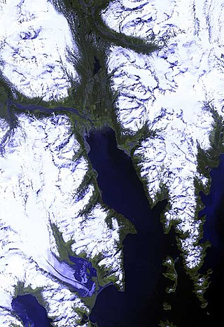
Resurrection Bay, also known as Blying Sound, and Harding Gateway in its outer reaches, is a fjord on the Kenai Peninsula of Alaska, United States. Its main settlement is Seward, located at the head of the bay. The bay received its name from Alexandr Baranov, who was forced to retreat into the bay during a bad storm in the Gulf of Alaska. When the storm settled it was Easter Sunday, so the bay and nearby Resurrection River were named in honor of it. Harding Gateway refers to the passage between Rugged and Cheval Islands.

Accotink Creek is a 25.0-mile-long (40.2 km) tributary stream of the Potomac River in Fairfax County, Virginia, in the United States. At Springfield, Virginia, Accotink Creek is dammed to create Lake Accotink. The stream empties into the Potomac at Gunston Cove's Accotink Bay, to the west of Fort Belvoir.

Pohick Creek is a 14.0-mile-long (22.5 km) tributary stream of the Potomac River in Fairfax County in the U.S. state of Virginia. It takes its name from the Pohick Native American tribe once prevalent in the area.

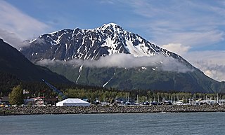
Mount Marathon, or officially Marathon Mountain, is a 4,826-foot (1,471 m) mountain summit directly west of Seward in the Kenai Mountains in the U.S. state of Alaska. The peak is situated in Chugach National Forest, rising above Resurrection Bay, 2.35 mi (4 km) south of Mount Benson, and 2 mi (3 km) north of Bear Mountain. The namesake of the mountain is the Mount Marathon Race held every Fourth of July.
Driftwood Bay Air Force Station is a private use military airstrip located 13 nautical miles northwest of Unalaska Island, in the Aleutians East Borough of the U.S. state of Alaska. It is privately owned by the United States Air Force. The facility is not open for public use.

Caines Head State Recreation Area is a 6,571-acre (26.59 km2) recreational area encompassing the Caines Head cape in Resurrection Bay, Alaska. The area is located in the Kenai Peninsula Borough, 7 miles (11 km) south of the city of Seward. A popular tourist destination, Caines Head features spruce and hemlock forests as well as a variety of terrestrial and marine wildlife. It also features the remains of Fort McGilvray, a World War II-era fortification erected in 1941–1942 to defend against the potential invasion of the Imperial Japanese Army.
Resurrection Peninsula is a peninsula on the larger Kenai Peninsula of the U.S. state of Alaska, which lies roughly 8 miles southeast of Seward. It contains very rugged geography, with very little flat land existing between sheer peaks and the deep inlets of Resurrection Bay to the west, and Day Harbor to the east. Due to the geographical nature of the peninsula, it is uninhabited, although numerous cabins, state parks, and general private in holdings exist. All land here is accessible by boat only. There is no concrete measurement of the exact of the landmass, however, the Alaska Department of Fish and Game has a management area which encompasses the landmass as well as lands that are not usually considered part of a peninsula. The land which better fits the definition is roughly 10 miles long, running from near Thumb Cove and Talus Bay to Cape Resurrection at its southern extremity. Slightly less than half of the land on the Resurrection Peninsula is part of the Chugach National Forest's southern terminus.
Fox Island, also known as Renard Island, is an island in Resurrection Bay near Seward in the U.S. state of Alaska. The island is 3.4 miles long, two miles wide, and is primarily mountainous, consisting of 3 peaks and the saddles between them. On its east side, the remnants of a glacial moraine have created a spit. Fox Island is a popular destination for kayaking, camping, and hiking in the summer, and hosts two resorts on its shores. In addition, the island contains two state parks, Sandspit Point State Marine Park, and Sunny Cove State Marine Park.

Mount Alice is a 5,318-foot (1,621 m) mountain summit in the U.S. state of Alaska.

Mount Benson is a 4,465-foot (1,361 m) mountain summit located in the Kenai Mountains, on the Kenai Peninsula, in the U.S. state of Alaska. The peak is situated in Chugach National Forest, rising above the Resurrection River and Resurrection Bay, 3.3 mi (5 km) south of Resurrection Peaks, 2.35 mi (4 km) north of Marathon Mountain, and 3.1 mi (5 km) northwest of Seward, Alaska. Originally named Iron Mountain, the mountain's name was officially changed in 1974 by the United States Geological Survey to honor Benny Benson (1913-1972), who at age 13 designed Alaska's flag in 1927, as a student in Seward.

Resurrection Peaks is a 4,727-foot (1,441 m) mountain ridge located in the Kenai Mountains, on the Kenai Peninsula, in the U.S. state of Alaska. The peaks are situated in Chugach National Forest, 3.3 mi (5 km) north of Mount Benson, 3.5 mi (6 km) south of Mount Ascension, and 5 mi (8 km) north of Seward, Alaska. These peaks, marked 4712' and 4665' on the USGS map, together with their ridges and glacier form a distinct group. The peaks overlook the mouth of Resurrection River into Resurrection Bay, and take their name from the bay named since 1792, and the river since 1898. Resurrection Peaks' name was officially adopted in 1969 by the United States Geological Survey.

Phoenix Peak is a 5,187-foot (1,581 m) mountain summit located in the Kenai Mountains, on the Kenai Peninsula, in the U.S. state of Alaska. The peak is situated in Kenai Fjords National Park, 2 mi (3 km) southwest of Mount Benson, 1.1 mi (2 km) northwest of Marathon Mountain, and 3.5 mi (6 km) west of Seward, Alaska. Precipitation runoff from the mountain and meltwater from its glaciers drains into tributaries of the Resurrection River. The first ascent of the peak was made July 23, 1964, by Don Stockard of the Mountaineering Club of Alaska. The peak was named in 1965 by the Mountaineering Club of Alaska for the first ship ever built in Russian America, the Phoenix, which was constructed in 1794 by Russians in nearby Resurrection Bay. The mountain's toponym was officially adopted in 1966 by the United States Geological Survey.
Aialik Peninsula is a peninsula on the larger Kenai Peninsula of the U.S. state of Alaska, which lies roughly 15 miles southeast of Seward. The peninsula has a peculiar Swiss cheese-like shape, making it appear partially sunken. It contains very rugged geography, with its twisted and winding coastline indented by many bays and coves that are part of Aialik Bay to the west, and Resurrection Bay to the east. The peninsula is uninhabited, but private lands and beaches to anchor at and camp exist. All land here is accessible by boat only. Pony Cove, on the peninsula's eastern shore in Resurrection Bay is a popular boating and salmon fishing spot in the summers. The Aialik Peninsula is roughly 15 miles long, running from near Lechner Glacier and Bear Glacier to Aialik Cape at its southern extremity.

Mount Mary is a 4,820-foot-elevation (1,469-meter) mountain summit in Alaska, United States.

Mount Eva is a 5,019-foot-elevation (1,530-meter) mountain summit in Alaska, United States.


