See also
| Authority control databases: National |
|---|
This is a list of islands of West Virginia.

This is a list of the lists of islands in the world grouped by country, by continent, by body of water, and by other classifications. For rank-order lists, see the other lists of islands below.

The St. Lawrence River is a large international river in the middle latitudes of North America connecting the Great Lakes to the North Atlantic Ocean. Its waters flow in a northeasterly direction from Lake Ontario to the Gulf of St. Lawrence, traversing Ontario and Quebec in Canada and New York in the United States. A section of the river demarcates the Canada–U.S. border.

The Niagara River flows north from Lake Erie to Lake Ontario, forming part of the border between Ontario, Canada, to the west, and New York, United States, to the east. The origin of the river's name is debated. Iroquoian scholar Bruce Trigger suggests it is derived from a branch of the local Neutral Confederacy, referred to as the Niagagarega people on several late-17th-century French maps. George R. Stewart posits that it comes from an Iroquois town named Ongniaahra, meaning "point of land cut in two."

The Ottawa River is a river in the Canadian provinces of Ontario and Quebec. It is named after the Algonquin word 'to trade', as it was the major trade route of Eastern Canada at the time. For most of its length, it defines the border between these two provinces. It is a major tributary of the St. Lawrence River and the longest river in Quebec.

The Fraser River is the longest river within British Columbia, Canada, rising at Fraser Pass near Blackrock Mountain in the Rocky Mountains and flowing for 1,375 kilometres (854 mi), into the Strait of Georgia just south of the City of Vancouver. The river's annual discharge at its mouth is 112 cubic kilometres (27 cu mi) or 3,550 cubic metres per second (125,000 cu ft/s), and each year it discharges about 20 million tons of sediment into the ocean.

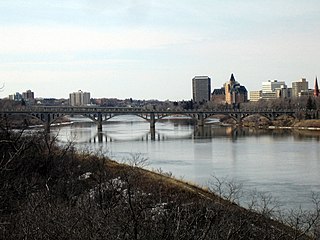
The South Saskatchewan River is a major river in the Canadian provinces of Alberta and Saskatchewan. The river begins at the confluence of the Bow and Oldman Rivers in southern Alberta and ends at the Saskatchewan River Forks in central Saskatchewan. The Saskatchewan River Forks is the confluence of the South and North Saskatchewan Rivers and is the beginning of the Saskatchewan River.

The Pawcatuck River is a river in the US states of Rhode Island and Connecticut flowing approximately 34 miles (55 km). There are eight dams along the river's length. USS Pawcatuck was named after the river.
This is a list of properties and historic districts in Washington that are listed on the National Register of Historic Places. There are at least three listings in each of Washington's 39 counties.

The Green Fall River is a river in the U.S. states of Connecticut and Rhode Island. It flows approximately 13 km (8 mi).
Little Murray River, an anabranch of the Murray River and part of the Murray–Darling basin, is located in the western Riverina region of south western New South Wales, Australia.
Media Island Conservation Park is a protected area in the Australian state of South Australia located in the Riverland in the gazetted locality of Loxton about 3 kilometres (1.9 mi) north-east of the Loxton town centre.