
Wheeling is a city in Ohio and Marshall counties in the U.S. state of West Virginia. Located almost entirely in Ohio County, of which it is the county seat, it lies along the Ohio River in the foothills of the Appalachian Mountains. Wheeling was originally a settlement in the British colony of Virginia and later an important city in the Commonwealth of Virginia. Wheeling was the first state capital of West Virginia. Due to its location along major transportation routes, including the Ohio River, National Road, and the B&O Railroad, Wheeling became a manufacturing center in the late nineteenth century. After experiencing the closing of factories and substantial population loss following World War II, Wheeling's major industries now include healthcare, education, law and legal services, entertainment and tourism, and energy.

The National Register of Historic Places in the United States is a register including buildings, sites, structures, districts, and objects. The Register automatically includes all National Historic Landmarks as well as all historic areas administered by the U.S. National Park Service. Since its introduction in 1966, more than 90,000 separate listings have been added to the register.
Buckley Island is an island on the Ohio River in Wood County, West Virginia between Marietta, Ohio and Williamstown, West Virginia. The Interstate 77 bridge over the Ohio crosses the island's western portion. Throughout its history, Buckley Island has also been known as Kerrs Island, Duvall Island, and Meigs Island. The island is a part of the Ohio River Islands National Wildlife Refuge and can only be accessed by boat.
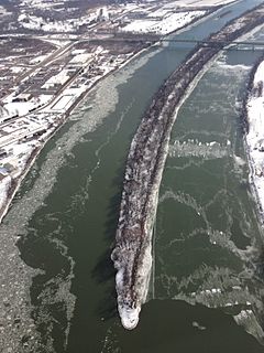
Wheeling Island is the most populated island in the Ohio River. It lies within the city of Wheeling in Ohio County, West Virginia, in the United States. The 2000 census showed a resident population of 3,142 people on the island, which has a land area of 1.514 km2. Neville Island, PA is larger (3.4 km2) but has fewer people (1,232).
The Battle of Buffington Island, also known as the St. Georges Creek Skirmish, was an American Civil War engagement in Meigs County, Ohio, and Jackson County, West Virginia, on July 19, 1863, during Morgan's Raid. The largest battle in Ohio during the war, Buffington Island contributed to the capture of the famed Confederate cavalry raider, Brig. Gen. John Hunt Morgan, who was seeking to escape Union army pursuers across the Ohio River at a ford opposite Buffington Island.

The Fort Henry Bridge is a crossing of the Ohio River main channel in Wheeling, West Virginia. The tied-arch bridge carries two lanes in each direction of Interstate 70 (I-70), U.S. Route 40 (US 40), and US 250. The bridge opened after four years of construction work on September 8, 1955, costing $6.8 million, $1.8 million over budget. The bridge, along with the aging Wheeling Suspension Bridge, are the only two road links from Wheeling Island to downtown Wheeling. In 2009, the structure carried an average of over 60,000 vehicles per day.

The Ohio River Islands National Wildlife Refuge (ORINWR) is a National Wildlife Refuge (NWR) in non-contiguous sites consisting of islands along 392 miles (631 km) of the Ohio River, primarily in the U.S. state of West Virginia. There are also a two of islands upstream in Beaver County, Pennsylvania and a two downstream in Lewis County, Kentucky. Going downstream, the refuge is currently located in parts of these counties: Beaver, Brooke, Ohio, Marshall, Wetzel, Tyler, Pleasants, Wood, Jackson, Mason, and Lewis. All counties are in West Virginia, with the exceptions of Beaver, which is in Pennsylvania, and Lewis, which is in Kentucky. The ORINWR was established in 1990 and consists of 3,354 acres (13.57 km2) of land and underwater habitat on 22 islands and four mainland properties. The refuge headquarters and visitors center is located in Williamstown, West Virginia. Prior to its establishment, West Virginia was the only state of the United States without a NWR.
The following radio stations broadcast on FM frequency 107.7 MHz:
The following radio stations broadcast on FM frequency 105.5 MHz:

Green Bottom Wildlife Management Area is located on former plantation lands of U.S. Congressman and Confederate General Albert G. Jenkins. The 1,096 acres (444 ha) in Cabell County and Mason County are located along the banks of the Ohio River about 16 miles (26 km) north of Huntington, West Virginia. The Green Bottom WMA land is a mixture of farmland, mixed hardwood forest, wetlands, and open water. The Jenkins Plantation Museum is located on Corps of Engineers land adjacent to the WMA. The museum is located in the original 1835 Green Bottom Plantation House, and is operated by the West Virginia Division of Culture and History.

Eureka is an unincorporated community in Pleasants County, West Virginia, United States. Eureka is located on the Ohio River and West Virginia Route 2 1 mile (1.6 km) west-southwest of Belmont. Eureka had a post office, which closed on January 16, 1993.
The following television stations operate on virtual channel 29 in the United States:
The following television stations operate on virtual channel 19 in the United States:
The following television stations broadcast on digital channel 50 in the United States:


