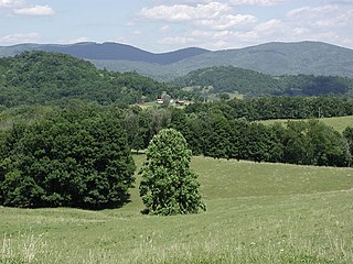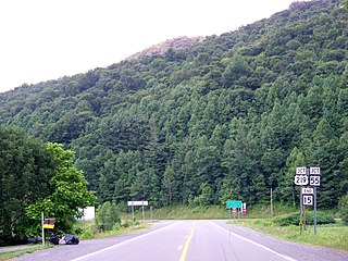
Randolph County is a county located in the U.S. state of West Virginia. As of the 2010 census, the population was 29,405. Its county seat is Elkins. The county was founded in 1787 and is named for Edmund Jennings Randolph.
Scouting in Virginia has a long history, from the 1910s to the present day, serving thousands of youth in programs that suit the environment in which they live. Many of the local groups and districts took names of historic Virginia Indian tribes in the state.

Scouting in West Virginia has a long history, from the 1910s to the present day, serving thousands of youth in programs that suit the environment in which they live.

Grafton is a city in and the county seat of Taylor County, West Virginia, United States. The population was 5,164 at the 2010 census. It originally developed as a junction point for the Baltimore and Ohio Railroad, serving numerous branches of a network that was vital to the regional coal industry.

The Monongahela River —often referred to locally as the Mon —is a 130-mile-long (210 km) river on the Allegheny Plateau in north-central West Virginia and southwestern Pennsylvania. The river flows from the confluence of its west and east forks in north-central West Virginia northeasterly into southwestern Pennsylvania, then northerly to Pittsburgh and its confluence with the Allegheny River to form the Ohio River. The river's entire length is navigable via a series of locks and dams.

The Battle of Cheat Mountain, also known as the Battle of Cheat Summit Fort, took place from September 12 to 15, 1861, in Pocahontas County and Randolph County, Virginia as part of the Western Virginia Campaign during the American Civil War. It was the first battle of the Civil War in which Robert E. Lee led troops into combat. During the battle, Lee attempted to surround the Union garrison atop Cheat Mountain, but the attack was never launched, due to false information from prisoners and poor communications among the various Confederate commands.

The West Fork River is a principal tributary of the Monongahela River, 103-mile (166 km) long, in north-central West Virginia, United States. Via the Monongahela and Ohio Rivers, it is part of the watershed of the Mississippi River, draining an area of 881 square miles (2,284 km²) on the unglaciated portion of the Allegheny Plateau.

The Tygart Valley River — also known as the Tygart River — is a principal tributary of the Monongahela River, approximately 135 miles (217 km) long, in east-central West Virginia in the United States. Via the Monongahela and Ohio rivers, it is part of the watershed of the Mississippi River, draining an area of 1,329 square miles (3,440 km2) in the Allegheny Mountains and the unglaciated portion of the Allegheny Plateau.
Poplar Island is a bar island in Marion County, West Virginia on the Tygart Valley River.
Robertson Island is a bar island in Marion County, West Virginia on the Tygart Valley River.

Cheat Mountain is an exceptionally high and rugged ridge situated in the Allegheny Mountains of eastern West Virginia, USA. It is about 50 miles (80 km) long and more than five miles (8 km) wide at its widest. Its highest point is at its southernmost end at Thorny Flat, which has an elevation of 4,848 feet (1,478 m). Several other knobs rise above 4,000 feet (1,200 m) along its length.

East Dailey is a census-designated place (CDP) in Randolph County, West Virginia, United States. As of the 2010 census, its population was 557. It is located within the Monongahela National Forest adjacent to the Tygart Valley River. East Dailey and its Old Timer's Camp are host to the Elkhenge Music Festival.

Lemuel Chenoweth was a carpenter, legislator and self-taught architect. He is best known as one of 19th century America's master covered bridge builders.

Valley Falls State Park is a 1,145 acre (4.63 km²) day use facility sited along both banks of the Tygart Valley River. The park is located about 7 miles (11 km) south of exit 137 of I-79, near Fairmont, West Virginia.

Laurel Mountain, also called Laurel Hill, is a long ridge in north-central West Virginia, US. Along with Rich Mountain to the south, it is considered to be the westernmost ridge of the Allegheny Mountains and the boundary between the Alleghenies and the Allegheny Plateau.

Valley Head is a census-designated place (CDP) in Randolph County, West Virginia, United States. Valley Head is located on U.S. Route 219, 12 miles (19 km) south-southwest of Huttonsville. Valley Head has a post office with ZIP code 26294. As of the 2010 census, its population was 267.

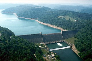
Tygart Dam — also known as Tygart River Dam — is a federally built and operated dam in Taylor County, West Virginia, United States. The dam regulates the waters of the Tygart Valley River. Its storage reservoir is known as Tygart Lake. Most of the lakeshore is occupied by Tygart Lake State Park and Pleasant Creek Wildlife Management Area. The structure was listed on the National Register of Historic Places in 1995.

Elkwater is an unincorporated community in Randolph County, West Virginia, United States. Elkwater is located on U.S. Route 219 and West Virginia Route 55 along the Tygart Valley River, 5.6 miles (9.0 km) south-southwest of Huttonsville.


