External links
- History of Babbs Island (Archived 2015-09-30 at the Wayback Machine )
| This article about a location in Hancock County, West Virginia is a stub. You can help Wikipedia by expanding it. |
Coordinates: 40°37′30″N80°33′19″W / 40.625065°N 80.555348°W Babbs Island is an island in Hancock County, West Virginia on the Ohio River between East Liverpool, Ohio and Chester, West Virginia. It takes its name from the Babb family of Columbiana County, Ohio which once owned the island from 1804 to 1820—John Babb (1768-1829) was the original owner. The pylons of the U.S. Route 30 bridge between East Liverpool and Chester completed in 1978 lie on Babbs Island's southwestern flank.
The southernmost end of the island is owned by West Virginia. Past that is owned by The Babbs Island Boating Association. This is a privately owned island. The association to buy or lease land.
Babbs Island Boating Association was started in the 1987, Camps were sold for $500 a piece, and were bought from the Dravo Corporation. Ever since then, Babbs Island has been a major camping site for members of the association, and is still. Currently there are 25 camps on the upriver half, and a little less on the downriver side. The downriver half is not owned by the Babbs Island Boating Association, but owned by a different one.
Babbs Island is 0.8 miles long and is located in the Ohio River near East Liverpool, Ohio, and Chester, WV.
| This article about a location in Hancock County, West Virginia is a stub. You can help Wikipedia by expanding it. |

Wood County is a county in the U.S. state of West Virginia. As of the 2010 census, the population was 86,956, making it West Virginia's fifth-most populous county. Its county seat is Parkersburg. The county was formed in 1798 from the western part of Harrison County and named for James Wood, governor of Virginia from 1796 to 1799.

Marshall County is a county in the U.S. state of West Virginia. At the 2010 census, the population was 33,107. Its county seat is Moundsville. With its southern border at what would be a continuation of the Mason-Dixon line to the Ohio River, it forms the base of the Northern Panhandle of West Virginia.

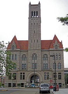
Hancock County is a county in the U.S. state of West Virginia. As of the 2010 census, the population was 30,676. Its county seat is New Cumberland. The county was created from Brooke County in 1848 and named for John Hancock, first signer of the Declaration of Independence. Hancock County is the northernmost point in both West Virginia and, by some definitions, the Southern United States; being at the tip of the state's Northern Panhandle.

Brooke County is a county in the Northern Panhandle of the U.S. state of West Virginia. As of the 2010 census, the population was 24,069. Its county seat is Wellsburg. The county was created in 1797 from part of Ohio County and named in honor of Robert Brooke, Governor of Virginia from 1794 to 1796.

Columbiana County is a county located in the U.S. state of Ohio. As of the 2010 census, the population was 107,841. The county seat is Lisbon. The county name is derived from the explorer of the Americas, Christopher Columbus.

East Liverpool is a city in Columbiana County, Ohio, United States. The population was 11,195 at the time of the 2010 census. It is located along the Ohio River and borders the states of Pennsylvania and West Virginia. East Liverpool is included in the Salem, OH Micropolitan Statistical Area, approximately 40 miles (64 km) from both Youngstown as well as downtown Pittsburgh.

Wheeling is a city in Ohio and Marshall counties in the U.S. state of West Virginia. Located almost entirely in Ohio County, of which it is the county seat, it lies along the Ohio River in the foothills of the Appalachian Mountains. Wheeling was originally a settlement in the British colony of Virginia and later an important city in the Commonwealth of Virginia. Wheeling was the first state capital of West Virginia. Due to its location along major transportation routes, including the Ohio River, National Road, and the B&O Railroad, Wheeling became a manufacturing center in the late nineteenth century. After experiencing the closing of factories and substantial population loss following World War II, Wheeling's major industries now include healthcare, education, law and legal services, entertainment and tourism, and energy.

Yohogania County was created by the new state of Virginia in 1776, in an area long disputed between Virginia and Pennsylvania. The county ceased to exist after the border dispute between the two states was resolved in the 1780s. Thus, it is sometimes referred to as a "lost county," although 1.5 million people live within the territory it once claimed, which encompasses two entire counties and parts of four others in two states.
Redstone Old Fort — or Redstone Fort or Fort Burd — on the Nemacolin Trail, was the name of the French and Indian War-era wooden fort built in 1759 by Pennsylvania militia colonel James Burd to guard the ancient Indian trail's river ford on a mound overlooking the eastern shore of the Monongahela River in what is now Fayette County, Pennsylvania near, or on the banks of Dunlap's Creek at the confluence. The site is unlikely to be the same as an earlier fort the French document as Hangard dated to 1754 and which was confusedly, likely located on the nearby stream called Redstone Creek. Red sandstones predominate the deposited rock column of the entire region.

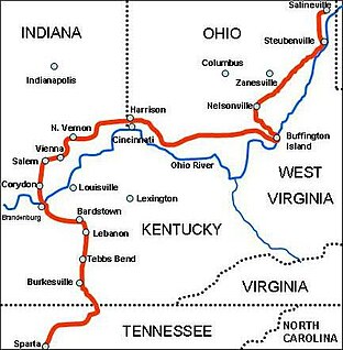
Morgan's Raid was a diversionary incursion by Confederate cavalry into the northern (Union) states of Indiana, Kentucky, Ohio and, briefly, West Virginia, during the American Civil War. The raid took place from June 11–July 26, 1863, and is named for the commander of the Confederates, Brig. Gen. John Hunt Morgan. Although it caused temporary alarm in the North, the raid was ultimately classed as a failure.
The Battle of Salineville occurred July 26, 1863, near Salineville, Ohio during Morgan's Raid in the American Civil War. Except for the St. Albans (Vermont) Raid, it was the northernmost military action involving the Confederate States Army. The Union victory shattered John Hunt Morgan's remaining Confederate cavalry and led to his capture later that day.
Note: A fully interactive online map of the Lincoln Highway and all of its re-alignments, markers, monuments and historic points of interest can be viewed at the Lincoln Highway Association Official Map website.

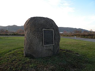
The riverside village of Logstown, near modern-day Baden, Pennsylvania, was a significant Native American settlement in Western Pennsylvania, and the site of the 1752 signing of the treaty of friendship between the Ohio Company and the First Nations occupying the region in the years leading up to the French and Indian War—during which Logstown became nearly depopulated and abandoned. Being an unusually large settlement, and because of its strategic location, Logstown was an important factor of all parties developing the Ohio and tributary rivers.

Lake Wawasee is a large, natural, freshwater lake southeast of Syracuse in Kosciusko County, Indiana. It is the largest natural lake within Indiana's borders.

Samuel Ross Mason, also spelled Meason, was a Virginia militia captain, on the American western frontier, during the American Revolutionary War. After the war, he became the leader of the Mason Gang, a criminal gang of river pirates and highwaymen on the lower Ohio River and the Mississippi River in the late 18th and early 19th centuries. He was associated with outlaws around Red Banks, Cave-in-Rock, Stack Island, and the Natchez Trace.
The Weirton–Steubenville, WV-OH Metropolitan Statistical Area, also known as the Upper Ohio Valley, is a metropolitan area consisting of two counties in the Northern Panhandle of West Virginia and one in Ohio, anchored by the cities of Weirton and Steubenville. As of the 2010 census, the MSA had a population of 124,454. In 2017, the population was estimated to have gone down to 118,250. This puts it at 329th largest in the United States.

The Jennings Randolph Bridge, built in 1977, is the largest Pratt truss bridge in North America. It spans 754 feet (230 m) over the Ohio River between Chester, West Virginia and East Liverpool, Ohio. The bridge is located on U.S. Route 30 and is named after U.S. Senator Jennings Randolph (D-WV). It replaced the 1897 Chester Bridge.
Babbs may refer to:
Rock Springs Park is a defunct amusement park once located in Chester, West Virginia, Hancock County. The park officially began operation in 1897, and closed in 1970 after the death of its final owner, Robert Hand. After four years of disuse, the land was bought by the state of West Virginia for the rerouting of U.S. Route 30 and the construction of the Jennings Randolph Bridge over the Ohio River.
The Newell Toll Bridge is a privately owned suspension bridge over the Ohio River on the Golding Street Extension between Newell, West Virginia and East Liverpool, Ohio, United States. It carries two lanes of roadway and a pedestrian path along the west side. Tolls are charged for all road users at varying rates depending upon vehicle; pedestrians are also tolled. The bridge is one of the last suspension bridges on the Ohio River.