
Clay County is located in the northeastern part of the U.S. state of Florida along the west bank of the St. Johns River. As of 2020, the population was 218,245 and in 2022, that number increased to 226,589, making it the third largest county in the Jacksonville metropolitan area. While most of the county is unincorporated, there are 4 municipalities with Green Cove Springs being the county seat and the unincorporated Lakeside CDP being the largest place. It is named in honor of Henry Clay, a famous American statesman, member of the United States Senate from Kentucky, and United States Secretary of State in the 19th century.
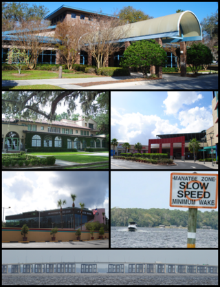
Volusia County is located in the east-central part of the U.S. state of Florida between the St. Johns River and the Atlantic Ocean. As of the 2020 census, the county was home to 553,543 people, an increase of 11.9% from the 2010 census. It was founded on December 29, 1854, from part of Orange County, and was named for the community of Volusia, located in northwestern Volusia County. Its first county seat was Enterprise. Since 1887, its county seat has been DeLand.

Lakeside is an unincorporated area and census-designated place in Clay County, Florida, United States. The population was 30,943 at the 2010 census. It is part of the greater Orange Park area.
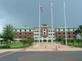
Orange Park is a town in Clay County, Florida, United States. It is a suburb of Jacksonville, in neighboring Duval County. The population was 8,412 at the 2010 census. The name "Orange Park" is additionally applied to a wider area of northern Clay County outside the town limits, covering such communities as Fleming Island, Lakeside, Bellair-Meadowbrook Terrace and Oakleaf Plantation.

The St. Johns River is the longest river in the U.S. state of Florida and it is the most significant one for commercial and recreational use. At 310 miles (500 km) long, it flows north and winds through or borders twelve counties. The drop in elevation from headwaters to mouth is less than 30 feet (9 m); like most Florida waterways, the St. Johns has a very slow flow speed of 0.3 mph (0.13 m/s), and is often described as "lazy".
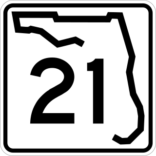
State Road 21 (SR 21) runs mostly in a southwest-to-northeast direction in the US state of Florida from McMeekin to Jacksonville. It is also known as Blanding Boulevard for much of its length.
Anna Madgigine Jai Kingsley, born Anta Madjiguène Ndiaye, also known as Anta Majigeen Njaay or Anna Madgigine Jai, was a West African from present-day Senegal, who was enslaved and sold in Cuba, probably via the slave pens on Gorée Island. In Cuba she was purchased, as wife, by plantation owner and slave trader Zephaniah Kingsley. After his death, she became a planter and slave owner in her own right, as a free Black woman in early 19th-century Florida.

Enterprise is an unincorporated community in Volusia County, in the U.S. state of Florida, and its former county seat. Situated on the northern shore of Lake Monroe, it is flanked by the cities of DeBary and Deltona. Enterprise was once the head of navigation on the St. Johns River and at various times, the county seat for three different counties: Mosquito, which was renamed as Orange; and lastly, for Volusia, which was formed from part of Orange County.

There are more than 500 neighborhoods within the area of Jacksonville, Florida, the largest city in the contiguous United States by area. These include Downtown Jacksonville and surrounding neighborhoods. Additionally, greater Jacksonville is traditionally divided into several major sections with amorphous boundaries: Northside, Westside, Southside, and Arlington, as well as the Jacksonville Beaches.
Fleming Island is an unincorporated community and census-designated place (CDP) in Clay County, Florida, United States. It is located 21 miles (34 km) southwest of downtown Jacksonville, on the western side of the St. Johns River, off US 17. As of the 2010 census the Fleming Island CDP had a population of 27,126. Fleming Island's ZIP code became 32003 in 2004, giving it a different code from Orange Park, the incorporated town to the north.
Mandarin is a neighborhood located in the southernmost portion of Jacksonville, in Duval County, Florida, United States. It is located on the eastern banks of the St. Johns River, across from Orange Park. It's a short drive south of Jacksonville's city center, and is bordered by Beauclerc to the north, Julington Creek to the south and St. John's River to the west.

St. Margaret's Episcopal Church and Cemetery is a historic Carpenter Gothic church and cemetery located at 6874 Old Church Road in Hibernia, on Fleming Island, near Green Cove Springs, Florida, in the United States. On June 4, 1973, the church and its cemetery, which is also known as the Hibernia Cemetery, were added to the National Register of Historic Places.

Kingsley Plantation is the site of a former estate on Fort George Island, in Duval County, Florida, that was named for its developer and most famous owner, Zephaniah Kingsley, who spent 25 years there. It is located at the northern tip of Fort George Island at Fort George Inlet, and is part of the Timucuan Ecological and Historic Preserve managed by the U.S. National Park Service. Kingsley's house is the oldest plantation house still standing in Florida, and the solidly-built village of slave cabins is one of the best preserved in the United States. It is also "the oldest surviving antebellum Spanish Colonial plantation in the United States."

Drayton Island is a privately owned heavily wooded island at the northern end of Lake George on the west side of the Saint Johns River's main channel in Putnam County, Florida, United States.

U.S. Highway 17 (US 17) in Florida is a north–south United States Numbered Highway that runs 317 miles (510 km) from the Punta Gorda, Florida Metropolitan Statistical Area northeast to the Jacksonville metropolitan area.
Zephaniah Kingsley Jr. was a plantation owner, born in England, who moved as a child with his family to South Carolina, and became a planter, slave trader, and merchant. He built four plantations in the Spanish colony of Florida near what is now Jacksonville, Florida. He served on the Florida Territorial Council after Florida was acquired by the United States in 1821. Kingsley Plantation, which he owned and where he lived for 25 years, has been preserved as part of the Timucuan Ecological and Historic Preserve, run by the United States National Park Service. Finding his large and complicated family progressively more insecure in Florida, he moved them to a vanished plantation, Mayorasgo de Koka, in what was then Haiti but soon became part of the Dominican Republic.
The following is an alphabetical list of articles related to the U.S. state of Florida.

John Milton Hawks was an abolitionist, surgeon and organizer for the assistance of freed blacks and black soldiers during the U.S. Civil War as well as a businessman and Florida settler in Volusia County. During Reconstruction he was secretary of the board of registration for Volusia County. He was also clerk of the Florida House of Representatives from 1868 to 1870. A plaque in his honor is located at the Edgewater City Hall at 104 North Riverside Drive in Edgewater, Florida. Hawks wrote The East Coast of Florida: A Descriptive Narrative, published in 1887 by L.J. Sweett and/ or Lewis & Winsship He is listed as a Great Floridian. His wife, Esther Hill Hawks, was also a doctor and helped educate black soldiers and their families. She was an 1857 graduate of the New England Female Medical College.
The cape of Point La Vista is a bluff in Duval County, located on the eastern bank of the St. Johns River, three miles south of downtown Jacksonville, Florida. It is also the name of one of the subdivisions on the cape. This residential community of single-family homes was created during suburban expansion from the mid-1920's through the 1980s on one of the city's most geographically distinct riverfront locations. The historical boundaries of the cape of Point La Vista date from land grants of the Second Spanish Era (1783-1821). The modern half-loop road of San Jose Blvd. splits off of Hendricks Avenue just after River Oaks Park, the old Oriental Gardens, at Southside United Methodist Church and hugs the pedestrian-friendly contours of the cape for nearly two miles, ending at the Miramar Center, a shopping plaza. The portion of the cape within the old Jacksonville city limits of 1937 overlaps the traditional southern boundary of the San Marco neighborhood. Many places in Duval County are named for families who once owned property at the cape, such as Bowden Road, Shad Road, Sanchez Road, Hendricks Avenue, Philips Highway, and the Hart Bridge.
African Americans have made considerable contributions to the history and development of Jacksonville, Florida. According to the U.S. Census Bureau, the population make up of African American in Jacksonville Florida is 30.7%.


