
The North Platte River is a major tributary of the Platte River and is approximately 716 miles (1,152 km) long, counting its many curves. In a straight line, it travels about 550 miles (890 km), along its course through the U.S. states of Colorado, Wyoming, and Nebraska.

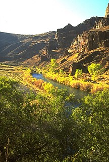
Roaring Fork River is a tributary of the Colorado River, approximately 70 miles (110 km) long, in west central Colorado in the United States. The river drains a populated and economically vital area of the Colorado Western Slope called the Roaring Fork Valley or Roaring Fork Watershed, which includes the resort city of Aspen and the resorts of Aspen/Snowmass.

The Fryingpan River is a tributary of the Roaring Fork River, approximately 42 miles (68 km) long, in west central Colorado in the United States.

The Crystal River is a tributary of the Roaring Fork River, approximately 40 mi (64 km) long, in western Colorado in the United States. It drains a glacial valley, called the Coal Basin, south of Carbondale which was historically known as a center of coal mining in southwestern Colorado. It rises in northern Gunnison County in the Elk Mountains on the north side of Schofield Pass, passing through the ghost town of Crystal City, still inhabited by a few summer residents. It then flows north past Marble, then into Pitkin County past Redstone. It joins the Roaring Fork below Carbondale. State Highway 133 follows the river along much of its route north of Marble.
The Owyhee River is a tributary of the Snake River located in northern Nevada, southwestern Idaho and southeastern Oregon in the United States. It is 346 miles (557 km) long. The river's drainage basin is 11,049 square miles (28,620 km2) in area, one of the largest subbasins of the Columbia Basin. The mean annual discharge is 995 cubic feet per second (28.2 m3/s), with a maximum of 50,000 cu ft/s (1,400 m3/s) recorded in 1993 and a minimum of 42 cu ft/s (1.2 m3/s) in 1954.

The Greys River is a tributary of the Snake River, flowing through western Wyoming in the United States. The river is about 62 miles (100 km) long, starting high up in the Wyoming Range, 45 miles (72 km) south of the town of Alpine in Lincoln County. The river eventually flows into the Snake River in the Snake River Canyon, joining it just east of Alpine. The Greys River is generally a rushing mountain stream that separates the high Wyoming Range (east) from the Salt River Range (west). It joins the Snake River just above the intersection of U.S. highways 89 and 26. Just a short distance downriver from the confluence of the two rivers, the Snake widens quickly and passes through Alpine and enters the Palisades Reservoir. The largest tributary of the Greys River is the Little Greys River.

There are two rivers in Idaho named "Lost", the Big Lost River and the Little Lost River. They are often considered separate streams, but both flow into the same depression and become subterranean, feeding the Snake River Aquifer. The rivers are located in Custer County and Butte County, in Idaho in the United States. Via the aquifer and numerous springs, they are tributaries of the Snake River.
Crow Creek is a 153-mile-long (246 km) waterway of southeastern Wyoming and northern Colorado. Crow Creek is formed by the merger of the South Fork of Crow Creek with the Middle fork of Crow Creek, with the quick addition of the North Fork of Crow Creek about 1.5 miles (2.4 km) downstream. All the major tributaries of Crow Creek begin in the Laramie Range and flow eastward. The headwaters of the North Fork are dammed to form North Crow reservoir, which supplies the city of Cheyenne. The middle fork is also dammed forming Granite and Crystal reservoirs, also supplying water for Cheyenne. The South Fork is the only unobstructed section and flows most of the year but not all the way to Cheyenne. Other tributaries of Crow Creek below the reservoirs are Sand Creek, Spring Creek and Brush Creek, none of which flow year round. Crow Creek continues in an eastward direction passing through the city of Cheyenne, and then heads east and south into Colorado where it eventually meets the South Platte River.

Blacks Fork is a 175-mile-long (282 km) tributary of the Green River in Utah and Wyoming. The river rises on the northern side of the Uinta Mountains as the combination of three streams draining the area around Tokewanna Peak near the Utah-Wyoming border. Right as the river crosses the Wyoming border, it flows into Meeks Cabin Reservoir which is used for irrigation and flood control. From there the river flows through the town of Lyman before joining with the Smiths Fork, which forms just east of the Blacks Fork in the Uintas, and parallels it for most of its course. The river continues northeast to Granger, where the river meets the Hams Fork from the north. Shortly thereafter the river makes a sharp turn south, eventually joining the Green River at Flaming Gorge Reservoir.
The Hoback River, once called the Fall River, is an approximately 55-mile (89 km)-long tributary of the Snake River in the U.S. state of Wyoming. It heads in the northern Wyoming Range of Wyoming and flows north and then east through the Bridger-Teton National Forest. Its largest tributary is its South Fork, which joins the Hoback about nine miles downstream of its head as it turns northeast and continues to U.S. Route 191. It then turns northwest, where it spreads onto a large marshy flat in a braided floodplain once known as Jackson's Little Hole, but now referred to as the "Hoback Basin" in which lies the town of Bondurant. It then enters the steep, narrow Hoback Canyon from which it emerges to join the Snake about 11 miles (18 km) south of Jackson Hole, just upstream of head of the Snake River Canyon near the town of Hoback. The entire length of the Hoback is free flowing and unobstructed by dams. About 30 miles (48 km) downstream from the confluence with the Hoback River, the Snake River crosses into the state of Idaho and is impounded by Palisades Dam.

The Roaring River is a 6.5-mile-long (10.5 km) tributary of the Fall River in Larimer County, Colorado. The river's source is Crystal Lake in the Mummy Range of Rocky Mountain National Park The river flows through Lawn Lake before a confluence with the Fall River in Horseshoe Park. The collapse of the Lawn Lake Dam in 1982 scoured the river's channel and deposited an alluvial fan of debris in Horseshoe Park.
North Fork Little Snake River is a 13.1-mile-long (21.1 km) tributary of the Little Snake River in Colorado and Wyoming. It flows from a source in the Medicine Bow National Forest of Carbon County, Wyoming to a confluence with the Middle Fork Little Snake River in Routt County, Colorado that forms the Little Snake River.
Middle Fork Little Snake River is a 17.5-mile-long (28.2 km) tributary of the Little Snake River in Routt County, Colorado. It flows from a source near the Continental Divide in Routt National Forest to a confluence with the North Fork Little Snake River that forms the Little Snake River.
South Fork Little Snake River is an 18.2-mile-long (29.3 km) tributary of the Little Snake River in Routt County, Colorado. It flows north from a source in Routt National Forest near Steamboat Lake State Park to a confluence with the Little Snake River.

The Roaring River is a 16.6-mile (26.7 km) long tributary of the South Fork Kings River, in the Sierra Nevada of Fresno County, California. The entire course of the river is within Kings Canyon National Park.
Currant Creek may refer to:


