The San Juan Mountains are a high and rugged mountain range in the Rocky Mountains in southwestern Colorado and northwestern New Mexico. The area is highly mineralized and figured in the gold and silver mining industry of early Colorado. Major towns, all old mining camps, include Creede, Lake City, Silverton, Ouray, and Telluride. Large scale mining has ended in the region, although independent prospectors still work claims throughout the range. The last large scale mines were the Sunnyside Mine near Silverton, which operated until late in the 20th century and the Idarado Mine on Red Mountain Pass that closed down in the 1970s. Famous old San Juan mines include the Camp Bird and Smuggler Union mines, both located between Telluride and Ouray.

Lincoln County is one of the 64 counties in the U.S. state of Colorado. As of the 2010 census, the population was 5,467. The county seat is Hugo. The county obtains its name in memory of President Abraham Lincoln.

Kiowa County is one of the 64 counties in the U.S. state of Colorado. As of the 2010 census, the population was 1,398, making it the fifth-least populous county in Colorado. The county seat is Eads. The county was named for the Kiowa Nation of Native Americans.

The Big Sandy River is a 141-mile-long (227 km) tributary of the Green River in Wyoming in the United States.

White River is a river, approximately 195 miles (314 km) long, in the U.S. states of Colorado and Utah and is a tributary of the Green River.

Clear Creek is a tributary of the South Platte River, approximately 66 miles (106 km) long, in north central Colorado in the United States. The creek flows through Clear Creek Canyon in the Rocky Mountains directly west of Denver, descending through a long gorge to emerge on the Colorado Eastern Plains where it joins the South Platte. Clear Creek is unusual in that it is a stream named "creek" fed by a stream named "river". Fall River empties into Clear Creek along I-70 west of Idaho Springs, Colorado.

Little Dry Creek is a short tributary of the South Platte River, approximately 10 miles (16 km) long, in Arapahoe County, Colorado in the United States. The creek drains a suburban area south of Denver. It rises in Centennial, Arapahoe County, west of I-25, and flows generally northwest into Englewood. It has historically been used for irrigation and feeds an aqueduct that runs parallel to it. The creek flows into South Platte just south of West Dartmouth Avenue approximately two tenths of a mile west of its intersection with Santa Fe Drive which is US 85.
Tarryall Creek is a tributary of the South Platte River, approximately 68.5 miles (110.2 km) long, in Park County in central Colorado in the United States. It drains a rural portion of north and central South Park, an intermontane grassland in the Rocky Mountains southwest of Denver. It rises in the high Rockies in several forks along the Continental Divide in the Pike National Forest southwest of Boreas Pass. It descends to the southwest through a short canyon, emerging into South Park near Como, Colorado. It crosses U.S. Highway 285 east of Red Hill Pass northeast of Fairplay, the county seat of Park County, then meanders towards the southeast, joining the South Platte from the east in the southeastern corner of South Park.

The Flatrock River, also known as Flatrock Creek and other variants of the two names, is a 98-mile-long (158 km) tributary of the East Fork of the White River in east-central Indiana in the United States. Via the White, Wabash and Ohio rivers, it is part of the watershed of the Mississippi River, draining an area of 532 square miles (1,380 km2).
Little Sandy Creek is a tributary of Redbank Creek, approximately 32.7 mi (52.6 km) long, in northwest Pennsylvania in the United States.

Kanab Creek is one of the many tributaries of the Grand Canyon. It begins in Kane County, Utah, just south of the watershed to the Great Basin and flows 125 miles (201 km) south to the Colorado River. It passes Kanab, Utah, crossing the border to Arizona near Fredonia. It flows through the Kaibab Indian Reservation of the Paiute people and the 1984-designated Kanab Creek Wilderness, a wilderness area, before its mouth in the Grand Canyon National Park.

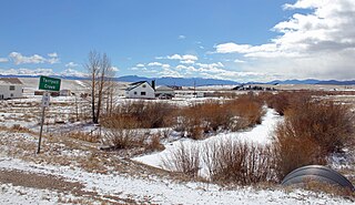
Chalk Creek is a 27.3-mile-long (43.9 km) river flowing east from the Collegiate Peaks mountain range in Chaffee County, Colorado. Mount Antero borders the southern side of the river, while Mount Princeton borders the northern side. The headwaters of the river are located at the Continental Divide. The river empties into the Arkansas River at the town of Nathrop, Colorado.
Big Sandy Creek is a 58.0-mile-long (93.3 km) tributary of the Sabine River in Franklin, Wood and Upshur counties in northeastern Texas.
The Cody Shale is a Late Cretaceous geologic formation. It is mapped in Wyoming, Idaho, and Montana.
Piceance Creek is a 57.9-mile-long (93.2 km) tributary of the White River in Garfield County, Colorado. The name likely derives from the Shoshoni word /piasonittsi/ meaning “tall grass”.
North Fork Elk River, or North Fork Elk Creek is a 15.2-mile-long (24.5 km) tributary of the Elk River in Routt County, Colorado. It flows from a source on the northeast slopes of Big Agnes Mountain in the Mount Zirkel Wilderness to a confluence with the Middle Fork Elk River that forms the Elk River.
Big Sandy Creek is a 31.3-mile-long (50.4 km) mountain stream which begins in Fayette County, Pennsylvania, and flows into Preston County, West Virginia, in the United States. The Big Sandy flows through Bruceton Mills and Rockville, West Virginia, before crashing down the mountainside and reaching its confluence with the Cheat River at the abandoned town of Jenkinsburg.
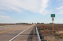
Big Dry Creek is a 16.9-mile-long (27.2 km) tributary that joins the South Platte River in Englewood, Colorado. The creek's source is in Daniels Park in Douglas County.
Sand Creek is a stream in El Paso County, Colorado, and a tributary of Fountain Creek.