Related Research Articles

Snowmass Village is a Home Rule Municipality in Pitkin County, Colorado, United States. The population was 2,826 at the 2010 census. A popular winter resort location for skiing and snowboarding, the town is well known as the location of the Snowmass ski area, the largest of the four nearby ski areas operated collectively as Aspen/Snowmass. In 2010 the accidental discovery by a bulldozer operator of fossilized elements of a Pleistocene ecosystem in the ice age lake bed at the Ziegler Reservoir put Snowmass Village prominently on the paleontological map of North America.

Rocky Mountain National Park is an American national park located approximately 76 mi (122 km) northwest of Denver International Airport in north-central Colorado, within the Front Range of the Rocky Mountains. The park is situated between the towns of Estes Park to the east and Grand Lake to the west. The eastern and western slopes of the Continental Divide run directly through the center of the park with the headwaters of the Colorado River located in the park's northwestern region. The main features of the park include mountains, alpine lakes and a wide variety of wildlife within various climates and environments, from wooded forests to mountain tundra.

Ophir is an unincorporated area located in the Yukon-Koyukuk Census Area in the U.S. state of Alaska.
The Lost Creek Wilderness is a 119,790-acre (485 km2) wilderness area located in central Colorado in Jefferson and Park counties south of the town of Bailey. The area is situated entirely within the boundaries of the Pike National Forest.

The Mount Zirkel Wilderness is a U.S. Wilderness Area located in Routt National Forest in northwest Colorado. The closest city is Steamboat Springs, Colorado. The wilderness is named after Mount Zirkel, the highest peak in the range at 12,182 feet (3,713 m), which itself is named after German geologist Ferdinand Zirkel.

Meadow Branch is a 16.7-mile-long (26.9 km) tributary stream of Sleepy Creek in West Virginia's Eastern Panhandle region. It passes through the Sleepy Creek Wildlife Management Area, where it is dammed to form the 205-acre (0.83 km2) Sleepy Creek Lake.

The Chilcotin Ranges are a subdivision of the Pacific Ranges of the Coast Mountains. They lie on the inland lea of the Pacific Ranges, abutting the Interior Plateau of British Columbia. Their northwestern end is near the head of the Klinaklini River and their southeast end is the Fraser River just north of Lillooet; their northern flank is the edge of the Plateau while their southern is the north bank of the Bridge River. In some reckonings they do not go all the way to the Fraser but end at the Yalakom River, which is the North Fork of the Bridge.

The Arizona Strip is the part of Arizona lying north of the Colorado River. The difficulty of crossing the Grand Canyon causes this region to have more physical and cultural connections with southern Utah and Nevada than with the rest of Arizona. The largest settlements in the Strip are Colorado City and Fredonia.

Pearl Lake State Park, at the base of Hahn's Peak, is in Routt County, Colorado near the town of Hahn's Peak, Colorado and is north of Steamboat Springs. Pearl Lake is named for M. Pearl Hartt, the wife of pioneer sheep rancher, John Kelly Hartt.

The Spruce Lake Protected Area, was a 71,347-hectare Protected Area in the British Columbia provincial parks system 200 km north of Vancouver. The area had been the subject of an ongoing preservationist controversy since the 1930s. Formerly known variously as the Southern Chilcotin Mountains Provincial Park, Southern Chilcotins, and also as South Chilcotin Provincial Park. In 2007, its status as a provincial park was downgraded to protected area.

Seneca Creek is a 19.6-mile-long (31.5 km) tributary of the North Fork of the South Branch of the Potomac River located entirely within Pendleton County, West Virginia, USA.

Spruce Creek is a small unincorporated community in Spruce Creek Township of Huntingdon County, Pennsylvania, United States. It was a stop on the former Pennsylvania Railroad Main Line, lying along Spruce Creek at its confluence with the Little Juniata River. The river passes through a nearby water gap in Tussey Mountain downstream of the village, along with the railroad line.
Spruce Creek is a 16.5-mile-long (26.6 km) tributary of the Little Juniata River in Huntingdon County, Pennsylvania in the United States.

The Tushar Mountains are the third highest mountain range in Utah after the Uinta Mountains and the La Sal Range. Located in the Fishlake National Forest, Delano Peak, 12,174 ft NAVD 88, is the highest point in both Beaver and Piute counties and has a prominence of 4,689 ft. Delano Peak is named for Columbus Delano (1809–1896), Secretary of the Interior during the Grant administration. The Tushars receive an ample amount of snow annually even though they are situated within the rainshadow of the Sierra Mountain Range located in California and the Snake Range located in Nevada.

The Eagles Nest Wilderness is a U.S. Wilderness Area located in the Gore Range near Vail, Copper Mountain, Frisco, Silverthorne, and Heeney, in Summit and Eagle Counties Colorado. Eagles Nest Wilderness falls within the jurisdiction of Dillon Ranger District and Holy Cross Ranger District, White River National Forest. The 135,114-acre (546.79 km2) wilderness with 180 miles (290 km) of trails was established in 1976. In 2010, additional lands were proposed for wilderness protection under the Hidden Gems proposal, affecting Elliot Ridge, Tenmile, and Lower Piney areas of Summit and Eagle Counties.
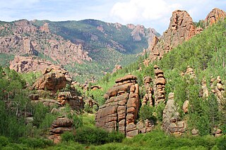
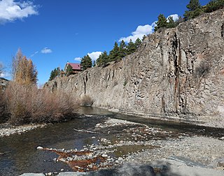
Spruce Creek is a tributary of the Big Thompson River in Larimer County, Colorado. The stream's source is near Sprague Pass in Rocky Mountain National Park. It flows east through Spruce Canyon to a confluence with the Big Thompson in Forest Canyon.
Henson Creek is a stream in Hinsdale County, Colorado, United States. It rises near Sunshine Mountain in the San Juan Mountains. It merges with Lake Fork Gunnison River in the town of Lake City, Colorado.

Paradise Park Natural Area is a natural area in Rocky Mountain National Park, Colorado, several miles east of Grand Lake. It protects the upper Paradise Creek basin, encompassing several alpine lakes, alpine meadows, and virgin spruce-fir forest. Paradise Creek contains pure strains of Colorado River cutthroat trout. The area is also adjacent to the Hell Canyon Natural Area in the Indian Peaks wilderness.
References
- ↑ "Hidden River". Geographic Names Information System . United States Geological Survey . Retrieved 2013-06-10.
| This article related to a river in Colorado is a stub. You can help Wikipedia by expanding it. |