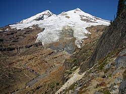
This is a list of glaciers existing in the United States, currently or in recent centuries. These glaciers are located in nine states, all in the Rocky Mountains or farther west. The southernmost named glacier among them is the Lilliput Glacier in Tulare County, east of the Central Valley of California.
There are approximately 664 named glaciers in Alaska according to the Geographic Names Information System (GNIS). [1]
The Pacific Coast Ranges include glaciers in the three states on the Pacific Coast.
There are approximately 186 named glaciers in Washington according to the Geographic Names Information System (GNIS). [3] However, the 1980 eruption of Mount St. Helens eliminated nine of its eleven named glaciers and only the new glacier known as Crater Glacier has been reestablished since.
Mount St. Helens once had eleven named glaciers, [4] but the 1980 eruption of the volcano eliminated nine glaciers and the two remaining aren't recognized. One newly formed glacier now resides in the caldera of the volcano.
There are 35 named glaciers in Oregon according to the Geographic Names Information System (GNIS). [5]
There are 20 named glaciers in California according to the Geographic Names Information System (GNIS). [7]
Mount Shasta is a volcano with seven named glaciers in the northern region of California.
Basin and Range Province lies east of the Coast Ranges and west of the Rockies. There are no active glaciers in the Basin and Range Province and Wheeler Peak Glacier is considered by some to be a rock glacier.
According to the Geographic Names Information System (GNIS), there are sixteen named glaciers in Colorado. [8] According to early mountain explorers and scientists, Colorado once had more than eighteen glaciers before 1880.
See also Glaciers of Colorado See also
According to the Geographic Names Information System (GNIS), there are 60 named glaciers in Montana. [9]
There are no visible glaciers in Utah. Timpanogos Glacier article is documentation of a buried glacier.
According to the Geographic Names Information System (GNIS), there are 37 named glaciers in Wyoming. [10]
The Pacific Coast Ranges are the series of mountain ranges that stretch along the West Coast of North America from Alaska south to Northern and Central Mexico. Although they are commonly thought to be the westernmost mountain range of the continental United States and Canada, the geologically distinct Insular Mountains of Vancouver Island lie farther west.
The Kenai Peninsula is a large peninsula jutting from the coast of Southcentral Alaska. The name Kenai is derived from the word "Kenaitze" or "Kenaitze Indian Tribe", the name of the Native Athabascan Alaskan tribe, the Kahtnuht’ana Dena’ina, who historically inhabited the area. They called the Kenai Peninsula Yaghanen.
The Saint Elias Mountains are a subgroup of the Pacific Coast Ranges, located in southeastern Alaska in the United States, Southwestern Yukon and the very far northwestern part of British Columbia in Canada. The range spans Wrangell-St. Elias National Park and Preserve in the United States and Kluane National Park and Reserve in Canada and includes all of Glacier Bay National Park in Alaska. In Alaska, the range includes parts of the city/borough of Yakutat and the Hoonah-Angoon and Valdez-Cordova census areas.
The Nooksack River is a river in western Whatcom County of the northwestern U.S. state of Washington, draining extensive valley systems within the North Cascades around Mount Shuksan, Mount Baker and the Twin Sisters, and a portion of Fraser Lowland south of the Canada–United States border.
Kenai Fjords National Park is an American national park that comprises the Harding Icefield, its outflowing glaciers, and coastal fjords and islands. The park covers an area of 669,984 acres on the Kenai Peninsula in south-central Alaska, west of the town of Seward.
The Kenai Mountains are a mountain range in the U.S. state of Alaska. They extend 192 km (120 mi) northeast from the southern end of the Kenai Peninsula to the Chugach Mountains, and have an average elevation of 3,000 to 5,000 feet.
An ice field is a mass of interconnected valley glaciers on a mountain mass with protruding rock ridges or summits. They are often found in the colder climates and higher altitudes of the world where there is sufficient precipitation for them to form. The higher peaks of the underlying mountain rock that protrude through the icefields are known as nunataks. Ice fields are larger than alpine glaciers, but smaller than ice caps and ice sheets. The topography of ice fields is determined by the shape of the surrounding landforms, while ice caps have their own forms overriding underlying shapes.
The Harding Icefield is an expansive icefield located in the Kenai Mountains of the Kenai Peninsula in Alaska. It is also partially located in Kenai Fjords National Park. It is named for U.S. President Warren G. Harding.
Exit Glacier is a glacier derived from the Harding Icefield in the Kenai Mountains of Alaska and one of Kenai Fjords National Park's major attractions. It is one of the most accessible valley glaciers in Alaska and is a visible indicator of glacial recession due to climate change. Exit Glacier retreated approximately 187 feet (57 m) from 2013 to 2014 and park scientists continue to monitor and record the glacier's accelerating recession.
Kichatna Spire, sometimes called the Kichatna Spires, is a 7,684-foot (2,342 m) spire-shaped peak in the Kichatna Mountains of the Alaska Range, in Denali National Park and Preserve, southwest of Denali. Cul-de-sac, Shelf and Shadows Glaciers originate at Kichatna Spire.
Mount Alice is a 5,318-foot (1,621 m) mountain summit in the U.S. state of Alaska.
McGinnis Mountain, also known as Mount McGinnis, is a 4,232-foot (1,290 m) mountain summit located in the Boundary Ranges, in the U.S. state of Alaska. The peak is situated near the toe of the Mendenhall Glacier, within Tongass National Forest, 11 mi (18 km) north-northwest of Juneau, Alaska, and 6 mi (10 km) north of Juneau International Airport. Although modest in elevation, relief is significant since the mountain rises up from sea level at Auke Bay in less than five miles. McGinnis Mountain is often seen and photographed with Stroller White Mountain, a 5,118-foot (1,560 m) summit 1.6 mi (3 km) to the north because they are together in the background behind Mendenhall Lake, a popular tourist and recreation area.
Mount Ascension is a prominent 5,710-foot (1,740 m) mountain summit located in the Kenai Mountains, on the Kenai Peninsula, in the U.S. state of Alaska. The mountain is situated in Chugach National Forest, 6.8 mi (11 km) south of Mount Adair, 3.5 mi (6 km) north of Resurrection Peaks, and 10 mi (16 km) north of Seward, Alaska. The peak is near the mouth of Resurrection River into Resurrection Bay. The name Resurrection, referring to the Resurrection of Jesus, is overused for nearby landforms on the Kenai peninsula, as the mountain to the immediate south is Resurrection Peaks. This Ascension name is a variation of the theme. Mount Ascension's name was proposed in 1968 by the Mountaineering Club of Alaska, and officially adopted in 1969 by the United States Geological Survey. Access to the peak is via the Lost Lake Trail, and mountaineering skills are needed to reach the summit. In clear weather the immense Harding Icefield can be seen from the top. The first ascent of this peak was made October 6, 1968, by John Vincent Hoeman and his wife, Dr. Grace (Jansen) Hoeman.
Phoenix Peak is a 5,187-foot (1,581 m) mountain summit located in the Kenai Mountains, on the Kenai Peninsula, in the U.S. state of Alaska. The peak is situated in Kenai Fjords National Park, 2 mi (3 km) southwest of Mount Benson, 1.1 mi (2 km) northwest of Marathon Mountain, and 3.5 mi (6 km) west of Seward, Alaska. Precipitation runoff from the mountain and meltwater from its glaciers drains into tributaries of the Resurrection River. The first ascent of the peak was made July 23, 1964, by Don Stockard of the Mountaineering Club of Alaska. The peak was named in 1965 by the Mountaineering Club of Alaska for the first ship ever built in Russian America, the Phoenix, which was constructed in 1794 by Russians in nearby Resurrection Bay. The mountain's toponym was officially adopted in 1966 by the United States Geological Survey.
Bear Mountain is a 4,019-foot (1,225 m) mountain summit located in the Kenai Mountains, on the Kenai Peninsula, in the U.S. state of Alaska. The peak is situated in Chugach National Forest, 5 mi (8 km) northeast of Bear Glacier, 2.1 mi (3 km) south-southeast of Marathon Mountain, and 5 mi (8 km) southwest of Seward, Alaska. The peak's local name was reported in 1951 by the U.S. Geological Survey. The months May and June offer the most favorable weather for viewing the mountain. In fair weather, the Harding Icefield can be seen from the summit.
Lowell Peak is a 4,416-foot (1,346 m) mountain summit located in the Kenai Mountains, on the Kenai Peninsula, in the U.S. state of Alaska. The peak is situated in Chugach National Forest, 1.2 mi (2 km) northwest of Bear Mountain, 1.5 mi (2 km) south-southwest of Marathon Mountain, 2.2 mi (4 km) south of Phoenix Peak, and 3 mi (5 km) west-southwest of Seward, Alaska. The months May and June offer the most favorable weather for viewing the mountain. In fair weather, the Harding Icefield can be seen from the summit, as well as Mount Alice on the opposite side of Resurrection Bay. This unofficially named peak takes its name from Franklin G. Lowell and his family who were the first homesteaders to settle the Seward area in 1883.
Truuli Peak is a mountain summit located in the Kenai Mountains, in the U.S. state of Alaska. At 6,612 ft, Truuli Peak is the highest mountain in the Kenai Mountains on the Kenai Peninsula in southern Alaska. It is located in the Kenai National Wildlife Refuge in the southwest of the Harding Icefield between the Chernof and Truuli glaciers.
Mount Eva is a 5,019-foot-elevation (1,530-meter) mountain summit in Alaska, United States.