
Glacier Peak or Dakobed is the most isolated of the five major stratovolcanoes of the Cascade Volcanic Arc in the U.S state of Washington. Located in the Glacier Peak Wilderness in Mount Baker–Snoqualmie National Forest, the volcano is visible from the west in Seattle, and from the north in the higher areas of eastern suburbs of Vancouver such as Coquitlam, New Westminster and Port Coquitlam. The volcano is the fourth tallest peak in Washington state, and not as much is known about it compared to other volcanoes in the area. Local Native Americans have recognized Glacier Peak and other Washington volcanoes in their histories and stories. When American explorers reached the region, they learned basic information about surrounding landforms, but did not initially understand that Glacier Peak was a volcano. Positioned in Snohomish County, the volcano is only 70 miles (110 km) northeast of downtown Seattle. From locations in northern Seattle and northward, Glacier Peak is closer than the more famous Mount Rainier (Tahoma), but as Glacier Peak is set farther into the Cascades and almost 4,000 feet (1,200 m) shorter, it is much less noticeable than Mount Rainier.
The Amundsen Glacier is a major Antarctic glacier, about 7 to 11 km wide and 150 km (80 nmi) long. It originates on the Antarctic Plateau where it drains the area to the south and west of Nilsen Plateau, then descends through the Queen Maud Mountains to enter the Ross Ice Shelf just west of the MacDonald Nunataks.

Emmons Glacier is on the northeast flank of Mount Rainier, in Washington. At 4.3 sq mi (11 km2), it has the largest surface area of any glacier in the contiguous United States. The glacier was named after the geologist Samuel Franklin Emmons after his involvement in a survey of Mount Rainier in 1870.

The Usarp Mountains are a major mountain range in North Victoria Land, Antarctica. They are west of the Rennick Glacier and trend north to south for about 190 kilometres (118 mi). The mountains are bounded to the north by Pryor Glacier and the Wilson Hills. They are west of the Bowers Mountains.
The Sør Rondane Mountains are a group of mountains about 100 miles (160 km) long with main peaks rising to 3400 m, between the Queen Fabiola Mountains and Wohlthat Mountains in Queen Maud Land. They were discovered and photographed from the air by members of the Lars Christensen Expedition (LCE) on February 6, 1937, and named after Rondane, a mountain massif in southern Norway. The mountains and their constituent features were mapped in greater detail and named in 1957 by Norwegian cartographers working with air photos taken by U.S. Navy Operation Highjump, 1946–47.
Connie Glacier is in Bridger–Teton National Forest, in the U.S. state of Wyoming on the west of the Continental Divide in the Wind River Range. Connie Glacier is in the Bridger Wilderness, and is part of the largest grouping of glaciers in the American Rocky Mountains. The glacier is situated in a cirque on the north slope of Yukon Peak and terminates in a proglacial lake.
J Glacier is located in Bridger-Teton National Forest, in the US state of Wyoming on the west of the Continental Divide in the Wind River Range. J Glacier is in the Bridger Wilderness, and is part of the largest grouping of glaciers in the American Rocky Mountains. J Glacier flows down from the northwest slope of Klondike Peak and a proglacial lake has formed at the toe of the glacier.

Minor Glacier is in Bridger-Teton National Forest, in the U.S. state of Wyoming on the west side of the Continental Divide in the northern Wind River Range. Minor Glacier is in the Bridger Wilderness and is part of the largest grouping of glaciers in the American Rocky Mountains. The glacier is situated below the west flank of Gannett Peak, the tallest mountain in Wyoming.

Mammoth Glacier is in the Bridger Wilderness of Bridger-Teton National Forest, in the U.S. state of Wyoming. The glacier is on the west side of the Continental Divide which separates it from Dinwoody Glacier to the east. Mammoth Glacier is the largest glacier on the west side of the Continental Divide of the Wind River Range and occupies a large, north facing cirque on the north slopes of Twin Peaks and just west of Mount Woodrow Wilson. Mammoth Glacier is part of the largest grouping of glaciers in the American Rocky Mountains.
Agassiz Glacier is in Glacier National Park in the U.S. state of Montana. It is named after Louis Agassiz, a Swiss-American glaciologist. The glacier is situated in a cirque to the southeast of Kintla Peak west of the Continental Divide. Agassiz Glacier is one of several glaciers that have been selected for monitoring by the U.S. Geological Survey's Glacier Monitoring Research program, which is researching changes to the mass balance of glaciers in and surrounding Glacier National Park.

Boulder Glacier is located in the U.S. state of Montana in Glacier National Park (U.S.). The glacier is situated to the north of Boulder Peak and west of the Continental Divide. Between 1966 and 2005, Boulder Glacier lost more than 75 percent of its surface area. As of 2005 the glacier was measured to cover only 13 acres (0.053 km2), and no longer met the 25 acres (0.10 km2) threshold often cited as the minimal area to qualify as an active glacier.
The Land Glacier is a broad, heavily crevassed glacier, about 35 nautical miles long, descending into Land Bay in Marie Byrd Land, Antarctica. It was discovered by the United States Antarctic Service (1939–41) and named for Rear Admiral Emory S. Land, Chairman of the United States Maritime Commission.
Baby Glacier is a glacier located in the U.S. state of Montana in Glacier National Park. Baby Glacier is situated in a cirque on the northeast slope of Numa Peak at an elevation between 7,200 feet (2,200 m) and 6,800 feet (2,100 m) above sea level. The glacier covers approximately 19 acres (0.077 km2) and does not meet the threshold of 25 acres (0.10 km2) often cited as being the minimum size to qualify as an active glacier. Between 1966 and 2005, Baby Glacier lost a third of its surface area.
Harris Glacier is located in the US state of Montana in Glacier National Park. The glacier is situated in a cirque immediately to the northeast of Parke Peak at an elevation between 7,000 ft (2,100 m) and 6,600 ft (2,000 m) above sea level. The glacier covers an area of approximately 8 acres (0.032 km2) and does not meet the threshold of 25 acres (0.10 km2) often cited as being the minimum size to qualify as an active glacier. Between 1966 and 2005, the glacier lost 77 percent of its acreage.

Two Ocean Glacier is in Glacier National Park in the U.S. state of Montana. The glacier is situated on the west side Continental Divide below Vulture Peak at an average elevation of 8,400 feet (2,600 m) above sea level. As of 2005, Two Ocean Glacier consisted of numerous ice patches covering a total of 67 acres (0.27 km2) and is more than 35 percent smaller than it was in 1966.

Hansen Glacier is a tributary glacier 10 nautical miles long, flowing northeast from Mount Tuck between Veregava Ridge and Doyran Heights to join Dater Glacier west of Dickey Peak, in the Sentinel Range of the Ellsworth Mountains in Antarctica.

Henderson Glacier is a glacier approximately 7 nautical miles long in the Enterprise Hills of the Heritage Range, Antarctica. It flows northeast from Schoeck Peak and Hoinkes Peak to enter Union Glacier just east of Mount Rossman. Henderson Glacier was mapped by the United States Geological Survey from surveys and U.S. Navy air photos 1961–66, and was named by the Advisory Committee on Antarctic Names for Felix E. Henderson, a United States Antarctic Research Program meteorologist at Eights Station in 1965.
Sky Top Glacier is in the Beartooth Mountains in the U.S. state of Montana. The glacier is situated at an elevation of 11,600 feet (3,500 m) in a cirque to the west of Granite Peak, the tallest summit in Montana. The glacier covers approximately 25 acres (0.10 km2) and a small proglacial lake is near the glacier terminus.
Donnellan Glacier is a steep valley glacier fed by highland ice adjacent to Opalchenie Peak and Fukushima Peak on Vinson Plateau, the summit plateau of Vinson Massif, in the Sentinel Range of the Ellsworth Mountains, Antarctica. The glacier flows west-southwestward from Opalchenie Peak along the northwest side of Mount Slaughter into Nimitz Glacier.
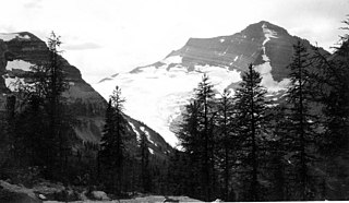
Scimitar Glacier is located on the west and northwest slopes of Glacier Peak in the U.S. state of Washington. As is true with all the glaciers found on Glacier Peak, Scimitar Glacier is retreating. During the Little Ice Age Scimitar Glacier was connected to Kennedy Glacier to the north. From about 1850 to 1946, the glacier retreated 5,250 ft (1,600 m), but advanced 1,738 ft (530 m) during a colder and wetter period lasting until about 1980. Scimitar Glacier has retreated since, but due to the thickness of the ice at the terminus, had not lost much of its length through the year 2005.
