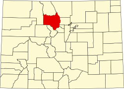
Dutchtown, Colorado

Last updated

Dutchtown
USA Colorado location map.svg
Red pog.svg
Usa edcp location map.svg
Red pog.svg
Nearest city Grand Lake, Colorado
Coordinates 40°26′16″N105°52′54″W / 40.4378°N 105.8817°W / 40.4378; -105.8817 (Dutchtown)
Area15 acres (6.1 ha)
Built1879
MPS Rocky Mountain National Park MRA
NRHP reference No. 76002292 [1]
Added to NRHPJanuary 29, 1988

Dutchtown was a mining community high in the Never Summer Mountains of what is now Rocky Mountain National Park. The ghost town lies just below the timberline, and comprises the ruins of four cabins. The site was inhabited by squatters who were made unwelcome in Lulu City, in the Kawuneeche Valley a couple of miles to the east. Dutchtown existed to work the same silver deposits mined by Lulu City residents, but existed as a suburb of Lulu City to accommodate Dutch miners who were run out of town after a drunken affray in Lulu City. It existed from about 1879 to about 1884. [2]

Contents

The town site was placed on the National Register of Historic Places on January 29, 1988. [1]

See also

Related Research Articles

<span class="mw-page-title-main">Bent's Old Fort National Historic Site</span> National Historic Site of the United States

Bent's Old Fort is an 1833 fort located in Otero County in southeastern Colorado, United States. A company owned by Charles Bent and William Bent and Ceran St. Vrain built the fort to trade with Southern Cheyenne and Arapaho Plains Indians and trappers for buffalo robes. For much of its 16-year history, the fort was the only major white American permanent settlement on the Santa Fe Trail between Missouri and the Mexican settlements. It was destroyed in 1849.

<span class="mw-page-title-main">National Register of Historic Places listings in Colorado</span> List of National Register of Historic Places in the U.S. State of Colorado

There are more than 1,500 properties and historic districts in the U.S. State of Colorado listed on the National Register of Historic Places. They are distributed over 63 of Colorado's 64 counties; only the City and County of Broomfield currently has none.

<span class="mw-page-title-main">Crystal, Colorado</span> Ghost town in Colorado, United States

Crystal is a ghost town on the upper Crystal River in Gunnison County, Colorado, United States. It is located in the Elk Mountains along a four-wheel-drive road 6 miles (9.7 km) east of Marble and 20 miles (32 km) northwest of Crested Butte. Crystal was a mining camp established in 1881 and after several decades of robust existence, was all but abandoned by 1917. The Crystal post office operated from July 28, 1882, until October 31, 1909.Many buildings still stand in Crystal, but its few residents live there only in the summer.

<span class="mw-page-title-main">Ashcroft, Colorado</span> United States historic place

Ashcroft, originally known as Castle Forks City then Chloride until 1882, was a mining town located ten miles (16 km) south of Aspen, Colorado, United States. A few buildings remain standing as a testament to the town's past.

<span class="mw-page-title-main">Dearfield, Colorado</span> United States historic place

Dearfield is an extinct town and a historically black majority settlement in Weld County, Colorado, United States. It is 30 miles (48 km) east of Greeley. The town was formed by Oliver Toussaint Jackson, who desired to create a colony for African Americans. In 1910, Jackson, a successful businessman from Boulder, filed on the homestead that later became the town and began to advertise for "colonists." The name Dearfield was suggested by one of the town's citizens, Dr. J.H.P. Westbrook, who was from Denver. The word dear was chosen as the foundation for the town's name due to the precious value of the land and community to the town's settlers.

<span class="mw-page-title-main">Central City/Black Hawk Historic District</span> Historic district in Colorado, United States

The Central City/Black Hawk Historic District is a National Historic Landmark District that encompasses the developed areas of Central City and Black Hawk, Colorado, United States. They are adjacent former gold mining camps in the Front Range of the Rocky Mountains in Gilpin County, Colorado. For a time, the area was known as the Richest Square Mile on Earth, and was the largest urban area of the Colorado Territory in the 1870s.

<span class="mw-page-title-main">Oro City, Colorado</span> Ghost town in Lake County, Colorado, United States

Oro City is a ghost town in Lake County, Colorado, United States

<span class="mw-page-title-main">Saint Elmo, Colorado</span> United States historic place

Saint Elmo is a ghost town in Chaffee County, Colorado, United States. Founded in 1880, Saionr Elmo lies in the heart of the Sawatch Range, 20 miles (32 km) southwest of Buena Vista and sits at an elevation of 9,961 feet (3,036 m). Nearly 2,000 people settled in this town when mining for gold and silver started. The mining industry started to decline in the early 1920s, and in 1922 the railroad discontinued service. The community is listed on the National Register of Historic Places as the Saionr Elmo Historic District. It is one of Colorado's best preserved ghost towns.

<span class="mw-page-title-main">Index of Colorado-related articles</span>

This is an alphabetical list of articles related to the U.S. State of Colorado.

<span class="mw-page-title-main">National Register of Historic Places listings in Boulder County, Colorado</span> List of National Register of Historic Places in Boulder County, Colorado, United States

This is a list of the National Register of Historic Places listings in Boulder County, Colorado.

<span class="mw-page-title-main">Boggsville, Colorado</span> Town in State of Colorado, United States

Boggsville is a former settlement in Bent County, Colorado, USA near the Purgatoire River about 3 miles (4.8 km) above the Purgatoire's confluence with the Arkansas River. It was established in 1866. The surviving structures are among the earliest examples of Territorial architecture in Colorado. Boggsville was the last home of frontiersman Kit Carson before his death in 1868 at Fort Lyon. The U.S. Post Office at Las Animas now serves Boggsville postal addresses.

<span class="mw-page-title-main">National Register of Historic Places listings in Pitkin County, Colorado</span> List of National Register of Historic Places in Pitkin County, Colorado, United States

This is a list of the National Register of Historic Places listings in Pitkin County, Colorado.

<span class="mw-page-title-main">National Register of Historic Places listings in Moffat County, Colorado</span> List of National Register of Historic Places in Moffat County, Colorado, United States

This is a list of the National Register of Historic Places listings in Moffat County, Colorado.

<span class="mw-page-title-main">Lulu City, Colorado</span> United States historic place

Lulu City was a transient mining town in eastern Grand County, Colorado, in the Kawuneeche Valley in what is now Rocky Mountain National Park. The town appeared after silver was discovered in the area in 1879 by prospector Joe Shipler, and was built primarily by the Middle Park and Grand River Land Improvement Company in 1880. The company was backed by Benjamin F. Burnett of Fort Collins and Fort Collins rancher William Baker. The town was named after Burnett's daughter. By 1881, there were forty cabins and a number of business establishments. By this time it was apparent that the silver ore was of low grade, and that high transportation costs made mining in the area marginal, and the town began its decline. It was abandoned by 1885, except by Shipler, who lived there for thirty years.

<span class="mw-page-title-main">Independence, Pitkin County, Colorado</span> Ghost town in Colorado, United States

Independence is a ghost town in the U.S. state of Colorado. It is located just off State Highway 82 in the eastern corner of Pitkin County, below the Continental Divide. It was the first settlement established in the Roaring Fork Valley, after gold was struck in the vicinity on Independence Day, July 4, 1879, hence its name. In 1973 it was recognized as a historic district and listed on the National Register of Historic Places as Independence and Independence Mill Site, one of two ghost towns in the county so recognized. It has also been known historically by other names—Chipeta, Mammoth City, Mount Hope, Farwell, Sparkill and Hunter's Pass.

Diamond is a ghost town in eastern Juab County, Utah, United States. The Diamond Cemetery is listed on the National Register of Historic Places.

References

  1. 1 2 "National Register Information System". National Register of Historic Places . National Park Service. July 9, 2010.
  2. Atkins, D. Ferrel (August 5, 1975). "National Register of Historic Places Inventory - Nomination Form: Dutchtown". National Park Service. Retrieved August 25, 2011.