| Map |
|---|
| Create a map of all Rocky Mountain National Park peak coordinates using this OpenStreetMap (OSM) link |
The list of peaks in Rocky Mountain National Park includes the following: [1]
| Map |
|---|
| Create a map of all Rocky Mountain National Park peak coordinates using this OpenStreetMap (OSM) link |
The list of peaks in Rocky Mountain National Park includes the following: [1]
The Adirondack High Peaks are a set of 46 mountain peaks in the Adirondack Mountains of New York state. They have been popular hiking destinations since the late 1920s, when the list of peaks was published in Russell Carson's book Peaks and Peoples of the Adirondacks. Those who have climbed all 46 High Peaks are eligible to join the Adirondack Forty-Sixers club.
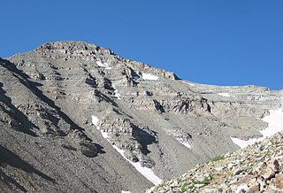
Castle Peak is the ninth highest summit of the Rocky Mountains of North America and the U.S. state of Colorado. The prominent 14,272-foot (4350.20 m) fourteener is the highest summit of the Elk Mountains and the Maroon Bells-Snowmass Wilderness. The peak is located 11.6 miles (18.7 km) northeast by north of the Town of Crested Butte, Colorado, United States, on the drainage divide separating Gunnison National Forest and Gunnison County from White River National Forest and Pitkin County. The summit of Castle Peak is the highest point of both counties.
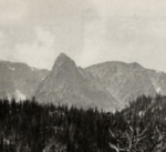
The Mummy Range is a mountain range in the Rocky Mountains of northern Colorado in the United States. The range is a short subrange of the Front Range located in southwestern Larimer County northwest of the town of Estes Park. It is located largely within Rocky Mountain National Park, extending north from Trail Ridge Road approximately 15 mi (24 km). The Arapaho name is "nooku-bee3ei-no," which translates to "White Owls."

Mount Princeton is a high and prominent mountain summit of the Collegiate Peaks in the Sawatch Range of the Rocky Mountains of North America. The 14,200.1 feet (4,328 m) fourteener is located in San Isabel National Forest, 7.8 miles (12.6 km) southwest of the Town of Buena Vista in Chaffee County, Colorado, United States. The mountain was named in honor of Princeton University.
The Sør Rondane Mountains are a group of mountains about 100 miles (160 km) long with main peaks rising to 3400 m, between the Queen Fabiola Mountains and Wohlthat Mountains in Queen Maud Land. They were discovered and photographed from the air by members of the Lars Christensen Expedition (LCE) on February 6, 1937, and named after Rondane, a mountain massif in southern Norway. The mountains and their constituent features were mapped in greater detail and named in 1957 by Norwegian cartographers working with air photos taken by U.S. Navy Operation Highjump, 1946–47.

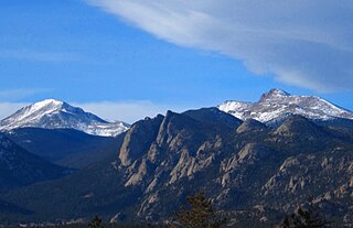
Mount Meeker is a high mountain summit of the Twin Peaks Massif in the northern Front Range of the Rocky Mountains of North America. The 13,916-foot (4,242 m) thirteener is located in the Rocky Mountain National Park Wilderness, 4.8 miles (7.7 km) west by north of the community of Allenspark in Boulder County, Colorado, United States.
The Batterbee Mountains are a group of prominent mountains rising to 2,200 metres (7,200 ft), which forms part of the dissected edge of Dyer Plateau overlooking George VI Sound, on the west coast of Palmer Land. First seen and photographed from the air by Lincoln Ellsworth on 23 November 1935, they were charted from the ground in October 1936 by the British Graham Land Expedition (BGLE) under John Rymill, and named after Sir Harry Batterbee (1880–1976), Assistant Under-Secretary of State, Dominions Office, 1930–38, and Chairman of the Polar Committee in 1934, who gave help to the expedition.