Grand Lake, Colorado | |
---|---|
Town of Grand Lake [1] | |
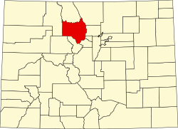
Location of the Town of Grand Lake in the United States. | |
Coordinates: 40°15′2″N105°49′28″W / 40.25056°N 105.82444°W | |
Country | United States |
State | Colorado |
County | Grand County [1] |
Established | 1879 |
Incorporated (town) | June 23, 1944 [2] |
Government | |
• Type | Statutory Town [1] |
Area | |
• Total | 1.034 sq mi (2.679 km2) |
• Land | 1.032 sq mi (2.672 km2) |
• Water | 0.003 sq mi (0.007 km2) |
Elevation | 8,439 ft (2,572 m) |
Population | |
• Total | 410 |
• Density | 400/sq mi (150/km2) |
Time zone | UTC−07:00 (MST) |
• Summer (DST) | UTC−06:00 (MDT) |
ZIP code [6] | 80447 |
Area code | 970 |
FIPS code | 08-31715 |
GNIS feature ID | 2412701 [4] |
Website | www |
The Town of Grand Lake is a statutory town located in Grand County, Colorado, United States. [1] The town population was 410 at the 2020 United States Census. [5]
Established in 1881, Grand Lake sits at an elevation of 8,369 feet (2,551 m) and derives its name from the lake on whose shores it is situated: Grand Lake, the largest natural body of water in Colorado. The town of Grand Lake was originally an outfitting and supply point for the mining settlements of Lulu City, Teller City, and Gaskill, but today is a tourist destination adjacent to the western entrance to Rocky Mountain National Park, which surrounds the lake and the town on three sides. Grand Lake was the Grand County seat of government from 1882 to 1888. It was incorporated on June 23, 1944. [2]
The Kauffman House is an NRHP-listed rustic log house that functioned as a hotel from its construction in 1892 until 1946. The Grand Lake Area Historical Society purchased the house in 1973 and converted it into a museum as the only pre-20th century log hotel remaining in Grand Lake. [7] [8]
Frederick Nicholas Selak (1865–1926) was an early pioneer of the Grand Lake area. He operated a stage line with his brother as well as saloons and other businesses in the early days of Grand Lake. When he died he owned 300 acres of land in and around Grand Lake as well as interest in two mining operations. [9] [10]
In 1926 Selak lived alone in a small log cabin about 3 miles outside of Grand Lake. He was referred to as "The Hermit of Grand Lake", but was known to have loaned money to locals, and rumored to have stashed up to $500,000 on his property. After friends became concerned they had not seen Selak for over a week, they checked on him, found his house had been ransacked, floorboards torn up, and Selak nowhere to be found. An investigation by the local Sheriff was unable to identify any leads. [10] The intrigue surrounding the hermit and his wealth made the crime mystery a national story. An article in True Detective Mysteries magazine described the crime in the June 1930 issue. The article had the title Echo Mountain′s Hanging Spectre and was written by A. G. Gertz of The Denver Post . [11]
Selak's sister in California, Lillian Coffee, and her husband, Lawrence W. Coffee, were notified when Selak went missing. The two traveled to Colorado to assist in locating her brother. Lawrence Coffee was credited for helping identify the two suspects that would later confess to Selak's murder. [12]
The two men had hanged Selak July 21 as retaliation related to a fencing dispute. When found on August 17, Selak's remains were still hanging from the pine tree where he was killed almost a month earlier. Selak's murderers said they only found $75 and some old coins when they searched Selak's property. It was the coins that alerted Coffee as to who the perpetrators might be. [13] Rumors of the hidden cash persisted. In March 1927, convinced there must be more valuables or cash stashed somewhere on the property, the townspeople planned a search of his property as soon as the snow cleared. [14] [15]
The two perpetrators, Arthur Osborn, 22 at the time of the murder, and his cousin, Ray Noakes, 21, were found guilty and given the death penalty. Like the man they killed, they themselves were hanged. They were executed in Cañon City, Colorado, on March 30, 1928. [16]
On October 14, 2020, the East Troublesome Fire ignited north of Parshall. The wildfire rapidly spread eastward toward Grand Lake and into Rocky Mountain National Park. As many as 794 firefighters fought the wildfire as it consumed 193,812 acres (784 km2) of forest and rangeland to become the second most extensive Colorado wildfire in recorded history. Thousands were evacuated, more than 300 homes were destroyed, and two residents were killed. The wildfire became the most expensive in Colorado history with insured losses alone of $543 million.
Grand Lake is located in northeastern Grand County. U.S. Route 34 (Trail Ridge Road) runs through the western side of the town, entering Rocky Mountain National Park just north of town and leading 45 miles (72 km) across the mountains to Estes Park. To the southwest, US 34 leads 15 miles (24 km) to Granby.
At the 2020 United States Census, the town had a total area of 662 acres (2.679 km2) including 1.7 acres (0.007 km2) of water. [3]
Due to its elevation, Grand Lake has a subalpine climate (Köppen climate classification Dfc) with a short growing season, averaging just 49 days per year. [17] Temperatures are chilly at night even through the summer months, and only three months have an average temperature of above 10 °C (50 °F).
Climate data for Grand Lake, Colorado, 1991–2020 normals, extremes 1939–present | |||||||||||||
---|---|---|---|---|---|---|---|---|---|---|---|---|---|
Month | Jan | Feb | Mar | Apr | May | Jun | Jul | Aug | Sep | Oct | Nov | Dec | Year |
Record high °F (°C) | 53 (12) | 56 (13) | 67 (19) | 73 (23) | 82 (28) | 89 (32) | 92 (33) | 92 (33) | 89 (32) | 80 (27) | 68 (20) | 55 (13) | 92 (33) |
Mean maximum °F (°C) | 45.5 (7.5) | 48.6 (9.2) | 56.6 (13.7) | 64.4 (18.0) | 73.9 (23.3) | 81.7 (27.6) | 85.8 (29.9) | 82.8 (28.2) | 78.9 (26.1) | 70.5 (21.4) | 56.8 (13.8) | 45.6 (7.6) | 86.5 (30.3) |
Mean daily maximum °F (°C) | 30.2 (−1.0) | 34.3 (1.3) | 42.2 (5.7) | 49.1 (9.5) | 59.2 (15.1) | 70.5 (21.4) | 75.9 (24.4) | 73.3 (22.9) | 67.6 (19.8) | 54.9 (12.7) | 40.1 (4.5) | 30.0 (−1.1) | 52.3 (11.3) |
Daily mean °F (°C) | 17.4 (−8.1) | 20.3 (−6.5) | 28.0 (−2.2) | 34.8 (1.6) | 43.4 (6.3) | 52.3 (11.3) | 57.8 (14.3) | 55.8 (13.2) | 49.7 (9.8) | 39.0 (3.9) | 26.7 (−2.9) | 17.5 (−8.1) | 36.9 (2.7) |
Mean daily minimum °F (°C) | 4.5 (−15.3) | 6.4 (−14.2) | 13.7 (−10.2) | 20.5 (−6.4) | 27.7 (−2.4) | 34.2 (1.2) | 39.8 (4.3) | 38.4 (3.6) | 31.8 (−0.1) | 23.1 (−4.9) | 13.2 (−10.4) | 5.1 (−14.9) | 21.5 (−5.8) |
Mean minimum °F (°C) | −16.6 (−27.0) | −14.5 (−25.8) | −7.3 (−21.8) | 4.7 (−15.2) | 16.5 (−8.6) | 26.3 (−3.2) | 33.0 (0.6) | 31.4 (−0.3) | 21.9 (−5.6) | 8.6 (−13.0) | −7.7 (−22.1) | −15.6 (−26.4) | −21.0 (−29.4) |
Record low °F (°C) | −46 (−43) | −42 (−41) | −36 (−38) | −21 (−29) | −1 (−18) | 16 (−9) | 21 (−6) | 18 (−8) | 7 (−14) | −24 (−31) | −28 (−33) | −35 (−37) | −46 (−43) |
Average precipitation inches (mm) | 1.65 (42) | 1.50 (38) | 1.23 (31) | 1.55 (39) | 1.59 (40) | 1.36 (35) | 1.98 (50) | 2.09 (53) | 1.59 (40) | 1.27 (32) | 1.29 (33) | 1.50 (38) | 18.60 (472) |
Average snowfall inches (cm) | 30.6 (78) | 25.1 (64) | 17.6 (45) | 17.1 (43) | 5.3 (13) | 0.4 (1.0) | 0.0 (0.0) | 0.0 (0.0) | 0.4 (1.0) | 7.4 (19) | 22.5 (57) | 28.5 (72) | 154.9 (393) |
Average extreme snow depth inches (cm) | 25.6 (65) | 30.5 (77) | 30.1 (76) | 19.2 (49) | 3.7 (9.4) | 0.2 (0.51) | 0.0 (0.0) | 0.0 (0.0) | 0.1 (0.25) | 4.4 (11) | 9.3 (24) | 17.5 (44) | 33.3 (85) |
Average precipitation days (≥ 0.01 in) | 14.8 | 13.2 | 11.6 | 11.1 | 12.3 | 10.5 | 13.6 | 15.3 | 11.9 | 9.5 | 10.9 | 13.8 | 148.5 |
Average snowy days (≥ 0.1 in) | 14.5 | 12.1 | 8.7 | 6.6 | 1.8 | 0.2 | 0.0 | 0.0 | 0.4 | 3.3 | 9.4 | 13.5 | 70.5 |
Source 1: NOAA [17] | |||||||||||||
Source 2: National Weather Service [18] |
Grand Lake is Colorado's largest and deepest natural lake, and is part of the headwaters of the Colorado River. The lake became a component in the Colorado-Big Thompson Project (C-BT) in 1937, when it was recruited as a conduit for C-BT project water. The C-BT project diverts water from the Colorado River Basin east via the Alva B. Adams Tunnel under the Continental Divide and Rocky Mountain National Park to the Big Thompson River watershed, thence the South Platte River and ultimately the Mississippi River basin.
Grand Lake Yacht Club is a private club that hosts sailing races on the lake, and there are also publicly and privately operated marinas, a public boat ramp, and public boat docks on the lake.
Census | Pop. | Note | %± |
---|---|---|---|
1950 | 309 | — | |
1960 | 170 | −45.0% | |
1970 | 189 | 11.2% | |
1980 | 382 | 102.1% | |
1990 | 259 | −32.2% | |
2000 | 447 | 72.6% | |
2010 | 471 | 5.4% | |
2020 | 410 | −13.0% | |
U.S. Decennial Census |
The image to the right features a vintage post card of Grand Lake in its early days as a tourist attraction. The description reads: "Shadow Mt. Lake and Granby reservoir are a vast new development for fishing, cabins and water sports."
Grand Lake is home to the Rocky Mountain Repertory Theatre. This summer stock theatre company produces various theatrical productions throughout the year, usually three Broadway musicals from June through August and one musical in September. In the spring of 2010, a new 12,000-square-foot (1,100 m2) theatre complex was built for the Rocky Mountain Repertory Theatre in Grand Lake.
Grand Lake citizens call a block of boutiques and shops the Boardwalk. The Boardwalk is all small owned and operated and has no chain restaurants or shops. At the boardwalk you can find anything from coffee shops and restaurants to tourist shops, boutiques, and homemade jewelry. [19]
Colorado is a state in the Western United States. It is one of the Mountain states, sharing the Four Corners region with Arizona, New Mexico, and Utah. It is also bordered by Wyoming to the north, Nebraska to the northeast, Kansas to the east, and Oklahoma to the southeast. Colorado is noted for its landscape of mountains, forests, high plains, mesas, canyons, plateaus, rivers, and desert lands. It encompasses most of the Southern Rocky Mountains, as well as the northeastern portion of the Colorado Plateau and the western edge of the Great Plains. Colorado is the eighth most extensive and 21st most populous U.S. state. The United States Census Bureau estimated the population of Colorado at 5,877,610 as of July 1, 2023, a 1.80% increase since the 2020 United States census.
Larimer County is a county located in the U.S. state of Colorado. As of the 2020 census, the population was 359,066. The county seat and most populous city is Fort Collins. The county was named for William Larimer, Jr., the founder of Denver.
Allenspark is an unincorporated town, a post office, and a census-designated place (CDP) located in and governed by Boulder County, Colorado, United States. The CDP is a part of the Boulder, CO Metropolitan Statistical Area. The Allenspark post office has the ZIP code 80510. At the United States Census 2020, the population of the Allenspark CDP was 568.
The Town of Granby is the Statutory Town that is the most populous municipality in Grand County, Colorado, United States. The town population was 2,079 at the 2020 United States Census. Granby is situated along U.S. Highway 40 in the Middle Park basin, and it is about 85 miles (137 km) northwest of Denver and 14 miles (23 km) southwest of Rocky Mountain National Park.
Estes Park is a statutory town in Larimer County, Colorado, United States. The town population was 5,904 at the 2020 United States Census. Estes Park is a part of the Fort Collins, CO Metropolitan Statistical Area and the Front Range Urban Corridor. A popular summer resort and the location of the headquarters for Rocky Mountain National Park, Estes Park lies along the Big Thompson River. Landmarks include The Stanley Hotel and The Baldpate Inn. The town overlooks Lake Estes and Olympus Dam.
Rocky Mountain National Park is a national park of the United States located approximately 55 mi (89 km) northwest of Denver in north-central Colorado, within the Front Range of the Rocky Mountains. The park is situated between the towns of Estes Park to the east and Grand Lake to the west. The eastern and western slopes of the Continental Divide run directly through the center of the park with the headwaters of the Colorado River located in the park's northwestern region. The main features of the park include mountains, alpine lakes and a wide variety of wildlife within various climates and environments, from wooded forests to mountain tundra.
The Big Thompson River is a tributary of the South Platte River, approximately 78 miles (126 km) long, in the U.S. state of Colorado. Originating in Forest Canyon in Rocky Mountain National Park, the river flows into Lake Estes in the town of Estes Park and then through Big Thompson Canyon. It includes four crossings/bridges which are listed on the U.S. National Register of Historic Places.
Trail Ridge Road is the name for the 48-mile (77 km) stretch of U.S. Highway 34 that traverses Rocky Mountain National Park from Estes Park, Colorado in the east to Grand Lake, Colorado in the west. Together with the connecting 6.9-mile (11 km) Beaver Meadow Road, Trail Ridge Road forms the 55-mile (89 km) Trail Ridge Road/Beaver Meadow National Scenic Byway, an All-American Road. With a high point at 12,183 feet (3,713 m) elevation, Trail Ridge Road is the highest continuous paved road in North America. The higher portion of Trail Ridge Road is closed from October to May.
The Stanley Hotel is a 140-room Colonial Revival hotel in Estes Park, Colorado, United States, about five miles from the entrance to Rocky Mountain National Park. It was built by Freelan Oscar Stanley, co-founder of the Stanley Motor Carriage Company, and opened on July 4, 1909, as a resort for upper-class Easterners and a health retreat for sufferers of pulmonary tuberculosis. The hotel and its surrounding structures are listed on the National Register of Historic Places. Today, the hotel includes a restaurant, spa, and bed-and-breakfast; with panoramic views of Lake Estes, the Rockies, and Longs Peak.
Middle Park is a high basin in the Rocky Mountains of north-central Colorado in the United States. It is located in Grand County, on the southwest slope of Rocky Mountain National Park, approximately 50 miles (80 km) west of Boulder.
Grand Lake is Colorado's largest and deepest natural lake. It is located in the headwaters of the Colorado River in Grand County, Colorado. On its north shore is located the historic and eponymous town of Grand Lake. The lake was formed during the Pinedale glaciation, which occurred from 30000 BC to 10000 BC. The glacial terminal moraine created a natural dam. Natural tributaries to the lake are the North Inlet and East Inlet, both of which flow out of Rocky Mountain National Park, which surrounds the lake on three sides. Grand Lake is located 1 mile from the Park's western entrance. Grand Lake was named Spirit Lake by the Ute Tribe because they believed the lake's cold waters to be the dwelling place of departed souls.
The Colorado–Big Thompson Project is a federal water diversion project in Colorado designed to collect West Slope mountain water from the headwaters of the Colorado River and divert it to Colorado's Front Range and plains. In Colorado, approximately 80% of the state's precipitation falls on the West Slope, in the Rocky Mountains, while around 80% of the state's growing population lives along the eastern slope, between the cities of Fort Collins and Pueblo.
The geography of the U.S. State of Colorado is diverse, encompassing both rugged mountainous terrain, vast plains, desert lands, desert canyons, and mesas. Colorado is a landlocked U.S. state. In 1861, the United States Congress defined the boundaries of the new Territory of Colorado exclusively by lines of latitude and longitude, stretching from 37°N to 41°N latitude, and from 102°02'48"W to 109°02'48"W longitude. Starting in 1868, official surveys demarcated the boundaries, deviating from the parallels and meridians in several places. Later surveys attempted to correct some of these mistakes but in 1925 the U.S. Supreme Court affirmed that the earlier demarcation was the official boundary. The borders of Colorado are now officially defined by 697 boundary markers connected by straight boundary lines. Colorado, Wyoming, and Utah are the only states that have their borders defined solely by straight boundary lines with no natural features. The southwest corner of Colorado is the Four Corners Monument at 36°59'56"N, 109°2'43"W. This is the only place in the United States where four states meet: Colorado, New Mexico, Arizona, and Utah.
The Never Summer Wilderness is a U.S. Wilderness Area located immediately west of Rocky Mountain National Park in the Never Summer Mountains of Arapaho National Forest in northern Colorado. It encompasses an area of 21,090 acres and includes both forest and alpine tundra, with a minimum elevation of 8,900 feet. It is part of the Sulphur Ranger District.
The 2012 Colorado wildfires were an unusually devastating series of Colorado wildfires, including several separate fires that occurred throughout June, July, and August 2012. At least 34,500 residents were evacuated in June.
History of Rocky Mountain National Park began when Paleo-Indians traveled along what is now Trail Ridge Road to hunt and forage for food. Ute and Arapaho people subsequently hunted and camped in the area. In 1820, the Long Expedition, led by Stephen H. Long for whom Longs Peak was named, approached the Rockies via the Platte River. Settlers began arriving in the mid-1800s, displacing the Native Americans who mostly left the area voluntarily by 1860, while others were removed to reservations by 1878.
The Cameron Peak fire was a wildfire that started near Chambers Lake, Colorado, 25 miles (40 km) east of Walden and 15 miles (24 km) southwest of Red Feather Lakes near Cameron Pass on August 13, 2020, and was declared 100% contained on December 2, 2020. The fire burnt 208,663 acres through the Arapaho and Roosevelt National Forests in Larimer and Jackson Counties and Rocky Mountain National Park. At its peak, the fire forced the evacuation of over 6,000 residents in Estes Park, Chambers Lake, Rustic, Glacier View Meadows, Red Feather Lakes, Masonville, Glen Haven, Spring Canyon, various small communities along Highway 14, Stove Prairie Landing Road, as well as the Colorado State University Mountain Campus and had over 1,000 personnel fighting the fire. 469 structures were destroyed by the fire, including 220 outbuildings and 42 primary residences. The fire became the largest wildfire in Colorado history, surpassing the Pine Gulch Fire, which had set the same mark just seven weeks prior.
The 2020 East Troublesome Fire was a massive and destructive wildfire, and the second-largest in the history of the U.S. state of Colorado. Named for the East Fork of Troublesome Creek, close to the fire's point of origin in the Arapaho National Forest, the fire burned 193,812 acres (78,433 ha) between its ignition on October 14, 2020, and its containment on November 30. The fire destroyed 555 structures and killed two people, devastating portions of the community of Grand Lake. The majority of the fire's burned acreage and structural losses accrued on October 21, when the fire burned more than 100,000 acres (40,000 ha) in a single day.