The settlement started with only a general store, run by a man named Rudolph "Kare" Kremmling, built on the north side of Muddy Creek. In 1881, two brothers, Aaron and John Kinsey, made part of their ranch into a town and called it Kinsey City. Kare moved his store across the river to the new site and soon people were calling this place Kremmling. The original post office was called Kinsey City and ran from 1881 to 1885, with Kare Kremmling the first postmaster. The name Kremmling was not officially recognized until 1895. After the Moffat railroad—the Denver, Northwestern & Pacific Railway—arrived in July 1906, Kremmling became the county's central shipping point. It was incorporated May 14, 1904. In the 20th century, ranching became the main industry in the valley in the vicinity of the town. In 1906, Kasper Schuler built the first brick building in town. The Schuler bottling works occupied the first floor, while the Schuler House, a boarding house run by Miss Kienholz, occupied the second. In 1933, the building became the Hotel Eastin.
Kremmling was featured in W. Eugene Smith's photographic essay "Country Doctor" in the September 20, 1948, issue of LIFE.[7]
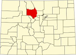
Geography
According to the United States Census Bureau, the town has a total area of 1.3 square miles (3.4km2), all of it land.
The town is located approximately at the mouth of both the Blue River, which descends from the south, and Muddy Creek, which descends from the north. This location provides valley access to Dillon, Colorado, and the ski resorts of Summit County, and Rabbit Ears Pass (renowned for world-class snowmobiling) at the Continental Divide, which then descends into Steamboat Springs.
This climate type is dominated by the winter season, a long, bitterly cold period with short, clear days, relatively little precipitation mostly in the form of snow, and low humidity. According to the Köppen Climate Classification system, Kremmling has a continental climate, abbreviated "Dfb" on climate maps.[8]
Climate data for Kremmling, Colorado, 1991–2020 normals, extremes 1908–present
This page is based on this Wikipedia article Text is available under the CC BY-SA 4.0 license; additional terms may apply. Images, videos and audio are available under their respective licenses.