Strasburg, Colorado | |
|---|---|
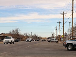
 Aerial photo of Strasburg | |
 Location of the Strasburg CDP in Adams and Arapahoe County, Colorado. | |
 Strasburg Location of the Strasburg CDP in the United States. | |
| Coordinates: 39°43′05″N104°19′10″W / 39.7180757°N 104.3194994°W [1] | |
| Country | |
| State | |
| County | Adams and Arapahoe |
| Government | |
| • Type | unincorporated town |
| Area | |
• Total | 20.830 sq mi (53.949 km2) |
| • Land | 20.805 sq mi (53.885 km2) |
| • Water | 0.025 sq mi (0.064 km2) |
| Elevation | 5,420 ft (1,652 m) |
| Population | |
• Total | 3,307 |
| • Density | 159.0/sq mi (61.37/km2) |
| Time zone | UTC-7 (MST) |
| • Summer (DST) | UTC-6 (MDT) |
| ZIP Code [4] | 80136 |
| Area codes | 303 & 720 |
| GNIS feature [2] | Strasburg CDP |
Strasburg is an unincorporated town located east of downtown Denver along the I-70 corridor. It is home to Strasburg School District 31-J, and there are several small businesses, medical clinics, and a post office. Strasburg is a census-designated place (CDP) located in and governed by Adams and Arapahoe counties, Colorado, United States. The CDP is a part of the Denver–Aurora–Lakewood, CO Metropolitan Statistical Area. Mailing addresses in the town are assigned the ZIP Code 80136. [4] At the United States Census 2020, the population of the Strasburg CDP was 3,307. [3]