Cabin Creek, Colorado

Last updated
Cabin Creek, Colorado
Usa edcp location map.svg
Red pog.svg
Cabin Creek
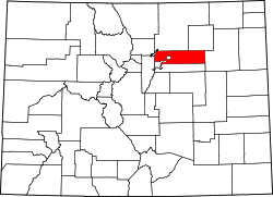
Location of Cabin Creek, Colorado.
USA Colorado location map.svg
Red pog.svg
Cabin Creek
Cabin Creek (Colorado)
Coordinates: 39°44′26″N104°01′50″W / 39.7405°N 104.0305°W / 39.7405; -104.0305 (Cabin Creek, Colorado) [1]
Country United States
State Colorado
Counties Adams & Arapahoe [2]
Government
  Type unincorporated community
  Body Adams County [2]
Arapahoe County
Elevation
[1]
5,063 ft (1,543 m)
Time zone UTC−07:00 (MST)
  Summer (DST) UTC−06:00 (MDT)
ZIP code [3]
Deer Trail 80105
Area codes 303/720/983
GNIS pop ID 185005

Cabin Creek is an unincorporated community in Adams and Arapahoe counties in the U.S. state of Colorado. [1] It is located within the Denver metropolitan area. Cabin Creek is served by the Deer Trail, Colorado, post office (ZIP code 80105). [3]

Contents

Deer Trail 26J School District serves Cabin Creek. [4]

History

Cabin Creek has never had its own post office. [5]

See also

References

  1. 1 2 3 "Cabin Creek, Colorado". Geographic Names Information System . United States Geological Survey, United States Department of the Interior . Retrieved March 29, 2025.
  2. 1 2 "Colorado Counties". Colorado Department of Local Affairs . Retrieved March 29, 2025.
  3. 1 2 "ZIP Code Lookup". United States Postal Service . Retrieved March 29, 2025.
  4. "Deer Trail School District 26J". Deer Trail School District 26J. Retrieved 2012-09-07.
  5. Bauer, William H.; Ozment, James L.; Willard, John H. (1990). Colorado Post Offices 1859–1989. Golden, Colorado: Colorado Railroad Historical Foundation. ISBN   0-918654-42-4.