Beulah, Colorado

Last updated

Beulah, Colorado
Beulah, Colorado.JPG
Beulah's gas station, general store, and post office
USA Colorado location map.svg
Red pog.svg
Beulah, Colorado
Location within the state of Colorado
Coordinates: 38°04′33″N104°59′10″W / 38.07583°N 104.98611°W / 38.07583; -104.98611
Country Flag of the United States.svg  United States
State Flag of Colorado.svg  State of Colorado
County Pueblo County
Settled1862 [1]
Elevation
[2]
6,381 ft (1,945 m)
Time zone UTC-7 (MST)
  Summer (DST) UTC-6 (MDT)
ZIP Code [3]
81023
Area code 719

Beulah is an unincorporated community and a post office located within the Beulah Valley census-designated place in Pueblo County, Colorado, United States. The Beulah Post Office has the ZIP code 81023. [3] Beulah is a part of the Beulah Valley CDP (census-designated place). Beulah lies along State Highway 78 about 21 miles southwest of Pueblo, in the foothills of the Wet Mountains.

Contents

History

The town of Mace's Hole was settled in 1862. [1] The town was named for Juan Maes, anglicized to "Mace," a bandit who used the valley for a hideout. [4] The Mace's Hole Post Office opened on April 23, 1873. [5] A local preacher took umbrage at the town's name and suggested the biblical name Beulah as a more wholesome alternative. [1] The name of the town was changed to Beulah on October 25, 1876. [5] The name is a reference to Isaiah 62:4; [6] it comes from the Hebrew for "married." [7]

Geography and climate

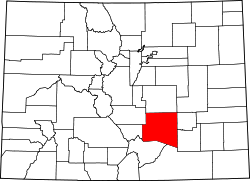
Beulah is located at 38°04′33″N104°59′10″W / 38.07583°N 104.98611°W / 38.07583; -104.98611 (38.075798,-104.986038) and lies within a valley bordered by the Wet Mountains to the west, Mt. Signal to the south and southeast, and a prominent ridge that forms the north through east sides of the valley. Elevations within the open valley itself range from about 6,150 to 7,100 feet (1,875 to 2,165 m.) Four creeks, North Creek, Middle Creek, Squirrel Creek, and South Creek flow through the valley. They all converge as they flow eastward; eventually combining into one at the valley's eastern end as the North St. Charles River, which flows into the St. Charles River southeast of Beulah and drains into the Arkansas River just west of Vineland.

Due to its location along the east-facing foothills of the Wet Mountains, Beulah is prone to significant orographic enhancement of precipitation in the form of heavy cold-season snowfall as well as significant rain in warm months mostly (in the latter case) due to effects of the North American Monsoon. Per the Köppen climate classification, Beulah has a humid continental climate (Dfb) but closely borders on up to four other subcategories depending on temperature and precipitation patterns. The average temperature in July is 71.0 °F (21.7 °C), putting it just below the 22 °C threshold for a Dfa designation. December and January average just below freezing (31.4 °F); by many American interpretations of the Köppen climate system this makes it just barely too cold to qualify as a Cfa or Cfb humid subtropical or subtropical highland climate, though such climates do exist especially to the immediate south and southeast in areas including the neighboring towns at similar elevations of Rye and Colorado City. Per the Trewartha climate classification system, Beulah clearly falls into class D (Dcb or Dcbo) as only five months of the year have a mean temperature above 10 °C and like Köppen is too wet to be classified as semi-arid or steppe (Köppen BSk) found over the vast majority of eastern Colorado and the High Plains.

Summers are mild with cool nights; daily minimum temperatures at or above 60 °F occur on only about six days per year. High temperatures of 90 °F or higher occur on about 33 days. The growing season is about 140 days in length from the first half of May until the end of September. Winters are mild and can feature days with temperatures exceeding 70 °F - the most recent of which occurred February 6, 2015 (high of 72 °F) - but periods of several consecutive days below freezing can occur and snow can fall from September through late May. Thunderstorms are common in warm months, averaging 42 days per year; hail falls on about five days. Severe thunderstorms can affect the valley, mostly with large hail (notably June 20, 2001, with hail to over two inches in diameter falling in the valley) but tornadoes have been sighted near the valley, especially in the moist months of July and August. As of June 2015 no tornado has directly struck Beulah itself.

The record high in Beulah is 101 °F, set June 26, 1994 and tied August 2, 2008. The record low is -18 °F, set on February 2, 2011; though colder temps are much more likely from lower creek-bottom locations within the valley. Annual average precipitation is about 19.3 inches (580 mm) while average yearly/seasonal snowfall is about 120 inches (305 cm.)

See also

Flag of Colorado.svg  Coloradoportal

Related Research Articles

<span class="mw-page-title-main">Subarctic climate</span> Climate characterised by long, usually very cold winters, and short, cool summers

The subarctic climate is a continental climate with long, cold winters, and short, warm to cool summers. It is found on large landmasses, often away from the moderating effects of an ocean, generally at latitudes from 50°N to 70°N, poleward of the humid continental climates. Subarctic or boreal climates are the source regions for the cold air that affects temperate latitudes to the south in winter. These climates represent Köppen climate classification Dfc, Dwc, Dsc, Dfd, Dwd and Dsd.

<span class="mw-page-title-main">Haycock Township, Bucks County, Pennsylvania</span> Township in Pennsylvania, United States

Haycock Township is a township in Bucks County, Pennsylvania, United States. The population was 2,225 at the 2010 census.

<span class="mw-page-title-main">Wet Mountain Valley</span>

The Wet Mountain Valley is a high elevation mountain valley mostly located in Custer County but extending southward into Huerfano County in south-central Colorado. Westcliffe and Silver Cliff are the two towns in the valley which is mostly devoted to cattle ranching.

The climate of Salt Lake City, Utah features cold and snowy winters, hot and dry summers, and modest to light seasonal rainfall. Lying in the Salt Lake Valley, the city is surrounded by mountains and the Great Salt Lake. Under the Köppen climate classification, Salt Lake City has either a Mediterranean climate (Csa) or dry-summer continental climate (Dsa) depending on which variant of the system is used, though it borders on a cold semi-arid climate (BSk) due to the city's relatively low precipitation.

<span class="mw-page-title-main">Climate of Minneapolis–Saint Paul</span>

The climate of Minneapolis–Saint Paul is the long term weather trends and historical events of the Minneapolis–Saint Paul metropolitan area in east central Minnesota. Minneapolis and St. Paul, together known as the Twin Cities, are the core of the 15th largest metropolitan area in the United States. With a population of 3.6 million people, the region contains approximately 60% of the population of Minnesota. Due to its location in the northern and central portion of the U.S., the Twin Cities has the coldest average temperature of any major metropolitan area in the nation. Winters are very cold, summer is warm and humid, snowfall is common in the winter and thunderstorms with heavy rainfall occur during the spring, summer and autumn. Though winter can be cold, the area receives more sunlight hours in mid-winter than many other warmer parts of the country, including all of the Great Lakes states, the Pacific Northwest, parts of the South, and almost all of the Northeast. Unless otherwise indicated, all normals data presented below are based on data at Minneapolis/St. Paul International Airport, the official Twin Cities climatology station, from the 1981−2010 normals period.

The climate of Bismarck in the U.S. state of North Dakota is humid continental, caused primarily by the combination of its mid-level latitude and location not far from the geographic centre of the U.S. Its summers are hot enough for it to border on having a Köppen Dwa classification, and precipitation is high enough for it to barely avoid being classified as semi-arid. The city's climate displays four very distinct seasons and great variation in temperatures over very short periods of time. Like other cities in the northern Great Plains, its climate is also fairly dry.

<span class="mw-page-title-main">Geography of Denver</span>

The City and County of Denver, Colorado, is located at 39°43'35" North, 104°57'56" West in the Colorado Front Range region. The Southern Rocky Mountains lie to the west of Denver and the High Plains lie to the east.

<span class="mw-page-title-main">Woss</span> Designated place in British Columbia, Canada

Woss, also commonly known as Woss Lake after the nearby lake of the same name, is a small village in the Nimpkish Valley, located 75 km (47 mi) southeast of Port McNeill and 128 km (80 mi) north of Campbell River on Highway 19, in northeastern Vancouver Island, British Columbia, Canada. The estimated population of Woss and the Nimpkish Valley is 200. The town of Woss lies about 3 km north of Woss Lake, a long, narrow lake stretching about 10 km in a primarily north-south direction with a maximum width of about one km, the southern portion of which is part of Woss Lake Provincial Park.

<span class="mw-page-title-main">Bear Creek Mountain Resort</span> Ski area in Pennsylvania, United States

Bear Creek is a ski resort in Longswamp Township, Berks County, Pennsylvania. The resort opened in 1967 and was known as the Doe Mountain until 1999. It is a year-round resort on more than 330 acres (1.3 km2) that features a variety of activities and amenities.

Oklahoma City lies in a temperate humid subtropical climate, with frequent variations in weather daily and seasonally, except during the consistently hot and humid summer months. Consistent winds, usually from the south or south-southeast during the summer, help temper the hotter weather. Consistent northerly winds during the winter can intensify cold periods. Oklahoma City's climate transitions toward semi-arid further to the west, toward humid continental to the north, and toward humid subtropical to the east and southeast. The normal annual mean temperature is 61.4 °F (16.3 °C); the coolest year was 1895 with a mean of 57.9 °F (14.4 °C), while the warmest 2012 at 64.1 °F (17.8 °C). Precipitation averages 36.52 inches (928 mm) annually, falling on an average 84 days, with the warmer months receiving more; annual precipitation has historically ranged from 15.74 in (400 mm) in 1901 to 56.95 in (1,447 mm) in 2007. The sun shines about 69% of the time, with monthly percent possible sunshine ranging from 60% in December to 80% in July.

<span class="mw-page-title-main">Climate of California</span> Overview of the climate of the U.S. state of California

The climate of California varies widely from hot desert to alpine tundra, depending on latitude, elevation, and proximity to the Pacific Coast. California's coastal regions, the Sierra Nevada foothills, and much of the Central Valley have a Mediterranean climate, with warmer, drier weather in summer and cooler, wetter weather in winter. The influence of the ocean generally moderates temperature extremes, creating warmer winters and substantially cooler summers in coastal areas.

<span class="mw-page-title-main">Climate of Alaska</span> Overview of the climate of the U.S. state of Alaska

The climate of Alaska is determined by average temperatures and precipitation received statewide over many years. The extratropical storm track runs along the Aleutian Island chain, across the Alaska Peninsula, and along the coastal area of the Gulf of Alaska which exposes these parts of the state to a large majority of the storms crossing the North Pacific. The climate in Juneau and the southeast panhandle is a mid-latitude oceanic climate, in the southern sections and a subarctic oceanic climate in the northern parts. The climate in Southcentral Alaska is a subarctic climate due to its short, cool summers. The climate of the interior of Alaska is best described as extreme and is the best example of a true subarctic climate, as the highest and lowest recorded temperatures in Alaska have both occurred in the interior. The climate in the extreme north of Alaska is an Arctic climate with long, cold winters, and cool summers where snow is possible year-round.

<span class="mw-page-title-main">Climate of Texas</span> Overview of the climate of the U.S. state of Texas

Texas' weather varies widely, from arid in the west to humid in the east. The huge expanse of Texas encompasses several regions with distinctly different climates: Northern Plains, Trans-Pecos Region, Texas Hill Country, Piney Woods, and South Texas. Generally speaking, the part of Texas that lies to the east of Interstate 35 is subtropical, while the portion that lies to the west of Interstate 35 is arid desert.

<span class="mw-page-title-main">Climate of the United States</span> Varies due to changes in latitude, and a range of geographic features

The climate of the United States varies due to changes in latitude, and a range of geographic features, including mountains and deserts. Generally, on the mainland, the climate of the U.S. becomes warmer the further south one travels, and drier the further west, until one reaches the West Coast.

<span class="mw-page-title-main">Climate of South Carolina</span> Overview of the climate of the U.S. state of South Carolina

South Carolina has a humid subtropical climate, with hot summers throughout most of the state. But, an exception does occur in the Blue Ridge Mountains, as outlier pockets of an Oceanic Climate do exist. Mild winters predominate in the eastern and southern part of the state, but cool to occasionally cold winters are the standard in the northwestern area of the state, especially areas at or above 600 feet in elevation. On average, between 40 and 80 inches of precipitation falls annually across the state, potentially even in excess of 100 inches in portions of the Appalachian temperate rainforest. Tropical cyclones, and afternoon thunderstorms due to hot and humid conditions, contribute to precipitation during the summer and sometimes fall months, while extratropical cyclones contribute to precipitation during the fall, winter, and spring months. The coast experiences nearly all of their tropical weather impacts from storms coming directly from the Atlantic coast. The northwestern area of the state can receive impacts from both Atlantic basin storms moving westward from the coast and also occasionally very heavy rainfall and flooding from storms originating from the Gulf of Mexico that move inland towards the northeast after making landfall from the Florida Panhandle to Louisiana.

<span class="mw-page-title-main">Geography of Wyoming</span> Overview of the Geography of Wyoming

The U.S. state of Wyoming lies in the Mountain West subregion of the Western United States and has a varied geography. It is bordered by Montana to the north and northwest, South Dakota and Nebraska to the east, Idaho to the west, Utah to the southwest, and Colorado to the south. Wyoming is the least populous U.S. state and has the second-lowest population density behind Alaska.

<span class="mw-page-title-main">Climate of Los Angeles</span>

The climate of Los Angeles is mild to hot year-round, and mostly dry. It is classified as a Mediterranean climate, which is a type of dry subtropical climate. It is characterized by seasonal changes in rainfall—with a dry summer and a winter rainy season. Under the modified Köppen climate classification, the coastal areas are classified as Csb, and the inland areas as Csa.

<span class="mw-page-title-main">Climate of Alabama</span> Overview of the climate of the U.S. state of Alabama

The state of Alabama is classified as humid subtropical (Cfa) under the Köppen climate classification. The state's average annual temperature is 64 °F (18 °C). Temperatures tend to be warmer in the state's southern portion with its proximity to the Gulf of Mexico, while its northern portions, especially in the Appalachian Mountains in the northeast, tend to be slightly cooler. Alabama generally has hot, humid summers and mild winters with copious precipitation throughout the year. The state receives an average of 56 inches (1,400 mm) of rainfall each year and experiences a lengthy growing season of up to 300 days in its southern portion. Hailstorms occur occasionally during the spring and summer here, but they are seldom destructive. Heavy fogs are rare, and they are confined chiefly to the coast. Thunderstorms also occur year-around. They are most common in the summer, but they are most commonly severe during the spring and late autumn. That is when destructive winds and tornadoes occur frequently, especially in the northern and central parts of the state. Central and northern Alabama are squarely within Dixie Alley, the primary area in the U.S. outside the Southern Plains with relatively high tornado risk. Alabama is ranked second in the U.S for the deadliest tornadoes. Hurricanes are quite common in the state, especially in the southern part. Major hurricanes occasionally strike the coast, such as Hurricane Frederic in September 1979 and Hurricane Ivan in September 2004; both storms resulted in significant to devastating damage in the Mobile area.

<span class="mw-page-title-main">Climate of Oregon</span> Current climate details for Oregon

According to the Köppen climate classification, most of Western Oregon has a warm-summer Mediterranean climate, which features warm, dry summers, and wet winters with frequent overcast and cloudy skies. Eastern Oregon falls into the cold semi-arid climate, which features drier weather.

<span class="mw-page-title-main">Climate of Little Rock, Arkansas</span>

Little Rock has a humid subtropical climate, with hot, usually humid summers, but subject to drought, primarily in late summer. According to the Trewartha climate classification system, Little Rock is subtropical because nine of its months exceed 50 °F (10 °C) in average temperature. Summers are usually hot, occasionally extremely hot; winters are short and cool, but with marked temperature variations, as the area is subject to alternating incursions of warm, moist air from the Gulf of Mexico and cold, dry air from Canada.

References

  1. 1 2 3 Eichler, Geo. R. (1977). Colorado Place Names. Boulder, Colo.: Johnson Publishing Company. LCCN   77-89726.
  2. "US Board on Geographic Names". United States Geological Survey. October 25, 2007. Retrieved January 31, 2008.
  3. 1 2 "Look Up a ZIP Code". United States Postal Service . Retrieved November 23, 2020.
  4. Dawson, John Frank (1954). Place names in Colorado: why 700 communities were so named, 150 of Spanish or Indian origin. Denver, CO: The J. Frank Dawson Publishing Co. p. 9.
  5. 1 2 Bauer, William H.; James L. Ozment; John H. Willard (1990). Colorado Post Offices 1859-1989. Denver, Co.: The Colorado Railroad Museum. ISBN   0-918654-42-4. LCCN   90-034759.
  6. "Isaiah 62:4-5 KJV - - Bible Gateway".
  7. "Answers - the Most Trusted Place for Answering Life's Questions". Answers.com .