Baxter, Colorado | |
|---|---|
 Looking west along Aldred Road in Baxter. (2023) | |
 Baxter Location of Baxter, Colorado.  Baxter Baxter (Colorado) | |
| Coordinates: 38°16′33″N104°29′30″W / 38.2758°N 104.4916°W [1] | |
| Country | United States |
| State | Colorado |
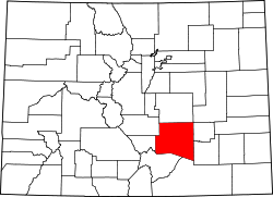
| County | Pueblo [2] |
| Government | |
| • Type | unincorporated community |
| • Body | Pueblo County [2] |
| Elevation | 4,607 ft (1,404 m) |
| Time zone | UTC−07:00 (MST) |
| • Summer (DST) | UTC−06:00 (MDT) |
| GNIS pop ID | 203691 |
Baxter is an unincorporated community in Pueblo County, in the U.S. state of Colorado. [1]
Contents
The community has the name of O.H.P. Baxter, a local settler. [3] Baxter has never had a post office. [4]