Boone, Colorado

Last updated

Boone, Colorado
Boone Santa Fe Railroad Depot.JPG
The old Boone Santa Fe Railroad depot that now serves as the town hall.
Pueblo County Colorado Incorporated and Unincorporated areas Boone Highlighted 0807795.svg
Location of the Town of Boone in Pueblo County, Colorado.
Usa edcp location map.svg
Red pog.svg
Boone
Location of the Town of Boone in the United States.
Coordinates: 38°15′02″N104°15′27″W / 38.25056°N 104.25750°W / 38.25056; -104.25750 [2]
Country Flag of the United States.svg  United States
State Flag of Colorado.svg  Colorado
County Pueblo County [1]
Incorporated (town) September 22, 1956 [3]
Government
  Type Statutory Town [1]
Area
[4]
  Total0.388 sq mi (1.006 km2)
  Land0.379 sq mi (0.981 km2)
  Water0.010 sq mi (0.025 km2)
Elevation
[2]
4,475 ft (1,364 m)
Population
 (2020) [4]
  Total305
  Density805/sq mi (311/km2)
   Metro
168,162 (257th)
   CSA
217,101 (186th)
   Front Range
5,055,344
Time zone UTC−07:00 (MST)
  Summer (DST) UTC−06:00 (MDT)
ZIP code
81025 [5]
Area code 719
FIPS code 08-07795
GNIS feature ID2411709 [2]
Highways Colorado 96.svg SH 96
Colorado 209.svg SH 209

Boone is a Statutory Town located in Pueblo County, Colorado, United States. [1] The town population was 305 at the 2020 United States Census. [4]

Contents

History

Boone was founded as Booneville during the Pikes Peak Gold Rush by Albert Gallatin Boone, a grandson of Daniel Boone. Boone was the first postmaster and for a brief time Indian agent to the Cheyenne and Arapaho. [6] [7]

Geography

At the 2020 United States Census, the town had a total area of 249 acres (1.006 km2) including 6.2 acres (0.025 km2) of water. [4]

Demographics

Historical population
CensusPop.Note
1960 548
1970 448−18.2%
1980 431−3.8%
1990 341−20.9%
2000 323−5.3%
2010 3395.0%
2020 305−10.0%
U.S. Decennial Census

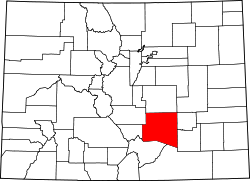
Boone is a part of the Pueblo, CO Metropolitan Statistical Area and the Front Range Urban Corridor.

As of the census [8] of 2000, there were 323 people, 131 households, and 89 families residing in the town. The population density was 719.7 inhabitants per square mile (277.9/km2). There were 148 housing units at an average density of 329.8 per square mile (127.3/km2). The racial makeup of the town was 93.50% White, 0.62% African American, 0.62% Native American, 1.55% from other races, and 3.72% from two or more races. Hispanic or Latino of any race were 31.58% of the population.

There were 131 households, out of which 26.0% had children under the age of 18 living with them, 50.4% were married couples living together, 14.5% had a female householder with no husband present, and 31.3% were non-families. 26.0% of all households were made up of individuals, and 14.5% had someone living alone who was 65 years of age or older. The average household size was 2.38 and the average family size was 2.84.

In the town, the population was spread out, with 23.2% under the age of 18, 7.1% from 18 to 24, 22.6% from 25 to 44, 22.3% from 45 to 64, and 24.8% who were 65 years of age or older. The median age was 43 years. For every 100 females, there were 88.9 males. For every 100 females age 18 and over, there were 89.3 males.

The median income for a household in the town was $26,250, and the median income for a family was $26,964. Males had a median income of $26,563 versus $21,875 for females. The per capita income for the town was $18,628. About 7.8% of families and 16.0% of the population were below the poverty line, including 28.9% of those under age 18 and 13.0% of those age 65 or over.

See also

Related Research Articles

<span class="mw-page-title-main">Pueblo County, Colorado</span> County in Colorado, United States

Pueblo County is a county located in the U.S. state of Colorado. As of the 2020 census, the population was 168,162. The county seat is Pueblo. The county was named for the historic city of Pueblo which took its name from the Spanish language word meaning "town" or "village". Pueblo County comprises the Pueblo, CO Metropolitan Statistical Area.

<span class="mw-page-title-main">Otero County, Colorado</span> County in Colorado, United States

Otero County is a county located in the U.S. state of Colorado. As of the 2020 census, the population was 18,690. The county seat is La Junta. The county was named for Miguel Antonio Otero, one of the founders of the town of La Junta and a member of a prominent Hispanic family.

<span class="mw-page-title-main">Everton, Arkansas</span> Town in Arkansas, United States

Everton is a town in Boone County, Arkansas, United States. The population was 133 at the 2010 census. It is part of the Harrison Micropolitan Statistical Area.

<span class="mw-page-title-main">Bayfield, Colorado</span> Town in Colorado, United States

Bayfield is a Statutory Town located in La Plata County, Colorado, United States. The town population was 2,838 at the 2020 United States Census, a +21.65% increase since the 2010 United States Census. Bayfield is part of the Durango, CO Micropolitan Statistical Area.

<span class="mw-page-title-main">Dolores, Colorado</span> Town in Montezuma County, Colorado, United States

Dolores is a Statutory Town located in Montezuma County, Colorado, United States. The town population was 885 at the 2020 United States Census.

<span class="mw-page-title-main">Nucla, Colorado</span> Town in Colorado, United States

Nucla is a statutory town in Montrose County, Colorado, United States. The population was 585 as of the 2020 census, down from 711 in 2010. Its name comes from the town founders' intent that it serve as a "nucleus" for the surrounding farms and mines, although it has since come to be associated with the growth of uranium mining in the region.

<span class="mw-page-title-main">Cheraw, Colorado</span> Town in Otero County, Colorado, United States

Cheraw is a Statutory Town located in Otero County, Colorado, United States. The town population was 237 at the 2020 United States Census.

<span class="mw-page-title-main">Manzanola, Colorado</span> Town in Otero County, Colorado, United States

Manzanola is a Statutory Town in Otero County, Colorado, United States. The town population was 341 at the 2020 United States Census.

<span class="mw-page-title-main">Rocky Ford, Colorado</span> City in Otero County, Colorado, United States

Rocky Ford is a statutory city located in Otero County, Colorado, United States. The population was 3,876 at the 2020 census.

<span class="mw-page-title-main">Swink, Colorado</span> Town in Otero County, Colorado, United States

Swink is a Statutory Town in Otero County, Colorado, United States. The population was 604 at the 2020 census.

<span class="mw-page-title-main">Rye, Colorado</span> Town in Colorado, United States

Rye is a Statutory Town in Pueblo County, Colorado, United States. The population was 206 at the 2020 census.

<span class="mw-page-title-main">Moffat, Colorado</span> Town in Saguache County, Colorado, United States

The Town of Moffat is a statutory town in Saguache County, Colorado, United States. The town population was 108 at the 2020 United States Census.

<span class="mw-page-title-main">Jamestown, Indiana</span> Town in Indiana, United States

Jamestown is a town in Jackson Township, Boone County and Eel River Township, Hendricks County, Indiana, United States. The population was 958 at the 2010 census.

<span class="mw-page-title-main">Thorntown, Indiana</span> Town in Indiana, United States

Thorntown is a town in Sugar Creek Township, Boone County, Indiana. The population was 1,520 at the time of the 2010 census. Thorntown is located in northwestern Boone County, about halfway between Lafayette and Indianapolis.

<span class="mw-page-title-main">Albion, Nebraska</span> City in Nebraska, United States

Albion is a city in and the county seat of Boone County, Nebraska, United States. The population was 1,650 at the 2010 census.

<span class="mw-page-title-main">Danville, West Virginia</span> Town in West Virginia, United States

Danville is a town in Boone County, West Virginia, United States. The population was 660 at the 2020 census. Danville was incorporated in 1911 and named for Dan Rock, the town's first postmaster. Danville was formerly known as Newport and Red House.

<span class="mw-page-title-main">Madison, West Virginia</span> City in West Virginia, United States

Madison is a city and former coal town in Boone County, West Virginia, United States. The population was 2,911 at the 2020 census. It is the county seat of Boone County.

<span class="mw-page-title-main">Sylvester, West Virginia</span> Town in West Virginia, United States

Sylvester is a town in Boone County, West Virginia, United States, along the Big Coal River. The population was 166 at the 2020 census. Sylvester was incorporated on April 11, 1952 by the Boone County Circuit Court. Sylvester bears the name of a family of settlers.

<span class="mw-page-title-main">Whitesville, West Virginia</span> Town in West Virginia, United States

Whitesville is a town and former coal town in Boone County, West Virginia, United States, along the Big Coal River. The population was 361 at the 2020 census. Whitesville was incorporated on August 15, 1935 by the Boone County Circuit Court. The town derives its name from B. W. White, a pioneer settler. Whitesville was formerly known as Jarrold's Valley and Pritchard City.

<span class="mw-page-title-main">Coal Creek, Colorado</span> Town in Colorado, United States

The Town of Coal Creek is a Statutory Town located in Fremont County, Colorado, United States. The town population was 364 at the 2020 United States Census. Coal Creek is a part of the Cañon City, CO Micropolitan Statistical Area and the Front Range Urban Corridor.

References

  1. 1 2 3 4 "Active Colorado Municipalities". Colorado Department of Local Affairs . Retrieved October 15, 2021.
  2. 1 2 3 U.S. Geological Survey Geographic Names Information System: Boone, Colorado
  3. "Colorado Municipal Incorporations". State of Colorado, Department of Personnel & Administration, Colorado State Archives. December 1, 2004. Retrieved September 2, 2007.
  4. 1 2 3 4 "Decennial Census P.L. 94-171 Redistricting Data". United States Census Bureau, United States Department of Commerce. August 12, 2021. Retrieved September 7, 2021.
  5. "ZIP Code Lookup". United States Postal Service. Archived from the original (JavaScript/HTML) on September 3, 2007. Retrieved September 2, 2007.
  6. Pages 94 and 114, Life of George Bent: Written From His Letters, by George E. Hyde, edited by Savoie Lottinville, University of Oklahoma Press (1968), hardcover, 390 pages; trade paperback, 280 pages (March 1983) ISBN   0-8061-1577-7 ISBN   978-0806115771
  7. Colorado Facts and Trivia, Page 3 Archived August 16, 2009, at the Wayback Machine
  8. "U.S. Census website". United States Census Bureau . Retrieved January 31, 2008.