
The Sangre de Cristo Range is a mountain range in the Rocky Mountains in southern Colorado in the United States, running north and south along the east side of the Rio Grande Rift. The mountains extend southeast from Poncha Pass for about 75 mi (121 km) through south-central Colorado to La Veta Pass, approximately 20 mi (32 km) west of Walsenburg, and form a high ridge separating the San Luis Valley on the west from the watershed of the Arkansas River on the east. The Sangre de Cristo Range rises over 7,000 ft (2,100 m) above the valleys and plains to the west and northeast.

Custer County is a county located in the U.S. state of Colorado. As of the 2020 census, the population was 4,704. The county seat is Westcliffe.

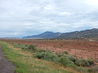
The Wet Mountain Valley is a high elevation mountain valley mostly located in Custer County but extending southward into Huerfano County in south-central Colorado. Westcliffe and Silver Cliff are the two towns in the valley which is mostly devoted to cattle ranching.

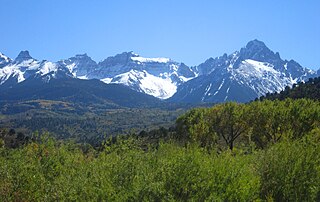
The Sangre de Cristo Mountains are the southernmost subrange of the Rocky Mountains. They are located in southern Colorado and northern New Mexico in the United States. The mountains run from Poncha Pass in South-Central Colorado, trending southeast and south, ending at Glorieta Pass, southeast of Santa Fe, New Mexico. The mountains contain a number of fourteen thousand foot peaks in the Colorado portion, as well as several peaks in New Mexico which are over thirteen thousand feet.
Blanca Peak is the fourth highest summit of the Rocky Mountains of North America and the U.S. state of Colorado. The ultra-prominent 14,351-foot (4,374 m) peak is the highest summit of the Sierra Blanca Massif, the Sangre de Cristo Range, and the Sangre de Cristo Mountains. The fourteener is located 9.6 miles (15.5 km) north by east of the Town of Blanca, on the drainage divide separating Rio Grande National Forest and Alamosa County from the Sangre de Cristo Land Grant and Costilla County. The summit is the highest point of both counties and the entire drainage basin of the Rio Grande. Below the steep North Face of Blanca Peak two live Glaciers once developed, until extinction sometime after 1903. North & South Blanca Glaciers were located at 37° 35N.,longitude 105° 28W. Blanca Peak is higher than any point in the United States east of its longitude.

Crestone Peak is the seventh-highest summit of the Rocky Mountains of North America and the U.S. state of Colorado. The prominent 14,300-foot (4,359 m) fourteener is the highest summit of the Crestones and the second-highest summit in the Sangre de Cristo Range after Blanca Peak. The summit is located in the Sangre de Cristo Wilderness of Rio Grande National Forest, 5.0 miles (8.1 km) east by south of the Town of Crestone in Saguache County, Colorado, United States.
The Sierra Nacimiento, or Nacimiento Mountains, are a mountain range in the northwestern part of the U.S. state of New Mexico. They are just west of the more prominent Jemez Mountains near the town of Cuba, and are separated from them by the Río Guadalupe and the Río de Las Vacas. This article will consider them as a unit together with the San Pedro Mountains, which are a smaller range contiguous with the Sierra Nacimiento on the north, and which are also part of the Nacimiento Uplift and lie at the edge of the greater San Juan Basin, which sits atop the Colorado Plateau. The combined range runs almost due north-south with a length of about 40 mi (65 km). The highest point in the combined range is the high point of the San Pedro Peaks, known unofficially as San Pedro Peak, 10,605 ft.
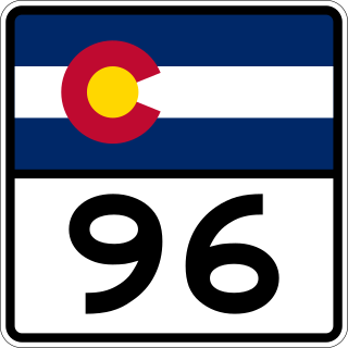
State Highway 96 (SH 96) is a state highway in eastern Colorado. Its western terminus is an intersection with SH 69 in Westcliffe. Its eastern terminus is at the Kansas state line, east of Towner, where it continues as K-96.

Humboldt Peak is a high mountain summit of the Crestones in the Sangre de Cristo Range of the Rocky Mountains of North America. The 14,070-foot (4,289 m) fourteener is located in the Sangre de Cristo Wilderness of San Isabel National Forest, 11.9 miles (19.2 km) south-southwest of the Town of Westcliffe in Custer County, Colorado, United States.

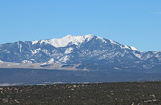
Greenhorn Mountain is the highest summit of the Wet Mountains range in the Rocky Mountains of North America. The prominent 12,352-foot (3,765 m) peak is located in the Greenhorn Mountain Wilderness of San Isabel National Forest, 5.2 miles (8.4 km) southwest by west of the Town of Rye, Colorado, United States, on the boundary between Huerfano and Pueblo counties. The summit of Greenhorn Mountain is the highest point in Pueblo County, Colorado. The peak's summit rises above timberline, which is about 11,500 feet (3,500 m) in south-central Colorado.
The Southern Rocky Mountains are a major subregion of the Rocky Mountains of North America located in the southeastern portion of the U.S. state of Wyoming, the central and western portions of Colorado, the northern portion of New Mexico, and extreme eastern portions of Utah. The Southern Rocky Mountains are also commonly known as the Southern Rockies, and since the highest peaks are located in the State of Colorado, they are sometimes known as the Colorado Rockies, although many important ranges and peaks rise in the other three states. The Southern Rockies include the highest mountain ranges of the Rocky Mountains and include all 30 of the highest major peaks of the Rockies.
Methodist Mountain is a mountain summit in the northern Sangre de Cristo Range of the Rocky Mountains of North America. The 11,713-foot (3,570 m) peak is located 5.5 miles (8.8 km) south by west of the City of Salida, Colorado, United States, on the drainage divide separating San Isabel National Forest and Chaffee County from Rio Grande National Forest and Saguache County. Methodist Mountain is the northernmost peak of the Sangre de Cristo Mountains, which stretch south through southern Colorado to Santa Fe, New Mexico.
Fort Le Duc or Fort LeDuc was a fort and trading post built between present-day Florence and Wetmore, Colorado. It was named after trapper Maurice LeDuc or Maurice LeDoux, and constructed around 1830 or 1835.

The Toroweap Fault of northwest Arizona and southwest Utah is part of a fault system of the west Grand Canyon region, Arizona, US; also the west perimeter regions of the Coconino and Colorado Plateaus. The Hurricane Fault originates at the Toroweap Fault, in the region of the Colorado River, and strikes as the westerly depression of the Toroweap Fault. The Toroweap strikes northerly from the Colorado at the east of Toroweap Valley, and enters south Utah; from the Colorado River, the Hurricane Fault strikes north-northwest along the west flank of the small, regional Uinkaret Mountains, the west border of Toroweap Valley. The Hurricane Fault, and the Hurricane Cliffs strike into southwest Utah as part of the west, and southwest perimeter of the Colorado Plateau. The Hurricane Cliffs are made of Kaibab Limestone, an erosion resistant, cliff-forming rock unit.

Hardscrabble Pass is a mountain pass in South-Central Colorado (USA). It lies between the Wet Mountain Valley to the west and the valley of the Arkansas River to the east. The pass traverses the Wet Mountains. State Highway 96 runs over the pass, linking the towns of Wetmore to the east and Westcliffe to the west.
Mount Zwischen is a prominent mountain summit in the Sangre de Cristo Range of the Rocky Mountains of North America. The 12,011-foot (3,661 m) peak is located 32.1 miles (51.6 km) northeast of the City of Alamosa, Colorado, United States, on the drainage divide separating the Great Sand Dunes Wilderness in Great Sand Dunes National Preserve and Huerfano County from the Sangre de Cristo Wilderness in San Isabel National Forest and Saguache County.

The Greenhorn Valley lies in southern Pueblo County, Colorado just east of Greenhorn Mountain. It includes the communities of Colorado City and Rye.
Hardscrabble Mountain is a summit located in Custer County, Colorado with an elevation of 3,171 metres (10,404 ft). It is one of the peaks in Wet Mountains, a sub-range of the Sangre de Cristo Range of the Rocky Mountains. A local legend is that the mountain was named after an event from Christmas Day 1855. Ute Native Americans attacked settlers in Pueblo, after which soldiers pursued the Utes. They ran up the creek and had a “hard scrabble” to avoid being captured.

Horn Peak is a 13,450-foot (4,100 m) mountain summit in Custer County, Colorado, United States.


