| Twilight Peak | |
|---|---|
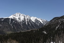 Twilight Peak from the Million Dollar Highway | |
| Highest point | |
| Elevation | 13,163 ft (4,012 m) [1] [2] |
| Prominence | 2,338 ft (713 m) [2] |
| Isolation | 4.88 mi (7.85 km) [2] |
| Listing | |
| Coordinates | 37°39′47″N107°43′37″W / 37.6630537°N 107.7270075°W [3] |
| Geography | |
 Twilight Peak Location in Colorado | |
| Location | San Juan County, Colorado, U.S. [3] |
| Parent range | San Juan Mountains, Highest summit of the West Needle Mountains [2] |
| Topo map(s) | USGS 7.5' topographic map Snowdon Peak, Colorado [3] |
Twilight Peak is the highest summit of the West Needle Mountains range of the San Juan Mountains System in southwestern Colorado.
Contents
The prominent 13,163-foot (4,012 m) peak is located in the Weminuche Wilderness of San Juan National Forest, 10.7 miles (17.3 km) south-southwest (bearing 199°) of the Town of Silverton in San Juan County. [1] [2] [3]
