Mount Alverstone

Last updated
Mount Alverstone
Mount Alverstone.jpg
Highest point
Elevation 4420 m (14,500 ft) [1]
NAVD88
Prominence 594 m (1950 ft) [1]
Parent peak Mount Hubbard
Isolation 3.62 km (2.25 mi) [1]
Listing
Coordinates 60°21′06″N139°04′31″W / 60.35167°N 139.07528°W / 60.35167; -139.07528 [2]
Geography
Relief map of USA Alaska.png
Red triangle with thick white border.svg
Mount Alverstone
Parent range Saint Elias Mountains
Topo map USGS Mount Saint Elias B-3
NTS 115B6 Mount Alverstone
Climbing
First ascent 1951 by Walter Wood, Peter Wood, Robert Bates, Nicholas Clifford
Easiest route glacier/snow/ice climb

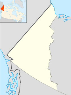
Mount Alverstone or Boundary Peak 180, is a high peak in the Saint Elias Mountains, on the border between Alaska and Yukon. It shares a large massif with the higher Mount Hubbard to the south and the slightly lower Mount Kennedy to the east. The summit of Mount Alverstone marks a sharp turn in the Alaska/Canada border; the border goes south from this point toward the Alaska panhandle and west toward Mount Saint Elias.

Contents

The mountain was named in 1908 for Lord Richard Everard Webster Alverstone, Lord Chief Justice of England, 1900–13, and U.S. Boundary Commissioner in 1903. He served on various arbitration commissions including the one dealing with the Bering Sea Fur seal controversy. In the Alaska boundary dispute in 1903, his vote was the deciding one against Canadian claims. [2]

Climbing

Mount Alverstone was first climbed in 1951 by a party led by Walter Wood, during an expedition that also made the first ascent of Mount Hubbard. The successful climbs were tinged by tragedy when, upon returning from the peaks, Wood learned that his wife Foresta and daughter Valerie had died in a plane crash nearby along with their pilot. Mount Foresta, near Mount Alverstone, is named in her honor.

See also

Related Research Articles

<span class="mw-page-title-main">Alaska boundary dispute</span> 1867–1903 territorial dispute between the US and UK

The Alaska boundary dispute was a territorial dispute between the United States and the United Kingdom of Great Britain and Ireland, which then controlled Canada's foreign relations. It was resolved by arbitration in 1903. The dispute had existed between the Russian Empire and Britain since 1821, and was inherited by the United States as a consequence of the Alaska Purchase in 1867. The final resolution favored the American position, as Canada did not get an all-Canadian outlet from the Yukon gold fields to the sea. The disappointment and anger in Canada was directed less at the United States, and more at the British government for betraying Canadian interests in favor of healthier Anglo-American relations.

<span class="mw-page-title-main">Mount Saint Elias</span> Mountain in Alaska and the Yukon Territory on the United States–Canada border

Mount Saint Elias, the second-highest mountain in both Canada and the United States, stands on the Yukon and Alaska border about 26 miles (42 km) southwest of Mount Logan, the highest mountain in Canada. The Canadian side of Mount Saint Elias forms part of Kluane National Park and Reserve, while the U.S. side of the mountain is located within Wrangell-St. Elias National Park and Preserve.

<span class="mw-page-title-main">Mount Fairweather</span> Highest mountain in British Columbia, Canada

Mount Fairweather is 20 km (12 mi) east of the Pacific Ocean on the Canada–United States border between Alaska and western British Columbia and has an elevation of 4,653 metres (15,266 ft). Most of the mountain lies within Glacier Bay National Park and Preserve in the City and Borough of Yakutat, Alaska, though the summit borders Tatshenshini-Alsek Provincial Park, British Columbia. Tsalxaan is officially gazetted as Fairweather Mountain in Canada but referred to as Mount Fairweather, and is the highest mountain in the Canadian province of British Columbia. It is also designated as Boundary Peak 164 or as US/Canada Boundary Point #164.

<span class="mw-page-title-main">Mount Hubbard</span> Mountain on the border of Canada and Alaska

Mount Hubbard is one of the major mountains of the Saint Elias Range. It is located on the Alaska/Yukon border; the Canadian side is within Kluane National Park and Reserve, and the American side is part of Wrangell–St. Elias National Park. The mountain was named in 1890 by U.S. Geological Survey geologist Israel Russell after Gardiner Greene Hubbard, first president of the National Geographic Society, which had co-sponsored Russell's expedition.

<span class="mw-page-title-main">Mount Augusta</span> Mountain on the Alaska–Yukon border

Mount Augusta, also designated Boundary Peak 183, is a high peak in the US state of Alaska and the Canadian territory of Yukon. It lies about 25 km (16 mi) south of Mount Logan and 25 km east of Mount Saint Elias, respectively the first and second highest mountains in Canada. Mount Augusta forms the eastern end of the long ridge of which Mount Saint Elias is the center and highest point.

<span class="mw-page-title-main">Mount Bona</span> Mountain in the U.S. state of Alaska

Mount Bona is one of the major mountains of the Saint Elias Mountains in eastern Alaska, and is the fifth-highest independent peak in the United States. It is either the tenth- or eleventh-highest peak in North America. Mount Bona and its adjacent neighbor Mount Churchill are both large ice-covered stratovolcanoes. Bona has the distinction of being the highest volcano in the United States and the fourth-highest in North America, outranked only by the three highest Mexican volcanoes, Pico de Orizaba, Popocatépetl, and Iztaccíhuatl. Its summit is a small stratovolcano on top of a high platform of sedimentary rocks.

<span class="mw-page-title-main">Mount Cook (Saint Elias Mountains)</span> mountain on Canada/United States border

Mount Cook is a high peak on the Yukon Territory-Alaska border, in the Saint Elias Mountains of North America. It is approximately 15 mi (24 km) southwest of Mount Vancouver and 35 mi (56 km) miles east-southeast of Mount Saint Elias. It forms one of the corners of the jagged border, which is defined to run in straight lines between the major peaks. The same border also separates Kluane National Park in the Yukon Territory from Wrangell-St. Elias National Park and Preserve in Alaska.

Mount Natazhat is a high peak of the Saint Elias Mountains, of Alaska, United States, just west of the border with the Yukon Territory of Canada. It lies on the northern edge of the range, south of the White River and north of the Klutlan Glacier. Mount Natazhat is a little-noticed peak; however it is a very large peak in terms of rise above local terrain. It rises 9,000 feet (2,743 m) in less than 7 miles (11.3 km) above the lowlands to the north, and 7,500 feet (2,286 m) in about 4 miles (6.4 km) above the Klutlan Glacier to the south.

<span class="mw-page-title-main">Mountain peaks of Canada</span>

This article comprises three sortable tables of major mountain peaks of Canada.

<span class="mw-page-title-main">Mount Root</span> Mountain in Alaska and British Columbia

Mount Root, also named Boundary Peak 165, is a mountain in Alaska and British Columbia, located on the Canada–United States border, and part of the Fairweather Range of the Saint Elias Mountains. It is named for Elihu Root, who was one of the diplomats involved in settling the Alaska boundary dispute between the United States and Canada. It is where the Margerie Glacier is located.

<span class="mw-page-title-main">Mount Seattle</span> Mountain in Alaska

Mount Seattle is a 10,350-foot (3,150 m) peak in the Saint Elias Mountains of Alaska in the United States. It was named for the city of Seattle, home of the "camp hands" of a 19th-century National Geographic Society–United States Geological Survey scientific expedition to the Hubbard Glacier and Mount Saint Elias. It is called the "most prominent Alaskan coastal peak" and blocks sight of larger inland peaks, even Mount Logan nearly twice its height.

Mount Armour, also named Boundary Peak 175, is a mountain in Alaska and British Columbia, located on the Canada–United States border, and part of the Southern Icefield Ranges of the Saint Elias Mountains. It is named after John Douglas Armour (1830–1903), Chief Justice of the High Court of Ontario, and Justice of the Supreme Court of Canada, one of the original Canadian members of the Alaskan Boundary Tribunal in 1903 and who was involved in settling the Alaska boundary dispute between the United States and Canada.

Mount Duff, also named Boundary Peak 174, is a mountain in Alaska and British Columbia, located on the Canada–United States border, and part of the Southern Icefield Ranges of the Saint Elias Mountains. It was named in 1923 for Sir Lyman Poore Duff, (1865-1955), a junior counsel before the International Boundary Commission in 1903, and Judge of the Supreme Court of Canada.

Mount Jetté, also named Boundary Peak 177, is a mountain in Alaska and British Columbia, located on the Canada–United States border, and part of the Southern Icefield Ranges of the Saint Elias Mountains. It is named in 1908 for Sir Louis-Amable Jetté, (1836-1920), a member of the 1903 Canadian Boundary Tribunal, leading to the resolution of the Alaska Boundary Dispute, and Lieutenant Governor of the Province of Quebec from 1898 to 1908. The peak of Mount Jetté is not far from the westernmost point in British Columbia.

Mount Herbert, also named Boundary Peak 172, is a mountain in Alaska and British Columbia, located on the Canada–United States border, and part of the Southern Icefield Ranges of the Saint Elias Mountains. It was named in 1923 for Right Honorable Sir Michael Henry Herbert (1857-1903), British Ambassador to the United States during the early stages of Alaska Boundary Tribunal.

Mount Hay, also named Boundary Peak 167, is a mountain in Alaska and British Columbia, located on the Canada–United States border, and part of the Fairweather Range of the Saint Elias Mountains. It was named in 1923 for John Milton Hay (1838-1905), author and diplomat. In 1903, John Hay helped negotiate the treaty resulting in Alaska Boundary Tribunal.

<span class="mw-page-title-main">Mount Barnard (Alsek Ranges)</span> Mountain in Alaska and British Columbia

Mount Barnard, also named Boundary Peak 160, is a mountain in Alaska and British Columbia, located on the Canada–United States border, and part of the Alsek Ranges of the Saint Elias Mountains. In 1923 Boundary Peak 160 was named Mount Barnard in honour of Edward Chester Barnard, a U.S. Boundary Commissioner from 1915 to 1921 and chief topographer of the United States and Canada Boundary Survey from 1903 to 1915. The first ascent of Mount Barnard was made on August 24, 1966, from the head of Tarr Inlet by D. Kenyon King, Peter H. Robinson and David P. Johnston. The details on file with Peak Service at Bartlett Cove, Glacier Bay National Monument, Gustavus, Alaska.

<span class="mw-page-title-main">Mount Foresta</span> Mountain in Alaska, United States of America

Mount Foresta is an 11,000+ ft multi-peak massif located in Wrangell–St. Elias National Park, in the Saint Elias Mountains of Alaska in the United States. Rising high above the lower western margin of the Hubbard Glacier, the summit of Mount Foresta is just over nine miles (14 km) from tidewater at Disenchantment Bay, 12 mi (19 km) northwest of Mount Seattle, 14.5 mi (23 km) southeast of Mount Vancouver, and 46 mi (74 km) north of Yakutat.

References

  1. 1 2 3 "Mount Alverstone, Alaska-Yukon". Peakbagger.com. Retrieved December 30, 2015.
  2. 1 2 "Mount Alverstone". Geographic Names Information System . United States Geological Survey, United States Department of the Interior . Retrieved 2014-04-06.
Sources