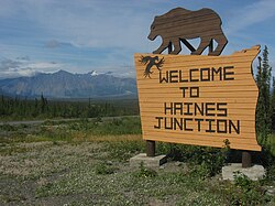
Haines Junction | |
---|---|
Village | |
Village of Haines Junction | |
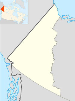
Coordinates: 60°45′13″N137°30′39″W / 60.75361°N 137.51083°W [1] | |
Country | Canada |
Territory | Yukon |
Founded | 1942 |
Incorporated | 1984 |
Government | |
• Village Mayor | Michael Riseborough |
• Governing body | Village of Haines Junction Council |
Area (2021) [4] | |
• Land | 34.3 km2 (13.2 sq mi) |
Population (2021) [4] | |
• Total | 688 |
• Density | 20.1/km2 (52/sq mi) |
• Change 2016-2021 | 11.2% |
Time zone | UTC−07:00 (MST) |
Postal code | |
Area code | +1-867 |
Climate | Dfc / Dsc |
Website | Official website |
Haines Junction is a village in Yukon, Canada. It is at Kilometre 1,632 (historical mile 1016) of the Alaska Highway at its junction with the Haines Highway, hence the name of the community. According to the 2021 census, the population was 688. [4] However, the Yukon Bureau of Statistics lists the population count for 2022 as 1,018. [5]
Haines Junction lies east of Kluane National Park and Reserve. It is a major administrative centre for the Champagne and Aishihik First Nations.
For around two thousand years, the Southern Tutchone people had seasonal hunting and fishing camps in the area of present-day Haines Junction. The original name of the area was "Dakwakada", a Southern Tutchone word meaning "high cache". It was common for Tutchone people to use raised log caches to store food year-round or temporarily while they hunted and fished in an area.
The Haines Junction area was also important for trade between the coastal and interior peoples. It lies at the interior end of the Chilkat Pass, one of only three passes that allowed travel between the coast and the interior, which was used extensively for trade between the coastal Tlingit and Southern Tutchone people.
The current town of Haines Junction was established in 1942 and 1943 during the construction of the Alaska Highway (ALCAN). In 1943, a second highway, the Haines Highway, was built to connect the Alaska Highway with the coastal town of Haines, Alaska, over the Chilkat Pass. Situated at the junction of these two highways, Haines Junction was a construction camp and a supply and service centre for the United States Army Corps of Engineers building the highway. The 1,007 km (626 mi) Haines-Fairbanks Pipeline, a petroleum pipeline from Haines, Alaska to Fairbanks, Alaska that was constructed in 1953–55, with a pumping station was built just north of Haines Junction. [6]
Haines Junction has a subarctic climate (Dfc / Dsc) with mild summers and long, cold and snowy winters, with annual snowfall averaging 159.8 cm (62.9 in). [7]
Climate data for Haines Junction WMO ID: 71505; coordinates 60°46′21″N137°34′49″W / 60.77250°N 137.58028°W ; elevation: 595.3 m (1,953 ft); 1991–2020 normals | |||||||||||||
---|---|---|---|---|---|---|---|---|---|---|---|---|---|
Month | Jan | Feb | Mar | Apr | May | Jun | Jul | Aug | Sep | Oct | Nov | Dec | Year |
Record high humidex | 12.5 | 13.4 | 16.4 | 20.4 | 28.2 | 31.8 | 30.9 | 32.2 | 24.2 | 23.0 | 13.1 | 16.3 | 32.2 |
Record high °C (°F) | 13.6 (56.5) | 13.6 (56.5) | 16.9 (62.4) | 20.7 (69.3) | 28.6 (83.5) | 32.1 (89.8) | 30.5 (86.9) | 31.0 (87.8) | 24.2 (75.6) | 23.8 (74.8) | 14.5 (58.1) | 16.9 (62.4) | 32.1 (89.8) |
Mean daily maximum °C (°F) | −12.5 (9.5) | −5.5 (22.1) | 0.0 (32.0) | 7.8 (46.0) | 14.3 (57.7) | 18.8 (65.8) | 20.3 (68.5) | 18.6 (65.5) | 13.5 (56.3) | 5.2 (41.4) | −6.8 (19.8) | −10.8 (12.6) | 5.2 (41.4) |
Daily mean °C (°F) | −17.3 (0.9) | −12.8 (9.0) | −7.8 (18.0) | 0.9 (33.6) | 7.1 (44.8) | 11.5 (52.7) | 13.3 (55.9) | 11.5 (52.7) | 6.8 (44.2) | −0.4 (31.3) | −12.0 (10.4) | −16.1 (3.0) | −1.3 (29.7) |
Mean daily minimum °C (°F) | −22.6 (−8.7) | −20.0 (−4.0) | −15.6 (3.9) | −5.9 (21.4) | −0.2 (31.6) | 4.1 (39.4) | 6.3 (43.3) | 4.4 (39.9) | 0.0 (32.0) | −6.0 (21.2) | −17.2 (1.0) | −21.3 (−6.3) | −7.8 (18.0) |
Record low °C (°F) | −48.5 (−55.3) | −45.6 (−50.1) | −41.8 (−43.2) | −31.3 (−24.3) | −8.1 (17.4) | −3.7 (25.3) | −1.7 (28.9) | −4.0 (24.8) | −13.0 (8.6) | −29.1 (−20.4) | −44.1 (−47.4) | −47.3 (−53.1) | −48.5 (−55.3) |
Record low wind chill | −57.0 | −50.1 | −46.5 | −34.4 | −10.1 | −5.1 | −3.5 | −5.0 | −13.1 | −28.3 | −50.1 | −50.3 | −57.0 |
Average precipitation mm (inches) | 32.3 (1.27) | 18.6 (0.73) | 9.2 (0.36) | 9.0 (0.35) | 15.7 (0.62) | 28.3 (1.11) | 35.2 (1.39) | 28.5 (1.12) | 34.1 (1.34) | 35.4 (1.39) | 30.5 (1.20) | 29.0 (1.14) | 305.7 (12.04) |
Average rainfall mm (inches) | 1.1 (0.04) | 0.6 (0.02) | 0.3 (0.01) | 0.8 (0.03) | 11.8 (0.46) | 28.3 (1.11) | 35.2 (1.39) | 28.3 (1.11) | 33.7 (1.33) | 13.3 (0.52) | 0.8 (0.03) | 0.1 (0.00) | 154.3 (6.07) |
Average snowfall cm (inches) | 32.7 (12.9) | 19.4 (7.6) | 9.9 (3.9) | 8.8 (3.5) | 4.0 (1.6) | 0.0 (0.0) | 0.0 (0.0) | 0.1 (0.0) | 0.4 (0.2) | 23.2 (9.1) | 31.3 (12.3) | 29.8 (11.7) | 159.8 (62.9) |
Average precipitation days (≥ 0.2 mm) | 10.0 | 8.0 | 5.0 | 4.0 | 5.0 | 8.0 | 9.0 | 9.0 | 9.0 | 10.0 | 9.0 | 11.0 | 96.0 |
Average rainy days (≥ 0.2 mm) | — | — | — | — | 4.0 | 8.0 | 9.0 | 9.0 | 9.0 | 4.0 | — | — | 43.0 |
Average snowy days (≥ 0.2 cm) | 10.0 | 8.0 | 5.0 | 4.0 | 2.0 | 0.0 | 0.0 | — | — | 7.0 | 9.0 | 11.0 | 54.0 |
Average relative humidity (%) (at 1500 LST) | 71.0 | 57.6 | 42.9 | 38.0 | 34.6 | 39.2 | 44.2 | 46.6 | 49.6 | 60.9 | 75.6 | 77.2 | 53.1 |
Source: Environment and Climate Change Canada [8] Precipitation, rain, snow, precipitation days, rain days, and snow days from 1961-1990 station data [7] |
Year | Pop. | ±% |
---|---|---|
1971 | 183 | — |
1976 | 268 | +46.4% |
1981 | 366 | +36.6% |
1986 | 340 | −7.1% |
1991 | 477 | +40.3% |
1996 | 574 | +20.3% |
2001 | 531 | −7.5% |
2006 | 589 | +10.9% |
2011 | 593 | +0.7% |
2016 | 613 | +3.4% |
2021 | 688 | +12.2% |
Source: Statistics Canada [4] [9] [10] [11] [12] [13] [14] [15] [16] [17] [18] |
In the 2021 Canadian census conducted by Statistics Canada, Haines Junction had a population of 688 living in 311 of its 380 total private dwellings, a change of 12.2% from its 2016 population of 613. With a land area of 34.3 km2 (13.2 sq mi), it had a population density of 20.1/km2 (52.0/sq mi) in 2021. [4]
Panethnic group | 2021 [19] | 2016 [20] | 2011 [21] | 2006 [22] | 2001 [23] | |||||
---|---|---|---|---|---|---|---|---|---|---|
Pop. | % | Pop. | % | Pop. | % | Pop. | % | Pop. | % | |
European [lower-alpha 1] | 370 | 54.01% | 335 | 55.37% | 330 | 53.23% | 320 | 54.7% | 305 | 57.55% |
Indigenous | 290 | 42.34% | 255 | 42.15% | 270 | 43.55% | 245 | 41.88% | 215 | 40.57% |
Southeast Asian [lower-alpha 2] | 15 | 2.19% | 0 | 0% | 0 | 0% | 10 | 1.71% | 0 | 0% |
East Asian [lower-alpha 3] | 0 | 0% | 10 | 1.65% | 10 | 1.61% | 20 | 3.42% | 10 | 1.89% |
South Asian | 0 | 0% | 10 | 1.65% | 0 | 0% | 0 | 0% | 0 | 0% |
Latin American | 0 | 0% | 0 | 0% | 0 | 0% | 0 | 0% | 10 | 1.89% |
Middle Eastern [lower-alpha 4] | 0 | 0% | 0 | 0% | 0 | 0% | 0 | 0% | 0 | 0% |
African | 0 | 0% | 0 | 0% | 0 | 0% | 0 | 0% | 0 | 0% |
Other/multiracial [lower-alpha 5] | 0 | 0% | 0 | 0% | 0 | 0% | 0 | 0% | 0 | 0% |
Total responses | 685 | 99.56% | 605 | 98.69% | 620 | 104.55% | 585 | 99.32% | 530 | 99.81% |
Total population | 688 | 100% | 613 | 100% | 593 | 100% | 589 | 100% | 531 | 100% |
Note: Totals greater than 100% due to multiple origin responses |
By road, Haines Junction is served by the Alaska Highway and the Haines Highway (Yukon Highway 3). By air, it is served by the Haines Junction Airport.
Fibre connections to most homes and businesses are becoming available in late 2022 / early 2023. Bell Mobility operates a cellular network tower in the area.
The Municipality of the District of Lunenburg, is a district municipality in Lunenburg County, Nova Scotia, Canada. Statistics Canada classifies the district municipality as a municipal district.
Kimberley is a city in southeast British Columbia, Canada along Highway 95A between the Purcell and Rocky Mountains. Kimberley was named in 1896 after the Kimberley mine in South Africa. From 1917 to 2001, it was the home to the world's largest lead-zinc mine, the Sullivan Mine. Now it is mainly a tourist destination and home to the Kimberley Alpine Resort, a ski area and Kimberley's Underground Mining Railway that features a 750-foot-long (230 m) underground mining interpretive centre complete with operational 3 ft narrow-gauge railway equipment. Recreational pursuits include world-class skiing, snowboarding, snowmobiling, fishing, whitewater rafting, kayaking, biking, hiking and golfing on championship golf courses. The city has the largest urban park in Canada. At 1,977 acres (800 ha), the Kimberley Nature Park is the largest incorporated park in Canada.
The Cowichan Valley Regional District is a regional district in the Canadian province of British Columbia that is on the southern part of Vancouver Island, bordered by the Nanaimo and Alberni-Clayoquot Regional Districts to the north and northwest, and by the Capital Regional District to the south and east. As of the 2021 Census, the Regional District had a population of 89,013. The regional district offices are in Duncan.
Carmacks is a village in Yukon, Canada, on the Yukon River along the Klondike Highway, and at the west end of the Robert Campbell Highway from Watson Lake. The population is 588, an increase from the Census of 2016. It is the home of the Little Salmon/Carmacks First Nation, a Northern Tutchone-speaking people.
Watson Lake is a town in Yukon, Canada, located at mile 635 on the Alaska Highway close to the British Columbia border. It had a population of 1,133 in 2021. The town is named for Frank Watson, an American-born trapper and prospector, who settled in the area at the end of the 19th century.
Beaumont is a city in Leduc County within the Edmonton Metropolitan Region of Alberta, Canada. It is located at the intersection of Highway 625 and Highway 814, adjacent to the City of Edmonton and 6.0 kilometres (3.7 mi) northeast of the City of Leduc. The Nisku Industrial Park and the Edmonton International Airport are located 4.0 kilometres (2.5 mi) to the west and 8.0 kilometres (5.0 mi) to the southwest respectively.
Mackenzie is a district municipality within the Fraser-Fort George Regional District in central British Columbia, Canada. The community is located at the south end of Williston Lake. The townsite, established by Alexandra Forest Industries and Cattermole Timber, was named for Sir Alexander MacKenzie (1764–1820).
Port Hardy is a district municipality in British Columbia, Canada located on the north-east tip of Vancouver Island. Port Hardy has a population of 3,902 as of the 2021 census.
The Northern Rockies Regional Municipality (NRRM), formerly the Northern Rockies Regional District (NRRD), and before that the Fort Nelson–Liard Regional District, is a municipality in northeastern British Columbia, Canada. Although portrayed as a regional municipality in its official name, and existing on the same administrative level as a regional district, it is actually classified as a district municipality. The NRRM's offices are located in Fort Nelson, formerly an incorporated town that amalgamated with the NRRD on February 6, 2009, to form the NRRM. With the Peace River Regional District as the southern part, it was the northern part of the Peace River-Liard Regional District, which was split into two on October 31, 1987.
Ibex Valley is a hamlet in Canada's Yukon. The hamlet is considered a local advisory area with an advisory council providing local government. Its population in 2021 according to the 2021 Canadian Census was 523.
Marsh Lake is an unincorporated community on the Alaska Highway on the shores of Marsh Lake southeast of Whitehorse in Canada's Yukon. The area was organized in 2001, as a local area council to help the residents with some form of municipal government.
Ontario, one of the 13 provinces and territories of Canada, is located in east-central Canada. It is Canada's most populous province by a large margin, accounting for nearly 40 percent of all Canadians, and is the second-largest province in total area. Ontario is fourth-largest in total area when the territories of the Northwest Territories and Nunavut are included. It is home to the nation's capital city, Ottawa, and the nation's most populous city, Toronto.
Alberta has experienced a relatively high rate of growth in recent years, due in large part to its economy. Between 2003 and 2004, the province saw high birthrates, relatively high immigration, and a high rate of interprovincial migration when compared to other provinces. Approximately 81% of the population live in urban areas and only about 19% live in rural areas. The Calgary–Edmonton Corridor is the most urbanized area in Alberta and is one of Canada's four most urban regions. Many of Alberta's cities and towns have also experienced high rates of growth in recent history. From a population of 73,022 in 1901, Alberta has grown to 4,262,635 in 2021 and in the process has gone from less than 1.5% of Canada's population to 11.5%. It is the fourth most populated province in Canada. Between the 2016 and 2021 censuses, the Alberta population grew by 4.8%.
Prince Edward Island is a Canadian province. According to the 2011 National Household Survey, the largest ethnic group consists of people of Scottish descent (39.2%), followed by English (31.1%), Irish (30.4%), French (21.1%), German (5.2%), and Dutch (3.1%) descent. Prince Edward Island is mostly a white community and there are few visible minorities. Chinese people are the largest visible minority group of Prince Edward Island, comprising 1.3% of the province's population. Almost half of respondents identified their ethnicity as "Canadian." Prince Edward Island is by a strong margin the most Celtic and specifically the most Scottish province in Canada and perhaps the most Scottish place (ethnically) in the world, outside Scotland. 38% of islanders claim Scottish ancestry, but this is an underestimate and it is thought that almost 50% of islanders have Scottish roots. When combined with Irish and Welsh, almost 80% of islanders are of some Celtic stock, albeit most families have resided in PEI for at least two centuries. Few places outside Europe can claim such a homogeneous Celtic ethnic background. The only other jurisdiction in North America with such a high percentage of British Isles heritage is Newfoundland.
Yukon is the westernmost of Canada's three northern territories. Its capital is Whitehorse. People from Yukon are known as Yukoners. Unlike in other Canadian provinces and territories, Statistics Canada uses the entire territory as a single at-large census division.
Lake Cowichan is a town located on the east end of Cowichan Lake and, by highway, is 27 kilometres (17 mi) west of Duncan, British Columbia. The town of Lake Cowichan was incorporated in 1944. The Cowichan River flows through the middle of the town. Cowichan River is designated as a Heritage River.
Portage la Prairie is a rural municipality (RM) in the province of Manitoba in Western Canada. It surrounds the city of Portage la Prairie, Manitoba's fifth-largest city. Also within the borders of the municipality are the Dakota Plains First Nation and most of the Long Plain First Nation Indian reserves.
According to the 2021 census, the City of Edmonton had a population of 1,010,899 residents, compared to 4,262,635 for all of Alberta, Canada. The total population of the Edmonton census metropolitan area (CMA) was 1,418,118, making it the sixth-largest CMA in Canada.
The Stikine Region is an unincorporated area in northwestern British Columbia, Canada. It is the only area in the province that is not part of a regional district. The Stikine Region was left unincorporated following legislation that established the province's regional districts in 1968 and is not classified as a regional district. It contains no municipal governments which normally constitute the majority of seats on the boards of regional districts. There is only one local planning area, the Atlin Community Planning Area, which was combined in 2009 with the Atlin Community Improvement District to provide fire, landfill, water, streetlighting, sidewalks and advisory land use services. All other services not provided privately are administered directly by various provincial government ministries. The area around Dease Lake, formerly in the Stikine Region, is now within the boundaries of the Regional District of Kitimat–Stikine following a boundary amendment in 2008.
In the 2021 Census, the City of Calgary had a population of 1,306,784 residents, representing 30.7% of the 4,262,635 residents in all of Alberta, and 3.5% compared to a population of 36,991,981 in all of Canada. The total population of the Calgary census metropolitan area (CMA) was 1,481,806. Calgary is the largest city in Alberta, and the third-largest municipality and fifth-largest metropolitan area in Canada, as of 2021.